Port Renfrew

Last updated

Port Renfrew
Port Renfrew Welcome Sign 2010.jpg
Nickname(s): 
The Land of Plenty, The Tall Tree Capital of Canada
24 Capital Regional District British Columbia.svg
Western Canada Map Assets Town.svg
Port Renfrew
Location of Port Renfrew within the Capital Regional District
Canada Vancouver Island location map.svg
Red pog.svg
Port Renfrew
Location of Port Renfrew
Canada British Columbia location map 2.svg
Red pog.svg
Port Renfrew
Port Renfrew (British Columbia)
Canada location map 2.svg
Red pog.svg
Port Renfrew
Port Renfrew (Canada)
Coordinates: 48°33′N124°25′W / 48.550°N 124.417°W / 48.550; -124.417 [1]
CountryCanada
Province British Columbia
Area
  Land8.69 km2 (3.36 sq mi)
Population
 (2016)
  Total144
  Density16.6/km2 (43/sq mi)
Postal code
V0S 0A1 & V0S 1K0
Website https://www.portrenfrew.com

Port Renfrew is a small unincorporated community located on the south shore of Port San Juan, an inlet on the west coast of Vancouver Island in British Columbia, Canada. Port Renfrew has a population of 262 (as of the 2021 Canadian census) [3] and has been touted as "the Tall Tree Capital of Canada". [4] [5]

Contents

History

Port Renfrew has been the home of First Nations since time immemorial. The Pacheedaht First Nation, meaning "People of the Sea Foam", have traditional village sites in and around the main town centre.

Originally named Port San Juan, the original settlers changed the name to honour Lord Renfrew[ clarification needed ] who planned to settle crofters there. The name change was due to mail being sent to the San Juan Islands instead of Port San Juan and the inlet the town sits beside retains the name. Like many coastal Vancouver Island communities, Port Renfrew has a rich history of forestry and fishing.

Between 1830 and 1925, 137 major shipping tragedies occurred in the immediate vicinity of the entrance to the Strait of Juan de Fuca. This stretch of coastline around Port Renfrew became known as the Graveyard of the Pacific.

Geography

Located at the head of the Port San Juan inlet, Port Renfrew lies adjacent to this natural harbour as well as the San Juan River. The other end of the inlet is located on the Strait of Juan de Fuca near its confluence with the Pacific Ocean. The San Juan Valley lies northeast of the town, surrounded by mountains on all sides.

Port Renfrew can be accessed from Victoria via British Columbia Highway 14 or from Lake Cowichan via Pacific Marine Road.

Climate

The climate is classic oceanic (Köppen: Cfb), because it is close to the Strait of Juan de Fuca towards the interior, the Mediterranean trend of rainfall patterns begins to be evidenced with high annual rainfall (proximity to the Csb), in terms of temperature is similar the Channel Islands. Summers are warm and almost fresh and winters are mild, one of the mildest in all of Canada. [6] [7]

Climate data for Port Renfrew
Climate ID: 1016335; coordinates 48°35′30″N124°19′35″W / 48.59167°N 124.32639°W / 48.59167; -124.32639 (Port Renfrew) ; elevation: 10.0 m (32.8 ft); 1981-2010 normals
MonthJanFebMarAprMayJunJulAugSepOctNovDecYear
Record high °C (°F)19.0
(66.2)
16.5
(61.7)
20.0
(68.0)
24.5
(76.1)
27.5
(81.5)
31.0
(87.8)
31.7
(89.1)
33.5
(92.3)
28.9
(84.0)
24.0
(75.2)
17.2
(63.0)
15.0
(59.0)
33.5
(92.3)
Average high °C (°F)6.3
(43.3)
7.5
(45.5)
9.7
(49.5)
12.3
(54.1)
15.2
(59.4)
17.4
(63.3)
19.4
(66.9)
20.0
(68.0)
17.8
(64.0)
12.9
(55.2)
8.5
(47.3)
5.9
(42.6)
12.7
(54.9)
Daily mean °C (°F)4.1
(39.4)
4.6
(40.3)
6.2
(43.2)
8.4
(47.1)
11.1
(52.0)
13.4
(56.1)
15.3
(59.5)
15.6
(60.1)
13.4
(56.1)
9.6
(49.3)
6.1
(43.0)
3.8
(38.8)
9.3
(48.7)
Average low °C (°F)1.8
(35.2)
1.6
(34.9)
2.7
(36.9)
4.3
(39.7)
6.9
(44.4)
9.4
(48.9)
11.0
(51.8)
11.1
(52.0)
9.0
(48.2)
6.3
(43.3)
3.7
(38.7)
1.6
(34.9)
5.8
(42.4)
Record low °C (°F)−12.5
(9.5)
−10.5
(13.1)
−6.7
(19.9)
−2.5
(27.5)
0.0
(32.0)
1.7
(35.1)
5.0
(41.0)
2.2
(36.0)
−0.6
(30.9)
−3.5
(25.7)
−11.5
(11.3)
−11.1
(12.0)
−12.5
(9.5)
Average precipitation mm (inches)555.7
(21.88)
376.6
(14.83)
362.3
(14.26)
258.7
(10.19)
154.7
(6.09)
107.9
(4.25)
50.5
(1.99)
82.4
(3.24)
123.9
(4.88)
371.2
(14.61)
579.7
(22.82)
481.0
(18.94)
3,504.6
(137.98)
Average rainfall mm (inches)544.0
(21.42)
362.0
(14.25)
356.0
(14.02)
258.1
(10.16)
154.6
(6.09)
107.9
(4.25)
50.5
(1.99)
82.4
(3.24)
123.9
(4.88)
371.0
(14.61)
575.4
(22.65)
468.9
(18.46)
3,454.7
(136.01)
Average snowfall cm (inches)11.8
(4.6)
14.6
(5.7)
6.3
(2.5)
0.6
(0.2)
0.1
(0.0)
0.0
(0.0)
0.0
(0.0)
0.0
(0.0)
0.0
(0.0)
0.2
(0.1)
4.3
(1.7)
12.1
(4.8)
50.0
(19.7)
Average precipitation days (≥ 0.2 mm)22.818.422.319.316.713.99.09.611.118.823.122.4207.3
Average rainy days (≥ 0.2 mm)22.117.822.019.316.713.99.09.611.118.822.821.5204.7
Average snowy days (≥ 0.2 cm)2.92.22.00.330.040.00.00.00.00.081.02.511.1
Source: Environment and Climate Change Canada [6]

Attractions

Avatar Grove Avatar Grove Tagged Giant.jpg
Avatar Grove

Port Renfrew sits at the head of Port San Juan and the mouth of the San Juan River, affording it a variety of recreational activities such as fishing, kayaking, and birding. The surrounding mountains and coastline are home to a variety of hiking trails, most notably the West Coast Trail to the north and Juan de Fuca Marine Trail to the southwest. The San Juan Valley to the east is home to numerous old growth forests and many of Canada's largest and oldest trees.

In town

Nearby

See also

Related Research Articles

<span class="mw-page-title-main">Strait of Juan de Fuca</span> Strait between Vancouver Island and the Olympic Peninsula

The Strait of Juan de Fuca is a body of water about 96 miles long that is the Salish Sea's main outlet to the Pacific Ocean. The international boundary between Canada and the United States runs down the centre of the Strait.

<span class="mw-page-title-main">Vancouver Island</span> Largest island in British Columbia, Canada

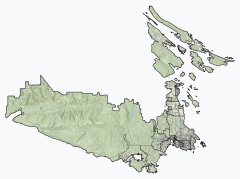
Vancouver Island is an island in the northeastern Pacific Ocean and part of the Canadian province of British Columbia. The island is 456 km (283 mi) in length, 100 km (62 mi) in width at its widest point, and 32,100 km2 (12,400 sq mi) in total area, while 31,285 km2 (12,079 sq mi) are of land. The island is the largest by area and the most populous along the west coasts of the Americas.

<span class="mw-page-title-main">Pacific Northwest</span> Region of northwestern North America

The Pacific Northwest (PNW), sometimes referred to as Cascadia, is a geographic region in western North America bounded by its coastal waters of the Pacific Ocean to the west and, loosely, by the Rocky Mountains to the east. Though no official boundary exists, the most common conception includes the U.S. states of Oregon, Washington, and Idaho, and sometimes the Canadian province of British Columbia. Some broader conceptions reach north into Alaska and Yukon, south into northern California, and east into western Montana. Other conceptions may be limited to the coastal areas west of the Cascade and Coast mountains. The variety of definitions can be attributed to partially overlapping commonalities of the region's history, culture, geography, society, ecosystems, and other factors.

<span class="mw-page-title-main">Esquimalt</span> District municipality in British Columbia, Canada

The Township of Esquimalt is a municipality at the southern tip of Vancouver Island, in British Columbia, Canada. It is bordered to the east by the provincial capital, Victoria, to the south by the Strait of Juan de Fuca, to the west by Esquimalt Harbour and Royal Roads, to the northwest by the New Songhees 1A Indian reserve and the town of View Royal, and to the north by a narrow inlet of water called the Gorge, across which is the district municipality of Saanich. It is almost tangential to Esquimalt 1 Indian Reserve near Admirals Road. It is one of the 13 municipalities of Greater Victoria and part of the Capital Regional District.

<span class="mw-page-title-main">Strait of Georgia</span> Waterway between Vancouver Island and mainland North America

The Strait of Georgia or the Georgia Strait is an arm of the Salish Sea between Vancouver Island and the extreme southwestern mainland coast of British Columbia, Canada, and the extreme northwestern mainland coast of Washington, United States. It is approximately 240 kilometres (150 mi) long and varies in width from 20 to 58 kilometres. Along with the Strait of Juan de Fuca and Puget Sound, it is a constituent part of the Salish Sea.

<span class="mw-page-title-main">Capital Regional District</span> Regional district in British Columbia, Canada

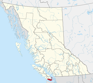
The Capital Regional District (CRD) is a local government administrative district encompassing the southern tip of Vancouver Island and the southern Gulf Islands in the Canadian province of British Columbia. The CRD is one of several regional districts in British Columbia and had an official population of 415,451 as of the Canada 2021 Census.

<span class="mw-page-title-main">Sechelt</span> Netherlands 23

Sechelt is a district municipality located on the lower Sunshine Coast of British Columbia. Approximately 50 km northwest of Vancouver, it is accessible from mainland British Columbia by a 40-minute ferry trip between Horseshoe Bay and Langdale, and a 25-minute drive from Langdale along Highway 101, also known as the Sunshine Coast Highway. The name Sechelt is derived from the she shashishalhem word shíshálh, the name of the First Nations people who first settled the area thousands of years ago.

<span class="mw-page-title-main">West Coast Trail</span> Backpacking trail in British Columbia, Canada

The West Coast Trail, originally called the Dominion Lifesaving Trail, is a 75 km (47 mi) backpacking trail following the southwestern edge of Vancouver Island in British Columbia, Canada. It was built in 1907 to facilitate the rescue of shipwrecked survivors along the coast, part of the treacherous Graveyard of the Pacific. It is now part of the Pacific Rim National Park and is often rated by hiking guides as one of the world's top hiking trails.

<span class="mw-page-title-main">British Columbia Coast</span> Coastal region of British Columbia, Canada

The British Columbia Coast, popularly referred to as the BC Coast or simply the Coast, is a geographic region of the Canadian province of British Columbia. As the entire western continental coastline of Canada along the Pacific Ocean is in the province, it is synonymous with being the West Coast of Canada.

<span class="mw-page-title-main">Juan de Fuca Provincial Park</span> Provincial park in British Columbia, Canada

Juan de Fuca Provincial Park is a provincial park located on the west coast of Vancouver Island in British Columbia, Canada. The park was established on April 4, 1996 by combining three former parks - China Beach, Loss Creek, and Botanical Beach - into one provincial park. It is the location of the majority of the Juan de Fuca Marine Trail, which is a southern compliment to the West Coast Trail within Pacific Rim National Park Reserve.

<span class="mw-page-title-main">Jordan River, British Columbia</span>

Jordan River, founded as and still officially gazetted as River Jordan, is a small settlement on the west coast of Vancouver Island, British Columbia, Canada, located approximately 70 km (43 mi) west of Victoria.

<span class="mw-page-title-main">Juan de Fuca Marine Trail</span> Wilderness hiking trail on Vancouver Island, Canada

The Juan de Fuca Marine Trail is a rugged 47 kilometres (29 mi) wilderness hiking trail located within Juan de Fuca Provincial Park along the southwestern coast of Vancouver Island. The trail stretches from China Beach, 35 km west of Sooke, to Botanical Beach, just outside Port Renfrew.

<span class="mw-page-title-main">Salish Sea</span> Marginal sea in British Columbia and Washington state

The Salish Sea is a marginal sea of the Pacific Ocean located in the Canadian province of British Columbia and the U.S. state of Washington. It includes the Strait of Georgia, the Strait of Juan de Fuca, Puget Sound, and an intricate network of connecting channels and adjoining waterways.

<span class="mw-page-title-main">Loss Creek (Canada)</span> River in British Columbia, Canada

Loss Creek is a stream in the Capital Regional District of British Columbia, Canada. Located on southern Vancouver Island, it flows through a long, steep-sided valley to the Strait of Juan de Fuca on the Pacific Ocean.

<span class="mw-page-title-main">Porcher Island</span>

Porcher Island is an island in Hecate Strait, British Columbia, Canada, near the mouth of the Skeena River and southwest of the port city of Prince Rupert. The locality of Porcher Island is located near the island's northern tip at Humpback Bay, 54°05′11″N130°23′23″W. Stephens and Prescott Islands are located off its northwestern tip.

<span class="mw-page-title-main">Port San Juan</span> Inlet on Vancouver Island, British Columbia.

Port San Juan is an inlet along the Pacific coast of Vancouver Island in British Columbia, Canada. It was formed from the San Juan and Leech River faults which flank the northern and southern slopes of the San Juan Valley. The San Juan and Gordon rivers empty into the inlet from the northeast.

<span class="mw-page-title-main">Sombrio Beach</span>

Sombrio Beach is a beach in the western Capital Regional District, British Columbia, Canada, southeast of the settlement of Port Renfrew. It is on the southwest coast of Vancouver Island on the Strait of Juan de Fuca, west of Sombrio Point, and astride the mouth of the Sombrio River. The beach is partly within Juan de Fuca Provincial Park and is traversed by the Juan de Fuca Marine Trail. It is on the traditional territory of the Pacheedaht Nation, and it was the site of a fishing and harvesting village called Qwa:qtłis.

<span class="mw-page-title-main">San Juan Valley (Vancouver Island)</span>

The San Juan Valley is a small valley located in the Capital Regional District of Vancouver Island in British Columbia, Canada.

The Sombrio River is a river in the Capital Regional District of British Columbia, Canada. Located on southern Vancouver Island, it flows to the Strait of Juan de Fuca on the Pacific Ocean at Sombrio Beach.

Jack Elliott Creek is a stream in the Capital Regional District of British Columbia, Canada. Located on southern Vancouver Island, it flows from its source to its mouth as a right tributary of Loss Creek.

References

  1. "Port Renfrew". Geographical Names Data Base . Natural Resources Canada.
  2. "Port Renfrew". Geographical Names Data Base . Natural Resources Canada.
  3. Government of Canada, Statistics Canada (8 February 2017). "Census Profile, 2016 Census - Port Renfrew, Unincorporated place [Designated place], British Columbia and British Columbia [Province]".{{cite web}}: Missing or empty |url= (help)
  4. Peterson, Dave (1 September 2014). "Tall Tree Capital of Canada: Port Renfrew, B.C." Northwest Travel Magazine. Retrieved 14 August 2020.
  5. "Port Renfrew Lodging". 17 August 2020
  6. 1 2 "1981 to 2010 Canadian Climate Normals". Environment and Climate Change Canada. 25 November 2021. Climate ID: 1016335. Retrieved 27 February 2022.
  7. "Climate & Weather | Vancouver Island, BC | Destination BC – Official Site". 11 September 2017. Archived from the original on 11 September 2017. Retrieved 23 February 2019.