Port Hardy

Last updated

Port Hardy
District of Port Hardy [1]
Port Hardy.jpg
Harbour of Port Hardy
Canada Vancouver Island location map.svg
Red pog.svg
Port Hardy
Canada British Columbia location map 2.svg
Red pog.svg
Port Hardy
Canada location map 2.svg
Red pog.svg
Port Hardy
Coordinates: 50°43′28″N127°29′53″W / 50.72444°N 127.49806°W / 50.72444; -127.49806 [2]
CountryCanada
Province British Columbia
Region North-Island
Regional District Mount Waddington
IncorporatedApril 5, 1966 [4]
Government
   Mayor Pat Corbett-Labatt [5]
Area
  Land38.55 km2 (14.88 sq mi)
Elevation
23 m (75 ft)
Population
 (2021)
  Total
3,902
  Density101.2/km2 (262/sq mi)
Time zone UTC−8 (PST)
Postal code
V0N
Area codes 250, 778
Climate Cfb
Website porthardy.ca OOjs UI icon edit-ltr-progressive.svg

Port Hardy is a district municipality in British Columbia, Canada located on the north-east tip of Vancouver Island. [6] Port Hardy has a population of 3,902 as of the 2021 census.

Contents

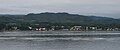
It is the gateway to Cape Scott Provincial Park, the North Coast Trail and the BC Marine Trail, located on the northernmost tip of Vancouver Island. The community has access to various outdoor activities, such as kayaking, caving, scuba diving, nature viewing, surfing, saltwater rapids, [7] fishing and camping.

Port Hardy's twin city is Numata, Japan.

Name

Port Hardy was named after Vice-Admiral Sir Thomas Masterman Hardy, who served as the captain of HMS Victory . [6] He served at the Battle of Trafalgar when Horatio Nelson died in his arms. [8] :105

Demographics

In the 2021 Census of Population conducted by Statistics Canada, Port Hardy had a population of 3,902 living in 1,791 of its 1,984 total private dwellings, a change of

Religion

According to the 2021 census, religious groups in Port Hardy included: [10]

Ethnicity

Panethnic groups in the District of Port Hardy (1986−2021)
Panethnic
group
2021 [10] 2016 [11] 2011 [12] 2006 [13] 2001 [14] 1996 [15] 1991 [16] [17] 1986 [18] [19] [20] :106
Pop. %Pop.%Pop.%Pop.%Pop.%Pop.%Pop.%Pop.%
European [a] 2,7852,8203,0153,1153,9654,6804,3954,575
Indigenous 8001,055700485460300460415
Southeast Asian [b] 80506035201052535
East Asian [c] 75851065609070105
South Asian 40153530204085180
African 25251515025030
Latin American 151560250203045
Middle Eastern [d] 0002500100
Other/Multiracial [e] 0104510350
Total responses3,8604,0803,9553,8104,5605,2805,0755,385
Total population3,9024,1324,0083,8224,5745,2835,0825,389
Note: Totals greater than 100% due to multiple origin responses
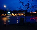
Filomi Days

Once a year, Port Hardy holds a celebration in Rotary Park to acknowledge its natural resource based economy. [21] The three syllables, fi, lo and mi, stand for "fishing, logging and mining". The celebration includes festivities in the park such as activities for children, fundraising concessions, entertainment, beer gardens, bake sales, craft sales, and fireworks. A dance for each age group and a parade are also held on Filomi Days weekend- typically the third weekend in July. Brookes Laidlaw represents the current Vice Admiral in the annual parade.

Tourism

A deer near the Quatse river Hardydeer.JPG
A deer near the Quatse river

Port Hardy's economy relies greatly on tourism. Ferries to Prince Rupert, another popular tourist destination in British Columbia, depart every other day during peak season.

Tourist traffic increases in the summer months. Book hotels and campgrounds in advance.[ citation needed ]

Wildlife

Deer, black bears, bald eagles, squirrels, seals, salmon and many other species of birds and mammals are often spotted along the Quatse Loop Nature Trail or at Storey's Beach which is a short drive from town. Humpback whales can occasionally been seen surfacing in the bay. Port Hardy has many wildlife charters, fishing charters and places to camp during tourist season.

Climate

Port Hardy has an oceanic climate (Köppen Cfb) due to its proximity to the Pacific moderating influence. As a result, summers are very cool for the latitude, whereas winters instead are very mild. Although there is a strong drying trend in summer, its summer rainfall is still higher than those of the southerly mediterranean climates. Winter rainfall is very high and in general Port Hardy is far wetter than Canada's interior.

Climate data for Port Hardy (Port Hardy Airport)
WMO ID: 71109; coordinates 50°40′49″N127°21′58″W / 50.68028°N 127.36611°W / 50.68028; -127.36611 (Port Hardy Airport) ; elevation: 21.6 m (71 ft); 1991−2020 normals, extremes 1944−present
MonthJanFebMarAprMayJunJulAugSepOctNovDecYear
Record high humidex 14.216.819.522.935.331.930.632.830.125.418.815.735.3
Record high °C (°F)13.8
(56.8)
16.7
(62.1)
19.8
(67.6)
23.3
(73.9)
33.4
(92.1)
31.7
(89.1)
28.0
(82.4)
28.7
(83.7)
26.2
(79.2)
25.6
(78.1)
18.9
(66.0)
14.8
(58.6)
33.4
(92.1)
Mean daily maximum °C (°F)6.5
(43.7)
7.2
(45.0)
8.7
(47.7)
11.3
(52.3)
14.2
(57.6)
16.1
(61.0)
18.0
(64.4)
18.4
(65.1)
16.0
(60.8)
11.8
(53.2)
8.3
(46.9)
6.0
(42.8)
11.9
(53.4)
Daily mean °C (°F)4.1
(39.4)
4.4
(39.9)
5.3
(41.5)
7.4
(45.3)
10.2
(50.4)
12.5
(54.5)
14.4
(57.9)
14.6
(58.3)
12.4
(54.3)
8.8
(47.8)
5.6
(42.1)
3.8
(38.8)
8.6
(47.5)
Mean daily minimum °C (°F)1.6
(34.9)
1.2
(34.2)
1.8
(35.2)
3.4
(38.1)
6.1
(43.0)
8.9
(48.0)
10.8
(51.4)
10.8
(51.4)
8.8
(47.8)
5.7
(42.3)
3.0
(37.4)
1.5
(34.7)
5.3
(41.5)
Record low °C (°F)−14.4
(6.1)
−11.8
(10.8)
−12.8
(9.0)
−3.4
(25.9)
−1.5
(29.3)
1.7
(35.1)
2.8
(37.0)
3.3
(37.9)
−1.2
(29.8)
−5.4
(22.3)
−12.5
(9.5)
−12.2
(10.0)
−14.4
(6.1)
Record low wind chill −19.8−23.5−15.3−6.9−4.30.00.00.0−2.9−7.7−20.8−22.0−23.5
Average precipitation mm (inches)239.6
(9.43)
149.7
(5.89)
170.7
(6.72)
119.0
(4.69)
71.6
(2.82)
73.6
(2.90)
57.3
(2.26)
78.0
(3.07)
121.2
(4.77)
244.7
(9.63)
319.3
(12.57)
265.9
(10.47)
1,910.5
(75.22)
Average rainfall mm (inches)227.2
(8.94)
144.1
(5.67)
165.2
(6.50)
117.6
(4.63)
71.6
(2.82)
73.6
(2.90)
59.5
(2.34)
78.0
(3.07)
121.2
(4.77)
244.7
(9.63)
320.7
(12.63)
255.8
(10.07)
1,879
(73.98)
Average snowfall cm (inches)12.7
(5.0)
5.6
(2.2)
5.4
(2.1)
1.4
(0.6)
0.0
(0.0)
0.0
(0.0)
0.0
(0.0)
0.0
(0.0)
0.0
(0.0)
0.0
(0.0)
3.5
(1.4)
10.7
(4.2)
39.3
(15.5)
Average precipitation days (≥ 0.2 mm)22.617.821.518.615.316.211.511.715.222.022.822.5217.6
Average rainy days (≥ 0.2 mm)21.617.221.018.615.316.211.911.715.222.022.621.4214.7
Average snowy days (≥ 0.2 cm)3.22.12.30.850.120.00.00.00.00.081.13.413.2
Average relative humidity (%) (at 3pm)81.976.273.670.169.272.173.174.678.081.482.683.476.3
Mean monthly sunshine hours 51.473.9114.2143.2174.7165.8201.8189.2150.095.556.346.31,462.4
Percentage possible sunshine 19.526.231.134.636.433.740.742.039.528.720.818.531.0
Source: Environment and Climate Change Canada [22] (sun 1981–2010) [23]

Radio

Transportation

Port Hardy is located at the northern end of British Columbia Highway 19, which runs south towards Nanaimo. It is served by the Bear Cove ferry terminal, which sees ferry sailings to Prince Rupert and summer-only service to Bella Coola. Port Hardy Airport has flights to Vancouver on Pacific Coastal Airlines. [24] There are two taxi companies and a public transport bus.

Sister-city relations

See also

Notes

  1. Statistic includes all persons that did not make up part of a visible minority or an indigenous identity.
  2. Statistic includes total responses of "Filipino" and "Southeast Asian" under visible minority section on census.
  3. Statistic includes total responses of "Chinese", "Korean", and "Japanese" under visible minority section on census.
  4. Statistic includes total responses of "West Asian" and "Arab" under visible minority section on census.
  5. Statistic includes total responses of "Visible minority, n.i.e." and "Multiple visible minorities" under visible minority section on census.

References

  1. "British Columbia Regional Districts, Municipalities, Corporate Name, Date of Incorporation and Postal Address" (XLS). British Columbia Ministry of Communities, Sport and Cultural Development. Archived from the original on 13 July 2014. Retrieved 2 November 2014.
  2. "Port Hardy". Geographical Names Data Base . Natural Resources Canada.
  3. "Port Hardy". Geographical Names Data Base . Natural Resources Canada.
  4. "Port Hardy". BC Geographical Names. 29 March 2023.
  5. "Port Hardy Mayor and Council". 29 March 2023.
  6. 1 2 "Port Hardy". BC Geographical Names .
  7. "Nakwakto Rapids" . Retrieved 29 March 2016.[ permanent dead link ]
  8. Akrigg, G.P.V.; Akrigg, Helen B. (1986), British Columbia Place Names (3rd, 1997 ed.), Vancouver: UBC Press, ISBN   0-7748-0636-2
  9. "Population and dwelling counts: Canada, provinces and territories, and census subdivisions (municipalities), British Columbia". Statistics Canada. 9 February 2022. Retrieved 20 February 2022.
  10. 1 2 Government of Canada, Statistics Canada (26 October 2022). "Census Profile, 2021 Census of Population". www12.statcan.gc.ca. Retrieved 11 November 2022.
  11. Government of Canada, Statistics Canada (27 October 2021). "Census Profile, 2016 Census". www12.statcan.gc.ca. Retrieved 21 March 2023.
  12. Government of Canada, Statistics Canada (27 November 2015). "NHS Profile". www12.statcan.gc.ca. Retrieved 21 March 2023.
  13. Government of Canada, Statistics Canada (20 August 2019). "2006 Community Profiles". www12.statcan.gc.ca. Retrieved 21 March 2023.
  14. Government of Canada, Statistics Canada (2 July 2019). "2001 Community Profiles". www12.statcan.gc.ca. Retrieved 21 March 2023.
  15. Government of Canada, Statistics Canada (4 June 2019). "Electronic Area Profiles Profile of Census Divisions and Subdivisions, 1996 Census". www12.statcan.gc.ca. Retrieved 21 March 2023.
  16. Government of Canada, Statistics Canada (29 March 2019). "1991 Census Area Profiles Profile of Census Divisions and Subdivisions - Part B". www12.statcan.gc.ca. Retrieved 21 March 2023.
  17. Government of Canada, Statistics Canada (29 March 2019). "Data tables, 1991 Census Population by Ethnic Origin (24), Showing Single and Multiple Origins (2) - Canada, provinces and territories, census divisions and census subdivisions". www12.statcan.gc.ca. Retrieved 21 March 2023.
  18. Government of Canada, Statistics Canada (27 June 2019). "Data tables, 1986 Census Census Profile for Canada, Provinces and Territories, Census Divisions and Census Subdivisions, 1986 Census - Part A". www12.statcan.gc.ca. Retrieved 21 March 2023.
  19. Government of Canada, Statistics Canada (27 June 2019). "Data tables, 1986 Census Census Profile for Canada, Provinces and Territories, Census Divisions and Census Subdivisions, 1986 Census - Part B". www12.statcan.gc.ca. Retrieved 21 March 2023.
  20. Government of Canada, Statistics Canada (3 April 2013). "Canada's aboriginal population by census subdivisions from the 1986 Census of Canada". www12.statcan.gc.ca. Retrieved 21 March 2023.
  21. About Port Hardy porthardycondos.com. Retrieved 5 December 2021.
  22. "1991 to 2020 Canadian Climate Normals Data". Environment Canada. Archived from the original on 7 July 2024. Retrieved 7 July 2024.
  23. "Canadian Climate Normals 1981-2010 Station Data - Climate - Environment Canada". Environment Canada. Archived from the original on 7 July 2024. Retrieved 16 February 2017.
  24. "Route Map". Pacific Coastal Airlines. 29 March 2023.
  25. "Port Hardy Twinning History" . Retrieved 10 January 2021.
  26. "Sister Cities: Port Hardy - Numata". The Canada-Japan Society. Retrieved 29 March 2023.
  27. カナダ ポートハーディ地区との交流 [Exchange with the District of Port Hardy, Canada] (in Japanese). Town of Numata. Retrieved 29 March 2023.