Hope, British Columbia

Last updated

Hope
District of Hope [1]
Hope, BC - municipal building.jpg
Municipal building and street clock with Memorial Park in background
District of Hope Flag.png
DistrictofHopeSeal.png
Canada British Columbia location map 2.svg
Red pog.svg
Location of Hope in British Columbia
14 Fraser Valley Regional District British Columbia.svg
Red pog.svg
Location of Hope in Fraser Valley Regional District
Coordinates: 49°23′09″N121°26′31″W / 49.38583°N 121.44194°W / 49.38583; -121.44194
CountryCanada
Province British Columbia
Regional district Fraser Valley
Established1848
Government
  MayorVictor A. Smith
Area
  Total40.95 km2 (15.81 sq mi)
Elevation
41 m (135 ft)
Population
 (2021)
  Total6,686
  Density151.0/km2 (391/sq mi)
Time zone UTC-8 (Pacific Standard Time)
  Summer (DST) UTC-7 (Pacific Daylight Time)
Area code 604 / 778 / 236
Highways BC-1 (TCH).svg Hwy 1 (TCH) (Trans-Canada Highway)
BC-3 (Crowsnest).svg Hwy 3
BC-5 (Yellowhead).svg Hwy 5
BC-7.svg Hwy 7
Website hope.ca OOjs UI icon edit-ltr-progressive.svg

Hope is a district municipality at the confluence of the Fraser and Coquihalla rivers in the province of British Columbia, Canada. Hope is at the eastern end of both the Fraser Valley and the Lower Mainland region, and is at the southern end of the Fraser Canyon. To the east, over the Cascade Mountains, is the Interior region, beginning with the Similkameen Country on the farther side of the Allison Pass in Manning Park. Located 154 kilometres (96 mi) east of Vancouver, Hope is at the southern terminus of the Coquihalla Highway and the western terminus of the Crowsnest Highway, locally known as the Hope-Princeton (Highways 5 and 3, respectively), where they merge with the Trans-Canada Highway (Highway 1). Hope is at the eastern terminus of Highway 7. As it lies at the eastern end of the Fraser Valley in the windward Cascade foothills, the town gets very high amounts of rain and cloud cover – particularly throughout the autumn and winter.

Contents

Hope is a member municipality of the Fraser Valley Regional District which provides certain municipal services to unincorporated settlements and rural areas.

The District of Hope includes Hope [2] (the previous Town of Hope) [3] and surrounding areas, including the communities of Kawkawa Lake, [4] Silver Creek, [5] Flood, and Lake of the Woods. [6] [7]

History

The Stó:lō have lived in the Fraser Valley since 8,000 to 10,000 years ago.

In late 1782, a smallpox epidemic among the Stó:lō killed thousands – an estimated two-thirds of the population.

Explorer Simon Fraser arrived in what is now Hope in 1808, and the Hudson's Bay Company created the Fort Hope trading post in 1848. The area was transformed by the Fraser Canyon Gold Rush, beginning in 1858. The following year Governor James Douglas laid out the Fort Hope town site. Hope became part of the new British colony of British Columbia when it was created on 2 August 1858. Along with the rest of British Columbia, Hope became part of Canada in 1871.

Late in 1859, Reverend Alexander St. David Francis Pringle arrived in Hope, and on 1 December of that year, founded the first library on the British Columbia mainland. Within two years, he also founded the Christ Church Anglican church, the oldest church on the British Columbia mainland that still holds services on its original site. It is a National Historic Site of Canada. [8] [9]

Hope incorporated as a village on 6 April 1929, became a town on 1 January 1965, and was reincorporated as a District Municipality named the District of Hope on 7 December 1992. [10]

Naming

Fort Hope was established in 1848–49 by Henry Newsham Peers. [11] He discovered a route through the mountains that did not dip below the 49th parallel, which had become the American border. Thus, the hope that his route would be workable was fulfilled. [12] :115

World War II

During World War II an internment camp for Japanese Canadians was set up near Hope at Tashme, now known as Sunshine Valley, just beyond the 100-mile exclusion zone from the coast.

Recent history

In 2011, the metal Kawkawa Bridge was demolished; previously, it was featured in the 1982 Rambo film, First Blood . [13] [14] In 2020, a wood carved statue of Sylvester Stallone character John Rambo was erected in Hope. [15]

Geography

The Fraser River west of Hope Tree Hope British Columbia Canada 03A.jpg
The Fraser River west of Hope
The Coquihalla River near Hope Coquihalla River.jpg
The Coquihalla River near Hope

Hope is at the easternmost point of British Columbia's lower mainland area and is usually considered to be part of the Fraser Canyon area or "eastern Fraser Valley" as "Lower Mainland" is commonly understood as synonymous with "greater Vancouver". There are relatively significant peaks to the north, east, and south of the townsite. Only to the west can flat land be seen, and that view is dominated by the broad lower reaches of the Fraser River. The segment from Lytton to Hope separates the Cascade Mountains and Coast Mountains, thereby forming the lower part of the Fraser Canyon, which begins far upriver near Williams Lake. At Hope, the river enters a broad flood plain extending 130 kilometres (81 mi) to the coast and Vancouver. The Coquihalla and Sumallo Rivers and Silverhope Creek rise in the Cascade Mountains northeast and southeast and south of Hope, respectively, and empty into the Fraser River. The Skagit River begins south of Hope, across a low pass from the head of the Silverhope valley, which is the access to the Canadian shoreline of Ross Lake.

Hope Panorama.png
Hope panorama

Climate

Hope has an oceanic climate (Köppen climate classification Cfb) with warm summers and moderately cold winters. Hope has a very cloudy climate for most of the year, with the cloudiest month December averaging only 4.4 monthly sunshine hours or 1.7% of possible sunshine. Late summer is the sunniest time of the year.

Climate data for Hope Airport, 1981–2010 normals, extremes 1910–present [lower-alpha 1]
MonthJanFebMarAprMayJunJulAugSepOctNovDecYear
Record high °C (°F)15.0
(59.0)
19.4
(66.9)
25.1
(77.2)
32.2
(90.0)
38.4
(101.1)
41.4
(106.5)
40.6
(105.1)
39.1
(102.4)
38.3
(100.9)
30.3
(86.5)
18.9
(66.0)
16.1
(61.0)
41.4
(106.5)
Mean daily maximum °C (°F)4.7
(40.5)
7.0
(44.6)
12.1
(53.8)
15.1
(59.2)
18.6
(65.5)
20.9
(69.6)
23.6
(74.5)
24.8
(76.6)
21.4
(70.5)
14.5
(58.1)
7.1
(44.8)
3.5
(38.3)
14.4
(57.9)
Daily mean °C (°F)2.1
(35.8)
3.6
(38.5)
7.4
(45.3)
10.1
(50.2)
13.5
(56.3)
16.0
(60.8)
18.2
(64.8)
19.0
(66.2)
15.9
(60.6)
10.5
(50.9)
4.6
(40.3)
1.2
(34.2)
10.2
(50.4)
Mean daily minimum °C (°F)−0.4
(31.3)
0.3
(32.5)
2.6
(36.7)
5.0
(41.0)
8.4
(47.1)
11.0
(51.8)
12.8
(55.0)
13.2
(55.8)
10.3
(50.5)
6.4
(43.5)
2.1
(35.8)
−1.0
(30.2)
5.9
(42.6)
Record low °C (°F)−25.0
(−13.0)
−23.3
(−9.9)
−16.7
(1.9)
−5.6
(21.9)
−2.8
(27.0)
1.1
(34.0)
3.3
(37.9)
1.1
(34.0)
−1.1
(30.0)
−11.2
(11.8)
−21.4
(−6.5)
−24.4
(−11.9)
−25.0
(−13.0)
Average precipitation mm (inches)290.5
(11.44)
201.1
(7.92)
159.0
(6.26)
172.8
(6.80)
112.0
(4.41)
93.8
(3.69)
77.8
(3.06)
49.1
(1.93)
97.0
(3.82)
218.6
(8.61)
352.5
(13.88)
219.0
(8.62)
2,043.3
(80.44)
Average rainfall mm (inches)265.9
(10.47)
182.1
(7.17)
154.3
(6.07)
171.7
(6.76)
112.0
(4.41)
93.8
(3.69)
77.8
(3.06)
49.1
(1.93)
97.0
(3.82)
217.4
(8.56)
339.0
(13.35)
195.2
(7.69)
1,955.2
(76.98)
Average snowfall cm (inches)27.9
(11.0)
24.9
(9.8)
5.1
(2.0)
1.0
(0.4)
0
(0)
0
(0)
0
(0)
0
(0)
0
(0)
1.3
(0.5)
14.3
(5.6)
29.0
(11.4)
103.5
(40.7)
Average precipitation days (≥ 0.2 mm)18.915.917.518.216.313.910.58.110.315.721.617.7184.6
Average rainy days (≥ 0.2 mm)16.713.717.218.216.313.910.58.110.215.620.814.9176.1
Average snowy days (≥ 0.2 cm)5.64.01.40.5000000.22.96.320.9
Average relative humidity (%)77.168.057.256.557.659.458.555.055.768.880.278.064.3
Mean monthly sunshine hours 13.256.3114.7144.6185.4194.6236.2251.8188.796.919.64.41,506.4
Percent possible sunshine 4.919.831.235.239.140.148.256.449.728.97.11.730.2
Source: Environment Canada [16] [17]

Demographics

In the 2021 Census of Population conducted by Statistics Canada, Hope had a population of 6,686 living in 2,939 of its 3,243 total private dwellings, a change of

Ethnicity

Panethnic groups in the District of Hope (1996−2021)
Panethnic
group
2021 [19] 2016 [20] 2011 [21] 2006 [22] 2001 [23] 1996 [24]
Pop. %Pop.%Pop.%Pop.%Pop.%Pop.%
European [lower-alpha 2] 5,1254,9304,9205,1505,2855,390
Indigenous 720645465600525400
East Asian [lower-alpha 3] 200175235250260295
South Asian 10015535351040
Southeast Asian [lower-alpha 4] 7580115153510
Latin American 4040100040
African 15100201010
Middle Eastern [lower-alpha 5] 0200000
Other/Multiracial [lower-alpha 6] 402002500
Total responses6,3356,0655,8006,1156,1206,190
Total population6,6866,1815,9696,1856,1846,247
Note: Totals greater than 100% due to multiple origin responses

Religion

According to the 2021 census, religious groups in Hope included: [19]

Economy

Hope's labour force works in a variety of industries. Almost 50 percent of the labour force is involved in four main industries: accommodation and food services (17.1 percent), health care and social assistance (12.8 percent), retail trade (10.3 percent), and transportation and warehousing (8 percent) (2006 data). [25]

One of the town's largest employers is Nestlé Waters. Nestlé, the world's biggest bottler of water, packages more than 300 million litres of water from Hope aquifers annually. Nestlé pays C$675 to the provincial government for this quantity of water (C$2.25 per million litres). The Nestlé bottling plant employs approximately 75 people. [26]

Economic planning

Hope's economic development planning is rooted in the community's strategic location, telecommunications infrastructure (high-speed internet), and strong support for new development and redevelopment. The 2014 Economic Profile identifies several sectors as significant areas of opportunity within the local economy: [27]

In addition, the Revitalization Tax Exemption Bylaw, adopted by the Hope District Council in 2013, [27] encourages property owners who develop or redevelop their properties to apply for financial incentives in the form of tax relief.

Arts and culture

Totem overlooking Fraser River in downtown Hope Hope Totem 01A.jpg
Totem overlooking Fraser River in downtown Hope

Chainsaw wood carving

Hope holds chainsaw wood carving competitions and exhibitions. From 4 to 7 September 2008 the Second Annual Hope Chainsaw Carving Competition took place. [8] :24 Chainsaw wood carvings are displayed and exhibited throughout the downtown core of Hope. Memorial Park in downtown Hope has a display of chainsaw wood carvings. Hope is home to carver Pete Ryan, who made a number of the chainsaw wood carvings exhibited in downtown Hope. [8] :25

The Hope Arts Gallery exhibits and sells a variety of art by local artists. [28] It is located in downtown Hope and has several rooms displaying sculpture, pottery, paintings and drawings, jewellery, fabric arts, basketry, cards and gifts, and photography. The gallery is run by volunteers from the Hope Arts Guild. The gallery presents ART WALK, a self-guided tour to art and chainsaw wood carvings in Hope.

Hope Brigade Days

One of Hope's largest events of the year is Hope Brigade Days, which occurs the weekend after Labour Day every September. Events include a parade, fireworks display, midway, chainsaw carving competition, demolition derby, kids' carnival, and 4x4 racing. [29]

Attractions

Lake and mountain view, Hope Hope British Columbia Canada By Jeff W Brooktree.jpg
Lake and mountain view, Hope

Hope Museum

The Hope Museum shows the history, culture and heritage of Hope. In downtown Hope, together with the Hope Visitor Centre, the Hope Museum is open year-round. Exhibits include First Nations culture, early Fort Hope, the Fraser Canyon Gold Rush, the Kettle Valley Railway, pioneer life, logging, and mining. [8] :9 [30]

Hope Recreation Complex

The Hope Recreation Complex includes a library, pool, arena, and fitness centre. The Hope and District Recreation Complex is run by the Fraser Valley Regional District. [31]

Hope Slide

The Hope Slide was one of the largest landslides ever recorded in Canada. It occurred in the morning hours of 9 January 1965, near Hope, killing four people. A viewing site showing the Hope Slide is approximately a 15-minute drive east of Hope on Highway 3. [8] :41 [32]

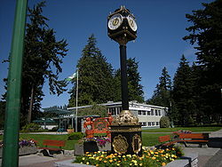
Memorial Park and Friendship Garden

Friendship Garden Hope friendship garden.jpg
Friendship Garden

Immediately adjacent to the District Hall in Hope is a Japanese garden called the Friendship Garden, dedicated to the Japanese-Canadians who were interned nearby at Tashme during World War II. [8] :26 It was built by local Japanese-Canadians and presented to Hope on 27 July 1991. [33] Men from that camp were employed during the war building the Hope-Princeton Highway.

Hope Memorial Park, adjacent to the District Hall and Friendship Garden, is the site of a concert series on Sunday afternoons in July and August. [8] :27

Memorial Park was granted to the then-village of Hope in 1932 by the province of British Columbia. It occupies roughly 7 acres (28,000 m2) in the heart of the town.

Othello Tunnels

Othello Tunnels is the popular name for the main human-made features of Coquihalla Canyon Provincial Park, east of Hope along the canyon of the Coquihalla River and a decommissioned railway grade, now a walking trail, leading eventually to Coquihalla Pass. Originally part of the Kettle Valley Railway, five tunnels and a series of bridges give views of the Coquihalla River as it passes through the river's narrow gorge. [8] :37 [34]

There are two main options for hikers to explore Othello Tunnels. The Othello Tunnels portion of Kettle Valley Trail, 4 km to-and-back, is stroller-friendly and wheelchair-accessible. The Hope-Nicola Valley Trail Loop, a 5.5 km loop hiking trail, is relatively well-maintained but not accessible, nor recommended for people with mobility issues. [35]

Sports

Ogilvie Peak rises some 1,800 m (5,900 ft) above the east shore of Kawkawa Lake and is the southwesternmost summit of the Coquihalla Range of the Cascade Mountains. Ogilvie Peak, BC.jpg
Ogilvie Peak rises some 1,800 m (5,900 ft) above the east shore of Kawkawa Lake and is the southwesternmost summit of the Coquihalla Range of the Cascade Mountains.

Curling

The Hope Curling Club is near the Hope Recreation Complex. The club sponsors bonspiels such as the Men's Bonspiel every January, and the Mixed Curling Bonspiel. [36]

Golf

Hope has a golf course and club on the banks of the Coquihalla River.

Hope Icebreakers Junior Hockey Club

The Hope Icebreakers were a Canadian junior ice hockey team. They played in the Pacific International Junior Hockey League and the town of Hope from the 2003–2008 seasons, after which they were approved by BC Hockey to move to Mission, British Columbia. They subsequently changed their name to the Mission Icebreakers. The Icebreakers have a Sasquatch logo.

Government

The District of Hope is a district municipality that is part of the regional district called the Fraser Valley Regional District.

District municipality

The Mayor of Hope is Victor Smith. [37]

Fraser Valley Regional District

The mayor of Hope also serves as a director on the board of the Fraser Valley Regional District. [38] In addition to regional planning, the Fraser Valley Regional District (FVRD) works in collaboration with the District of Hope to provide recreational and cultural programs, ice arena and swimming pool, regional parks, mapping, air quality, mosquito control, weed control, E911 dispatch fire service, and search and rescue. [39]

Province of British Columbia

Hope is in the Fraser-Nicola riding [40] (electoral district) provincially. The current MLA for Fraser-Nicola is Jackie Tegart. Prior to the 2017 election, Hope was in the Chilliwack-Hope riding provincially, and represented by MLA Laurie Throness, who was elected in 2013. [41]

Parliament of Canada

Hope is in the electoral district of Chilliwack—Hope, [42] [43] which is represented in the House of Commons of Canada by Mark Strahl. [44]

Infrastructure

Transportation

Highways

The Trans-Canada Highway (Highway 1) passes through Hope. Hope is the southern terminus of the Coquihalla Highway (Highway 5), the western terminus of the Crowsnest Highway, locally known as the Hope-Princeton highway (Highway 3), and the eastern terminus of Highway 7.

Hope Aerodrome

Hope Aerodrome (IATA: YHE, ICAO: CYHE) is 2.6  NM (4.8 km; 3.0 mi) west of the Hope Townsite [2] (the previous Town of Hope) within the municipal District of Hope, British Columbia. The aerodrome is operated by the Fraser Valley Regional District. There is one turf runway 3,960 ft (1,210 m) long. The airfield is home to the Vancouver Soaring Association, a gliding club owning and operating school and recreational sailplanes and tow planes. Hope Aerodrome lies within the community of Flood in the District of Hope. [6] [7]

Railways

Both the Canadian Pacific and Canadian National railways pass through Hope. The Canadian, a Canadian transcontinental passenger train currently operated by Via Rail Canada, passes through Hope, calling at the Hope railway station.[ citation needed ]

Heliports

Hope Heliport is a private heliport at Fraser Canyon Hospital. It has charter helicopter service available that provides service for the natural resource industry, including forestry and mining exploration, as well as other industries including film, tourism, and public service.

Health care

Fraser Canyon Hospital

Fraser Canyon Hospital is a 10-bed hospital and provides services including 24/7 emergency care stabilization and triage and hospice beds and services. Emergency care stabilization and triage 24/7 is unique to the hospital due to its geographic isolation and emergency service requirements in an area where major highways converge. [45] Fraser Canyon Hospital officially opened on 10 January 1959, and began as a 20-bed hospital, complete with delivery and operating rooms. [46]

Education

The Fraser-Cascade School District #78 operates several schools in the District of Hope. [47] There are two schools in Hope Townsite [2] (the previous Town of Hope): Coquihalla Elementary School, which offers Kindergarten to Grade 6; and Hope Secondary School, which offers Grades 7–12. In addition, Silver Creek Elementary School, in the community of Silver Creek, offers grades Kindergarten to 7, with these students then attending Hope Secondary School for grades 8–12. [48] The Fraser-Cascade School District also operates other educational programs such as the District Alternative Secondary Program. [49] District enrollment declined from 1,993 students in the 2009–2010 school year to 1,615 in 2014–2015. [50]

Hope has been a popular location to shoot films. First Blood (1982), the first Rambo film, starring Sylvester Stallone, Brian Dennehy, and Richard Crenna, was filmed almost entirely in and around Hope, [14] as was Shoot to Kill (1988), starring Sidney Poitier, Tom Berenger and Kirstie Alley. K2 (1992) was also filmed nearby, with the area's mountains standing in for the Himalayas. [8] :20

Hope Springs (2003), starring Colin Firth and Heather Graham, was filmed in and around Hope, but set in a fictional Hope, Vermont, in the United States. [8] :20

Other films made in whole or in part in and around Hope have included Fire with Fire (1986), White Fang II (1994), Far from Home: The Adventures of Yellow Dog (1995), The Pledge (2001), The Stickup (2003, starring James Spader), Suspicious River (2004), Afghan Knights (2007), and Wind Chill (2007). [8] :20 Hope was the setting for a story by Todd McFarlane in Spider-Man #8-12.

Reality show contestant Ryan Jenkins from VH1's series Megan Wants a Millionaire was found dead in the Thunderbird Motel in Hope on 23 August 2009, of an apparent suicide after being charged with the murder of his wife in California. [51]

In Spider-Man issues #8–12 (the "Perceptions" story arc), a Wendigo creature is blamed in the deaths of several children near Hope, British Columbia, and terrorizing the town. Spider-Man's alter ego, Peter Parker, is sent to take pictures during the media frenzy that follows.

The reality show Highway Thru Hell , shown on the Discovery Channel, is based in Hope and surrounding areas.

In the 2012 video game Deadlight , the protagonist, Randall Wayne, is from the town of Hope. A fictionalized version of the town and its denizens is presented via flashbacks.

A Dog's Way Home was partially filmed within the town.

Scenes of the 2021 wendigo horror film ‘’Antlers’’ were also filmed in hope.

Hope features as the final location in Rebuild: Gangs of Deadsville.

Notable natives and residents

See also

Related Research Articles

<span class="mw-page-title-main">Lower Mainland</span> Region in British Columbia, Canada

The Lower Mainland is a geographic and cultural region of the mainland coast of British Columbia that generally comprises the regional districts of Metro Vancouver and the Fraser Valley. Home to approximately 3.05 million people as of the 2021 Canadian census, the Lower Mainland contains sixteen of the province's 30 most populous municipalities and approximately 60% of the province's total population.

<span class="mw-page-title-main">Fraser Valley</span> Geographical region in British Columbia

The Fraser Valley is a geographical region in southwestern British Columbia, Canada and northwestern Washington State. It starts just west of Hope in a narrow valley encompassing the Fraser River and ends at the Pacific Ocean stretching from the North Shore Mountains, opposite the city of Vancouver BC, to just south of Bellingham, Washington.

Hudson's Hope is a district municipality in northeastern British Columbia, Canada, in the Peace River Regional District. Having been first settled along the Peace River in 1805, it is the third-oldest European-Canadian community in the province, although it was not incorporated until 1965. Most jobs in the economy are associated with the nearby W. A. C. Bennett Dam and Peace Canyon Dam, and timber logging.

<span class="mw-page-title-main">Sparwood</span> District municipality in British Columbia, Canada

Sparwood is a district municipality in the Canadian province of British Columbia. It is the second-largest community on the Elk River.

<span class="mw-page-title-main">Merritt, British Columbia</span> City in British Columbia, Canada

Merritt is a city in the Nicola Valley of the south-central Interior of British Columbia, Canada. It is 270 km (170 mi) northeast of Vancouver. Situated at the confluence of the Nicola and Coldwater rivers, it is the first major community encountered after travelling along Phase One of the Coquihalla Highway and acts as the gateway to all other major highways to the B.C. Interior. The city developed in 1893 when part of the ranches owned by William Voght, Jesus Garcia, and John Charters were surveyed for a town site.

<span class="mw-page-title-main">Squamish-Lillooet Regional District</span> Regional district in British Columbia, Canada

The Squamish-Lillooet Regional District is a quasi-municipal administrative area in British Columbia, Canada. It stretches from Britannia Beach in the south to Pavilion in the north. Lillooet, Pemberton, Whistler and Squamish are the four municipalities in the regional district. Its administrative offices are in the Village of Pemberton, although the district municipalities of Squamish and Whistler are larger population centres. The district covers 16,353.68 km² of land area.

<span class="mw-page-title-main">Greater Vancouver</span> Metropolitan area in British Columbia, Canada

Greater Vancouver, also known as Metro Vancouver, is the metropolitan area with its major urban centre being the city of Vancouver, British Columbia, Canada. The term "Greater Vancouver" describes an area that is roughly coterminous with the region governed by the Metro Vancouver Regional District (MVRD), though it predates the 1966 creation of the regional district. It is often used to include areas beyond the boundaries of the regional district but does not generally include wilderness and agricultural areas that are included within the MVRD.

<span class="mw-page-title-main">Peachland</span> District municipality in British Columbia, Canada

Peachland is a district municipality in the Okanagan Valley on the west side of Okanagan Lake in British Columbia, Canada. It was founded in 1899 by John Moore Robinson, although the region had long been home to the Okanagan people. Peachland is approximately half-an-hour's drive south of the city of Kelowna and about a 20-minute drive north of Summerland. The Okanagan Valley is very narrow in the area and there are few terraces that mark former lake levels and the former lake bottom. As a result, the city is largely located on a steep sidehill. Like many other areas in the Okanagan, Peachland is rapidly growing, with new residents coming from all across Canada. Across the lake from Peachland is Rattlesnake Island, home of the legendary Ogopogo. Peachland is approximately 370 km from Vancouver, British Columbia, on the British Columbia south coast.

<span class="mw-page-title-main">Regional District of East Kootenay</span> Regional district in British Columbia, Canada

The Regional District of East Kootenay (RDEK) is a regional district in the Canadian province of British Columbia, Canada. In the 2016 census, the population was 60,439. Its area is 27,542.69 km2 (10,634.29 sq mi). The regional district offices are in Cranbrook, the largest community in the region. Other important population centres include the cities of Kimberley and Fernie, and the district municipality of Invermere and Sparwood. Despite its name, the regional district does not include all of the region known as the East Kootenay, which includes the Creston Valley and the east shore of Kootenay Lake.

<span class="mw-page-title-main">North Cowichan</span> District municipality in British Columbia, Canada

North Cowichan is a district municipality established in 1873 on Vancouver Island, in British Columbia, Canada. The municipality is part of the Cowichan Valley Regional District. North Cowichan is noted for a landscape including forests, beaches, rivers, and lakes. The municipality encompasses the communities of Chemainus; Westholme; Crofton; Maple Bay; and "the South End". The latter is an informal name for a built-up area which is essentially a suburb of the City of Duncan, a separate municipality.

<span class="mw-page-title-main">Fraser Valley Regional District</span> Regional district in British Columbia, Canada

The Fraser Valley Regional District (FVRD) is a regional district in British Columbia, Canada. Its headquarters are in the city of Chilliwack. The FVRD covers an area of 13,361.74 km² (5,159 sq mi). It was created in 1995 by an amalgamation of the Fraser-Cheam Regional District and Central Fraser Valley Regional District and the portion of the Dewdney-Alouette Regional District from and including the District of Mission eastwards.

<span class="mw-page-title-main">Columbia-Shuswap Regional District</span> Regional district in British Columbia, Canada

The Columbia–Shuswap Regional District is a regional district in the Canadian province of British Columbia, located in the Southern Interior region on the Trans-Canada Highway between Vancouver and Calgary, Alberta. The regional district borders the Province of Alberta across the Rocky Mountains.

<span class="mw-page-title-main">Cowichan Valley Regional District</span> Regional district in British Columbia, Canada

The Cowichan Valley Regional District is a regional district in the Canadian province of British Columbia is on the southern part of Vancouver Island, bordered by the Nanaimo and Alberni-Clayoquot Regional Districts to the north and northwest, and by the Capital Regional District to the south and east. As of the 2021 Census, the Regional District had a population of 89,013. The regional district offices are in Duncan.

Princeton is a town municipality in the Similkameen area of southern British Columbia, Canada. The former mining and railway hub lies at the confluence of the Tulameen into the Similkameen River, just east of the Cascade Mountains. It is at the junction of BC Highway 3 and 5A.

<span class="mw-page-title-main">Mackenzie, British Columbia</span> District municipality in British Columbia, Canada

Mackenzie is a district municipality within the Fraser-Fort George Regional District in central British Columbia, Canada. The community is located at the south end of Williston Lake. The townsite, established by Alexandra Forest Industries and Cattermole Timber, was named for Sir Alexander MacKenzie (1764–1820).

<span class="mw-page-title-main">Regional District of Fraser–Fort George</span> Regional district in British Columbia, Canada

The Regional District of Fraser–Fort George (RDFFG) is a regional district located in the Central Interior of British Columbia, Canada. It is bounded by the Alberta border to the east, the Columbia–Shuswap and Thompson–Nicola regional districts to the south and southeast, Cariboo Regional District to the southwest, the Regional District of Bulkley–Nechako to the west, and the Peace River Regional District to the north and northeast. As of the Canada 2011 Census, Fraser–Fort George had a population of 91,879 and a land area of 51,083.73 km2. The offices of the regional district are located at Prince George.

The District of Kent is a district municipality located 116 kilometres (72 mi) east of Vancouver, British Columbia. Part of the Fraser Valley Regional District, Kent consists of several communities, the largest and most well-known being Agassiz—the only town in the municipality—Harrison Mills, Kilby, Mount Woodside, Kent Prairie, Sea Bird Island and Ruby Creek. Included within the municipality's boundaries are several separately-governed Indian reserves, including the Seabird Island First Nation's reserves on and around the island of the same name.

<span class="mw-page-title-main">Fort St. James</span> District municipality in British Columbia, Canada

Fort St. James is a district municipality and former fur trading post in northern central British Columbia, Canada. It is located on the south-eastern shore of Stuart Lake in the Omineca Country, at the northern terminus of Highway 27, which connects to Highway 16 at Vanderhoof.

Mission—Matsqui—Fraser Canyon is a federal electoral district located in Fraser Valley of British Columbia.

<span class="mw-page-title-main">South Asian Canadians in British Columbia</span>

The South Asian community in British Columbia was first established in 1897. The first immigrants originated from Punjab, British India, a northern region and state in modern-day India and Pakistan. Punjabis originally settled in rural British Columbia at the turn of the twentieth century, working in the forestry and agricultural industries.

References

  1. "British Columbia Regional Districts, Municipalities, Corporate Name, Date of Incorporation and Postal Address" (XLS). British Columbia Ministry of Communities, Sport and Cultural Development. Archived from the original on July 13, 2014. Retrieved November 2, 2014.
  2. 1 2 3 "Hope Townsite Roadmap" (PDF). hope.ca. Archived from the original (PDF) on October 27, 2011.
  3. "Fraser Valley Regional District". Archived from the original on February 1, 2014.
  4. "Kawkawa Lake Roadmap" (PDF). hope.ca. Archived from the original (PDF) on October 27, 2011.
  5. "Silver Creek Roadmap" (PDF). hope.ca. Archived from the original (PDF) on October 27, 2011.
  6. 1 2 "Map of the District of Hope" (PDF). hope.ca. Archived from the original (PDF) on October 27, 2011.
  7. 1 2 "Hope BC". www.hope.ca. Archived from the original on July 18, 2012.
  8. 1 2 3 4 5 6 7 8 9 10 11 Hope Visitor Guide. Hope BC: Hope Standard Publications. 2008.
  9. :38 Christ Church . Canadian Register of Historic Places . Retrieved 29 October 2011.
  10. "Crowsnest Highway". crowsnest-highway.ca.
  11. "Biography – PEERS, HENRY NEWSHAM – Volume IX (1861-1870) – Dictionary of Canadian Biography". www.biographi.ca.
  12. Akrigg, G.P.V.; Akrigg, Helen B. (1986), British Columbia Place Names (3rd, 1997 ed.), Vancouver: UBC Press, ISBN   0-7748-0636-2
  13. "Hope, B.C. celebrates 'Rambo bridge' before demolition". CTV News. July 9, 2011. Archived from the original on August 20, 2020.
  14. 1 2 "Rambo First Blood Filming Location Self-Guided Tour". District of Hope. 14 October 2019. Archived from the original on December 14, 2020.
  15. "Sylvester Stallone 'very proud' of new Rambo carving in B.C. town". CTV News. August 18, 2020. Archived from the original on December 14, 2020.
  16. "Hope A". Environment Canada. Retrieved 1 March 2017.[ permanent dead link ]
  17. "Hope Little Mountain". Environment Canada. 31 October 2011. Retrieved 1 March 2017.
  18. "Population and dwelling counts: Canada, provinces and territories, and census subdivisions (municipalities), British Columbia". Statistics Canada. February 9, 2022. Retrieved February 20, 2022.
  19. 1 2 Government of Canada, Statistics Canada (2022-10-26). "Census Profile, 2021 Census of Population". www12.statcan.gc.ca. Retrieved 2022-11-11.
  20. Government of Canada, Statistics Canada (2021-10-27). "Census Profile, 2016 Census". www12.statcan.gc.ca. Retrieved 2023-03-12.
  21. Government of Canada, Statistics Canada (2015-11-27). "NHS Profile". www12.statcan.gc.ca. Retrieved 2023-03-12.
  22. Government of Canada, Statistics Canada (2019-08-20). "2006 Community Profiles". www12.statcan.gc.ca. Retrieved 2023-03-12.
  23. Government of Canada, Statistics Canada (2019-07-02). "2001 Community Profiles". www12.statcan.gc.ca. Retrieved 2023-03-12.
  24. Government of Canada, Statistics Canada (2019-06-04). "Electronic Area Profiles Profile of Census Divisions and Subdivisions, 1996 Census". www12.statcan.gc.ca. Retrieved 2023-03-12.
  25. "Occupations and the Labour Force in the Fraser Valley Regional District" (PDF). Retrieved February 13, 2017.
  26. Lau, Andree (2015-07-10). "Nestle Water Use In B.C. Under Fire Again Amid Drought, Wildfires". The Huffington Post B.C. Archived from the original on 21 September 2015. Retrieved 7 September 2015.
  27. 1 2 "2014 Economic Profile Hope, British Columbia" (PDF). hopebc.ca. Advantage Hope. Retrieved 30 May 2017.
  28. "www.hopeartsgallery.com". Archived from the original on 2016-03-07. Retrieved 2015-04-06.
  29. "48th Annual Hope Brigade Days, Hope BC". Hope Brigade Days, Hope BC. Retrieved 9 September 2015.
  30. p.12B, The Hope Standard newspaper, Thursday 14 August 2008, Experience the Past special reprint section available at Hope Visitor Centre
  31. "About the Recreation Centre". www.fvrd.bc.ca. Archived from the original on May 29, 2015.
  32. Hope Slide Souvenir Edition, The Hope Standard, January 1965, available at the Hope Visitors Centre
  33. "Friendship Garden". 23 March 2011.
  34. "redirect". gov.bc.ca. Archived from the original on 2016-03-03.
  35. PerfectDayToPlay (2019-10-05). "Othello Tunnels & Hope-Nicola Valley Loop: Rocks & Railway Adventure". PerfectDayToPlay Blog. Retrieved 2020-03-20.
  36. "Events - Hope BC Canada - www.hopebc.com (HopeBC Events)". hopebc.com. 1 August 2015.
  37. "Mayor and Council/District Department Contacts". hope.caaccess-date=April 6, 2015.
  38. "Board of Directors". fvrd.bc.ca.
  39. "District of Hope". www.fvrd.bc.ca. Archived from the original on February 1, 2014.
  40. "Electoral District Maps". April 2020.
  41. "Members; Laurie Throness". Legislative Assembly of British Columbia. Retrieved 7 September 2015.
  42. "Chilliwack—Hope" . Retrieved June 22, 2017.
  43. "Voter Information Service" . Retrieved June 22, 2017.
  44. "Mark Strahl". parl.gc.ca.
  45. "Hospital Services Directory". www.fraserhealth.ca. Archived from the original on August 28, 2009.
  46. Simone Rolph, Hope Standard, 14 January 2009
  47. "SD78 | HR & Jobs". Archived from the original on 2015-10-17. Retrieved 2015-09-07.
  48. "Fraser Cascade School District 78 – SD78 Board of Education".
  49. "District Alternative Secondary Program". Archived from the original on 2009-08-07. Retrieved 2009-03-23.
  50. "Budget 2015/2016" (PDF). School District No. 78 (Fraser Cascade). Retrieved 7 September 2015.
  51. Rolph, Simone (2009-08-23). "U.S. fugitive Ryan Jenkins found hanged in Hope motel". Hope Standard. Archived from the original on 2009-08-27. Retrieved 2020-02-24.
  52. "Darren R. Huston". CNBC. 6 October 2014. Retrieved 3 July 2015.
  1. Extreme high and low temperatures in the table below were recorded at Hope from March 1910 to December 1937 and at Hope Airport from January 1938 to present.
  2. Statistic includes all persons that did not make up part of a visible minority or an indigenous identity.
  3. Statistic includes total responses of "Chinese", "Korean", and "Japanese" under visible minority section on census.
  4. Statistic includes total responses of "Filipino" and "Southeast Asian" under visible minority section on census.
  5. Statistic includes total responses of "West Asian" and "Arab" under visible minority section on census.
  6. Statistic includes total responses of "Visible minority, n.i.e." and "Multiple visible minorities" under visible minority section on census.

49°23′09″N121°26′31″W / 49.38583°N 121.44194°W / 49.38583; -121.44194