Sumallo River

Last updated

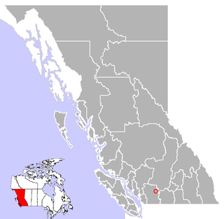
The Sumallo River is located in southern British Columbia, in the Cascade Mountains to the east of Hope. [1] It begins on the east slopes of Mount Payne, [2] south of the village of Sunshine Valley. It flows north until it reaches Sunshine Valley where it turns southeast and proceeds into Manning Park. It continues southeast within the park, running alongside Highway 3 before eventually meeting the Skagit River at the northern boundary of Skagit Valley Provincial Park, to the northeast of Marmot Mountain.

British Columbia Province of Canada

British Columbia is the westernmost province of Canada, located between the Pacific Ocean and the Rocky Mountains. With an estimated population of 5.016 million as of 2018, it is Canada's third-most populous province.

Hope, British Columbia District municipality in British Columbia, Canada

Hope is a commuter town and district municipality at the confluence of the Fraser and Coquihalla rivers in the province of British Columbia, Canada. Hope is at the eastern end of both the Fraser Valley and the Lower Mainland region, and is at the southern end of the Fraser Canyon. To the east over the Cascade Mountains is the Interior region, beginning with the Similkameen Country on the farther side of the Allison Pass in Manning Park. Located 154 kilometres (96 mi) east of Vancouver, Hope is at the southern terminus of the Coquihalla Highway and the western terminus of the Crowsnest Highway, locally known as the Hope-Princeton, where they merge with the Trans-Canada Highway. Hope is at the eastern terminus of Highway 7. As it lies at the eastern end of the Fraser Valley in the windward Cascade foothills, the town gets very high amounts of rain and cloud cover – particularly throughout the autumn and winter.

Sunshine Valley, British Columbia Unincorporated in British Columbia, Canada

Sunshine Valley, formerly named Tashme, is an unincorporated settlement and former Japanese Canadian internment camp on the Crowsnest Highway between of the town of Hope (NW) and the entrance to Manning Park in the Cascade Mountains of British Columbia. Located just outside the 100 mile "quarantine" zone from which all Japanese Canadians were removed during World War II, it was a large camp housing 2400 people on the site of a former Depression-era Relief Workers' Camp. Men housed in the camp were employed in the construction of the highway during the war. After the war, the site was sold off and has continued in existence as a proposed Boy's Town, the Allison Lumber Company and then a small campground and recreational community, and served as the basetown for the small Silvertip Ski Area which was located at the head of Tearse Creek, a tributary of the Upper Sumallo River which flows north into the town from the south & upon entering the town, turns southeast & enters Manning Park. In Hope, there is a Tashme Friendship Garden in memory of the camp and its residents.

The name comes from the word Semall-á-ow given to Alexander Caulfield Anderson by his Nlaka'pamux guide on an 1846 journey through the North Cascades. This word is not from the Halkomelem language from local Sto:lo people, so it may be a Nlaka'pamuctsin (Thompson) word. [3]

Alexander Caulfield Anderson Canadian explorer

Alexander Caulfield Anderson was a Hudson's Bay Company fur-trader, explorer of British Columbia and civil servant.

Nlakapamux ethnic group

The Nlaka'pamux or Nlakapamuk, also previously known as the Thompson, Thompson River Salish, Thompson Salish, Thompson River Indians or Thompson River people, and historically as the Klackarpun, Haukamaugh, Knife Indians and Couteau Indians, are an indigenous First Nations people of the Interior Salish language group in southern British Columbia. Their traditional territory includes parts of the North Cascades region of Washington.

North Cascades mountains in the U.S. and Canada

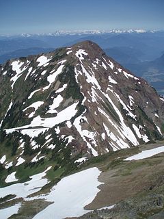
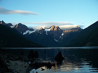
The North Cascades are a section of the Cascade Range of western North America. They span the border between the Canadian province of British Columbia and the U.S. state of Washington and are officially named in the U.S. and Canada as the Cascade Mountains. The portion in Canada is known to Americans as the Canadian Cascades, a designation that also includes the mountains above the east bank of the Fraser Canyon as far north as the town of Lytton, at the confluence of the Thompson and Fraser Rivers.

Related Research Articles

The Fraser Valley is the region of the Fraser River basin in southwestern British Columbia downstream of the Fraser Canyon. The term is sometimes used outside British Columbia to refer to the entire basin including the Fraser Canyon and up from there to its source, but in general British Columbian usage of the term refers to the stretch of the river downstream from the town of Hope, and includes all of the Canadian portion of the Fraser Lowland and areas flanking it.

Skagit River river in Canada and the United States

The Skagit River is a river in southwestern British Columbia in Canada and northwestern Washington in the United States, approximately 150 mi (240 km) long. The river and its tributaries drain an area of 1.7 million acres (6900 km2) of the Cascade Range along the northern end of Puget Sound and flows into the sound.

Spuzzum human settlement in Canada

Spuzzum is an unincorporated settlement in British Columbia, Canada. Because it is on the Trans-Canada Highway, approximately 50 kilometres (31 mi) north of the community of Hope, it is often referred to as being "beyond Hope". Spuzzum was immortalized in the early 1980s by the band "Six Cylinder" in a song with the refrain "If you haven't been to Spuzzum, you ain't been anywhere."

Coquihalla River river in Canada

The Coquihalla River is a tributary of the Fraser River in the Cascade Mountains of the Canadian province of British Columbia. It originates in the Coquihalla Lakes and empties into the Fraser River at Hope.

Vedder River river in Washington state, US and British Columbia, Canada

The Vedder River, called the Chilliwack River above Vedder Crossing, is a river in the Canadian province of British Columbia and the U.S. state of Washington.

Chilliwack Lake Provincial Park provincial park

Chilliwack Lake Provincial Park is a provincial park in British Columbia, Canada. Covering 92.58 km², the park is located 150 km east of Vancouver in the Chilliwack River Valley.

E. C. Manning Provincial Park

E.C. Manning Provincial Park is a provincial park in British Columbia, Canada. It is usually referred to as Manning Park, although that nomenclature is also used to refer to the resort and ski area at the park's core. The park is 70,844 hectares.

Silver Lake Provincial Park is a provincial park in British Columbia, Canada, located in the Skagit River Valley just south of Hope and comprising 77 ha.

Skagit Valley Provincial Park is a provincial park in British Columbia, Canada, centred on the Skagit River and its tributaries. The park borders E. C. Manning Provincial Park in Canada and Ross Lake National Recreation Area and North Cascades National Park in the United States. It includes part of Ross Lake, a reservoir formed by a hydroelectric dam in Whatcom County, Washington.

Cheam Peak

Cheam Peak or Mount Cheam.

Wahleach Lake lake in Canada

Wahleach Lake, commonly known as Jones Lake, is a lake and reservoir located in the Skagit Range in the Lower Mainland of British Columbia, Canada, east of the city of Chilliwack and southwest of the town of Hope.

Skagit Range

The Skagit Range is a subrange of the Cascade Range in southwestern British Columbia, Canada and northwestern Washington, United States, which are known in Canada as the Canadian Cascades or, officially, the Cascade Mountains. The Skagit Range lies to the west of the Skagit River and east and north of the Chilliwack River and flanks the Upper Fraser Valley region of British Columbia's Lower Mainland.

Mount Triumph mountain of the North Cascades in Washington

Mount Triumph is a summit in the North Cascades range of Washington state. Located approximately 5.5 miles (8.9 km) west-northwest of the town of Newhalem, it was named by Lage Wernstedt, a surveyor with the U.S. Forest Service. A significant peak in North Cascades National Park, Mount Triumph is one of its "outstanding sights" and is well known among regional climbers for its lack of easy climbing routes to the summit. Despite its moderate elevation, its local relief is dramatic. With the terrain deeply dissected by the valleys of Bacon Creek on the west and Goodell Creek on the east, it rises 1 mile (1.6 km) in less than 2 miles (3.2 km) on the latter side.

Matsqui is a former District Municipality in British Columbia, Canada. It was incorporated in 1892, and merged with the District Municipality of Abbotsford in 1995 to create the new City of Abbotsford. Matsqui used to be the west part of what is now Abbotsford. It had commercial growth in the Clearbrook area which then spilled over to Abbotsford.

Grass Indian Reserve No. 15 is an Indian Reserve in the area of the City of Chilliwack, British Columbia, Canada, located 3.5 miles southeast of that city's downtown area. 64.80 ha. in size, it is shared by nine bands of the Sto:lo people. These are :

North Cascades National Park Complex

North Cascades National Park Complex is a complex of the United States National Park Service (NPS) located in the north-central portion of the state of Washington. The complex manages three contiguous NPS units: North Cascades National Park, Ross Lake National Recreation Area, and Lake Chelan National Recreation Area.

The Leq' a: mel First Nation, formerly known as the Lakahahmen First Nation, is a First Nations band government whose community and offices are located in the area near Deroche, British Columbia, Canada, about 12 kilometres east of the District of Mission. They are a member government of the Sto:lo Nation tribal council, which is one of two tribal councils of the Sto:lo.

References

  1. "Sumallo River". BC Geographical Names.
  2. "Mount Payne". BC Geographical Names.
  3. Ethnographic Overview of Stó:lo People and the Traditional Use of the Hudson's Bay Company Brigade Trail Area Brian Thom (Written while working at Stó:lo Nation, Chilliwack, BC) Prepared for: Chilliwack Forest District, Ministry of Forests For Contract No. 12015-20/CS96DCK-002. August 1995

Coordinates: 49°13′00″N121°05′00″W / 49.21667°N 121.08333°W / 49.21667; -121.08333

Geographic coordinate system Coordinate system

A geographic coordinate system is a coordinate system that enables every location on Earth to be specified by a set of numbers, letters or symbols. The coordinates are often chosen such that one of the numbers represents a vertical position and two or three of the numbers represent a horizontal position; alternatively, a geographic position may be expressed in a combined three-dimensional Cartesian vector. A common choice of coordinates is latitude, longitude and elevation. To specify a location on a plane requires a map projection.