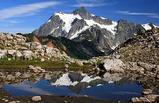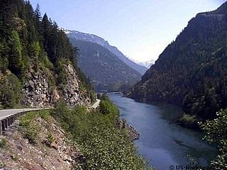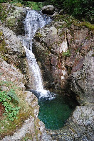
North Cascades National Park is a national park of the United States in Washington. At more than 500,000 acres (200,000 ha), it is the largest of the three National Park Service units that comprise the North Cascades National Park Complex. North Cascades National Park consists of a northern and southern section, bisected by the Skagit River that flows through the reservoirs of Ross Lake National Recreation Area. Lake Chelan National Recreation Area lies on the southern border of the south unit of the park. In addition to the two national recreation areas, other protected lands including several national forests and wilderness areas, as well as Canadian provincial parks in British Columbia, nearly surround the park. North Cascades National Park features the rugged mountain peaks of the North Cascades Range, the most expansive glacial system in the contiguous United States, the headwaters of numerous waterways, and vast forests with the highest degree of flora biodiversity of any American national park.

The North Cascades are a section of the Cascade Range of western North America. They span the border between the Canadian province of British Columbia and the U.S. state of Washington and are officially named in the U.S. and Canada as the Cascade Mountains. The portion in Canada is known to Americans as the Canadian Cascades, a designation that also includes the mountains above the east bank of the Fraser Canyon as far north as the town of Lytton, at the confluence of the Thompson and Fraser Rivers.

The Skagit River is a river in southwestern British Columbia in Canada and northwestern Washington in the United States, approximately 150 mi (240 km) long. The river and its tributaries drain an area of 1.7 million acres (690,000 hectares) of the Cascade Range along the northern end of Puget Sound and flows into the sound.

Ross Lake is a large reservoir in the North Cascade mountains of northern Washington state, United States, and southwestern British Columbia, Canada. The lake runs approximately north–south, is 23 miles (37 km) long, up to 1.5 miles (2.5 km) wide, and the full reservoir elevation is 1,604 feet above sea level.

Ross Lake National Recreation Area is a US national recreation area in north central Washington just south of the Canada–US border. It is the most accessible part of the North Cascades National Park Complex which also includes North Cascades National Park and Lake Chelan National Recreation Area. Ross Lake NRA follows the Skagit River corridor from the Canada–US border to the western foothills of the Cascades. The NRA contains a portion of scenic Washington State Route 20, the North Cascades Highway, and includes three reservoirs: 12,000-acre (4,900 ha) Ross Lake, 910-acre (370 ha) Diablo Lake, and 210-acre (85 ha) Gorge Lake. These reservoirs make up the Skagit River Hydroelectric Project operated by Seattle City Light. Nestled in the "American Alps" the Ross Lake NRA bisects the north and south units of North Cascades National Park.
Akamina-Kishinena Provincial Park is a provincial park located in the southeastern corner of British Columbia, Canada. The park was established by order-in-council on July 13, 1995 to protect the ecological integrity of a relatively narrow stretch of the Rocky Mountains in the southeastern corner of the province.
Cummins Lakes Provincial Park and Protected Area is a provincial park and protected area located in the eastern interior of British Columbia, Canada. It was established on August 4, 2000 to protect mountainous wilderness along the Cummins River.

Sx̱ótsaqel/Chilliwack Lake Provincial Park is a provincial park in British Columbia, Canada. Covering 92.58 km2, the park is located 150 km east of Vancouver in the Chilliwack River Valley.

Davis Lake Provincial Park is a 185 acres (0.75 km2) park in British Columbia, Canada, established as a protected provincial park in October 1963. It is located east of the southern end of Stave Lake, northeast of Mission, British Columbia, approximately 18 km north on Sylvester Rd from BC Highway 7. There are campgrounds and beaches at the south end of the lake, access is walk-in only via a 1 km unmaintained gravel road.

E.C. Manning Provincial Park is a provincial park in British Columbia, Canada. It is usually referred to as Manning Park, although that nomenclature is also used to refer to the resort and ski area at the park's core. The park covers 83,671 hectares (323 mi2) and was the second most visited provincial park in 2017-18 after Cypress Provincial Park. The park lies along British Columbia Highway 3, and occupies a large amount of land between Hope and Princeton along the Canada-United States border.
Gordon Bay Provincial Park is a provincial park in British Columbia, Canada.

Kakwa Provincial Park and Protected Area is a 170,890 ha provincial park in northeastern British Columbia, Canada. The park preserves the southernmost portion of the Hart Ranges and the northernmost portion of the Continental Ranges. The park also preserves significant marine fossil deposits located in the region.

Kennedy Lake Provincial Park is a provincial park in British Columbia, Canada located on the SW side of Kennedy Lake, SE of Tofino, British Columbia adjacent to the Pacific Rim National Park Reserve. The park has day use facilities only.

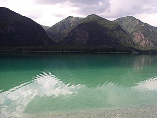
Muncho Lake Provincial Park is a provincial park in British Columbia, Canada, located on the Alaska Highway as it transits the northernmost Canadian Rockies west of Fort Nelson. The park is part of the larger Muskwa-Kechika Management Area. It is named after Muncho Lake, which is in the park and is both the name of the lake and of the community located there.
Schoen Lake Provincial Park is a provincial park in northeastern Vancouver Island, British Columbia, Canada, located east of the community of Woss Lake and southwest of Sayward. The park lies inside the Nimpkish Valley watershed. On October 28, 1977, the "Class A" park was officially created to protect, exhibit and interpret an example of the natural features and processes of the Insular Mountains Natural Region. The park covers a total area of 8,775 hectares. Within those hectares of park land is a number of lakes, creeks and mountain ranges.

Silver Lake Provincial Park is a provincial park in British Columbia, Canada, located in the Skagit River Valley just south of Hope and comprising 77 hectares.

Tantalus Provincial Park is a provincial park located in the Tantalus Range overlooking Squamish Valley in British Columbia, Canada. It was established on December 19, 1998 to protect a large area of pristine alpine wilderness.

The Stephen Mather Wilderness is a 634,614 acres (256,819 ha) wilderness area honoring Stephen Mather, the first director of the National Park Service. It is located within North Cascades National Park, Lake Chelan National Recreation Area, and Ross Lake National Recreation Area in the North Cascade Range of Washington, United States.

The geography of the North Cascades describes a range of rugged mountains in British Columbia, Canada and Washington, United States. In Canada, the range is officially named the Cascade Mountains but is commonly referred to as the Canadian Cascades.
Omineca Provincial Park and Protected Area is a provincial park and protected area located in the north-central interior of British Columbia, Canada. It was established on 11 April 2001 by BC Parks to protect provincially significant riparian and wetland habitats along the Omineca River.


