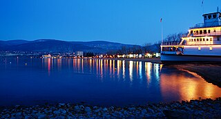
Penticton is a city in the Okanagan Valley of the Southern Interior of British Columbia, Canada, situated between Okanagan and Skaha lakes. In the 2016 Canadian Census, its population was 33,761, while its census agglomeration population was 43,432.

The Okanagan, also called the Okanagan Valley and sometimes the Okanagan Country, is a region in the Canadian province of British Columbia defined by the basin of Okanagan Lake and the Canadian portion of the Okanagan River. It is part of the Okanagan Country, extending into the United States as Okanogan County in north-central Washington. According to the 2016 Canadian census, the region's population is 362,258. The largest populated cities are Kelowna, Penticton, Vernon, and West Kelowna.

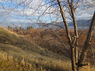
Skaha Bluffs is a rock climbing area just south of Penticton, British Columbia, Canada on a hillside above Skaha Lake. The climbing takes place in three parallel canyons. Notable climbing walls include Fortress, Red Tail, Doctors wall, The Great White Wall and The Grand Canyon. The area is mostly a sport climbing area, though traditional climbing opportunities also exist. The rocks in the area are predominantly a coarse-grained gneiss and are generally under 30 metres tall. Skaha Bluffs is a climbing area with mild weather, easy access and a number of sport climbing routes. Access is from Lakeside Road to Smythe Road up along Gillies Creek.
Banana Island Provincial Park is a provincial park in British Columbia, Canada. It is a small 10.4 hectare island in the South Thompson River, located approximately 35 kilometres east of Kamloops. There are no camping or recreational facilities, as it is an environmentally sensitive area. The island was designated as a provincial park on 30 April 1996 following recommendations from the Kamloops Land and Resource Management Plan to protect spring salmon spawning grounds and nesting grounds for several varieties of birds. It is used for nesting by Canada geese, Osprey and bald eagles, and other waterfowl and raptors. It is also a winter habitat for Tundra and Trumpeter swans. The island is vegetated with ponderosa pine and grassy undercover, and was historically used by the Neskonlith First Nation in accessing river resources.

Chasm Provincial Park is a provincial park in British Columbia, Canada, located near the town of Clinton. Expanded to 3,067 hectares in 1995, the park was originally created in 1940 to preserve and promote a feature known as the Painted Chasm, or simply The Chasm, a gorge created from melting glacial waters eroding a lava plateau over a 10 million year span called the Chilcotin Group.

Kalamalka Lake Provincial Park and Protected Area is a provincial park in Coldstream, British Columbia, Canada. Located within the Okanagan region, the park encompasses a land area of about 978 hectares of pristine natural areas in the North Okanagan Regional District. Kalamalka Lake Provincial Park and Protected Area adopted its current name from Kalamalka Lake, for which it is located on its shore. During the process of entering summer, calcium carbonate forms crystals that reflect sunlight and create the vivid blue and green colours. Temperature changes in the fall and the spring sometimes create ribbons of deep blue colour in the lake, seen from the park.
Monte Lake Provincial Park is a provincial park in British Columbia, Canada, located on the east side of Monte Lake and to the south of the community of Monte Lake, British Columbia which is at the north end of the lake. About five hectares in size, it protects an area of Ponderosa pine and grasslands.

Myra-Bellevue Provincial Park is a provincial park in British Columbia, Canada, located in the Okanagan Highland east of Kelowna. It was established to protect the full elevational range of the North Okanagan Basin and North Okanagan Highlands ecosections.
Okanagan Falls Provincial Park, now officially named sx̌ʷəx̌ʷnitkʷ Provincial Park, is a provincial park in British Columbia, Canada, located within the traditional territory of the Osoyoos Indian Band. Since time immemorial, the Osoyoos Indian Band's Okanagan ancestors have inhabited and cared for the lands and waters in their traditional territory. The park is also located within the town of Okanagan Falls, protecting the area around the waterfall of the same name, which lies below the outlet of Skaha Lake in the course of the Okanagan River.

Okanagan Lake Provincial Park is a provincial park in British Columbia, Canada. Established in 1955, the park covers a total area of 98 hectares.
Syringa Park is a provincial park on the east shore of Lower Arrow Lake in the West Kootenay region of southeastern British Columbia. At the foot of the Norns Range, Tulip Creek passes through the centre, and Syringa Creek is closer to the southeastern boundary. The park is about 19 kilometres (12 mi) west of Castlegar via Broadwater Rd.

The Okanagan Highland is an elevated hilly plateau area in British Columbia, Canada, and the U.S. state of Washington. Rounded mountains with elevations up to 8,000 ft (2,400 m) above sea level and deep, narrow valleys are characteristic of the region.
The Penticton Indian Band is a First Nations government in the Canadian province of British Columbia, located next to the city of Penticton in the Okanagan Valley. They are a member of the Okanagan Nation Alliance. It has an accredited High School.

Vaseux Lake is a shallow freshwater lake located along the course of the Okanagan River in the Okanagan Valley of British Columbia, Canada.

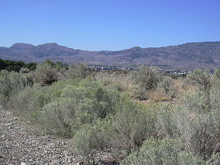
The Okanagan Desert is the common name for a semi-arid shrubland located in the southern region of the Okanagan Valley in British Columbia and Washington. It is centred around the city of Osoyoos and is the only semi-arid shrubland in Canada. Part of this ecosystem is referred to as the Nk'mip Desert by the Osoyoos Indian Band, though it is identical to the shrublands elsewhere in the region. To the northwest of this area lies an arid shrubland near Kamloops.

South Chilcotin Mountains Provincial Park is a provincial park in British Columbia, Canada, located on Highway 40 northwest of Lillooet, British Columbia. The park, which is 56,796 ha. in size, was established on April 18, 2001, and It was created out of a portion of the Spruce Lake Protected Area. The park is located on three Indigenous Nations: The Tsilhqot’in, St’at’imc, and Secwepemc.

McIntyre Bluff, officially called nʕaylintn since 7 August 2015, is a large ridge of rock, made of gneiss, located south of Vaseux Lake between Okanagan Falls and Oliver in British Columbia, Canada. The bluff rises prominently over the surrounding valley and is one of the most well known landmarks in the Okanagan.
Vaseux-Bighorn National Wildlife Area is a National Wildlife Area in British Columbia, Canada, primarily set aside to protect winter rangeland for California bighorn sheep. In 1979, the Vaseux-Bighorn Wildlife Area was established in response to substantial reduction in wild animal populations in the area. Identified factors contributing to species decline at the time were high predator population, overharvesting of species, and illegal hunting. Land development, cattle raising, and lumbering also might have altered species populations. Under these conditions, the area was able to be classified as a Category IV area by the IUCN and is now used for wildlife habitat and conservation. Even with minimal anthropogenic use of the area, threats persist through invasive species. Recreational use is limited spatially and is only open to the public during the day.

Okanagan dry forests is a temperate coniferous forest ecoregion in the Pacific Northwest of North America, as defined by the World Wildlife Fund (WWF) categorization system. It is closely associated with the Okanagan region of British Columbia and Washington. Only 20% of the ecosystem is still intact, and continues to be under threat for preservation due to land clearing and urban expansion, alongside the increasing threats of fire and extreme weather due to climate change.

White Lake Grasslands Protected Area is a conservation site located in the Regional District of Okanagan-Similkameen of British Columbia, Canada. It was established on April 18, 2001 by an order-in-council under the Environment and Land Use Act to protect the semi-arid grassland and pine forest ecosystem west of Vaseux Lake.


