
Pacific Rim National Park Reserve is a 511 km2 (197 sq mi) national park located in British Columbia, Canada, which comprises three separate regions: Long Beach, the Broken Group Islands, and the West Coast Trail. It is located in the Pacific Coast Mountains, which are characterized by rugged coasts and temperate rainforests.

Lake Nipigon is part of the Great Lakes drainage basin. It is the largest lake entirely within the boundaries of the Canadian province of Ontario.

Shuswap Lake is a lake located in the southern interior of British Columbia, Canada that drains via the Little Shuswap River into Little Shuswap Lake. Little Shuswap Lake is the source of the South Thompson River, a branch of the Thompson River, a tributary of the Fraser River. It is at the heart of a region known as the Columbia Shuswap or "the Shuswap", noted for its recreational lakeshore communities including the city of Salmon Arm. The name "Shuswap" is derived from the Shuswap or Secwepemc First Nations people, the most northern of the Interior Salish peoples, whose territory includes the Shuswap. The Shuswap call themselves /ʃǝxwépmǝx/ in their own language, which is called /ʃǝxwepmǝxtʃín/.
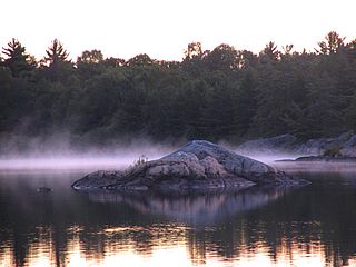
The Massasauga Provincial Park is a provincial park in Parry Sound District, Ontario, Canada, stretching from the town of Parry Sound south to the Moon River. The park has an area of 131.05 km2 (50.60 sq mi).

Desolation Sound is a deep water sound at the northern end of the Salish Sea and of the Sunshine Coast in British Columbia, Canada.
Anstey-Hunakwa Provincial Park is a provincial park in the Shuswap Country of the Southern Interior of British Columbia, Canada. 6,852 hectares in size, the park was established 18 April 2001.
Clayoquot Arm Provincial Park is a provincial park in British Columbia, Canada.

Fossli Provincial Park is a provincial park in British Columbia, Canada, located on Stirling Arm of Sproat Lake on Vancouver Island. The 52-hectare park, west of Port Alberni, is accessible by water or private logging road. It has few services, but has a 30-minute hiking trail to an old homestead site. The homestead belonged to Helen and Armour Ford, who donated the land for the park to the province in 1974. Saint Andrew's Creek runs through the park, and is a fall spawning ground for coho salmon.

Herald Provincial Park is a provincial park in British Columbia, Canada. It is on the north shore of the Salmon Arm of Shuswap Lake, in the Southern Interior of British Columbia, Canada. The park is some 30 minutes northeast of the city of Salmon Arm. Herald Park contains a popular camping area, as well as a day use/picnic area. Large pebble beaches stretch along the southern boundary of the park. Walking and hiking trails exist throughout the park, including an easy 10-minute hike to the spectacular Margaret Falls.

Say Nuth Khaw Yum Provincial Park, also known as Indian Arm Provincial Park, is a provincial park located in the Lower Mainland of British Columbia, Canada. The park was established on July 13, 1995 by BC Parks to protect the forested mountain terrain of Indian Arm.
Okeover Arm Provincial Park is a provincial park in British Columbia, Canada. The park is located on the west side of Okeover Inlet facing Desolation Sound, on the east side of the Malaspina Peninsula.
West Arm Provincial Park is a provincial park in British Columbia, Canada.

Kennedy Lake is the largest lake on Vancouver Island, British Columbia, Canada. Located north of Ucluelet on the island's central west coast, the lake is formed chiefly by the confluence of the Clayoquot and Kennedy Rivers. Outflow is via a short stretch of the Kennedy River into Tofino Inlet. The lake includes an extensive northern arm called Clayoquot Arm.
Silver Beach Provincial Park is a provincial park in British Columbia, Canada, located at the head of the Seymour Arm of Shuswap Lake in that province's Shuswap Country, adjacent to the settlement of Seymour Arm.
Taylor Arm Provincial Park is a provincial park in British Columbia, Canada, located on the north side of Sproat Lake 23 km northwest of Port Alberni on Vancouver Island. Situated along Highway 4, the 71-hectare park has few services but provides group camping sites, undeveloped beaches, and day-use areas. The group camping site has pit toilets and a hand pump water supply, and is connected to the lake shore via a trail that passes under the highway.

Saanich Inlet is a body of salt water that lies between the Saanich Peninsula and the Malahat highlands of Vancouver Island, British Columbia, Canada. Located just northwest of Victoria, the inlet is 25 km (16 mi) long, has a surface area of 67 km2 (26 sq mi), and its maximum depth is 226 m (741 ft). It extends from Satellite Channel in the north to Squally Reach and Finlayson Arm in the south. The only major tributary feeding the inlet is the Goldstream River.
Indian Arm is a steep-sided glacial fjord adjacent to the city of Vancouver in southwestern British Columbia. Formed during the last Ice Age, it extends due north from Burrard Inlet, between the communities of Belcarra and the District of North Vancouver, then on into mountainous wilderness. Burrard Inlet and the opening of Indian Arm was mapped by Captain George Vancouver and fully explored days later by Dionisio Alcalá Galiano in June 1792.

Last Mountain Lake, also known as Long Lake, is a prairie lake formed from glaciation 11,000 years ago. It is located in south central Saskatchewan, Canada, about 40 kilometres (25 mi) north-west of the city of Regina. It flows into the Qu'Appelle River via Last Mountain Creek, which flows past Craven. It is approximately 93 km (58 mi) long, and 3 km (1.9 mi) across at its widest point. It is the largest naturally occurring body of water in southern Saskatchewan. Only Lake Diefenbaker, which is man-made, is larger. The lake is a popular resort area for residents of south-eastern Saskatchewan.
Clayoquot Sound Biosphere Reserve is a UNESCO Biosphere Reserve situated in Clayoquot Sound on the west coast of Vancouver Island in British Columbia, Canada. A diverse range of ecosystems exist within the biosphere reserve boundaries, including temperate coastal rainforest, ocean and rocky coastal shores.
Lewis Channel is a strait located between Cortes Island and West Redonda Island in the Discovery Islands of British Columbia, Canada. It is part of the northern Salish Sea.


