
Pawnee National Grassland is a United States National Grassland located in northeastern Colorado on the Colorado Eastern Plains. The grassland is located in the South Platte River basin in remote northern and extreme northeastern Weld County between Greeley and Sterling. It comprises two parcels totaling 193,060 acres (78,130 ha) largely between State Highway 14 and the Wyoming border. The larger eastern parcel lies adjacent to the borders of both Nebraska and Wyoming. It is administered in conjunction with the Arapaho-Roosevelt National Forest from the U.S. Forest Service office in Fort Collins, with a local ranger district office in Greeley.

Aspen parkland refers to a very large area of transitional biome between prairie and boreal forest in two sections, namely the Peace River Country of northwestern Alberta crossing the border into British Columbia, and a much larger area stretching from central Alberta, all across central Saskatchewan to south central Manitoba and continuing into small parts of the US states of Minnesota and North Dakota. Aspen parkland consists of groves of aspen, poplar and spruce, interspersed with areas of prairie grasslands, also intersected by large stream and river valleys lined with aspen-spruce forests and dense shrubbery. This is the largest boreal-grassland transition zone in the world and is a zone of constant competition and tension as prairie and woodlands struggle to overtake each other within the parkland.
Bonaparte Provincial Park is an 11,811 hectare provincial park in British Columbia, Canada. It is located within the Bonaparte Plateau.
Graystokes Provincial Park is a provincial park located on the border between the regional districts of Central Okanagan and North Okanagan in south-central British Columbia. It was established on 18 April 2001 to protect a large area of the ecologically diverse Okanagan Highland east of the Okanagan Valley.

Juniper Beach Provincial Park is a provincial park in the Thompson Country region of south central British Columbia, Canada. The facility is on the north side of the Thompson River, west of the town of Savona, and downstream from the Kamloops Lake outflow. On BC Highway 1, the locality is by road about 20 kilometres (12 mi) east of Cache Creek and 65 kilometres (40 mi) west of Kamloops.
Porcupine Meadows Provincial Park is a 2,704 hectare provincial park in British Columbia, Canada, located north of Tranquille Lake to the northwest of Kamloops. Its name is a direct translation of the Shuswap word for this area, "pisitsoolsia", named so for the numerous porcupine in the area.
Zumwalt Prairie is a grassland area located in Wallowa County in northeast Oregon, United States. Measuring 330,000 acres (130,000 ha), much of the land is used for agriculture, with some portions protected as the Zumwalt Prairie Preserve owned by The Nature Conservancy. Part of that portion is designated as a National Natural Landmark. The high altitude prairie is along the west edge of Hells Canyon on the Oregon-Idaho border.

The Churn Creek Protected Area is a 36,747-hectare (90,800-acre) provincial protected area in British Columbia, Canada. It is a mix of dryland canyon and steppe and adjoining rangeland flanking the canyon of Churn Creek and that stream's confluence with the Fraser River at the northern apex of the Camelsfoot Range. The historic Gang Ranch is just north of the Churn Creek Protected Area. The Empire Valley Ranch ecological preserve was added to the Protected Area in an expansion.
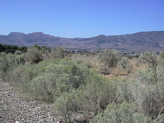
The Okanagan Desert is the common name for a semi-arid shrubland located in the southern region of the Okanagan Valley in British Columbia and Washington. It is centred around the city of Osoyoos and is the only semi-arid shrubland in Canada. Part of this ecosystem is referred to as the Nk'mip Desert by the Osoyoos Indian Band, though it is identical to the shrublands elsewhere in the region. To the northwest of this area lies an arid shrubland near Kamloops.

Pseudoroegneria spicata is a species of grass known by the common name bluebunch wheatgrass. This native western North American perennial bunchgrass is also known by the scientific synonyms Elymus spicatus and Agropyron spicatum. The grass can be found in the United States, Canada, and Mexico from Alaska and Yukon south as far as Sonora and Nuevo León.

The Eastern Cascades Slopes and Foothills ecoregion is a Level III ecoregion designated by the United States Environmental Protection Agency (EPA) in the U.S. states of Oregon, Washington, and California. In the rain shadow of the Cascade Range, the eastern side of the mountains experiences greater temperature extremes and receives less precipitation than the west side. Open forests of ponderosa pine and some lodgepole pine distinguish this region from the Cascades ecoregion, where hemlock and fir forests are more common, and from the lower, drier ecoregions to the east, where shrubs and grasslands are predominant. The vegetation is adapted to the prevailing dry, continental climate and frequent wildfire. Volcanic cones and buttes are common in much of the region.

The Blue Mountains ecoregion is a Level III ecoregion designated by the United States Environmental Protection Agency (EPA) in the Pacific Northwest, mainly in the state of Oregon, with small areas over the state border in Idaho and southeastern Washington. It is also contiguous with the World Wildlife Fund's Blue Mountain forests ecoregion.

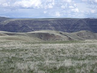
The Columbia Plateau ecoregion is a Level III ecoregion designated by the United States Environmental Protection Agency (EPA) encompassing approximately 32,100 square miles (83,139 km2) of land within the U.S. states of Washington, Oregon, and Idaho. The ecoregion extends across a wide swath of the Columbia River Basin from The Dalles, Oregon to Lewiston, Idaho to Okanogan, Washington near the Canada–U.S. border. It includes nearly 500 miles (800 km) of the Columbia River, as well as the lower reaches of major tributaries such as the Snake and Yakima rivers and the associated drainage basins. It is named for the Columbia Plateau, a flood basalt plateau formed by the Columbia River Basalt Group during the late Miocene and early Pliocene. The arid sagebrush steppe and grasslands of the region are flanked by moister, predominantly forested, mountainous ecoregions on all sides. The underlying basalt is up to 2 miles (3 km) thick and partially covered by thick loess deposits. Where precipitation amounts are sufficient, the deep loess soils have been extensively cultivated for wheat. Water from the Columbia River is subject to resource allocation debates involving fisheries, navigation, hydropower, recreation, and irrigation, and the Columbia Basin Project has dramatically converted much of the region to agricultural use.

The Snake River Plain ecoregion is a Level III ecoregion designated by the United States Environmental Protection Agency (EPA) in the U.S. states of Idaho and Oregon. It follows the Snake River across Idaho, stretching roughly 400 miles (640 km) from the Wyoming border to Eastern Oregon in the xeric intermontane west. Characterized by plains and low hills, it is considerably lower and less rugged than surrounding ecoregions. Many of the alluvial valleys bordering the Snake River are used for agriculture. Where irrigation water and soil depth are sufficient, sugar beets, potatoes, alfalfa, small grains, and vegetables are grown. Elsewhere, livestock grazing is widespread. Cattle feedlots and dairy operations are found locally.

The Northern Basin and Range ecoregion is a Level III ecoregion designated by the United States Environmental Protection Agency (EPA) in the U.S. states of Oregon, Idaho, Nevada, Utah, and California. It contains dissected lava plains, rolling hills, alluvial fans, valleys, and scattered mountain ranges in the northern part of the Great Basin. Although arid, the ecoregion is higher and cooler than the Snake River Plain to the north and has more available moisture and a cooler climate than the Central Basin and Range to the south. Its southern boundary is determined by the highest shoreline of Pleistocene Lake Bonneville, which once inundated the Central Basin and Range. The western part of the region is internally drained; its eastern stream network drains to the Snake River system.

South Chilcotin Mountains Provincial Park is a provincial park in British Columbia, Canada, located on Highway 40 northwest of Lillooet, British Columbia. The park, which is 56,796 ha. in size, was established on April 18, 2001, and It was created out of a portion of the Spruce Lake Protected Area. The park is located on three Indigenous Nations: The Tsilhqot’in, St’at’imc, and Secwepemc.
Vaseux-Bighorn National Wildlife Area is a National Wildlife Area in British Columbia, Canada, primarily set aside to protect winter rangeland for California bighorn sheep. In 1979, the Vaseux-Bighorn Wildlife Area was established in response to substantial reduction in wild animal populations in the area. Identified factors contributing to species decline at the time were high predator population, overharvesting of species, and illegal hunting. Land development, cattle raising, and lumbering also might have altered species populations. Under these conditions, the area was able to be classified as a Category IV area by the IUCN and is now used for wildlife habitat and conservation. Even with minimal anthropogenic use of the area, threats persist through invasive species. Recreational use is limited spatially and is only open to the public during the day.

Okanagan dry forests is a temperate coniferous forest ecoregion in the Pacific Northwest of North America, as defined by the World Wildlife Fund (WWF) categorization system. It is closely associated with the Okanagan region of British Columbia and Washington. Only 20% of the ecosystem is still intact, and continues to be under threat for preservation due to land clearing and urban expansion, alongside the increasing threats of fire and extreme weather due to climate change.
South Okanagan—Similkameen National Park Reserve is a proposed national park reserve located in the Regional District of Okanagan-Similkameen of British Columbia. The goal of the park is to work with the local First Nations to protect a large patch of Okanagan dry forests and part of the northern reach of the Columbia Plateau ecoregion in Canada.

White Lake Grasslands Protected Area is a protected area located in the Regional District of Okanagan-Similkameen of British Columbia, Canada. It was established on April 18, 2001 by order-in-council under the Environment and Land Use Act to protect the semi-arid grassland and pine forest ecosystem west of Vaseux Lake.


