The Stuart River or Nak'alkoh is one of the largest tributaries of the Nechako River in northeastern British Columbia, Canada. The Nechako is in turn one the more important tributaries of the Fraser River. The Stuart River flows 187 kilometres (116 mi) from Stuart Lake to its junction with the Nechako River. The river drains a portion of the Nechako Plateau—a gently-rolling region characterized by small lakes and tributaries. Low but impressive ridges interact with the river, creating high bluffs and hoodoos.
Tl'azt'en Nation is a First Nations band located along the north shore of Stuart Lake near the outlet of the Tache River, in the northern interior of British Columbia. The main village belonging to Tl'azt'en Nation is Tache, 60 km north-west of Fort St. James.The small settlements of Middle River (Dzit'lain'li).on Trembleur Lake and Grand Rapids, along the Tache River between Stuart Lake and Trembleur Lake also belong to Tl'azt'en Nation. The main administrative offices are in Tache, as a school - Eugene Joseph Elementary School, Daycare, Head Start, Health Unit, Education Centre/ Learning Centre for Adults, RCMP/ Justice Office, Public Works building that supplies diesel and gasoline, water treatment plant, a newly built youth recreation center (2012), a Catholic and Christian church, one in Old Tache and one in "sunny side", a volunteer fire department with a fire hall; rec sites include a paintball park, a basketball court and a hockey rink. The village of Portage once belonged to Tla'zt'en Nation but separated in 1994 as Yekooche First Nation. The village of Pinchie once belonged to Tl'azt'en Nation separated on March 12, 2019 and is now the Binche Whut'en First Nation Prior to 1988 Tl'azt'en Nation was known as the Stuart-Trembleur band. Tl'azt'en Nation belongs to the Carrier Sekani Tribal Council.
Atlin/Áa Tlein Téix'i Provincial Park is a provincial park in British Columbia, Canada. Situated in the remote northwestern corner of the province, the park protects large tracts of boreal forest, alpine tundra and glaciated terrain. The southern third of Atlin Lake, the largest natural body of freshwater in the province, is within the park boundary. The park is very undeveloped; no roads traverse it and no facilities, supplies, developed campsites or maintained hiking trails are available inside the park. The area has become a focal point in controversies involving proposed hydroelectric projects affecting Atlin Lake and environmental groups who view these proposals as potentially damaging to the lake's environment and its surroundings.

Big Bar Lake Provincial Park is a provincial park in British Columbia, Canada. It includes vehicle accessible camping, a boat launch, swimming, angling, and hiking opportunities. There are 46 campsites within the park in two very close campgrounds.
Charlie Lake Provincial Park is a provincial park in British Columbia, Canada, established on the western shore of Charlie Lake. It is roughly 92 hectares in size.
Kekuli Bay Provincial Park, formerly Kalamalka West Provincial Park, is a provincial park in British Columbia, Canada, located on the west shore of Kalamalka Lake on BC Highway 97 south of Vernon. The lake is popular for waterskiing and boating, and the park includes a boat launch, as well as a campground with a view of the lake. The park was established in 1990. Its size is about 57 hectares.
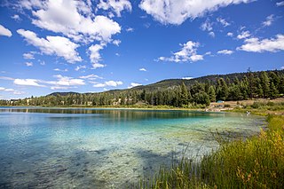
Kentucky Alleyne Provincial Park is a provincial park in British Columbia. The park is located 38 kilometres south of the city of Merritt, and east of the community of Aspen Grove. The park is named for two of its largest lakes, Kentucky Lake and Alleyne Lake. All lakes in the park have a distinctive turquoise colouration.
Kikomun Creek Provincial Park is a provincial park in British Columbia, Canada.

Mara Provincial Park is a day-use provincial park in British Columbia, Canada, located on Mara Lake south of Sicamous. The park is open with services from May 1 to September 27. The gate is locked open during the off season.
Tłu Tue - Maxhamish Lake Provincial Park and Protected Area is a 27,516-hectare (67,990-acre) provincial park in British Columbia, Canada.
Nickel Plate Provincial Park is a provincial park in British Columbia, Canada. Formerly known as Clearwater Park, it is located in the Similkameen District at the northeast corner of Nickel Plate Lake. The park is also 29km northeast of Hedley near the Apex Ski Resort.
Nimpkish Lake Provincial Park is a provincial park on northern Vancouver Island, British Columbia, Canada on Vancouver Island. The park is 3,949 ha. in area and was established on 1995. It is 32 km south of Port McNeill and on the southwest side of Nimpkish Lake. Primary access is by boat launch, though radio-controlled logging roads lead to the edge of the park. Western Forest Products in Woss, British Columbia should be contacted for road advisories. The park is in the traditional territory of the Namgis First Nation.
Norbury Lake Provincial Park is a 97-hectare (240-acre) provincial park in British Columbia, Canada.
One Island Lake Provincial Park is a provincial park in British Columbia, Canada.

White Lake Provincial Park is a provincial park in British Columbia, Canada and is located 10 kilometres northeast of Balmoral, British Columbia. Established in 1965, the park is just west of Cedar Creek Camp, a park owned by the not-for-profit organisation of People In Motion. The lake is popular with anglers fishing for rainbow trout; in terms of angler days, it is one of the top three fishing lakes in the province.
Wistaria Provincial Park is a provincial park in the Canadian province of British Columbia, located 60 km southwest of Burns Lake and approximately 80 km southeast of Houston, BC.
Woss Lake Provincial Park is a provincial park in British Columbia, Canada, located 75 kilometres southeast of Port McNeill, near the community of Woss, which is also known as Woss Lake.
Tweedsmuir North Provincial Park and Protected Area is a provincial park in British Columbia, Canada, which along with Tweedsmuir South Provincial Park and Entiako Provincial Park were once part of Tweedsmuir Provincial Park, then B. C.'s largest park, 9,810 square kilometres (3,790 sq mi) located in the Coast Range.

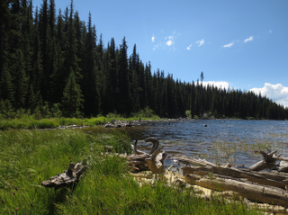
Trembleur Lake is a lake in the Omineca Country of the Central Interior of British Columbia, Canada, northwest of Fort St. James between Stuart Lake and the south end of Takla Lake. It is part of the Nechako Lakes. Its name in the Dakelh language is Dzindlat Bun. It has also been known as Cross Lake. Trembleur Lake Provincial Park is on its north shore, above the Middle River. The reserve settlement of Middle River is at that river's mouth into Trembleur Lake.

