Anderson Bay Provincial Park is a provincial park in British Columbia, Canada, located on the southeast end of Texada Island near the community of Gillies Bay. Created in 2000, it is approximately 35 hectares in area.
Babine Lake Marine Park is on Babine Lake, which borders the Skeena and Omineca regions of central British Columbia. This provincial park comprises six separate sites around the lake. Vehicle access to the lake, via BC Highway 16 and Nilkitkwa forestry service road, is by road about 105 kilometres (65 mi) northeast of Smithers; via BC Highway 16 and Central Babine Lake Highway, is about 132 kilometres (82 mi) east of Smithers; or via Babine Lake Road, is about 20 kilometres (12 mi) northeast of Burns Lake.
Burgoyne Bay Provincial Park is a provincial park in British Columbia, Canada located on southwestern Saltspring Island near Fulford Harbour. The parks faces northwest to Sansum Narrows, which is the channel between Saltspring Island and Vancouver Island. Mount Maxwell Provincial Park lies adjacent to the north.

Buccaneer Bay Provincial Park is a provincial park in British Columbia, Canada, located 17 km west of Sechelt on North Thormanby Island, offshore from the community of Halfmoon Bay.
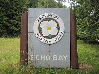
Echo Bay Marine Provincial Park is a provincial park in British Columbia, Canada, established in 1971 and containing 1.5 hectares. It is located at the bay of the same name, offshore from the community of the same name, which is the location of the Simoom Sound post office and is on the west side of Gilford Island.
Gordon Bay Provincial Park is a provincial park in British Columbia, Canada.

Helliwell Provincial Park is a provincial park in British Columbia, Canada located on a headland at the northeast end of Hornby Island.
Kootenay Lake Provincial Park is a provincial park in British Columbia, Canada. It encompasses five widely dispersed parks around Kootenay Lake: Kootenay Lake Provincial Park, Kootenay Lake Provincial Park, Kootenay Lake Provincial Park, Kootenay Lake Provincial Park, and Kootenay Lake Provincial Park.

Mount Maxwell Provincial Park is a provincial park in the Gulf Islands of British Columbia, Canada. It is located on Burgoyne Bay and the Sansum Narrows on the western shores of Saltspring Island.
Pennask Lake Provincial Park is a provincial park in British Columbia, Canada, located on the easternmost heights of the Thompson Plateau, 50 km (31 mi) to the northwest of the Okanagan town of Peachland.

Pilot Bay Provincial Park is a provincial park in British Columbia, Canada.

Porpoise Bay Provincial Park is a provincial park in British Columbia, Canada near the town of Sechelt. Features of the park include a campsite with group and walk-in camping opportunities, as well as opportunities for paddling, swimming and observing nature.

Saltery Bay Provincial Park is a provincial park in British Columbia, Canada. The park is located southeast of the city of Powell River, and on the north side of the entrance to Jervis Inlet in the central area of the province's Sunshine Coast region.
Sandwell Provincial Park is a provincial park in British Columbia, Canada. It is a small oceanfront site on Lock Bay, on the northeast shore of Gabriola Island. Hiking, swimming and beach-walking are popular activities here, though it is only accessible at low tide and park facilities are limited. There are also petroglyphs carved into the sandstone boulders on Lock Bay's foreshore.
Sargeant Bay Provincial Park, is a provincial park in British Columbia, Canada, located just west of the community of Sechelt on the southern Sunshine Coast. Created in 1990 at 57 ha. in size, the park was expanded to approximately 146 ha. in 1997.
Santa Gertrudis-Boca del Infierno Provincial Park, legally Santa-Boca Provincial Park, is a provincial park on Nootka Island in British Columbia, Canada. It was established on 30 April 1996 to protect and Santa Gertrudis Cove and Boca del Infierno Bay, which are located on the southeastern shore of Nootka Island.

Shannon Falls Provincial Park is a provincial park in British Columbia, Canada. It is located 58 kilometers (36 mi) from Vancouver and 2 kilometers (1.2 mi) south of Squamish along the Sea to Sky Highway.
Tweedsmuir North Provincial Park and Protected Area is a provincial park in British Columbia, Canada, which along with Tweedsmuir South Provincial Park and Entiako Provincial Park were once part of Tweedsmuir Provincial Park, then B. C.'s largest park, 9,810 square kilometres (3,790 sq mi) located in the Coast Range.
Thurston Bay Marine Provincial Park is a provincial park on the northwest side of Sonora Island in British Columbia, Canada.

Tribune Bay Provincial Park is a provincial park located on Hornby Island in British Columbia, Canada. It features a broad, crescent-shaped beach of white sand, Tribune Bay, and spring wildflowers. There are opportunities for canoeing, fishing, hiking, tennis, picnicking and open water swimming. Six pit toilets are provided.

