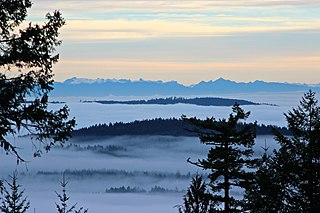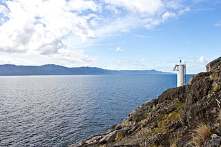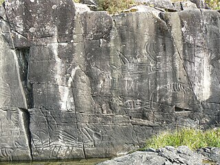
Allison Lake Provincial Park is a provincial park in British Columbia, Canada, located 28 kilometres north of Princeton, British Columbia. The park, which is 23 ha. in size, was established July 26, 1960. It is mainly a recreation area, offering camping, swimming and fishing. The park contains mostly aspen.
Anderson Bay Provincial Park is a provincial park in British Columbia, Canada, located on the southeast end of Texada Island near the community of Gillies Bay. Created in 2000, it is approximately 35 hectares in area.

Arbutus Grove Provincial Park is a 22 hectare provincial park located on Vancouver Island in British Columbia, Canada. It was established on 21 July 1966 to protect a representative strand of Arbutus tree.
Arrow Lakes Provincial Park is a provincial park in British Columbia, Canada.

Bodega Ridge Provincial Park is a provincial park in British Columbia, Canada. It is on Galiano Island, which lies between Vancouver and Vancouver Island, and comprises 233 hectares. The park's high cliffs are home to bald eagles, peregrine falcons, and turkey vultures.
Eneas Lakes Provincial Park is a provincial park in British Columbia, Canada, located west of the town of Peachland, to the south of Peachland Creek. The park is approximately 1036 ha. in size and was established in 1968. The Eneas Lakes lie at the head of Finlay Creek.

Francis Point Provincial Park is a provincial park in British Columbia, Canada, located on the southwest end of the Francis Peninsula, south of the community of Pender Harbour on the west side of the Sechelt Peninsula in the Sunshine Coast region. Established in 2004, the park is 83 ha. in size, 74 ha. of it upland, the other 9 ha. foreshore.

Harmony Islands Marine Provincial Park is a provincial park in British Columbia, Canada, located on the east side of Hotham Sound, which is a side-inlet of the lower reaches of Jervis Inlet, on that inlet's north side roughly opposite the mouth of Sechelt Inlet.

Little Qualicum Falls Provincial Park is a provincial park in British Columbia, Canada, on central Vancouver Island, that encompasses the entire southern shore of Cameron Lake. The Island Rail Corridor line to Port Alberni passes through the park.
Mudzenchoot Provincial Park is a provincial park in British Columbia, Canada, located 90 km (56 mi) northwest of Fort St. James in the Omineca Country of British Columbia's Central Interior. It is at a high elevation and is characterized by dry meadows including unique vegetation such as erigerons, aster type species, and cotton grass. The provincial park has zero facilities or road access points.
Muscovite Lakes Provincial Park is a provincial park in British Columbia, Canada. It is located on the western shore of Lake Williston, about 125 kilometres (78 mi) north of Mackenzie.
Sabine Channel Provincial Park, also known as Sabine Channel Marine Provincial Park, is a provincial park in British Columbia, Canada, in the waters surrounding Jervis Island in Sabine Channel, which separates Texada Island, to the north, from Lasqueti Island, which lies to the south. Established in 2001, the park is approximately 2,254 hectares in size.

Saltery Bay Provincial Park is a provincial park in British Columbia, Canada. The park is located southeast of the city of Powell River, and on the north side of the entrance to Jervis Inlet in the central area of the province's Sunshine Coast region.

South Texada Island Provincial Park is a provincial park in British Columbia, Canada. It is located on the SouthWest side of Texada Island. Created in 1997, the park is approximately 900 hectares in area.

Sproat Lake Provincial Park is a provincial park near Port Alberni in British Columbia, Canada's Vancouver Island. Its name derives from a lake named after 19th century entrepreneur and colonial official Gilbert Malcolm Sproat.

Squitty Bay Provincial Park is a provincial park in British Columbia, Canada, located on Lasqueti Island in the Northern Gulf Islands of the Strait of Georgia region.

Stamp River Provincial Park is a provincial park in British Columbia, Canada. The 327-hectare park is located 14 km north of Port Alberni on Vancouver Island. There are 23 camping spaces and 2 km of trails within the park along the Stamp River, named for Edward Stamp, a sawmill pioneer in the Alberni Valley.
Stuart River Provincial Park is a provincial park in British Columbia, Canada. It is located in two sections north and northwest of Vanderhoof along the Stuart River southeast of Stuart Lake and the city of Fort St. James. The upper section is located at 54°13′20″N124°00′00″W and comprises c.7391 ha. while the lower, eastern section is centred at 54°03′00″N123°37′00″W and comprises c.3390 ha. and is within the Greater Prince George area. The upper site, which is located around the confluence of the Stuart and Nechako Rivers, includes the site of Chinlac, a Dakelh village whose inhabitants were massacred and enslaved by the Tsilhqot'in of Anahim Lake c. 1745.
Taylor Arm Provincial Park is a provincial park in British Columbia, Canada, located on the north side of Sproat Lake 23 km northwest of Port Alberni on Vancouver Island. Situated along Highway 4, the 71-hectare park has few services but provides group camping sites, undeveloped beaches, and day-use areas. The group camping site has pit toilets and a hand pump water supply, and is connected to the lake shore via a trail that passes under the highway.
Hotham Sound is a sidewater of Jervis Inlet on the South Coast of British Columbia, Canada, located near the mouth of that inlet on the north flank of its lower reaches, roughly opposite the mouth of Sechelt Inlet. There is a deep basin at its entrance reaching a depth of 730 m (2,400 ft). Harmony Islands Marine Provincial Park is located on the east side of Hotham Sound. The spectacular Harmony Falls, also called Freil Lake Falls, plunges a total of 444 m (1,457 ft) into the Sound.


