
The Peace River is a 1,923-kilometre-long (1,195 mi) river in Canada that originates in the Rocky Mountains of northern British Columbia and flows to the northeast through northern Alberta. The Peace River joins the Athabasca River in the Peace-Athabasca Delta to form the Slave River, a tributary of the Mackenzie River. The Finlay River, the main headwater of the Peace River, is regarded as the ultimate source of the Mackenzie River. The combined Finlay–Peace–Slave–Mackenzie river system is the 13th longest river system in the world.

Afton State Park is a state park of Minnesota, USA, on the St. Croix River in Washington County. Its hiking trails offer views of the river, rolling glacial moraine, and bluffland it preserves. It is a popular place for birdwatching, picnics, camping, and other typical outdoor recreational activities. To deter overuse of a state park only 20 miles (32 km) from downtown St. Paul, there is no vehicle access to the camping area or swimming beach.

The North Shore Mountains are a mountain range overlooking Vancouver in British Columbia, Canada. Their southernmost peaks are visible from most areas in Vancouver and form a distinctive backdrop for the city.

William O'Brien State Park is a 1,520-acre (6.2 km2) state park of Minnesota, USA, along the St. Croix River. Its hiking trails traverse rolling glacial moraine, riparian zones, restored oak savanna, wooded areas and bogs. It is a popular place for birdwatching, picnics, camping, cross-country skiing, canoeing, fishing, and other typical outdoor recreational activities.

The Beatton River is a tributary of the Peace River, flowing generally east, then south through north-eastern British Columbia, Canada. The river rises at Pink Mountain, about 10 kilometres (6 mi) west of the Alaska Highway hamlet of the same name, and flows 240 kilometres (150 mi) generally east, then south, draining into the Peace River just downstream of Fort St. John. The river meanders mostly through the boreal forest and muskeg of the Peace Plain. Its major tributaries are the Doig and Blueberry Rivers.
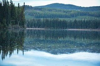
Beatton River Provincial Park is a provincial park in the Peace River Country of northeastern British Columbia, Canada.

Champion Lakes Provincial Park is a provincial park in the West Kootenay region of British Columbia, Canada, northeast of the city of Trail in the province's West Kootenay region.

E.C. Manning Provincial Park is a provincial park in British Columbia, Canada. It is usually referred to as Manning Park, although that nomenclature is also used to refer to the resort and ski area at the park's core. The park covers 83,671 hectares (323 mi2) and was the second most visited provincial park in 2017-18 after Cypress Provincial Park. The park lies along British Columbia Highway 3, and occupies a large amount of land between Hope and Princeton along the Canada-United States border.

Kalamalka Lake Provincial Park and Protected Area is a provincial park in Coldstream, British Columbia, Canada. Located within the Okanagan region, the park encompasses a land area of about 978 hectares of pristine natural areas in the North Okanagan Regional District. Kalamalka Lake Provincial Park and Protected Area adopted its current name from Kalamalka Lake, for which it is located on its shore. During the process of entering summer, calcium carbonate forms crystals that reflect sunlight and create the vivid blue and green colours. Temperature changes in the fall and the spring sometimes create ribbons of deep blue colour in the lake, seen from the park.

Mount Assiniboine Provincial Park is a provincial park in British Columbia, Canada, located around Mount Assiniboine.
Nancy Greene Provincial Park is a provincial park in British Columbia, Canada, located approximately 27 km (17 mi) northwest of the city of Rossland and 31 km (19 mi) west of the city of Castlegar in that province's West Kootenay region, at the junction of Highway 3 and Highway 3B. It is named for Nancy Greene, Canadian Olympic medallist in downhill skiing, who is a native of Rossland.

Plumper Cove Marine Provincial Park is a provincial park in British Columbia, Canada. The park is located on the northwest shore of Keats Island in Howe Sound, northwest of Vancouver, British Columbia.

Sugarbowl-Grizzly Den Provincial Park and Protected Area is a provincial park in British Columbia, Canada.

Strathcona Provincial Park is the oldest provincial park in British Columbia, Canada, and the largest on Vancouver Island. Founded in 1911, the park was named for Donald Alexander Smith, 1st Baron Strathcona and Mount Royal, a wealthy philanthropist and railway pioneer. It lies within the Strathcona Regional District. The Clayoquot Sound Biosphere Reserve, established in 2000, includes three watersheds in the western area of the park.
Tsintsunko Lakes Provincial Park is a 333-hectare provincial park in British Columbia, Canada, located south of the Deadman River between Kamloops (SE) and Bonaparte Lake (NW). It is located on the Bonaparte Plateau. It was established April 30, 1996.
Tweedsmuir South Provincial Park is a provincial park covering parts of the eastern Kitimat Ranges, northern Pacific Ranges, and the Rainbow Range in British Columbia, Canada. It was established on May 21, 1938 in the western interior of the province, to protect its important natural features. The park hosts a variety of recreation activities for visitors. This park encompasses a range of diverse species in this park including bears, moose, and various fish. There are also a few at risk species in this park.
The Elk Lakes cabin is an alpine hut located between the French and Italian Military Groups in the Canadian Rockies. It resides near the Continental Divide in Elk Lakes Provincial Park, British Columbia. It is 62 km south of the Trans-Canada Highway in Kananaskis Country, Alberta and 104 km north of Sparwood, British Columbia. The area has hiking trails, and provides access to mountaineering objectives. In winter, ice climbs and skiing terrain with much powder abound. Elk Lakes terrain is similar to that near the Elizabeth Parker hut. The hut is maintained by the Alpine Club of Canada.

Mactaquac Provincial Park is a Canadian provincial park with an area of 5.25 square kilometres (2.03 sq mi). It is located on the Saint John River 15 kilometres west of Fredericton, New Brunswick in the community of Mactaquac.
Little Mac Ski Hill, known as Little Mac, is a community-operated ski area adjacent to Mackenzie, British Columbia, Canada in the northern Rocky Mountain Trench. The area has one tow lift and vertical differential of 90 m (295 ft). The longest run is 210 m (689 ft). In addition to downhill skiing, the hill also has areas for tobogganing and snowboarding. The hill itself is connected to John Dahl Regional Park which features groomed cross-country ski trails and eventually connects to the Mackenzie Recreation Centre. In 2021 an outdoor ice rink was opened in the park and was open to members of the public to use. Though not directly part of the ski area, there are an additional 32 km (20 mi) of groomed and lit cross-country ski trails immediately accessible from the town of Mackenzie, with three specially built warming huts.
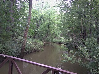
Buck Creek is a 20.3-mile-long (32.7 km) tributary of the Grand River in Kent and Allegan counties in the U.S. state of Michigan. It rises in northern Allegan County in Byron and Gaines townships, and flows through the cities of Kentwood and Wyoming as an urban stream to enter the Grand River in Grandville. The Grand River is a tributary of Lake Michigan.


