White Lake Grasslands Protected Area

Last updated
White Lake Grasslands Protected Area
Hiking to McIntyre Bluff 06.jpg
Trail leading up to McIntyre Bluff
Canada British Columbia location map 2.svg
Red pog.svg
Location Okanagan-Similkameen RD, British Columbia, Canada
Nearest city Okanagan Falls
Coordinates 49°17′37″N119°35′49″W / 49.2936°N 119.597°W / 49.2936; -119.597
Area3,764 ha (14.53 sq mi)
Designation Protected Area
EstablishedApril 18, 2001
Governing body BC Parks
Website White Lake Grasslands

White Lake Grasslands Protected Area is a conservation site located in the Regional District of Okanagan-Similkameen of British Columbia, Canada. It was established on April 18, 2001 by an order-in-council under the Environment and Land Use Act to protect the semi-arid grassland and pine forest ecosystem west of Vaseux Lake. [2]

Contents

The region spans from the lake's shoreline to mountain tops, providing protection and essential ecosystems for various red and blue-listed endangered species native to British Columbia. [3] Additionally, the area encompasses archaeological sites and land traditionally occupied by the First Nations. [3]

History and past use of the area

The land was first recommended for protection by Okanagan-Shuswap Land & Resource Management in 2000 and was established as a Class A provincial park on April 18, 2001, under the Environment and Land Use Act. [2] [3] The overall aim of the land's classification is to protect the ecosystems and rare or endangered species located in the Southern Okanagan Basin.

First Nations

Historically, the White Lake Grasslands Protected Area has encompassed parts of the traditional territory and ancestral homelands of a number of First Nations, including the Syilx Okanagan Nation and the Nlaka'pamux Nation Tribal Council. [4] First Nations Territories have existed and have been inhabited for approximately ten thousand years. [4] The White Lake Grasslands Protected Area drew significant interest from settlers during the 1850s gold rush, leading to the displacement of the Syilx/Okanagan people and the loss of their essential resources and territory. [4] During the period, intense cattle grazing caused damage to the grasslands, resulting in the replacement of native grasses with low-growing, graze-resistant shrubs, leafy forbs, and invasive plants. [4]

One of the aims of the White Lake Grasslands Protected Area is to preserve and protect traditional lands of the First Nations. Since the conclusion of colonialism and European settlement, the Nation Park located in South Okanagan has been co-managed by the Syilx/Okanagan Nation. [4] The Nation provides leadership on conservation and economic goals, and also participates in traditional land use and spiritual activities. [4]

Geography

White Lake Grasslands Protected Area is divided into five sites [5] with a total area of 37.64 km2. [6] It is located west of the Okanagan River to the McIntyre Bluff and includes Mt. McLellan, Mount Hawthorne, and Mt. Keogan. The St. Andrews Golf Course on the east side of Mt. Parker is also protected. Surrounding communities include White Lake, Green Lake, and Okanagan Falls, and other unprotected provincial parks. Visitors can access the protected area through Green Lake Road and Fairview-White Lake Road.

Climate and the effects of climate change

The Area is located within the South Okanagan Basin Ecosection, which features a hot, xeric climate originating from the Ponderosa Pine biogeoclimatic zone (PPxhl). [3] The forest zone is sited in the narrow band, which is known for having the driest and warmest valleys of the Southern Interior. [7] During the growing season, there are significant moisture shortages due to the hot and dry summers. Winters are mild with light snow. [8] The zone has a mean annual precipitation of 280–500 mm, with 15-40% as snowfall. [8]

Heatwaves, wildfires, and droughts brought on by climate change pose a potential threat to grasslands. [4] Climate change could lead to longer periods of droughts and extreme weathers, such as intense storms. Thus, the soil moisture level could impact vegetation growth, which is critical for the survival of species. [4] This region has an overflowing amount of species at risk that inhabit mid-elevation grasslands and old-growth ponderosa pines. [4]

To mitigate the impacts of climate change on the ecosystem, natural vegetation and water bodies throughout the region should be protected to increase the capacity of the soil to hold more water, which prevents droughts and floods, decreases debris and soil run-off, and naturally filters water. [4]

Management

The protected area is classified as IUCN Management Category II under the national designation. It is designated as a protected area for terrestrial and inland waters. Its management authority is under the oversight of the Government of British Columbia, which operates within the jurisdiction of a sub-national ministry or agency. [6]

Framework from the Protected Area Strategy (PAS) recognizes the province's ecologically representative sites. [3] Areas that need to be protected are identified with the guidance of the Okanagan-Shuswap Land and Resource Management Plan (OSLRMP). [3] The Management Direction Statement (MDS), [3] which gathers opinions from stakeholders and interested parties, leads the management strategy in this protected area.

All development related to these statements is in line with BC Parks' Impact Assessment Policy. [3]

Conservation goals

The Okanagan Valley, known for its warm winters and hot summers, is one of Canada's most threatened ecosystems. [2] The White Lake Grasslands Protected Area is therefore [4] crucial for the survival of species such as the White-headed woodpecker.

Regulations of the area:

There are many obstacles to managing the White Lake Grasslands Protected Area, including:

With staff to oversee and enact rules, the national park reserve would guarantee the safety of places that are vulnerable to danger. In consultations with the Syilx/Okanagan Nation, the Wilderness Committee [4] suggests expanding the park limits to include Vaseux Lake, White Lake, and the adjacent territories in the national park reserve[ citation needed ]

Ecology

Trees, shrubs, forbs and grasses

This table lists the plant species that can be found during the drier and wetter phases [3] :

PhaseTreesShrubsForbs and grasses
Dry Pinus ponderosa (ponderosa pine) Amelanchier alnifolia (saskatoon), artemisia tridentata (big sage), A. frigida (pasture sage), chrysothamnus nauseosus (rabbit brush) Festuca saximontana (rocky mtn. fescue), festuca idahoensis (Odaho fescue), crepis atrabarba (slender hawksbeard), Astragalus miser (timber milk-vetch), agropyron spicatum (bluebunch wheatgrass), balsamorhiza sagittata (balsamroot), and Achillea millefolium (yarrow)
WetPinus ponderosa (ponderosa pine), pseudotsuga menziesii (douglas-fir)Amelanchier alnifolia (saskatoon), Symphoricarpos albus (snowberry), rosa spp. (roses), acer glabrum (douglas maple), mahonia aquifolium (tall oregon-grape), and cornus stolonifera (res-osier dogwood) Agropyron spicatum (bluebunch wheatgrass), Koeleria macrantha (June grass), poa sandbergii (sandberg's bluegrass), and Antennaria dimorpha (pussytoes)

Birds

There are 183 bird species in the area, including one globally threatened species, seven introduced species, and two rare/accidental species. [9]

White-headed woodpeckers White-headed Woodpecker - Sisters - Oregon.jpg
White-headed woodpeckers
Globally threatened speciesIntroduced species
Picoides allbolarvatus (white-headed woodpecker)

*listed as Endangered in 2000, reassessed as a priority of conservation in 2013 [10]

Callipela california (California quail), Perdix perdix (gray partridge), Phasianus colchicus (ring-necked pheasant), Alectoris chukar (chukar), Streptopelia decaocto (Eurasia collared-dove), Sturnus vulgaris (European starling), Passer domesticus (house sparrow)

Rare/accidental species: Himantopus mexicanus (black-necked stilt), Spinus psaltria (lesser goldfinch)

Endangered species

Many species of red and blue-listed endangered wildlife inhabit the protected area. [3] These include two amphibian species, five reptile species, fifteen bird species, eight mammal species, two insect species and three plant species in the park. [3]

Mammals

Red listedBlue listed
Taxidea taxus (badger), lepus townsendii (white-tailed jackrabbit) Ovis canadensis californiana (California bighorn)*, myotis thysanodes (fringed myotis)**, sylvilagus nuttallii (nuttall's cottontail)**, euderma maculatum (spotted bat)**, corynohinus townsendii (townsend's big-eared bat), reithrodontomys megalotis (western harvest mouse)***

Amphibians

Red listedBlue listed
Ambystoma tigrinum (tiger salamander) Spea intermontana (great basin spadefoot toad)**

Reptiles

Red listedBlue listed
Hypsiglena torquata (desert night snake)* Pituophis catenifer deserticola (gopher snake), chrysemys picta (painted turtle), coluber constrictor (racer), charina bottae (rubber boa), Crotalus viridis (western rattlesnake)

Insects

Red listedBlue listed
Argia vivida (vivid dancer) Callophrys affinis (immaculate green hairstreak)

Plants

Red listedBlue listed
Agastache urticifolia (nettle-leaved giant-hyssop), Pyrrocoma carthamoides var. carthamoides (Columbia goldenweed) Epipactis gigantea (giant helleborine)

*Observation within 500m of Protected Area, but not recorded within the boundary

**Species of special concern

***Includes both * & **

Tourism

The White Lake Grasslands Protected Area is located in Kelowna, the capital of the Okanagan. [11] It is situated on the eastern shore of Okanagan Lake, [11] and provides a range of outdoor recreation activities. There are several wilderness trails, including the White Lake Trail which starts from the Nature Trust property south of the lake [2] and two routes to the summit of Mount Keogan, which is near the Mahoney Ecological Reserve. [12] Additionally, wildlife viewing, particularly bird watching, is a key part of activity in the protected area. Valued sites are Kearns Creek, Mahoney Lake, Rattlesnake Lake, Mclntyre Bluff and Myers Flats. [3] Several existing nature appreciation activities, such as cycling, horseback riding, and cross-country skiing. [2] Hunting is accessible but is limited to BC Hunting & Trapping Regulations Synopsis. [2]

Okanagan Mountain Provincial Park and Myra-Bellevue Provincial Park are located near Okanagan, and Fintry Provincial Park is near the White Lake Grasslands Protected Area. [12] These parks provide high-value rare species and outdoor recreation activities, similar to what The White Lake Grasslands Protected Area provides.[ citation needed ]

See also

Related Research Articles

<span class="mw-page-title-main">Okanagan</span> Region of British Columbia, Canada

The Okanagan, also called the Okanagan Valley and sometimes the Okanagan Country, is a region in the Canadian province of British Columbia defined by the basin of Okanagan Lake and the Canadian portion of the Okanagan River. It is part of the Okanagan Country, extending into the United States as Okanogan County in north-central Washington. According to the 2016 Canadian census, the region's population is 362,258. The largest populated cities are Kelowna, Penticton, Vernon, and West Kelowna.

<span class="mw-page-title-main">Okanagan Mountain Provincial Park</span> Provincial park in British Columbia, Canada

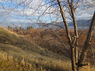
Okanagan Mountain Provincial Park is a provincial park within the Okanagan-Similkameen Regional District of British Columbia, Canada, focused on the mountain of the same name and located on the east side of Okanagan Lake, opposite Peachland and immediately south of the City of Kelowna. The park is one of the largest in the area, covering 110.38 square kilometres (42.62 sq mi). Most of the park is only accessible by foot, horseback, bicycle, or boat as motor vehicle access is restricted to BC Parks staff and technicians servicing the three telecommunications towers in the park.

<span class="mw-page-title-main">Cathedral Provincial Park and Protected Area</span> Provincial park in British Columbia, Canada

Cathedral Provincial Park and Protected Area, usually known as Cathedral Provincial Park and also as Cathedral Park, is a provincial park in British Columbia, Canada. It is located east of E.C. Manning Provincial Park, south of BC Highway 3, and southeast of the town of Princeton, and southwest of Keremeos. Its southern boundary is the border with the United States. Much of the park is the basin of the Ashnola River. Cathedral Park is home to teal sub-alpine lakes, vast ridges and jarred peaks, old-growth forests, and rock formations of siltstone, granodiorite, and basalt. Hikers can scramble along various peaks such as the 8000-foot Grimface Mountain and Lakeview Mountain. Tourists flock to Smokey the Bear and Stone City because of their unique formations with incredible views formed by millennia of erosion, volcanic and tectonic activity, and glacial recession.

Driftwood Canyon Provincial Park is a provincial park in British Columbia, Canada. Driftwood Canyon Provincial Park covers 23 ha of the Bulkley River Valley, on the east side of Driftwood Creek, a tributary of the Bulkley River, 10 km northeast of the town of Smithers. The park is accessible from Driftwood Road from Provincial Highway 16. It was created in 1967 by the donation of the land by the late Gordon Harvey (1913–1976) to protect fossil beds on the east side of Driftwood Creek. The beds were discovered around the beginning of the 20th century. The park lands are part of the asserted traditional territory of the Wet'suwet'en First Nation.

<span class="mw-page-title-main">Okanagan Lake Provincial Park</span> Provincial park in British Columbia, Canada

Okanagan Lake Provincial Park is a provincial park in British Columbia, Canada. Established in 1955, the park covers a total area of 98 hectares.

Syringa Park is a provincial park on the east shore of Lower Arrow Lake in the West Kootenay region of southeastern British Columbia. At the foot of the Norns Range, Tulip Creek passes through the centre, and Syringa Creek is closer to the southeastern boundary. The park is about 19 kilometres (12 mi) west of Castlegar via Broadwater Rd.

The Okanagan Nation Alliance is a First Nations Tribal Council in the Canadian province of British Columbia, spanning the Nicola, Okanagan and Similkameen Districts of the Canadian province of British Columbia and also the Colville Indian Reservation in Washington state of the United States of America. Their territory covers roughly 69,000 km2 in the Canadian Province of British Columbia and also some area of Washington state in the United States of America. The diverse landscape covers deserts, lakes, forests, and grasslands.

<span class="mw-page-title-main">Vaseux Lake</span> Lake in the Okanagan Valley of British Columbia, Canada

Vaseux Lake is a shallow freshwater lake located along the course of the Okanagan River in the Okanagan Valley of British Columbia, Canada.

<span class="mw-page-title-main">Okanagan Desert</span>

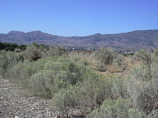
The Okanagan Desert is the common name for a semi-arid shrubland located in the southern region of the Okanagan Valley in British Columbia and Washington. It is centred around the city of Osoyoos and is the only semi-arid shrubland in Canada. Part of this ecosystem is referred to as the Nk'mip Desert by the Osoyoos Indian Band, though it is identical to the shrublands elsewhere in the region. To the northwest of this area lies an arid shrubland near Kamloops.

<span class="mw-page-title-main">Wildlife of Canada</span> Overview of the wildlife of Canada

The wildlife of Canada or biodiversity of Canada consist of over 80,000 classified species, and an equal number thought yet to be recognized. Known fauna and flora have been identified from five kingdoms: protozoa represent approximately 1% of recorded species; chromist ; fungis ; plants ; and animals. Insects account for nearly 70 percent of documented animal species in Canada. More than 300 species are found exclusively in Canada.

The biogeoclimatic zones of British Columbia are units of a classification system used by the British Columbia Ministry of Forests for the Canadian province's fourteen different broad, climatic ecosystems. The classification system, termed Biogeoclimatic Ecosystem Classification, exists independently of other ecoregion systems, one created by the World Wildlife Fund and the other in use by Environment Canada, which is based on one created by the Commission for Environmental Cooperation (CEC) and also in use by the US Environmental Protection Agency (EPA). The system of biogeoclimatic ecosystem classification was partly created for the purpose of managing forestry resources, but is also in use by the British Columbia Ministry of Environment and Climate Change Strategy and other provincial agencies. A biogeoclimatic zone is defined as "a geographic area having similar patterns of energy flow, vegetation and soils as a result of a broadly homogenous macroclimate."

<span class="mw-page-title-main">Lac du Bois Grasslands Protected Area</span> Provincial park in Thompson-Nicola Regional District, British Columbia

Lac du Bois Grasslands Protected Area is a protected area located north of Kamloops in British Columbia, Canada. The protected area was established by BC Parks on 30 April 1996 to protect a unique mixed forest-grassland ecosystem overlooking the North and South forks of the Thompson River.

<span class="mw-page-title-main">Skaha Bluffs Provincial Park</span> Provincial park in British Columbia, Canada

Skaha Bluffs Provincial Park is a provincial park in British Columbia, Canada. Skaha Bluffs lies within the asserted territory of the Okanagan Nation Alliance. World-class climbing opportunities are found at Skaha Bluffs, recreational climbing has been occurring in the area since the 1980s.

<span class="mw-page-title-main">South Chilcotin Mountains Provincial Park</span> Provincial park in British Columbia, Canada

South Chilcotin Mountains Provincial Park is a provincial park in British Columbia, Canada, located on Highway 40 northwest of Lillooet, British Columbia. The park, which is 56,796 ha. in size, was established on April 18, 2001, and It was created out of a portion of the Spruce Lake Protected Area. The park is located on three Indigenous Nations: The Tsilhqot’in, St’at’imc, and Secwepemc.

Vaseux-Bighorn National Wildlife Area is a National Wildlife Area in British Columbia, Canada, primarily set aside to protect winter rangeland for California bighorn sheep. In 1979, the Vaseux-Bighorn Wildlife Area was established in response to substantial reduction in wild animal populations in the area. Identified factors contributing to species decline at the time were high predator population, overharvesting of species, and illegal hunting. Land development, cattle raising, and lumbering also might have altered species populations. Under these conditions, the area was able to be classified as a Category IV area by the IUCN and is now used for wildlife habitat and conservation. Even with minimal anthropogenic use of the area, threats persist through invasive species. Recreational use is limited spatially and is only open to the public during the day.

Gwen Bridge is an environmental scientist and conservation advocate. Her work has focused on sustainable land management practices to help facilitate the cultural preservation of Indigenous communities across North America.

<span class="mw-page-title-main">Okanagan dry forests</span> Temperate coniferous forest ecoregion in British Columbia, Canada and Washington, United States

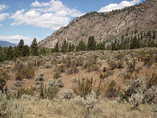
Okanagan dry forests is a temperate coniferous forest ecoregion in the Pacific Northwest of North America, as defined by the World Wildlife Fund (WWF) categorization system. It is closely associated with the Okanagan region of British Columbia and Washington. Only 20% of the ecosystem is still intact, and continues to be under threat for preservation due to land clearing and urban expansion, alongside the increasing threats of fire and extreme weather due to climate change.

<span class="mw-page-title-main">South Okanagan—Similkameen National Park Reserve</span> Proposed national park reserve in British Columbia, Canada

South Okanagan—Similkameen National Park Reserve is a proposed national park reserve located in the Regional District of Okanagan-Similkameen of British Columbia. The goal of the park is to work with the local First Nations to protect a large patch of Okanagan dry forests and part of the northern reach of the Columbia Plateau ecoregion in Canada.

References

  1. "Protected Planet | White Lake Grasslands Protected Area". Protected Planet. Retrieved 2020-10-20.
  2. 1 2 3 4 5 6 Environment, Ministry of. "White Lake Grasslands Protected Area - BC Parks". bcparks.ca. Retrieved 2020-10-20.
  3. 1 2 3 4 5 6 7 8 9 10 11 12 13 14 15 16 Ministry of Water, Land and Air Protection Environmental Stewardship Division (March 2003). "Management Direction statement for White Lake Grasslands Protected Area" (PDF). Okanagan Region. 1 (1): 5. Retrieved 2023-10-10.
  4. 1 2 3 4 5 6 7 8 9 10 11 12 13 Dawe, Charlottle (2019). "South Okanagan - Similkameen Nation Park Reserve" (PDF). Report. Wilderness Committee (4): 1.
  5. "White Lake Grasslands Protected Area Map" (PDF). White Lake Grasslands Protected Area. BC Parks. Retrieved Oct 10, 2023.
  6. 1 2 "Protected Planet | White Lake Grasslands Protected Area". Protected Planet. UNEP-WCMC. October 2023. Retrieved 2023-10-11.
  7. "Ponderosa Pine Biogeoclimatic zone (PP)". http://www.env.gov.bc.ca . Retrieved 2023-10-12.
  8. 1 2 Hope, G.D.; Lloyd, D.A.; Mitchell, W.R.; Erickson, W.R.; Harper, W.L.; Wikeem, B.M. (1991). "Chapter 9: Ponderosa Pine Zone" (PDF). Ecosystems of British Columbia.
  9. "White Lake Grasslands Protected Area bird checklist - Avibase - Bird Checklists of the World". avibase.bsc-eoc.org. Retrieved 2023-10-12.
  10. "White-headed Woodpecker (Picoides albolarvatus)". wildlife-species.canada.ca. 2015-08-19. Retrieved 2023-10-12.
  11. 1 2 "Kelowna in the Okanagan is Canada's cherry capital". Destination Canada Business Events. Retrieved 2023-10-30.
  12. 1 2 PeakVisor. "White Lake Grasslands Protected Area". PeakVisor. Retrieved 2023-10-30.