
The Athabasca River is a river in Alberta, Canada, which originates at the Columbia Icefield in Jasper National Park and flows more than 1,231 km (765 mi) before emptying into Lake Athabasca. Much of the land along its banks is protected in national and provincial parks, and the river is designated a Canadian Heritage River for its historical and cultural importance. The scenic Athabasca Falls is located about 30 km (19 mi) upstream from Jasper.

Kalamalka Lake is a large lake in the interior plateau of southern central British Columbia, Canada, east of Okanagan Lake. The lake is located approximately 4 kilometres (2.5 mi) south of the city of Vernon and is its main drinking water supply. The lake is named after the Okanagan First Nation chief who occupied its northern shores.

The Ogoki River is a river in the Thunder Bay and Cochrane Districts of Ontario. It springs from the wilderness just east of Savant Lake, flowing north of Lake Nipigon to Ogoki, where it joins the Albany River which empties into James Bay. The river is 480 kilometres (300 mi) long.

Lake Nipigon is part of the Great Lakes drainage basin. It is the largest lake entirely within the boundaries of the Canadian province of Ontario.

Williston Lake is a reservoir created by the W. A. C. Bennett Dam which is located in the Northern Interior of British Columbia, Canada.
Akamina-Kishinena Provincial Park is a provincial park located in the southeastern corner of British Columbia, Canada. The park was established by order-in-council on July 13, 1995 to protect the ecological integrity of a relatively narrow stretch of the Rocky Mountains in the southeastern corner of the province.
Cariboo River Provincial Park is a provincial park in British Columbia, Canada, located between Barkerville and Likely in the upper Cariboo River basin.
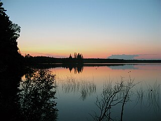
Emar Lakes Provincial Park is a provincial park in British Columbia, Canada. The park is located in the upper Emar Creek watershed, northwest of the community of Little Fort. The Hudson's Bay Company Brigade Trail was identified in the park near Jim Lake and Richard Lake.
François Lake Provincial Park is a provincial park in British Columbia, Canada, located at the east end of Francois Lake. The total park area is 7,214 hectares. It is about 12 kilometres (7.5 mi) off BC Highway 16, southwest of the town of Fraser Lake. There is no potable water at the site so campers should bring their own.
Harry Lake Aspen Provincial Park is a provincial park in British Columbia, Canada, located northwest of Ashcroft near the upper basin of Hat Creek.
Tudyah Lake Provincial Park is a provincial park in British Columbia, Canada. The park is approximately 56 km south of Mackenzie, BC on Highway 97.
Tweedsmuir North Provincial Park and Protected Area is a provincial park in British Columbia, Canada, which along with Tweedsmuir South Provincial Park and Entiako Provincial Park were once part of Tweedsmuir Provincial Park, then B. C.'s largest park, 9,810 square kilometres (3,790 sq mi) located in the Coast Range.

Ten Mile Lake Provincial Park is a provincial park in the Cariboo Land District of British Columbia, Canada, ten miles (16 km) north of the city of Quesnel. The park is situated within the Fraser Plateau and Basin complex, in a transition area between the wetter Quesnel Highland to the east, and the dry Chilcotin Plateau to the west.
Lakeland Provincial Park and Lakeland Provincial Recreation Area are located east of Lac La Biche, Alberta, Canada, in Lac La Biche County.

The Winisk River is a river in northern Ontario, Canada, that starts at Wunnummin Lake and flows east to Winisk Lake. From there it continues in a mostly northerly direction to Hudson Bay. The Winisk River is 475 kilometres (295 mi) long and has a drainage basin of 67,300 square kilometres (26,000 sq mi). The name is from Cree origin meaning "groundhog".

Beaver River is a large river in east-central Alberta and central Saskatchewan, Canada. It flows east through Alberta and Saskatchewan and then turns sharply north to flow into Lac Île-à-la-Crosse on the Churchill River which flows into Hudson Bay.

Last Mountain Lake, also known as Long Lake, is a prairie lake formed from glaciation 11,000 years ago. It is located in south central Saskatchewan, Canada, about 40 kilometres (25 mi) north-west of the city of Regina. It flows into the Qu'Appelle River via Last Mountain Creek, which flows past Craven. It is approximately 93 km (58 mi) long, and 3 km (1.9 mi) across at its widest point. It is the largest naturally occurring body of water in southern Saskatchewan. Only Lake Diefenbaker, which is man-made, is larger. The lake is a popular resort area for residents of south-eastern Saskatchewan.
The Makobe River is a river in northeastern Ontario, Canada. It is in the Saint Lawrence River drainage basin, and is a left tributary of the Montreal River.
Abitibi-De-Troyes Provincial Park is in Cochrane District of Northern Ontario, Canada. It was established in 1985 and provides backcountry canoeing, camping, hunting, fishing and nature viewing activities. The park is named after Pierre de Troyes who may have portaged across Long Point during his Hudson Bay expedition in 1686.

The Kopka River is a river in northwestern Ontario, Canada. It forms at the height-of-land west of Lake Nipigon, flowing through rugged wilderness of Ontario's northern boreal forest, and drains into Wabinosh Lake.

