
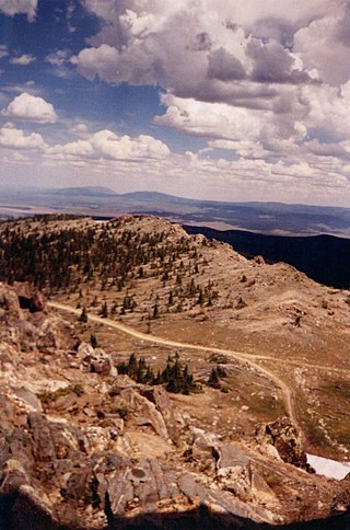
The Yengo National Park is a protected national park that is located in the Lower Hunter region of New South Wales, in eastern Australia. The 154,328-hectare (381,350-acre) park is situated 213 kilometres (132 mi) northwest of Sydney, 40 kilometres (25 mi) south of Cessnock, 121 kilometres (75 mi) northwest of Gosford, and 91 kilometres (57 mi) southwest of Newcastle. The average elevation of the terrain is 309 metres.
Hull River is a national park in Queensland (Australia), 1275 km northwest of Brisbane. GIS mapping data from Queensland Department of Natural Resources (2002) showed an area of 3,240 hectares, of which about 2,100 hectares are estuarine mangroves, with the remainder being swamp forests dominated by Melaleuca and specialist Eucalypt species. Rainfall averages 3,600 mm per year. The park is part of the Coastal Wet Tropics Important Bird Area, identified as such by BirdLife International because of its importance for the conservation of lowland tropical rainforest birds.

Mount Robson is the most prominent mountain in North America's Rocky Mountain range; it is also the highest point in the Canadian Rockies. The mountain is located entirely within Mount Robson Provincial Park of British Columbia, and is part of the Rainbow Range. Mount Robson is the second highest peak entirely in British Columbia, behind Mount Waddington in the Coast Range. The south face of Mount Robson is clearly visible from the Yellowhead Highway, and is commonly photographed along this route.

The Hart Ranges are a major subrange of the Canadian Rockies located in northeastern British Columbia and western Alberta. The mountains constitute the southernmost portion of the Northern Rocky Mountains.

The South Jasper Ranges are mountain ranges of the Rocky Mountains in Alberta and British Columbia, Canada.

Midnight Sun Peak is a mountain in the Baffin Mountains, Baffin Island, Nunavut, Canada. It is part of the Auyuittuq National Park area with an elevation of 1,967 m (6,453 ft).
The Kitwanga River is a tributary of the Skeena River near Hazelton in northwestern British Columbia, Canada, joining that stream at the community of Kitwanga (Gitwangak), which means "people of the place of rabbits".
The Nahatlatch River is a tributary of the Fraser River in the Canadian province of British Columbia. It originates in the Lillooet Ranges of the Coast Mountains and empties into the Fraser River in the Fraser Canyon, north of Boston Bar.

The Cariboo River is a tributary of the Quesnel River, one of the main tributaries of the Fraser River, in the Canadian province of British Columbia. It flows through the Cariboo region of the British Columbia Interior, southeast of Prince George. Above Cariboo Lake it was formerly known as the Swamp River. The name was adopted, and replaced the former names, in 1936 in association with Cariboo Lake.
Birch Mountains Wildland Provincial Park is a wildland provincial park in northern Alberta, Canada. The park was established on 20 December 2000 with an area of 144,505 hectares. On 14 May 2018, the park was enlarged slightly to an area of 145,969 hectares. Thye park was created as part of Alberta's "Special Places" initiative. The park is contained in the Lower Athabasca Region Land Use Framework finalized in 2012. It contains a free roaming wood bison herd. The park is named for the Birch Mountains that are partially contained within the boundaries of the park.

The geography of the North Cascades describes a range of rugged mountains in British Columbia, Canada and Washington, United States. In Canada, the range is officially named the Cascade Mountains but is commonly referred to as the Canadian Cascades.
The Tuya River is a major tributary of the Stikine River in northwest part of the province of British Columbia, Canada. From its source at High Tuya Lake in Tuya Mountains Provincial Park just south of Ash Mountain, the highest peak of the Tuya Range, the Tuya River flows south about 200 km (120 mi) to meet the Stikine River in the Grand Canyon of the Stikine. The Tuya River's main tributary is the Little Tuya River. The Tuya River divides the Tanzilla Plateau on the east from the Kawdy Plateau, to the northwest, and the Nahlin Plateau, to the southwest. All three are considered sub-plateaus of the Stikine Plateau. The Tuya River's watershed covers 3,575 km2 (1,380 sq mi), and its mean annual discharge is estimated at 36.9 m3/s (1,300 cu ft/s). The mouth of the Tuya River is located about 24 km (15 mi) northeast of Telegraph Creek, British Columbia, about 67 km (42 mi) southwest of Dease Lake, British Columbia, and about 210 km (130 mi) east of Juneau, Alaska. The Tuya River's watershed's land cover is classified as 35.7% shrubland, 31.4% conifer forest, 14.0% mixed forest, 7.2% herbaceous, and small amounts of other cover.
The Sierra Madre Range is a mountain range in the western United States, located in south-central Wyoming and north-central Colorado. Geologically, it may be considered an extension of the Park Range of Colorado. South of the Great Divide Basin, the US Continental Divide runs along the Sierre Madre high points. Its western basins drain into the Colorado River and its eastern into the North Platte River. Buck Mountain, elevation 11,396 feet, is the highest peak in the range and lies within Colorado. Bridger Peak, elevation 11,004 feet, is the range's highest elevation in Wyoming.

Bluerock Wildland Provincial Park is a wildland provincial park located in Kananaskis Improvement District, Alberta, Canada. It was established on 24 July 2001 and has an area of 12,719.59 hectares. The park was named for the Bluerock Creek that flows through and forms part of the western boundary of the park and Bluerock Mountain which is the creek's source. The park is included in the South Saskatchewan Region land use framework and administered by the South Saskatchewan Regional Plan. Sheep River Provincial Park and Bluerock Wildland Provincial Park are managed under the same Management Plan.
The Zymagotitz River is a tributary of the Skeena River located in the North Coast Regional District of the province of British Columbia, Canada. It originates in the Kitimat Ranges of the Coast Mountains, and flows south and west about 45 km (28 mi) to the Skeena River, about 10 km (6.2 mi) downriver from Terrace and about 100 km (62 mi) east of Prince Rupert.
Birch River Wildland Provincial Park is a wildland provincial park in northern Alberta, Canada. It was established on 14 May 2018 and covers 331,832 hectares (1,281.2 sq mi).The park is contained in the Lower Athabasca Region Land Use Framework finalized in 2012. The park is named for the Birch River that flows through it.
Bob Creek Wildland Provincial Park is a wildland provincial park located in the Municipal District of Ranchland, in southern Alberta, Canada. It was established on 12 May 1999, modified slightly on 24 June 2003, and is 20,777.69 hectares in area. The park is included in the South Saskatchewan Region Land Use Framework and administered by the South Saskatchewan Regional Plan. Because they are so intertwined, Bob Creek Wildland and Black Creek Heritage Rangeland are managed through the same Management Plan. The park gets its name from the Bob Creek that runs through the center of the park and drains the surrounding hills.

The Flathead Range is a mountain range of the Canadian Rockies in Alberta and British Columbia, Canada. It is located on the Continental Divide, east of Fernie, in the Kootenay Land District. It stretches 27 km (17 mi) lengthwise north–south from Crowsnest Pass to North Kootenay Pass. The range's toponym was officially adopted on 30 June 1912 by the Geographic Board of Canada, and was named in association with the Flathead River.
Mount Farrow is a mountain summit in British Columbia, Canada.
Whitehorse Wildland Provincial Park is a wildland provincial park in west-central Alberta, Canada. The park was established on 26 August 1998 and had an area of 17,439.886 hectares. On 23 July 2002, the area was changed slightly to 17,325.54 ha. The park is included in the Upper Athabasca Region Land Use Framework. The park is named for the creek within the boundaries of the park.


