Catala Island Marine Provincial Park is a provincial park in British Columbia, Canaded on the west coast of Vancouver Island at the mouth of Esperanza Inlet, between Kyuquot Sound (N) and Nootka Sound (S). The park is 955 ha. in size and was established in July 1995.

Quatsino Provincial Park is a provincial park in British Columbia, Canada, located on Quatsino Sound on northern Vancouver Island. The park was established July 12, 1995 and is 654 hectares in size. The park is 50 kilometres (31 mi) west of Port Hardy, British Columbia and is accessible by rough logging roads or by boat. Quatsino is on a popular kayaking route.
Desolation Sound Marine Provincial Park is a provincial park in British Columbia, Canada located along Desolation Sound. The park is distinguished by its many picturesque sheltered coves and anchorages, frequented by yachts and pleasure craft. The scenery consists of waterfalls, rugged glaciated peaks, and steep forested slopes that fall into the ocean.
Dawley Passage Provincial Park is a provincial park in British Columbia, Canada, located at the south end of Fortune Channel, which lies between Meares Island and the mainland of Vancouver Island just south. The park is to the north of the resort town of Tofino and is accessible by boat only. It was created on July 13, 1995 as part of the Clayoquot Land-Use Decision and contains 154 ha, .
Epper Passage Provincial Park is a provincial park in British Columbia, Canada, located on the north side of Vargas Island in the Clayoquot Sound region of the West Coast of Vancouver Island. Also on Vargas Island is Vargas Island Provincial Park. Other provincial parks nearby are Flores Island Marine Provincial Park, Gibson Marine Provincial Park, Maquinna Marine Provincial Park, Sydney Inlet Provincial Park, Dawley Passage Provincial Park and Hesquiat Peninsula Provincial Park. The park was created as part of the Clayoquot Land-Use Decision on July 13, 1995, and contains approximately 306 ha.

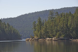
Gibson Marine Provincial Park is a provincial park in British Columbia, Canada, located on the southeast end of Flores Island in the central Clayoquot Sound region of Vancouver Island. The park was created on 13 November 1967. It contains approximately 143 hectares and is adjacent to Flores Island Provincial Park.
Green Inlet Marine Provincial Park is a provincial park in British Columbia, Canada, in the North Coast region to the southeast of Butedale and containing 33 ha.

Harmony Islands Marine Provincial Park is a provincial park in British Columbia, Canada, located on the east side of Hotham Sound, which is a side-inlet of the lower reaches of Jervis Inlet, on that inlet's north side roughly opposite the mouth of Sechelt Inlet.
Háthayim Marine Provincial Park, formerly Von Donop Marine Provincial Park, is a provincial park in British Columbia, Canada, located on the north end of Cortes Island in the Discovery Islands.

Klewnuggit Inlet Marine Provincial Park is a provincial park in British Columbia, Canada, located on the east side of Grenville Channel, 100 kilometres (62 mi) southeast of Prince Rupert, in the Range 4 Coast Land District.

Lowe Inlet Marine Provincial Park is a provincial park in British Columbia, Canada located on the Inside Passage of the North Coast, 118 km south of Prince Rupert and 75 km north of Butedale. Established on 14 June 1994, the park now contains approximately 765 hectares.

Penrose Island Marine Provincial Park is a provincial park in the Central Coast region of British Columbia, Canada, located on the north side of the entrance to Rivers Inlet, 86 km north of Port Hardy at the south end of Fitz Hugh Sound. Comprising 1,079 hectares of marine area and 934 hectares of land area, the park is accessible by boat only and entrance to its anchorages are on its eastern side, the western being exposed to the open ocean. Exploration by dinghy and kayak are popular with visitors, as are nature viewing, scuba diving and exploring the islands many beaches and adjoining islets. The nearest supply centre for fuel and food is at the community of Rivers Inlet.
Princess Louisa Marine Provincial Park is a provincial park in British Columbia, Canada surrounding Princess Louisa Inlet.

Port Renfrew is a small unincorporated community located on the south shore of Port San Juan, an inlet on the west coast of Vancouver Island in British Columbia, Canada. Port Renfrew has a population of 262 and has been touted as "the Tall Tree Capital of Canada".

Sechelt Inlets Marine Provincial Park is a provincial park in British Columbia, Canada, that protects six separate sites along three inlets north of the city of Sechelt. The six sites are located at various locations on Sechelt Inlet and its two side arms, Salmon Inlet and Narrows Inlet. Established initially as a recreation area in 1980, it was converted to a park in 1999, consisting of approximately 140 hectares in total.

Saanich Inlet is a body of salt water that lies between the Saanich Peninsula and the Malahat highlands of Vancouver Island, British Columbia, Canada. Located just northwest of Victoria, the inlet is 25 km (16 mi) long, has a surface area of 67 km2 (26 sq mi), and its maximum depth is 226 m (741 ft). It extends from Satellite Channel in the north to Squally Reach and Finlayson Arm in the south. The only major tributary feeding the inlet is the Goldstream River.
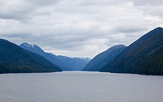
Grenville Channel is a strait on the North Coast of British Columbia, Canada, between Pitt Island and the mainland to the south of Prince Rupert. It is part of the Inside Passage shipping route, about 45 nautical miles long and is 0.2 nautical miles wide at its narrowest point.

Hot Springs Cove, formerly Refuge Cove, is an unincorporated settlement on Sydney Inlet on West Coast of Vancouver Island. It is located on the west side of the Openit Peninsula in the western Clayoquot Sound region. Hot Springs Cove derives its name from its proximity to Ramsay Hot Springs, and is protected by Maquinna Marine Provincial Park. The post office at Hot Springs Cove was closed in 1974 but had operated since 1947, when it was first named Sydney Inlet until being renamed in 1948. Despite the closure of the post office, there remains a year-round population in the vicinity.
Clayoquot Sound Biosphere Reserve is a UNESCO Biosphere Reserve situated in Clayoquot Sound on the west coast of Vancouver Island in British Columbia, Canada. A diverse range of ecosystems exist within the biosphere reserve boundaries, including temperate coastal rainforest, ocean and rocky coastal shores.

Checleset Bay is a bay on the northwest coast of Vancouver Island, British Columbia, Canada. It is located southeast of Brooks Peninsula and northwest of Kyuquot Sound. Much of the land around the bay is part of Brooks Peninsula Provincial Park. Checleset Bay has three large inlets, Nasparti Inlet, Ououkinsh Inlet, and Malksope Inlet.


