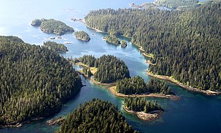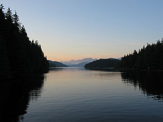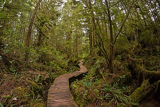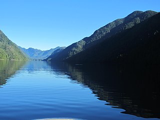
Clayoquot Sound is located on the west coast of Vancouver Island in the Canadian province of British Columbia. It is bordered by the Esowista Peninsula to the south, and the Hesquiaht Peninsula to the North. It is a body of water with many inlets and islands. Major inlets include Sydney Inlet, Shelter Inlet, Herbert Inlet, Bedwell Inlet, Lemmens Inlet, and Tofino Inlet. Major islands include Flores Island, Vargas Island, and Meares Island. The name is also used for the larger region of land around the waterbody.

Big Bunsby Marine Provincial Park is a provincial park on the west coast of northern Vancouver Island in British Columbia, Canada, to the southeast of the Brooks Peninsula in Checleset Bay. It is accessible only by boat.

Quatsino Provincial Park is a provincial park in British Columbia, Canada, located on Quatsino Sound on northern Vancouver Island. The park was established July 12, 1995 and is 654 hectares in size. The park is 50 kilometres (31 mi) west of Port Hardy, British Columbia and is accessible by rough logging roads or by boat. Quatsino is on a popular kayaking route.
Clayoquot Plateau Provincial Park is a provincial park in British Columbia, Canada. It is located on the west side of the Kennedy River, to the northeast of the town of Tofino.
Dawley Passage Provincial Park is a provincial park in British Columbia, Canada, located at the south end of Fortune Channel, which lies between Meares Island and the mainland of Vancouver Island just south. The park is to the north of the resort town of Tofino and is accessible by boat only. It was created on July 13, 1995 as part of the Clayoquot Land-Use Decision and contains 154 ha, .
Epper Passage Provincial Park is a provincial park in British Columbia, Canada, located on the north side of Vargas Island in the Clayoquot Sound region of the West Coast of Vancouver Island. Also on Vargas Island is Vargas Island Provincial Park. Other provincial parks nearby are Flores Island Marine Provincial Park, Gibson Marine Provincial Park, Maquinna Marine Provincial Park, Sydney Inlet Provincial Park, Dawley Passage Provincial Park and Hesquiat Peninsula Provincial Park. The park was created as part of the Clayoquot Land-Use Decision on July 13, 1995, and contains approximately 306 ha.

Flores Island Marine Provincial Park, also known as Flores Island Provincial Park, is a provincial park in British Columbia, Canada, located on the island of the same name in the central Clayoquot Sound region of the West Coast of Vancouver Island, British Columbia, Canada. The park contains 7113 ha. and was created on July 13, 1995, as part of the Clayoqout Land-Use Decision. Gibson Marine Provincial Park, which was created in 1967, adjoins it to the southeast. Sulphur Passage Provincial Park is off the northeast coast of Flores Island, surrounding Obstruction Island.

Gibson Marine Provincial Park is a provincial park in British Columbia, Canada, located on the southeast end of Flores Island in the central Clayoquot Sound region of Vancouver Island. The park was created on 13 November 1967. It contains approximately 143 hectares and is adjacent to Flores Island Provincial Park.

Hesquiat Lake Provincial Park is a provincial park located on the west coast of Vancouver Island in British Columbia, Canada. It was established on April 5, 2001 to mature coastal forests of Western hemlock, western red cedar and lodgepole pine along the eastern shores of Hesquiat Lake.

Hesquiat Peninsula Provincial Park is a provincial park at the western extremity of the Clayoquot Sound region of the West Coast of Vancouver Island, British Columbia, Canada. The park was established by order-in-council on July 12, 1995 as part of the Clayoquot Land-Use Decision.

Juan de Fuca Provincial Park is a provincial park located on the west coast of Vancouver Island in British Columbia, Canada. The park was established on April 4, 1996 by combining three former parks — China Beach, Loss Creek, and Botanical Beach — into one provincial park. It is the location of the majority of the Juan de Fuca Marine Trail, which is a southern compliment to the West Coast Trail within Pacific Rim National Park Reserve.

Maquinna Marine Provincial Park and Protected Area is a provincial park in British Columbia, Canada, located northwest of Tofino in the Clayoquot Sound region of the West Coast of Vancouver Island, protecting Ramsay Hot Springs, which is the name-source of the cove, settlement and former post office of Hot Springs Cove.
Memory Island Provincial Park is a provincial park located on Vancouver Island in British Columbia, Canada. It was established by BC Parks on 23 August 1945 to protect a small island located at the southern end of Shawnigan Lake.
Wallace Island Marine Provincial Park is a provincial park in the Gulf Islands of British Columbia, Canada. The park includes almost all 72 hectares of Wallace Island. Land on the northern side of Princess Cove extending north towards Chivers is private. This long, thin island lies in Trincomali Channel south-west of Galiano Island, and about 2 km (1.2 mi) northeast of Saltspring Island. There are a few hiking trails, and camping is permitted in designated areas.

Kennedy Lake is the largest lake on Vancouver Island, British Columbia, Canada. Located north of Ucluelet on the island's central west coast, the lake is formed chiefly by the confluence of the Clayoquot and Kennedy Rivers. Outflow is via a short stretch of the Kennedy River into Tofino Inlet. The lake includes an extensive northern arm called Clayoquot Arm.
Schoen Lake Provincial Park is a provincial park in northeastern Vancouver Island, British Columbia, Canada, located east of the community of Woss Lake and southwest of Sayward. The park lies inside the Nimpkish Valley watershed. On October 28, 1977, the "Class A" park was officially created to protect, exhibit and interpret an example of the natural features and processes of the Insular Mountains Natural Region. The park covers a total area of 8,775 hectares. Within those hectares of park land is a number of lakes, creeks and mountain ranges.

Sydney Inlet Provincial Park is a provincial park in the Clayoquot Sound region of the west coast of Vancouver Island, British Columbia, Canada, located north of the settlement of Hot Springs Cove and northwest of the resort town of Tofino. Sydney Inlet was the name of the post office in the area from its creation in 1947 to 1948, when it was renamed Hot Springs Cove, though that post office was subsequently closed in 1974.

Strathcona Provincial Park is the oldest provincial park in British Columbia, Canada, and the largest on Vancouver Island. Founded in 1911, the park was named for Donald Alexander Smith, 1st Baron Strathcona and Mount Royal, a wealthy philanthropist and railway pioneer. It lies within the Strathcona Regional District. The Clayoquot Sound Biosphere Reserve, established in 2000, includes three watersheds in the western area of the park.
Sulphur Passage Provincial Park is a provincial park in British Columbia, Canada, located in the central part of the Clayoquot Sound region of the West Coast of Vancouver Island, British Columbia, Canada. It is located around Obstruction Island to the northeast of Flores Island. The eponymous Sulphur Passage is located on the east side Obstruction Island.
Tranquil Creek Provincial Park is a provincial park in British Columbia, Canada, located at the head of the Kennedy River, east of the head of Bedwell Sound on Vancouver Island.


