
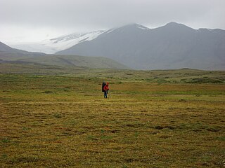
The Stikine River is a major river in northern British Columbia (BC), Canada and southeastern Alaska in the United States. It drains a large, remote upland area known as the Stikine Country east of the Coast Mountains. Flowing west and south for 610 kilometres (379 mi), it empties into various straits of the Inside Passage near Wrangell, Alaska. About 90 percent of the river's length and 95 percent of its drainage basin are in Canada. Considered one of the last truly wild large rivers in BC, the Stikine flows through a variety of landscapes including boreal forest, steep canyons and wide glacial valleys.
Telegraph Creek is a small community located off Highway 37 in northern British Columbia at the confluence of the Stikine River and Telegraph Creek. The only permanent settlement on the Stikine River, it is home to approximately 250 members of Tahltan First Nation and non-native residents. The town offers basic services, including Anglican and Catholic churches, a general store, a post office, a clinic with several nurses on-call around the clock, two Royal Canadian Mounted Police officers, and a K-9 school. Steep river banks and rocky gorges form the terraced nature of the geography.
Great Glacier Provincial Park is a provincial park in the Stikine Country region of British Columbia, Canada. It was established on January 25, 2001 to protect Great Glacier and the surrounding mountainous terrain. The park lies in the traditional territory of the Tahltan First Nation about 120 kilometres (75 mi) south of the Tahltan community of Telegraph Creek.
Lava Forks Provincial Park is a provincial park in northern British Columbia, Canada. It is the site of Canada's most recent volcanic eruption, which occurred around 1904 at Lava Fork.
Mount Edziza Provincial Park is a provincial park in Cassiar Land District of northern British Columbia, Canada. It was established on 27 July 1972 to protect the Mount Edziza volcanic complex and the surrounding Tahltan Highland.
Spatsizi Headwaters Provincial Park is a provincial park in the Stikine Region of British Columbia, Canada. It was established on January 25, 2001 to protect the headwaters of the Spatsizi River while providing recreational facilities for visitors.
Spatsizi Plateau Wilderness Provincial Park is located in the northern portion of British Columbia, Canada, approximately 698, 659 hectares and encompasses the Spatsizi River and Gladys Lake Ecological Reserve. The park is a designated protected area that is intended for the conservation and research on caribou, grizzly bears, fish, and other wildlife species populations. Before the provincial park's establishment in 1975, the area was a historical hunting ground for local Indigenous communities like the Tahltan First Nations. It is the second largest provincial park in British Columbia.
The Stikine River Provincial Park is a provincial park in British Columbia. The park covers a total area of approximately 217,000 hectares. The main feature of the Stikine River Provincial Park is a portion of the Stikine River known as "The Grand Canyon". This portion of the river is approximately eighty kilometers long and runs through a canyon that has been created from the river cutting through the rock that now forms the walls of the "canyon".

Nahta Cone is a small cinder cone in Cassiar Land District of northwestern British Columbia, Canada. It has an elevation of 1,670 metres and lies near the northern edge of the Arctic Lake Plateau, a glacially scored plateau of the Tahltan Highland which in turn extends along the western side of the Stikine Plateau. The cone is about 70 kilometres south-southeast of the community of Telegraph Creek and lies in the southwestern corner of Mount Edziza Provincial Park, one of the largest provincial parks in British Columbia.

The Mount Edziza volcanic complex is a group of volcanoes and associated lava flows in northwestern British Columbia, Canada. Located on the Tahltan Highland, it is 40 kilometres southeast of Telegraph Creek and 85 kilometres southwest of Dease Lake. The complex encompasses a broad, steep-sided lava plateau that extends over 1,000 square kilometres. Its highest summit is 2,786 metres in elevation, making the MEVC the highest of four large complexes in an extensive north–south trending volcanic region. It is obscured by an ice cap characterized by several outlet glaciers that stretch out to lower altitudes.
Stikine, also known formerly as Boundary, is an unincorporated locality and former customs post on the Stikine River, located on the Canadian side of the British Columbia-Alaska boundary on the Stikine River's west (right) bank. The customs post was seasonal and operated in the summer months only. The name Boundary was in use from 1930 to 1964, with designation "Customs Post" changed in 1955 to "locality".

The Stikine Plateau is a plateau in northern British Columbia, Canada. It lies between the Boundary Ranges of the Coast Mountains on the west and southwest and the Cassiar Mountains along its northeast, and between the Skeena Mountains on its south and southeast and the Jennings and Nakina Rivers on the north.

The Iskut River, located in the northwest part of the province of British Columbia is the largest tributary of the Stikine River, entering it about 11 km (6.8 mi) above its entry into Alaska.
Fowler is a locality on the west side of the lower Stikine River in northwestern British Columbia, Canada, located in the vicinity of the Great Glacier and Choquette Hot Springs Provincial Park. Fowler Creek lies opposite it across the Stikine.
The Taku Plateau is a sub-plateau of the Stikine Plateau in the far northwestern Interior of British Columbia, Canada. It lies to the south of the Teslin Plateau, part of the Yukon Plateau and to the southeast of the Yukon Plateau's other major sub-area within British Columbia, the Tagish Highland. Immediately northeast is the Kawdy Plateau and to the northwest of the Nahlin Plateau. The Inklin River forms the plateau's southwestern boundary with the northwestern extremities of the Tahltan Highland, beyond which are the Boundary Ranges. Very mountainous, its highest summit is Nahlin Mountain.
Stikine, meaning "great river" in the Tlingit language, may refer to:
The Tuya River is a major tributary of the Stikine River in northwest part of the province of British Columbia, Canada. From its source at High Tuya Lake in Tuya Mountains Provincial Park just south of Ash Mountain, the highest peak of the Tuya Range, the Tuya River flows south about 200 km (120 mi) to meet the Stikine River in the Grand Canyon of the Stikine. The Tuya River's main tributary is the Little Tuya River. The Tuya River divides the Tanzilla Plateau on the east from the Kawdy Plateau, to the northwest, and the Nahlin Plateau, to the southwest. All three are considered sub-plateaus of the Stikine Plateau. The Tuya River's watershed covers 3,575 km2 (1,380 sq mi), and its mean annual discharge is estimated at 36.9 m3/s (1,300 cu ft/s). The mouth of the Tuya River is located about 24 km (15 mi) northeast of Telegraph Creek, British Columbia, about 67 km (42 mi) southwest of Dease Lake, British Columbia, and about 210 km (130 mi) east of Juneau, Alaska. The Tuya River's watershed's land cover is classified as 35.7% shrubland, 31.4% conifer forest, 14.0% mixed forest, 7.2% herbaceous, and small amounts of other cover.
Craig Headwaters Protected Area is a protected area located in the Stikine Region of British Columbia, Canada. It was established on January 25, 2001 to protect the Craig River Valley from the Alaskan border to its confluence with the Iskut River.
Taku River/T'aḵú Téiú' Conservancy is a conservancy located in the Stikine Region of British Columbia, Canada. It was established on June 22, 2012, as a result of the Wóoshtin Wudidaa Atlin Taku Land Use Plan and Taku River Tlingit First Nation Strategic Engagement Agreement. The conservancy protects a large region of pristine wilderness along the Taku River from its confluence with the Nakina and Inklin Rivers to the Canada–United States border] with Alaska.

