
Buse Lake Protected Area, informally known as Buse Lake Provincial Park, is a provincial park in British Columbia, Canada, 23 km east-southeast of Kamloops near Monte Creek. It was created in 2000 as part of the outcome of the Kamloops Landuse and Resource Management Plan (KLRMP) and is 228 hectares in size.
Burgoyne Bay Provincial Park is a provincial park in British Columbia, Canada located on southwestern Saltspring Island near Fulford Harbour. The parks faces northwest to Sansum Narrows, which is the channel between Saltspring Island and Vancouver Island. Mount Maxwell Provincial Park lies adjacent to the north.

Tā Chʼilā Provincial Park, formerly Boya Lake Provincial Park, is a provincial park located in the Stikine Region of British Columbia, Canada. The park located 120 km north-by-northwest of the community of Dease Lake near BC Highway 37. Boya Lake is named for Charlie Boya, a First Nations man from the area.
Bonaparte Provincial Park is an 11,811 hectare provincial park in British Columbia, Canada. It is located within the Bonaparte Plateau.
Conkle Lake Provincial Park is a provincial park in British Columbia, Canada, west of the confluence of the Kettle and West Kettle Rivers. The park size is 587 hectares. Bird species that live in the area are the common loon, merganser, ruffed grouse, pileated woodpecker, black-capped chickadee, and ruby-crowned kinglet. Mammals that live in the area are bears, squirrels, raccoons, rodents, beavers, deer, rabbits, foxes, and moose.
Eskers Provincial Park is a provincial park in British Columbia, Canada. The park comprises roughly 4,044 hectares and was created in 1987. Located west of Nukko Lake, which lies northwest of the city of Prince George, it protects an area of the 40-kilometre (25 mi) Stuart River Eskers Complex. Eskers are winding ridges of gravel formed by the glaciers which once covered the British Columbia Interior.
Emar Lakes Provincial Park is a provincial park in British Columbia, Canada. The park is located in the upper Emar Creek watershed, northwest of the community of Little Fort. The Hudson's Bay Company Brigade Trail was identified in the park near Jim Lake and Richard Lake.
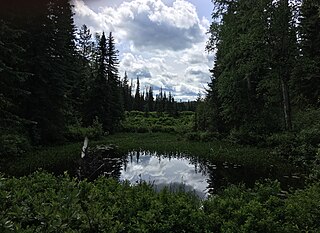
Gold Muchalat Provincial Park is a provincial park in British Columbia, Canada, located between the Gold and Muchalat Rivers.
Greenstone Mountain Provincial Park is a provincial park in British Columbia, Canada, located south of Kamloops Lake on the northern edge of the Thompson Plateau.

Lakelse Lake Provincial Park is a provincial park in British Columbia, Canada, located just west of Highway 37 between Terrace and Kitimat. The name is derived from the Coast Tsimshian language word "LaxGyels" - "fresh water mussel", for the mollusk that is found on the bottom of both Lakelse Lake and Lakelse River. Before Lakelse Lake became a provincial park, Hatchery Creek, which runs throughout the park, was the site of a sockeye salmon hatchery operated by the Canadian Government between 1919 and 1936. Lakelse Lake Provincial Park was established on March 16, 1956.

McConnell Lake Provincial Park is a provincial park in British Columbia, Canada, located near Lac Le Jeune between Kamloops and Merritt, near BC Highway 5.
Walloper Lake Provincial Park is a provincial park in British Columbia, Canada. Walloper Lake is a small lake located on the Trans-Canada Highway, 38 kilometres (24 mi) from the city of Kamloops.
Pennask Lake Provincial Park is a provincial park in British Columbia, Canada, located on the easternmost heights of the Thompson Plateau, 50 km (31 mi) to the northwest of the Okanagan town of Peachland.
Porcupine Meadows Provincial Park is a 2,704 hectare provincial park in British Columbia, Canada, located north of Tranquille Lake to the northwest of Kamloops. Its name is a direct translation of the Shuswap word for this area, "pisitsoolsia", named so for the numerous porcupine in the area.
Pyramid Creek Falls Provincial Park is a provincial park in British Columbia, Canada, located on the east side of the North Thompson River between the towns of Blue River (S) and Valemount (N).
Shuswap Lake Marine Provincial Park is a provincial park in British Columbia, Canada, comprising 894 ha. The Park has a variety of amenities including boat launch ramps, picnic areas, and 27 campsites around the perimeter of Shuswap Lake. The lake's name and that of the surrounding Shuswap Country is from the Shuswap people (Secwepemc), the most northern of the Salishan speaking people.

South Texada Island Provincial Park is a provincial park in British Columbia, Canada. It is located on the SouthWest side of Texada Island. Created in 1997, the park is approximately 900 hectares in area.
Tsintsunko Lakes Provincial Park is a 333-hectare provincial park in British Columbia, Canada, located south of the Deadman River between Kamloops (SE) and Bonaparte Lake (NW). It is located on the Bonaparte Plateau. It was established April 30, 1996.
Tunkwa Provincial Park is a provincial park on the northern Thompson Plateau in south central British Columbia, Canada. The locality is by road about 16 kilometres (10 mi) north of Logan Lake and 27 kilometres (17 mi) south of Savona.
The Lillooet Land District is one of the 59 cadastral subdivisions of British Columbia, which were created by the Lands Act of the Colony of British Columbia in 1859, defined as "a territorial division with legally defined boundaries for administrative purposes". The land district's boundaries came to be used as the boundary of the initial Lillooet riding for the provincial Legislature from 1871, when the colony became a province. In addition to use in descriptions of land titles and lot surveys, the Land District was also the basis of the Lillooet Mining District.


