The list of provincial parks of the Lower Mainland contains the provincial parks located within this geographic region of the province of British Columbia. It includes parks from the two regional districts of Fraser Valley and Metro Vancouver. These parks are administered by BC Parks under the jurisdiction of the Ministry of Environment and Climate Change Strategy.

Garibaldi Provincial Park, also called Garibaldi Park, is a wilderness park located on the coastal mainland of British Columbia, Canada, 70 kilometres (43.5 mi) north of Vancouver. It was established in 1920 and named a Class A Provincial Park of British Columbia in 1927. The park is a popular destination for outdoor recreation, with over 30,000 overnight campers and over 106,000 day users in the 2017/2018 season.

Say Nuth Khaw Yum Provincial Park, also known as Indian Arm Provincial Park, is a provincial park located in the Lower Mainland of British Columbia, Canada. The park was established on July 13, 1995 by BC Parks to protect the forested mountain terrain of Indian Arm.
Monkman Provincial Park is a provincial park in British Columbia, southwest of Tumbler Ridge and northeast of Hansard. Like Monkman Pass, Monkman Lake, Monkman Creek and Monkman Falls, it was named after Alexander Monkman.
Upper Seymour River Provincial Park is a provincial park in British Columbia, Canada. Located in an isolated area in the interior of the province, 40 kilometres north of the community of Seymour Arm. It protects at the headwaters of the Seymour River, which is the major drainage system into the Seymour Arm of Shuswap Lake.
Purden Lake Provincial Park is a provincial park in British Columbia, Canada. It is located east of Prince George. It encompasses the north and east sides of Purden Lake. It was established in August 1971 and covers 2,521 hectares. In 2018, Purden became the first accessible park in British Columbia, adding wheelchair ramps and specialist playground equipment.

Tsútswecw Provincial Park is a provincial park in British Columbia, Canada, located northeast of Kamloops and northwest of Salmon Arm. It stretches along the banks of the Adams River, between the south end of Adams Lake and the western portion of Shuswap Lake.
Tweedsmuir South Provincial Park is a provincial park covering parts of the eastern Kitimat Ranges, northern Pacific Ranges, and the Rainbow Range in British Columbia, Canada. It was established on May 21, 1938 in the western interior of the province, to protect its important natural features. The park hosts a variety of recreation activities for visitors. This park encompasses a range of diverse species in this park including bears, moose, and various fish. There are also a few at risk species in this park.

Buttle Lake is a lake on Vancouver Island in Strathcona Regional District, British Columbia, Canada. It is about 23 kilometres (14 mi) long and 1.5 kilometres (0.9 mi) wide, has an area of 28 square kilometres (11 sq mi), is up to 120 metres (394 ft) deep, and lies at an elevation of 221 metres (725 ft). The lake is located between Campbell River and Gold River in Strathcona Provincial Park. The lake is the headwaters of the Campbell River.

The Squamish Nation is a First Nations government of the Squamish people. The Squamish Nation government includes an elected council and an administrative body based primarily in West Vancouver, North Vancouver, and Squamish, BC.

Chilliwack Lake is a lake in the upper basin of the Chilliwack River southeast of the city of the same name in the Lower Mainland of British Columbia, Canada. The lake, while entirely within Canada, is located just north of the border between British Columbia and the state of Washington and is both fed and drained by the Chilliwack River, which has its source in the North Cascades of Washington state and Canada, which surround the lake on all sides.

Mount Seymour Provincial Park is a park in Vancouver, British Columbia's North Shore Mountains. With an area of 35 square kilometres, it is located approximately 15 kilometres north of Downtown Vancouver. The park, named after Frederick Seymour, was established in 1936. Mount Seymour Provincial Park provides visitors with a variety of recreational activities and animals with natural habitat.
Anarchist Protected Area is a 467-hectare (1,150-acre) park in British Columbia, Canada, with limited public access. It was established by BC Parks to increase the representation of low-elevation Douglas fir and ponderosa pine forests in the provincial protected area system. It is named after the nearby Anarchist Mountain.
The Anstey River is a 30-kilometre-long (19 mi) river in the Interior region of British Columbia, Canada. It flows roughly north to south from the Monashee range of the Columbia Mountains, and drains into Anstey Arm on Shuswap Lake. The Anstey River drainage covers 24,000 hectares and is uninhabited. The river was named for Francis Senior Anstey, who operated one of the first major logging operations in the area. The lower river and its delta are protected within Anstey Hunakwa Provincial Park.
Misinchinka Ranges, is the largest subdivision range of the Hart Ranges, of the Northern Rockies in British Columbia, Canada. The boundaries of the Misinchinka Ranges generally lie between the Rocky Mountain Trench to the west, Clearwater Creek and the Sukunka River to the east, the Peace Arm of Williston Reservoir to the north and Monkman Provincial Park to the south.
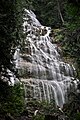
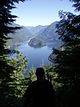
![]() Media related to Provincial Parks of British Columbia at Wikimedia Commons
Media related to Provincial Parks of British Columbia at Wikimedia Commons