| Wrinkly Face Provincial Park | |
|---|---|
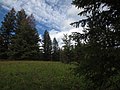
 Field of Wildflowers in Wrinkly Face Provincial Park | |
 Location in British Columbia  Location in Regional District of Central Okanagan | |
 Interactive map of Wrinkly Face Provincial Park | |
| Location | Central Okanagan, British Columbia, Canada |
| Nearest city | Kelowna, Canada |
| Coordinates | 50°2′24″N119°18′38″W / 50.04000°N 119.31056°W |
| Area | 43 ha (110 acres) |
| Established | 20 May 2004 |
| Governing body | BC Parks |
| Website | Wrinkly Face Provincial Park |
Wrinkly Face Provincial Park is a provincial park 16 kilometres north of Winfield in British Columbia, Canada. [2] Access to the park is limited, and there are no motorized vehicles allowed inside its boundaries. [3] The name of the park, Wrinkly Face, refers to the appearance of the basalt cliffs that are located in it. [4]