
Adams Lake Provincial Park is a provincial park in British Columbia, Canada. It encompasses three distinct parks: Adams Lake Provincial Park, Adams Lake Marine Provincial Park, and Adams Lake Marine Provincial Park.
Liard River Hot Springs Provincial Park is a provincial park in British Columbia, Canada. It is home to the second largest natural hot springs in Canada, after Deer River Hot Springs 15 km to the north east. It is a natural river of hot water rather than a spring fed man made pool. The park is part of the larger Muskwa-Kechika Management Area. The community of Liard River, British Columbia is located nearby.
Arctic Pacific Lakes Provincial Park is a provincial park in British Columbia, Canada, protecting a pair of lakes known as Arctic and Pacific Lakes, which as their name indicate are on the divide between the Pacific and Arctic drainages. Inherently, the Continental Divide runs between the two lakes, which lie in a narrow valley amid the rugged mountains of the northwesternmost McGregor Plateau. The pass formed by the lakes was important during early fur trade operations and was one of the main links between New Caledonia and the fur companies' eastern territories beyond the Rockies.
Babine Mountains Provincial Park is a provincial park in British Columbia, Canada, located to the east of the Bulkley River between the town of Smithers and Babine Lake. Established by Order-in-Council as the Babine Mountains Recreation Area in 1984, it was upgraded to park status and its name changed in 1999. It contains approximately 31,465 hectares.
Bearhole Lake Provincial Park is a provincial park in British Columbia, Canada, 5 km east of the mining community of Tumbler Ridge, on the Alberta Plateau. Established in January 2001, the park includes 12,705 ha of land in the Boreal White and Black Spruce biogeoclimatic zones within the Kiskatinaw Plateau. It is transition zone with mixed wood forests including spruce, pine, and larch. Bearhole Lake, the headwaters of the Kiskatinaw River provides habitat for trumpeter swans, yellow perch, burbot, rainbow trout, and northern pike.

Bligh Island Marine Provincial Park is a provincial park in British Columbia, Canada.
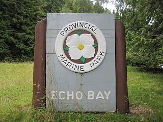
Echo Bay Marine Provincial Park is a provincial park in British Columbia, Canada, established in 1971 and containing 1.5 hectares. It is located at the bay of the same name, offshore from the community of the same name, which is the location of the Simoom Sound post office and is on the west side of Gilford Island.
Ethel F. Wilson Memorial Provincial Park is a provincial park in central British Columbia, Canada. The park is situated on the northern tip of Pinkut Lake. Activities in the park include rainbow trout fishing and boating. The park has five campsites that are allocated on a first-come first-served basis. The area of the park is 33 hectares.
Ed Bird – Estella Lakes Provincial Park is a provincial park in British Columbia, Canada.
Finger-Tatuk Provincial Park is a provincial park in British Columbia, Canada. Established in 1999, it covers 17,151 hectares and includes Finger Lake and Tatuk Lake, as well as several smaller lakes and archaeological sites once used by Dakelh (Carrier) First Nations peoples. The lakes are known for rainbow trout and kokanee salmon, and each of the two larger lakes has a resort.
Gold Muchalat Provincial Park is a provincial park in British Columbia, Canada, located between the Gold and Muchalat Rivers.
Little Andrews Bay Marine Provincial Park is a provincial park in British Columbia, Canada, located on Ootsa Lake in the Nechako Country in that province's Central Interior. It is 102 hectares in size.

Lockhart Beach Provincial Park is a provincial park Located 40 km north of Creston, British Columbia, Canada, on BC Highway 3A. "This park and the adjacent Lockhart Creek Provincial Park extend 3 hectares, from the sunny shores of Kootenay Lake to the headwaters of Lockhart Creek. "This small park provides the only easy access to public camping along the south arm of Kootenay Lake. An 18-site campground and day-use area are located near a sand and fine gravel beach."
Nilkitkwa Lake Provincial Park is a provincial park in British Columbia, Canada.
Norbury Lake Provincial Park is a 97-hectare (240-acre) provincial park in British Columbia, Canada.
Pennask Creek Provincial Park is a provincial park in British Columbia, Canada. It is located on highway 97C about 50 kilometres west of Kelowna.
Smith River Falls – Fort Halkett Provincial Park is a provincial park in British Columbia, Canada, protecting Smith River Falls and the former Fort Halkett, a Hudson's Bay Company trading post. The park is located at the confluence of the Smith and Liard Rivers.
Tsintsunko Lakes Provincial Park is a 333-hectare provincial park in British Columbia, Canada, located south of the Deadman River between Kamloops (SE) and Bonaparte Lake (NW). It is located on the Bonaparte Plateau. It was established April 30, 1996.
Topley Landing Provincial Park is a provincial park near Topley Landing in British Columbia, Canada.

Rainbow/Q'iwentem Provincial Park is a provincial park in the Cariboo region of British Columbia. The park was established in 2013 and is 385 hectares in size, protecting the land between Sulphurous Lake and Deka Lake. While there are no developed trails in the park, routes used by locals exist connecting roads on the North Shore of Deka Lake to the North Shore of Sulphurous Lake. The park is accessible by road only from the southwest.

