Bedard Aspen Provincial Park is a provincial park in British Columbia, Canada, located in the Cornwall Hills to the west of Cache Creek-Ashcroft in that province's Thompson Country region. The valley of Hat Creek is to its west.
Boundary Creek Provincial Park is a provincial park in British Columbia, Canada located south of Greenwood BC in that province's Boundary Country, adjacent to BC Highway 3. The eponymous Boundary Creek flows through the park.
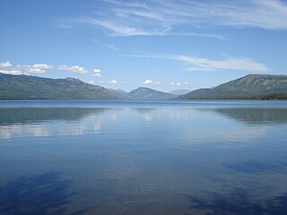
Blue Earth Lake Provincial Park is a provincial park in the Upper Hat Creek area at the south end of the Cornwall Hills, just northwest of Ashcroft, British Columbia, Canada.
Coldwater River Provincial Park is a provincial park in British Columbia, Canada, located at the confluence of the Coldwater River with Cullet Creek, 50 km south of Merritt on BC Highway 5.
Epsom Provincial Park is a provincial park in British Columbia, Canada, located west of Ashcroft around Oregon Jack Hill.
Elephant Hill Provincial Park is a provincial park in British Columbia, Canada, protecting Elephant Hill, a prominent landmark adjacent to the Trans-Canada Highway at the cut-off for the town of Ashcroft, a few miles south of the town of Cache Creek. The park is approximately 968 hectares in area.
Harry Lake Aspen Provincial Park is a provincial park in British Columbia, Canada, located northwest of Ashcroft near the upper basin of Hat Creek.
Kinaskan Lake Provincial Park is a provincial park in British Columbia, Canada, located at the south end of Kinaskan Lake along the Stewart-Cassiar Highway near Mowdade Lake and southeast of Mount Edziza. At the south end of the park, the Iskut River, of which the lake is an expansion, spills over 12.2-metre Cascade Falls. The park is approximately 800 ha. in size.
Oregon Jack Provincial Park is a provincial park in British Columbia, Canada located in the Clear Range west of Ashcroft. It protects the limestone canyon of Oregon Jack Creek, at the head of which is a waterfall named the Notch, above which is included a wetland area. The site was an important First Nations site and there are pictographs, culturally modified trees and a site known as the Three Sisters Rock Shelter.
Slim Creek Provincial Park is a provincial park in British Columbia, Canada.
Tsintsunko Lakes Provincial Park is a 333-hectare provincial park in British Columbia, Canada, located south of the Deadman River between Kamloops (SE) and Bonaparte Lake (NW). It is located on the Bonaparte Plateau. It was established April 30, 1996.

The Bonaparte Indian Band a.k.a. Bonaparte First Nation, is a member band of the Shuswap Nation Tribal Council of the Secwepemc (Shuswap) people.

The Stswecem'c Xgat'tem First Nation, formerly known as Canoe Creek Band/Dog Creek Indian Band, created as a result of merger of the Canoe Creek Band and Dog Creek Band is a First Nations government of the Secwepemc (Shuswap) Nation, located in the Fraser Canyon-Cariboo region of the Central Interior of the Canadian province of British Columbia. It was created when the government of the then-Colony of British Columbia established an Indian reserve system in the 1860s. It is a member government of the Northern Shuswap Tribal Council.
The Lytton First Nation, a First Nations band government, has its headquarters at Lytton in the Fraser Canyon region of the Canadian province of British Columbia. While it is the largest of all Nlaka'pamux bands, unlike all other governments of the Nlaka'pamux (Thompson) people, it is not a member of any of the three Nlaka'pamux tribal councils, which are the Nicola Tribal Association, the Fraser Canyon Indian Administration and the Nlaka'pamux Nation Tribal Council.

Ashcroft Manor Ranch, known also as Ashcroft Ranch, is an historic ranch in the Thompson Country of British Columbia, Canada, founded by Clement Francis Cornwall and his brother, Henry Cornwall. Ashcroft Manor's main house and buildings are an historic site adjacent to the Trans-Canada Highway and west of the Canadian Pacific main line, which named its flag stop Ashcroft Station at the current site of the village of Ashcroft. The manor is 11 kilometres (7 mi) south of Cache Creek on BC Highway 1 at the access road junction to the village of Ashcroft below on the Thompson River.

Hat Creek is a tributary of the Bonaparte River in British Columbia, Canada, joining that stream at Carquile, which is also known as Lower Hat Creek and is the site of the Hat Creek Ranch heritage museum and visitor centre. The Hat Creek basin includes a broad upper plateau area encircled by the gentle but high summits of the Clear Range and, to its east, the Cornwall Hills; this area is known as Upper Hat Creek. Adjacent to Upper Hat Creek is the gateway to Marble Canyon and a rancherie of the Pavilion First Nation, who are both a St'at'imc and Secwepemc people. During the Fraser Canyon and Cariboo Gold Rushes an important trail northwards from the lower Fraser Canyon led from Foster Bar on the Fraser via Laluwissen Creek into Upper Hat Creek, then via the creek to the Bonaparte River. The economy of the basin is ranching-based and includes some of the oldest ranches in the British Columbia Interior. On the northwest edge of the Upper Hat Creek basin there is a large lignite deposit and several exploratory pits, some dating back to the 19th century but some more recent, part of an intended, but now shelved Hat Creek coal-thermal proposal.

The Deadman River, also known as the Deadman's River, Deadman Creek or Deadman's Creek, is a tributary of the Thompson River in the British Columbia Interior of British Columbia, Canada. It is about 70 kilometres (43 mi) in length.
Arrowstone Provincial Park is a provincial park in the Thompson Country of the Southern Interior of British Columbia, Canada, located to the northeast of the town of Cache Creek. The park was established by Order-in-Council in 1996 with an area of 6203 hectares. In 2000 its boundaries were slightly reduced, such that its area is now 6175 hectares.
The Cornwall Hills are a range of mountainous hills in the Thompson Country of the Interior of British Columbia, Canada. They are located west and southwest of the communities of Cache Creek and Ashcroft and form the divide between the basin of the Thompson and that of Upper Hat Creek to the west. Named for Clement Francis Cornwall, distinguished colonist and later Lieutenant-Governor of British Columbia, and his brother Henry, who owned the Ashcroft Manor Ranch, also known as the Cornwall Ranch, which lay on the western slope of these hills. To their north are the Trachyte Hills, as far as the middle basin of Hat Creek and ending at Lower Hat Creek, and to their south is part of the Clear Range which forms the rest of the basin divide around Hat Creek.
The Lillooet Land District is one of the 59 cadastral subdivisions of British Columbia, which were created by the Lands Act of the Colony of British Columbia in 1859, defined as "a territorial division with legally defined boundaries for administrative purposes". The land district's boundaries came to be used as the boundary of the initial Lillooet riding for the provincial Legislature from 1871, when the colony became a province. In addition to use in descriptions of land titles and lot surveys, the Land District was also the basis of the Lillooet Mining District.

