
Duke Point is a geographical location in the extreme southeastern part of the city of Nanaimo in British Columbia. It is located on a thin peninsula to the east of the Nanaimo River estuary, just across the Northumberland Channel from Gabriola Island.
Anderson Bay Provincial Park is a provincial park in British Columbia, Canada, located on the southeast end of Texada Island near the community of Gillies Bay. Created in 2000, it is approximately 35 hectares in area.
Burgoyne Bay Provincial Park is a provincial park in British Columbia, Canada located on southwestern Saltspring Island near Fulford Harbour. The parks faces northwest to Sansum Narrows, which is the channel between Saltspring Island and Vancouver Island. Mount Maxwell Provincial Park lies adjacent to the north.

Buccaneer Bay Provincial Park is a provincial park in British Columbia, Canada, located 17 km west of Sechelt on North Thormanby Island, offshore from the community of Halfmoon Bay.
Brackendale Eagles Provincial Park is a provincial park in British Columbia, Canada, located on the Squamish River adjacent to Brackendale, a suburban neighbourhood of Squamish. It is notable for its bald eagle population during the winter months and is inaccessible to visitors.
Bobtail Mountain Provincial Park is a provincial park in British Columbia, Canada. It was established on June 29, 2000, under the Protected Areas of British Columbia Act.
Dionisio Point Provincial Park is a provincial park campground in the southern Gulf Islands of British Columbia, Canada. It is located at the northwestern tip of Galiano Island, across Porlier Pass from Valdes Island.
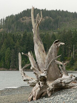
French Beach Provincial Park is a provincial park located on Vancouver Island, between Sooke and Jordan River, British Columbia. The area has a day use parking lot and B.C. provincial campground. It was created in 1980 as the first family-oriented park on the southwest coast of Vancouver Island. Situated on the scenic Strait of Juan de Fuca on the west coast of southern Vancouver Island, French Beach Provincial Park offers views of the Strait and the Olympic Mountains. The beach spreads on 1,600-meters and is a location for whale watching as well as spotting Bald eagles, Ospreys and a variety of seabirds.
Hemer Provincial Park is a provincial park in British Columbia, Canada. It is located south of Nanaimo.

Mount Elphinstone Provincial Park is a provincial park located near BC Highway 101, in British Columbia, Canada. Located near Mount Elphinstone, the park is on the west side of Howe Sound and north of the town of Gibsons and near the community of Roberts Creek. Created in 2000, the park is approximately 141 hectares in size.

Pirates Cove Marine Provincial Park is a provincial park on De Courcy Island in British Columbia, Canada.

Plumper Cove Marine Provincial Park is a provincial park in British Columbia, Canada. The park is located on the northwest shore of Keats Island in Howe Sound, northwest of Vancouver, British Columbia.

Porpoise Bay Provincial Park is a provincial park in British Columbia, Canada near the town of Sechelt. Features of the park include a campsite with group and walk-in camping opportunities, as well as opportunities for paddling, swimming and observing nature.
Princess Louisa Marine Provincial Park is a provincial park in British Columbia, Canada surrounding Princess Louisa Inlet.
Roberts Creek Provincial Park is a provincial park in British Columbia, Canada, located northwest of the community of Roberts Creek, between Gibsons and Sechelt. First created in 1947 with an area of 100 acres (0.40 km2), it was modified in size in 2000 to approximately 40 ha.
Sandwell Provincial Park is a provincial park in British Columbia, Canada. It is a small oceanfront site on Lock Bay, on the northeast shore of Gabriola Island. Hiking, swimming and beach-walking are popular activities here, though it is only accessible at low tide and park facilities are limited. There are also petroglyphs carved into the sandstone boulders on Lock Bay's foreshore.

Tetrahedron Provincial Park is a provincial park located within the territory of the shíshálh Nation on the southern Sunshine Coast, in British Columbia, Canada. The park was created in 1995 thanks to the efforts of a collective of NGOs who came together to protect the headwaters of the Chapman Creek and Gray Creek Community Watersheds from commercial logging activities.

Cedar is a small community in the Canadian province of British Columbia. It is located near the east coast of Vancouver Island — about 8 kilometres (5.0 mi) south-east of Nanaimo — along the banks of the Nanaimo River. Its geographical coordinates are 49°07′N123°51′W.
Gambier Island is an island located in Howe Sound near Vancouver, British Columbia. It is about 17,049 acres in size and is located about 10 kilometres north of the Horseshoe Bay community and ferry terminal in westernmost West Vancouver.
South Thormanby Island is an island off the Sunshine Coast of British Columbia, Canada, located 17 km west of Sechelt, and within the shared territories of the Tla'amin Nation and the shíshálh Nation.


