
The Stein Valley Nlaka’pamux Heritage Park is located near Lytton, British Columbia. The park was established in 1995. The park is co-managed, operated, and planned through a partnership between the Lytton First Nation and the government of British Columbia. The park provides recreational opportunities and cultural heritage activities, and features a number of pictographs.
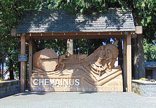
Chemainus is a community within the municipality of North Cowichan in the Chemainus Valley on the east coast of southern Vancouver Island, British Columbia, Canada.

North Cowichan is a district municipality established in 1873 on Vancouver Island, in British Columbia, Canada. The municipality is part of the Cowichan Valley Regional District. North Cowichan is noted for a landscape including forests, beaches, rivers, and lakes. The municipality encompasses the communities of Chemainus; Westholme; Crofton; Maple Bay; and "the South End". The latter is an informal name for a built-up area which is essentially a suburb of the City of Duncan, a separate municipality.

Cowichan Bay is a bay and community located on the east coast of southern Vancouver Island near Duncan, in British Columbia, Canada. The mouth of the Cowichan River is near Cowichan Bay. Mount Tzouhalem with its hiking trails and ecological reserve stands to the north. The bay is known for its fishing and scenic value. The area's main industries are fishing and tourism.
The Cowichan Valley is a region around the Cowichan River, Cowichan Bay and Cowichan Lake on Vancouver Island, in British Columbia, Canada. There is some debate as to the origin of the name Cowichan, which many believe to be an anglicized form of the First Nations tribal name Quw'utsun.

Carmanah Walbran Provincial Park, originally Carmanah Pacific Provincial Park, is a remote wilderness park located inside traditional Ditidaht First Nation ancestral territory. The park covers a land area of 16,450 ha (63.5 sq mi) immediately adjacent to Pacific Rim National Park Reserve's West Coast Trail on the south-western, coastal terrain of Vancouver Island. The provincial park comprises the entire drainage of Carmanah Creek, and a good portion of the lower Walbran River drainage, both of which independently empty into the Pacific Ocean. The park is named after the Anglicized diitiid?aatx word kwaabaaduw7aa7tx, or Carmanah, meaning "as far up as a canoe can go" and John Thomas Walbran, a colonial explorer and ship's captain. Access to the park is by gravel logging road from Port Alberni, Lake Cowichan, or Port Renfrew.
Yahk Provincial Park is a provincial park located just south of Yahk, British Columbia, 70 kilometres south of Cranbrook, and 14.5 kilometres north of the Canada–United States border at Kingsgate in British Columbia, Canada.

Quatsino Provincial Park is a provincial park in British Columbia, Canada, located on Quatsino Sound on northern Vancouver Island. The park was established July 12, 1995 and is 654 hectares in size. The park is 50 kilometres (31 mi) west of Port Hardy, British Columbia and is accessible by rough logging roads or by boat. Quatsino is on a popular kayaking route.

Golden Ears Provincial Park is a 555.9 square kilometres (214.6 sq mi) provincial park in British Columbia, Canada. It is named after the prominent twin peaks, which are commonly referred to as Golden Ears. The park was originally part of Garibaldi Provincial Park but was split off as a separate park in 1967. The area was logged extensively in the 1920s by the Lougheed and Abernathy Logging Company. Many recreational attractions are found within the park. Golden Ears Provincial Park is a protected area that contains many endangered species of flora and fauna.

Cowichan River Provincial Park is a provincial park on Vancouver Island in British Columbia, Canada. It includes the Cowichan River in a 1,418 ha area stretching almost 20 kilometres in length from the village of Lake Cowichan to Glenora, just south of Duncan. The Cowichan Valley Trail runs the length of the park, which is part of the greater Trans Canada Trail.
Gordon Bay Provincial Park is a provincial park in British Columbia, Canada.

Koksilah River Provincial Park is a provincial park in British Columbia, Canada.
Tłu Tue - Maxhamish Lake Provincial Park and Protected Area is a 27,516-hectare (67,990-acre) provincial park in British Columbia, Canada.

Mount Assiniboine Provincial Park is a provincial park in British Columbia, Canada, located around Mount Assiniboine.
Nitinat River Provincial Park is a provincial park in the Canadian province of British Columbia on Vancouver Island.
Woss Lake Provincial Park is a provincial park in British Columbia, Canada, located 75 kilometres southeast of Port McNeill, near the community of Woss, which is also known as Woss Lake.
Spatsizi Plateau Wilderness Provincial Park is located in the northern portion of British Columbia, Canada, approximately 698, 659 hectares and encompasses the Spatsizi River and Gladys Lake Ecological Reserve. The park is a designated protected area that is intended for the conservation and research on caribou, grizzly bears, fish, and other wildlife species populations. Before the provincial park's establishment in 1975, the area was a historical hunting ground for local Indigenous communities like the Tahltan First Nations. It is the second largest provincial park in British Columbia.

Tantalus Provincial Park is a provincial park located in the Tantalus Range overlooking Squamish Valley in British Columbia, Canada. It was established on December 19, 1998 to protect a large area of pristine alpine wilderness.
Westholme is a community located in the Chemainus River Valley alongside the Island Highway, between Chemainus and Duncan in British Columbia, Canada. It is part of the Chemainus Land District in the District Municipality of North Cowichan. Westholme is one of the original settlements on Vancouver Island. Once a thriving mining and farming community, it is now filled with hobby farms and upscale private estates on large acreages, many of which are owned to this day by the descendants of original settlers to this area.
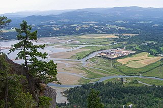
The Chemainus River is located on southern Vancouver Island, British Columbia, Canada. Its source is in the Vancouver Island Ranges, and it flows eastwards to the Strait of Georgia near the town of Chemainus, British Columbia. The valley that surrounds the river additionally includes the communities of Crofton and Westholme as well as the Halalt First Nation Reserve and several smaller reserves. Located on one of the largest islands at the mouth of the river, an old now-deserted village called Xulel-thw stands on the northeast corner; Coast Salish peoples lived there and in other now-deserted villages in the area, constantly moving throughout history.


