The Fraser River is the longest river within British Columbia, Canada, rising at Fraser Pass near Blackrock Mountain in the Rocky Mountains and flowing for 1,375 kilometres (854 mi), into the Strait of Georgia just south of the City of Vancouver. The river's annual discharge at its mouth is 112 cubic kilometres (27 cu mi) or 3,550 cubic metres per second (125,000 cu ft/s), and each year it discharges about 20 million tons of sediment into the ocean.

Chilliwack is a city of about 100,000 people and 261 km2 (100 sq mi) in the Canadian province of British Columbia. It is located about 100 km (62 mi) east of the City of Vancouver in the Fraser Valley. The enumerated population is 93,203 in the city and 113,767 in the greater metropolitan area.

Quesnel is a city located in the Cariboo Regional District of British Columbia, Canada. Located nearly evenly between the cities of Prince George and Williams Lake, it is on the main route to northern British Columbia and the Yukon. Quesnel is located at the confluence of the Fraser River and Quesnel River. As of 2021, Quesnel's metropolitan area had a population of 23,113 making it one of the largest urban centres between Prince George and Kamloops.

Hope is a district municipality at the confluence of the Fraser and Coquihalla rivers in the province of British Columbia, Canada. Hope is at the eastern end of both the Fraser Valley and the Lower Mainland region, and is at the southern end of the Fraser Canyon. To the east, over the Cascade Mountains, is the Interior region, beginning with the Similkameen Country on the farther side of the Allison Pass in Manning Park. Located 154 kilometres (96 mi) east of Vancouver, Hope is at the southern terminus of the Coquihalla Highway and the western terminus of the Crowsnest Highway, locally known as the Hope-Princeton, where they merge with the Trans-Canada Highway. Hope is at the eastern terminus of Highway 7. As it lies at the eastern end of the Fraser Valley in the windward Cascade foothills, the town gets very high amounts of rain and cloud cover – particularly throughout the autumn and winter.

The University of the Fraser Valley (UFV), formerly known as University College of the Fraser Valley and Fraser Valley College, is a public university with campuses in Abbotsford, Chilliwack, Mission and Hope, British Columbia, Canada. Founded in 1974 as Fraser Valley College, it was a response to the need for expanded vocational training in the communities of the Fraser Valley. In 1991, it became a university college, with degree-granting status. As the University College of the Fraser Valley, it grew rapidly, becoming one of the largest university colleges in Canada.

The Fraser Valley Regional District (FVRD) is a regional district in British Columbia, Canada. Its headquarters are in the city of Chilliwack. The FVRD covers an area of 13,361.74 km2 (5,159 sq mi). It was created in 1995 by an amalgamation of the Fraser-Cheam Regional District and Central Fraser Valley Regional District and the portion of the Dewdney-Alouette Regional District from and including the District of Mission eastwards.

Chilliwack-Kent is a provincial electoral district for the Legislative Assembly of British Columbia, Canada that first existed from 2001 to 2009, when it was replaced by the Chilliwack-Hope riding. In the 2015 redistribution, the eastern portion of Chilliwack-Hope was adjusted and the name Chilliwack-Kent was brought back into service and was contested in the 2017 general election.

A quiggly hole, also known as a pit-house or simply as a quiggly or kekuli, is the remains of an earth lodge built by the First Nations people of the Interior of British Columbia and the Columbia Plateau in the United States. The word quiggly comes from a mispronunciation of the nsyilxcǝn term qʷc̓iʔ, which was incorporated into Chinook Jargon as kickwillie. Kick willy, kickwillie, or keekwulee are the spelling variations of the Chinook Jargon word for "beneath" or "under".

Parts of this article have been adapted from the BC Parks website.

Canim Beach Provincial Park is a provincial park in British Columbia, Canada, located at the southwest end of Canim Lake in the Interlakes District of the South Cariboo region, adjacent to the Secwepemc Indian reserve community of Canim Lake, British Columbia just northeast of 100 Mile House. The park was established by Order-in-Council in 1956 and expanded by later legislation in 2000 and 2004 to total a current approximate of 8.2 hectares, 3.6 hectares of upland and 4.6 hectares of foreshore.

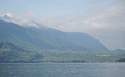
Sx̱ótsaqel/Chilliwack Lake Provincial Park is a provincial park in British Columbia, Canada. Covering 92.58 km2, the park is located 150 km east of Vancouver in the Chilliwack River Valley.

Barry Penner, is a Canadian lawyer and former politician in the province of British Columbia. He served as a Member of the Legislative Assembly of British Columbia (MLA), representing the riding of Chilliwack from 1996 to 2001, Chilliwack-Kent from 2001 to 2009, and Chilliwack-Hope from 2009 to 2012. A caucus member of the British Columbia Liberal Party, he served in several cabinet posts under premiers Gordon Campbell and Christy Clark, including as Minister of Environment, Minister of Aboriginal Relations and Reconciliation, and Attorney General.

The District of Kent is a district municipality located 116 kilometres (72 mi) east of Vancouver, British Columbia. Part of the Fraser Valley Regional District, Kent consists of several communities, the largest and most well-known being Agassiz—the only town in the municipality—Harrison Mills, Kilby, Mount Woodside, Kent Prairie, Sea Bird Island and Ruby Creek. Included within the municipality's boundaries are several separately-governed Indian reserves, including the Seabird Island First Nation's reserves on and around the island of the same name.

Steven Lewis Point, (Xwelíqwetel) is a Canadian academic administrator, criminal lawyer, and jurist. He is the current chancellor of the University of British Columbia. He served as the 28th Lieutenant Governor of British Columbia from 2007 to 2012. He also served as the chair of the advisory committee on the safety and security of vulnerable women, a committee that provides community-based guidance to the implementation of the recommendations from the Missing Women Commission of Inquiry.
Hunter Island is an island on the coast of the Canadian province of British Columbia. It is located inshore from Queen Charlotte Sound, about 130 kilometres (81 mi) north of the town of Port Hardy at the north end of Vancouver Island.

Chilliwack Lake is a lake in the upper basin of the Chilliwack River southeast of the city of the same name in the Lower Mainland of British Columbia, Canada. The lake, while entirely within Canada, is located just north of the border between British Columbia and the state of Washington and is both fed and drained by the Chilliwack River, which has its source in the North Cascades of Washington state and Canada, which surround the lake on all sides.

The following outline is provided as an overview of and topical guide to British Columbia:
Chilliwack is a city made up of several amalgamated villages and communities. The urban core has a decidedly north–south axis bisected by the Trans-Canada Highway. The city is bounded in north by the Fraser River, in the east by the Eastern Hillsides, in the south by the Canada-U.S. border, and in the west by the Vedder Canal.

Mount Seymour Provincial Park is a park in Vancouver, British Columbia's North Shore Mountains. With an area of 35 square kilometres, it is located approximately 15 kilometres north of Downtown Vancouver. The park, named after Frederick Seymour, was established in 1936. Mount Seymour Provincial Park provides visitors with a variety of recreational activities and animals with natural habitat.