
Haida Gwaii, also known as the Queen Charlotte Islands, is an archipelago located between 55–125 km (34–78 mi) off the northern Pacific coast of Canada. The islands are separated from the mainland to the east by the shallow Hecate Strait. Queen Charlotte Sound lies to the south, with Vancouver Island beyond. To the north, the disputed Dixon Entrance separates Haida Gwaii from the Alexander Archipelago in the U.S. state of Alaska.

Graham Island is the largest island in the Haida Gwaii archipelago, lying off the mainland coast of British Columbia, Canada. It is separated by the narrow Skidegate Channel from the other principal island of the group to the south, Moresby Island. It has a population of 3,858, an area of 6,361 km2 (2,456 sq mi), and is the 101st largest island in the world and Canada's 22nd largest island.
The North Coast Regional District is a quasi-municipal administrative area in British Columbia. It is located on British Columbia's west coast and includes Haida Gwaii, the largest of which are Graham Island and Moresby Island. Its administrative offices are in the City of Prince Rupert.

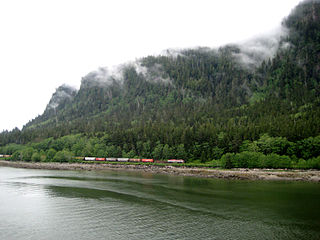
Skidegate is a Haida community in Haida Gwaii in British Columbia, Canada. It is on the southeast coast of Graham Island, the largest island in the archipelago, and is approximately 50 kilometres (31 mi) west of mainland British Columbia across Hecate Strait.
Sandspit is the largest community on Moresby Island, in Haida Gwaii off the Pacific coast of British Columbia, Canada. The only town on Moresby Island, Sandspit has accommodations, a campground, supermarket and 85-berth harbour serving visitors to Gwaii Haanas.
Port Clements is an incorporated village situated at the east end of Masset Inlet in Haida Gwaii off the coast of the Province of British Columbia in Canada. Known as Gamadiis in HlG̱aagilda X̱aayda kil, it is one of seven village sites that flourished in the rich waters at the mouth of Yakoun River, where an estuary shelters nine Pacific salmonid species and many kinds of birds. Founded by Eli Tingley in 1907, it was once known under the name Queenstown, but renamed to Port Clements in 1914 after Herb S. Clements, the local MP at the time, when the name "Queenstown" duplicated and therefore became unusable for the post office.

Daajing Giids, known as Queen Charlotte City from 1891–2022, is a village municipality in the Haida Gwaii archipelago in the province of British Columbia, Canada. It is located on the southern end of Graham Island at Skidegate Inlet and is a member municipality of the North Coast Regional District.
Moresby Island is a large island that forms part of the Haida Gwaii archipelago in British Columbia, Canada, located at 52°45′00″N131°50′00″W. It is separated by the narrow Skidegate Channel from the other principal island of the group to the north, Graham Island.

Skidegate Channel is a strait located in the Haida Gwaii archipelago of British Columbia, Canada. It divides the archipelago's two main islands, Graham Island to the north and Moresby Island to the south.
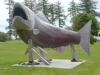
The Yakoun River is the largest river of Haida Gwaii, in the province of British Columbia, Canada. Located on Graham Island it flows about 58 km (36 mi) from Yakoun Lake north to Masset Inlet, a large saltwater bay located in the heart of the Graham Island and connected to the Pacific Ocean at Dixon Entrance via a long narrow inlet called Masset Sound.

New Clew, also Clue, Kloo, Kliew, Klue, Clew Indian Reserve, is a locality and First Nations reserve of the Haida people, located on the north shore of Louise Island, which is located in Cumshewa Inlet on Haida Gwaii, formerly known as the Queen Charlotte Islands, of the North Coast of British Columbia, Canada.

Cumshewa is a former village of the Haida people located on the north flank of Cumshewa Inlet in the Haida Gwaii of the North Coast of British Columbia, Canada. It is named for Cumshewa, an important Haida chief during the era of the Maritime Fur Trade, as is Cumshewa Head, an important headland and point on the north side of the opening of Cumshewa Inlet, which pierces Moresby Island from the east and was the location of several historical Haida villages.
Gold Harbour was a historic gold and silver mine in Haida Gwaii, on the north coast of British Columbia, Canada. It is notable as the location of the first lode mine worked in what is now British Columbia.
The Skidegate Band Council, also known as the Skidegate First Nation, is a band government of the Haida people, one of two of the Haida Tribal Society aka the Council of the Haida Nation. Its offices are located in Skidegate, British Columbia.
Maude Island is an island in the Haida Gwaii archipelago of the North Coast region of British Columbia, Canada. It is located within Skidegate Inlet, a large saltwater inlet within Graham Island. It is the larger of two islands in British Columbia by that name, the other being a small islet offshore from Nanoose Bay and Lantzville on southeastern Vancouver Island.

Tanu is a traditional Haida village site located on Tanu Island, Haida Gwaii, opposite of Kung'a Island in Laskeek Bay, within the Gwaii Haanas National Park Reserve and Haida Heritage Site.

Various Imperial and colonial actions against Haida Gwaii Authorities have been undertaken since the 19th century. The indigenous peoples of Haida Gwaii often reacted violently to European and American ships which trespassed in their waters and lands. From the 18th to 19th centuries, various skirmishes took place between Haida authorities and European and American merchantmen and warships. Canadian settlers did not arrive on Haida Gwaii islands until 1900, and many Canadian colonial police actions attempted to assault the Haida Gwaii authorities and citizens. The indigenous Haida population was decimated by diseases such as smallpox which were introduced accidentally by way of Fort Victoria. The presence of foreign diseases, to which the Haida had no immunity, along with some colonial hostility, meant that the numbers of Haida citizens was reduced from tens of thousands to 588 by 1915. This erosion of Haida cultural institutions was essential to open the way for subsequent British and Canadian incursions and jurisdictional claims.
Kaisun, also Ḵaysuun, Qaysun, Qaysun Llanagaay, or Sealion Town, is a former village of the Haida people located on the west side of Moresby Island in Haida Gwaii of the North Coast of British Columbia, Canada. The Haida of Kaisun were Qayahl Llaanas, the Sealion People, of the Eagle moiety. It was normal for members of both Haida moieties to live in a village. In Kaisun, houses of the Raven moiety were on the west side of the village, while Eagle houses were on the east side. There were close connections between Kaisun and the nearby village of Chaatl, about 10 km (6.2 mi) to the north in a straight line, or about 20 km (12 mi) by water.
Chaatl, also spelled Cha'atl, Tsaa'ahl, Tts’aa’ahl, and other variations, was a historic Haida village located on the shore of Chaatl Island, facing south across Buck Channel to the western side of northern Moresby Island, near the western end of Skidegate Channel, Haida Gwaii, British Columbia, Canada. Across Buck Channel from Chaatl was the long-abandoned village site of Niisii. There were close connections between Chaatl and the nearby village of Kaisun, about 10 km (6.2 mi) to the south in a straight line, or about 20 km (12 mi) by water.

