The Kootenays or Kootenay is a region of southeastern British Columbia. It takes its name from the Kootenay River, which in turn was named for the Kutenai First Nations people.
The International Selkirk Loop is a 280-mile-long (450 km) scenic highway in the U.S. states of Idaho and Washington, as well as the Canadian province of British Columbia. The loop encircles the Selkirk Mountain Range, and offers several side trips aside from the main route. Included on the loop is the Kootenay Lake Ferry, the longest free ferry in the world. The portion of the loop in the United States has been designated an All-American Road by the United States Department of Transportation.

Adams Lake Provincial Park is a provincial park in British Columbia, Canada. It encompasses three distinct parks: Adams Lake Provincial Park, Adams Lake Marine Provincial Park, and Adams Lake Marine Provincial Park.
James Chabot Provincial Park is a provincial park in British Columbia, Canada. Formerly Athalmer Beach Provincial Park, it is located in Invermere at the northeast end of Windermere Lake in the Columbia Valley region of the East Kootenay. Windermere Lake Provincial Park is located at the lake's southwestern end.
Kootenay Lake Provincial Park is a provincial park in British Columbia, Canada. It encompasses five widely dispersed parks around Kootenay Lake: Kootenay Lake Provincial Park, Kootenay Lake Provincial Park, Kootenay Lake Provincial Park, Kootenay Lake Provincial Park, and Kootenay Lake Provincial Park.
Kianuko Provincial Park is a provincial park in British Columbia, Canada.
Kikomun Creek Provincial Park is a provincial park in British Columbia, Canada.

Lockhart Beach Provincial Park is a provincial park Located 40 km north of Creston, British Columbia, Canada, on BC Highway 3A. "This park and the adjacent Lockhart Creek Provincial Park extend 3 hectares, from the sunny shores of Kootenay Lake to the headwaters of Lockhart Creek. "This small park provides the only easy access to public camping along the south arm of Kootenay Lake. An 18-site campground and day-use area are located near a sand and fine gravel beach."

Pilot Bay Provincial Park is a provincial park in British Columbia, Canada.
Premier Lake Provincial Park is a provincial park near Cranbrook, British Columbia. It is located on the south and western shores of Premier Lake in the East Kootenays, a small lake situated on the eastern flank of the Kootenay trench about 60 km north of Cranbrook. Also contained within the park are several smaller lakes, including Rockbluff (Quartz) Lake, Yankee Lake and Canuck Lake, all notable for the vivid green colour of their water.

The Purcell Wilderness Conservancy is a provincial park in British Columbia, Canada. It was established in 1974, and encompasses six large drainages in the Purcell Mountains in the southeast of the province. It contains high peaks, alpine meadows and ridges, deep creek and river valleys, and hot springs at Dewar Creek.
Syringa Park is a provincial park on the east shore of Lower Arrow Lake in the West Kootenay region of southeastern British Columbia. At the foot of the Norns Range, Tulip Creek passes through the centre, and Syringa Creek is closer to the southeastern boundary. The park is about 19 kilometres (12 mi) west of Castlegar via Broadwater Rd.

Stagleap Provincial Park is a provincial park in British Columbia, Canada. The park is approximately 1133 hectares. It is 34 kilometers west of Creston.

The Cody Caves are a network of limestone caves in the Selkirk Mountains in British Columbia, Canada. They are located 2 miles (3.2 km) north of Ainsworth Hot Springs on the west side of Kootenay Lake.

Kootenay Pass, known locally as "the Salmo–Creston" is a mountain pass in the Selkirk Mountains of British Columbia, Canada. The pass summit divides the drainage basin of the Pend d'Oreille River on the west from that of Kootenay River/Kootenay Lake to the east. It is used by the Crowsnest Highway to transverse the Selkirks, connecting the communities of Salmo and Creston. At its opening the highway route was also dubbed the Kootenay Skyway.
Boswell is an unincorporated community in the West Kootenay region of southeastern British Columbia. The former steamboat landing and temporary ferry terminal is adjacent to McGregor Creek on the east shore of the south arm of Kootenay Lake. Comprising a few kilometres stretched along BC Highway 3A, the location is by road about 48 kilometres (30 mi) north of Creston and by road and ferry about 76 kilometres (47 mi) southeast of Nelson.

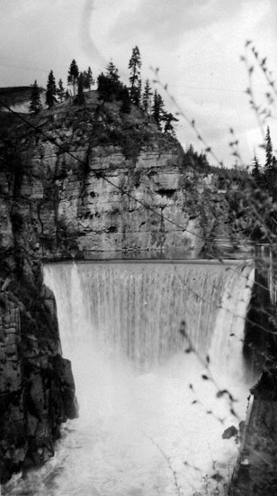
The Goat River is a tributary of the Kootenay River in the Canadian province of British Columbia. The river meets the Kootenay near the town of Creston. The Goat River Dam, constructed in the 1930s, was an early source of electricity for the town. Before dikes were built, the river was a major source of spring flooding in the Creston valley.

The Kootenay Lake ferry is a ferry across Kootenay Lake in southeastern British Columbia, which operates between Balfour, on the west side of the lake, and Kootenay Bay, on the east side. The MV Osprey 2000 and the MV Balfour are the two vessels used.
There are many lakes named Long Lake in British Columbia, Canada.


