
Lake Nipigon is part of the Great Lakes drainage basin. It is the largest lake entirely within the boundaries of the Canadian province of Ontario.

Desolation Sound is a deep water sound at the northern end of the Salish Sea and of the Sunshine Coast in British Columbia, Canada.
Babine Lake Marine Park is on Babine Lake, which borders the Skeena and Omineca regions of central British Columbia. This provincial park comprises six separate sites around the lake. Vehicle access to the lake, via BC Highway 16 and Nilkitkwa forestry service road, is by road about 105 kilometres (65 mi) northeast of Smithers; via BC Highway 16 and Central Babine Lake Highway, is about 132 kilometres (82 mi) east of Smithers; or via Babine Lake Road, is about 20 kilometres (12 mi) northeast of Burns Lake.

Bellhouse Provincial Park is a provincial park in the southern Gulf Islands of British Columbia, Canada. It is located in the Sturdies Bay area of southeastern Galiano Island. It is on land donated by Thorney Bellhouse in 1964, and is noted for its spring wildflowers, notably fawn lilies and chocolate lilies, as well as views of snow-capped mountains and abundant marine life.

Big Bunsby Marine Provincial Park is a provincial park on the west coast of northern Vancouver Island in British Columbia, Canada, to the southeast of the Brooks Peninsula in Checleset Bay. It is accessible only by boat.
Cormorant Channel Marine Provincial Park is a provincial park in British Columbia, Canada, located in the Pearse Islands, a small archipelago to the east of Cormorant Island and the Village of Alert Bay at the western end of Johnstone Strait.

Discovery Island Marine Provincial Park is a provincial park located about two nautical miles east of Oak Bay on the coast of British Columbia, Canada. It is about one mile (1.6 km) long and one-half mile (0.80 km) wide and looks out into the Strait of Juan de Fuca.
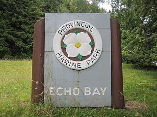
Echo Bay Marine Provincial Park is a provincial park in British Columbia, Canada, established in 1971 and containing 1.5 hectares. It is located at the bay of the same name, offshore from the community of the same name, which is the location of the Simoom Sound post office and is on the west side of Gilford Island.
Garden Bay Marine Provincial Park is a provincial park in British Columbia, Canada at the northwest end of the Sechelt Peninsula on the lower Sunshine Coast, near the community of Madeira Park. Established in 1969, it is approximately 163 ha.
Halkett Bay Marine Provincial Park is a provincial park off Gambier Island in British Columbia, Canada.
Hardy Island Marine Provincial Park, formerly Musket Island Marine Provincial Park, is a provincial park located near the southern tip of the Hardy Island in British Columbia, Canada. The park as created by BC Parks on 6 March 1992 to protect local flora and fauna. The park itself becomes a small island during high tide.
Little Andrews Bay Marine Provincial Park is a provincial park in British Columbia, Canada, located on Ootsa Lake in the Nechako Country in that province's Central Interior. It is 102 hectares in size.
Montague Harbour Marine Provincial Park is a provincial park in British Columbia, Canada, located on Galiano Island, one of the Gulf Islands off BC's South Coast in Canada. It is accessible by BC Ferries from Swartz Bay on Vancouver Island or Tsawwassen on the Mainland. The Island's ferry terminal is at Sturdies Bay, about 6 km (3.7 mi) from Montague.

Plumper Cove Marine Provincial Park is a provincial park in British Columbia, Canada. The park is located on the northwest shore of Keats Island in Howe Sound, northwest of Vancouver, British Columbia.
Rock Bay Marine Provincial Park is a provincial park in British Columbia, Canada, located on the Inside Passage at the junction of Johnstone Strait and Discovery Passage. The park contains approximately 525 ha. Rock Bay is located on the shore of Vancouver Island, immediately south of East Thurlow Island.

Simson Provincial Park is a provincial park in British Columbia, Canada.
The Marine Drive is a designated scenic route along Nova Scotia's Eastern Shore. It closely follows the coast of the Atlantic Ocean and the Strait of Canso from the Canso Causeway to the junction of Route 322 and Highway 111 in Dartmouth.

Sonora Island is one of the outer islands of the Discovery Islands of British Columbia, Canada. It is located at the eastern end of Johnstone Strait and the northern end of Discovery Passage within Electoral Area C of the Strathcona Regional District.

Tolmie State Park is a public recreation area covering 154 acres (62 ha) on Nisqually Beach on Puget Sound, eight miles (13 km) northeast of Olympia, Washington. The state park includes 1,800 ft (550 m) of saltwater shoreline at the mouth of a creek known as Big Slough as well as forest lands, a saltwater marsh, and an underwater park with artificial reef for scuba diving.
The Nisqually Reach is a portion of Puget Sound south of the Tacoma Narrows, near the Nisqually River delta. It is classified as a bay by the United States government. It was originally defined as "the portion of the Sound lying between Anderson Island and the mainland".


