
Oxbow is a town in the southeast of the province of Saskatchewan, Canada. It is located on the Canadian Pacific Railway and on Provincial Highway 18. It is approximately 58 kilometers west of Saskatchewan's border with Manitoba and approximately 26 kilometres (16 mi) north of the Canada–US border with North Dakota.
Walhachin is an unincorporated community in the Thompson Country region of south central British Columbia, Canada. The place is on a south shore bench of the Thompson River between Brassey and Jimmie creeks. The locality, off BC Highway 1, is by road about 77 kilometres (48 mi) northeast of Spences Bridge, 28 kilometres (17 mi) east of Cache Creek, and 66 kilometres (41 mi) west of Kamloops.
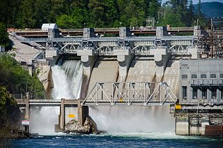
The Stave River is a tributary of the Fraser, joining it at the boundary between the municipalities of Maple Ridge and Mission, about 35 kilometres (22 mi) east of Vancouver, British Columbia, Canada, in the Central Fraser Valley region.
Edge Hills Provincial Park is a provincial park in British Columbia, Canada, located west of the town of Clinton. The Edge Hills flank the wall of the Fraser Canyon north of Moran Canyon and form a small fore-range between the river and the higher Marble Range just east. Access to the Edge Hills is via the Jesmond Road, which cuts north off the Pavilion Mountain Road at Kelly Lake. A spur road from the Jesmond Road west goes to an overlook atop the Edge Hills, known as Cougar Point.

Flores Island Marine Provincial Park, also known as Flores Island Provincial Park, is a provincial park in British Columbia, Canada, located on the island of the same name in the central Clayoquot Sound region of the West Coast of Vancouver Island, British Columbia, Canada. The park contains 7113 ha. and was created on July 13, 1995, as part of the Clayoqout Land-Use Decision. Gibson Marine Provincial Park, which was created in 1967, adjoins it to the southeast. Sulphur Passage Provincial Park is off the northeast coast of Flores Island, surrounding Obstruction Island.

Hamber Provincial Park is a provincial park in British Columbia, Canada, located 130 kilometres (80.7 mi) north of Golden. Straddling the Great Divide on the provincial boundary with Alberta, the park is surrounded on three sides by Jasper National Park and protects the headwaters of the Wood River at Fortress Lake.
Height of the Rockies Provincial Park is a provincial park in the Canadian Rockies of south eastern British Columbia, Canada. It is located west of the Continental Divide, adjacent to Elk Lakes Provincial Park.

Herald Provincial Park is a provincial park in British Columbia, Canada. It is on the north shore of the Salmon Arm of Shuswap Lake, in the Southern Interior of British Columbia, Canada. The park is some 30 minutes northeast of the city of Salmon Arm. Herald Park contains a popular camping area, as well as a day use/picnic area. Large pebble beaches stretch along the southern boundary of the park. Walking and hiking trails exist throughout the park, including an easy 10-minute hike to the spectacular Margaret Falls.

Mara Provincial Park is a day-use provincial park in British Columbia, Canada, located on Mara Lake south of Sicamous. The park is open with services from May 1 to September 27. The gate is locked open during the off season.
Mount Savona Provincial Park is a provincial park in British Columbia, Canada. The park is located west of the city of Kamloops and contains cultural sites of the Skeetchestn First Nation.
Nickel Plate Provincial Park is a provincial park in British Columbia, Canada. Formerly known as Clearwater Park, it is located in the Similkameen District at the northeast corner of Nickel Plate Lake. The park is also 29km northeast of Hedley near the Apex Ski Resort.
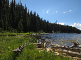
North Thompson Oxbows East Provincial Park is a provincial park in Thompson-Nicola Regional District in the Interior region of British Columbia, Canada. The park was established on April 30, 1996, and has an area of 288 hectares. The park protects a productive area of the North Thompson River lowlands that has high species diversity. There are patches of old-growth forest containing hybrid white spruce and subalpine fir. There are no camping or day-use facilities.
North Thompson Oxbows Jensen Island Provincial Park is a provincial park in Thompson-Nicola Regional District in the Interior region of British Columbia, Canada, about 20 kilometres (12 mi) north of Kamloops at the community of Heffley Creek. The park was established on April 30, 1996, and has an area of 30 hectares. It protects the riparian habitat of a single, seasonal oxbow on the right bank of the North Thompson River. There are no camping or day-use facilities.
North Thompson Oxbows Manteau Provincial Park is a provincial park in Thompson-Nicola Regional District in the Interior region of British Columbia, Canada. The park was established on April 30, 1996, and has an area of 515 hectares. It protects "…floodplain wetlands, numerous oxbow lakes, sandbars, back channels, levees, along the glacier-fed North Thompson River." There are no camping or day-use facilities.
Prophet River Hot Springs Provincial Park is a provincial park in British Columbia, Canada. Established high in the Muskwa Ranges, on the course of the Prophet River, it is part of the larger Muskwa-Kechika Management Area.

Highway 18 is a provincial highway in the Canadian province of Saskatchewan. It runs from Highway 13 near Robsart, approximately 65 kilometres (40 mi) east of the Alberta border, to the Manitoba border near Gainsborough, where it becomes Highway 3. It passes through three major communities, all in the eastern quarter of Saskatchewan – Estevan, Oxbow, and Carnduff; it also passes north of the west and east blocks of Grasslands National Park. Highway 18 is about 712 kilometres (442 mi) long, which is the longest east-west highway and second longest highway in Saskatchewan.

Cannington Manor Provincial Park is an historic park in the RM of Moose Mountain in the south-east corner of the Canadian province of Saskatchewan. An aristocratic English colony was established at the site in 1882 by Captain Edward Michell Pierce. It became a provincial park in 1986. Cannington Manor is located west and north of Highway 603. The Colony is 16 kilometres (9.9 mi) south-east of Moose Mountain Provincial Park, and 60 kilometres (37 mi) south of Moosomin.

Oxbow Regional Park is a 1,000-acre (4.0 km2) natural area park located ten miles (16 km) southeast of Troutdale along the Sandy River in the U.S. state of Oregon. Owned and operated by Metro regional government, it hosts a yearly festival celebrating salmon.

