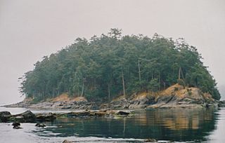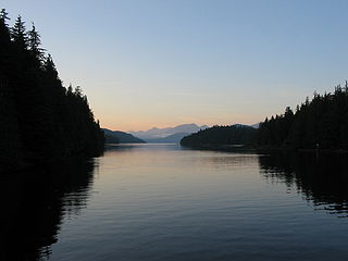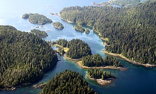
Gulf Islands National Park Reserve is a national park located on and around the Gulf Islands in British Columbia, Canada. In the National Parks System Plan, this park provides representation of the Strait of Georgia Lowlands natural region, the only place in Canada with a Mediterranean climate of dry, sunny summers and mild, wet winters, the result of a rain shadow effect from surrounding mountains between the region and the ocean. It has similar dominant vegetation as the Pacific Northwest, such as coastal Douglas-fir, western red cedar, shore pine, Pacific dogwood, bigleaf maple, and red alder, but also contains the northern extent of some of the more drought tolerant trees such as Garry oak and Arbutus. The park was created in 2003 as the fortieth national park. It covers 36 square kilometres (14 sq mi) of area on 16 islands and more than 30 islets, reefs and surrounding waters, making it the sixth smallest national park in Canada.

Lake Nipigon is part of the Great Lakes drainage basin. It is the largest lake entirely within the boundaries of the Canadian province of Ontario.

Adams Lake Provincial Park is a provincial park in British Columbia, Canada. It encompasses three distinct parks: Adams Lake Provincial Park, Adams Lake Marine Provincial Park, and Adams Lake Marine Provincial Park.
Babine Lake Marine Park is on Babine Lake, which borders the Skeena and Omineca regions of central British Columbia. This provincial park comprises six separate sites around the lake. Vehicle access to the lake, via BC Highway 16 and Nilkitkwa forestry service road, is by road about 105 kilometres (65 mi) northeast of Smithers; via BC Highway 16 and Central Babine Lake Highway, is about 132 kilometres (82 mi) east of Smithers; or via Babine Lake Road, is about 20 kilometres (12 mi) northeast of Burns Lake.

Vargas Island Provincial Park is a provincial park in British Columbia, Canada, comprising the west side of the island of the same name, which is located west of Meares Island and northwest of the resort community of Tofino in the Clayoquot Sound region of the West Coast of Vancouver Island, British Columbia, Canada. The park was created as part of the Clayoquot Land-Use Decision on July 13, 1995 and contains 5,805 hectares, 1,543 hectares of it being upland and 4,262 hectares being foreshore. Also located on Vargas Island, on its north side, is Epper Passage Provincial Park.

Cowichan River Provincial Park is a provincial park on Vancouver Island in British Columbia, Canada. It includes the Cowichan River in a 1,418 ha area stretching almost 20 kilometres in length from the village of Lake Cowichan to Glenora, just south of Duncan. The Cowichan Valley Trail runs the length of the park, which is part of the greater Trans Canada Trail.

Codville Lagoon Marine Provincial Park is a provincial park in British Columbia, Canada, located on the southwest end of King Island. The park was created in 1965 because it is a significant site to the Heiltsuk People. This park, which is approximately 755 ha. in area, has an unmaintained trail to Sagar Lake which has a red sand beach. Created in 1992, it was expanded in 1995 by the incorporation of the former Sugar Lake Provincial Park.
Dawley Passage Provincial Park is a provincial park in British Columbia, Canada, located at the south end of Fortune Channel, which lies between Meares Island and the mainland of Vancouver Island just south. The park is to the north of the resort town of Tofino and is accessible by boat only. It was created on July 13, 1995 as part of the Clayoquot Land-Use Decision and contains 154 ha, .
Epper Passage Provincial Park is a provincial park in British Columbia, Canada, located on the north side of Vargas Island in the Clayoquot Sound region of the West Coast of Vancouver Island. Also on Vargas Island is Vargas Island Provincial Park. Other provincial parks nearby are Flores Island Marine Provincial Park, Gibson Marine Provincial Park, Maquinna Marine Provincial Park, Sydney Inlet Provincial Park, Dawley Passage Provincial Park and Hesquiat Peninsula Provincial Park. The park was created as part of the Clayoquot Land-Use Decision on July 13, 1995, and contains approximately 306 ha.

Flores Island Marine Provincial Park, also known as Flores Island Provincial Park, is a provincial park in British Columbia, Canada, located on the island of the same name in the central Clayoquot Sound region of the West Coast of Vancouver Island, British Columbia, Canada. The park contains 7113 ha. and was created on July 13, 1995, as part of the Clayoqout Land-Use Decision. Gibson Marine Provincial Park, which was created in 1967, adjoins it to the southeast. Sulphur Passage Provincial Park is off the northeast coast of Flores Island, surrounding Obstruction Island.
François Lake Provincial Park is a provincial park in British Columbia, Canada, located at the east end of Francois Lake. The total park area is 7,214 hectares. It is about 12 kilometres (7.5 mi) off BC Highway 16, southwest of the town of Fraser Lake. There is no potable water at the site so campers should bring their own.

Horne Lake Caves Provincial Park is a provincial park on Vancouver Island in British Columbia, Canada. Its principal function is the protection, management, and recreational use of several caves collectively known as the Horne Lake Caves.

Juan de Fuca Provincial Park is a provincial park located on the west coast of Vancouver Island in British Columbia, Canada. The park was established on April 4, 1996 by combining three former parks — China Beach, Loss Creek, and Botanical Beach — into one provincial park. It is the location of the majority of the Juan de Fuca Marine Trail, which is a southern compliment to the West Coast Trail within Pacific Rim National Park Reserve.

Kakwa Provincial Park and Protected Area is a 170,890 ha provincial park in northeastern British Columbia, Canada. The park preserves the southernmost portion of the Hart Ranges and the northernmost portion of the Continental Ranges. The park also preserves significant marine fossil deposits located in the region.

Klewnuggit Inlet Marine Provincial Park is a provincial park in British Columbia, Canada, located on the east side of Grenville Channel, 100 kilometres (62 mi) southeast of Prince Rupert, in the Range 4 Coast Land District.
Mount Blanchet Provincial Park is a provincial park in British Columbia, Canada, located on the west side of the southern end of Takla Lake, north of Smithers.
Steelhead Provincial Park is a provincial park in the Thompson Country region of south central British Columbia, Canada. The facility is at the west end of Kamloops Lake near the town of Savona. On BC Highway 1, the locality is by road about 38 kilometres (24 mi) east of Cache Creek and 45 kilometres (28 mi) west of Kamloops.

Takla Lake is the fifth largest natural lake in British Columbia, Canada. It is a deep fjord-like lake with the Swannell Ranges to the east, the Driftwood River flowing into it from the north, and the Middle River draining it. It is the terminus of the early Stuart-Takla sockeye salmon run, and noted for its large rainbow trout, lake trout and Dolly Varden. The peninsula is the home of Mount Blanchet Provincial Park. Also on the peninsula is a herd of collared woodland caribou, and the winter range of grizzly bears. Two special features are Takla Lake Marine Park, and an Ecological Reserve on the peninsula, a stand of very northerly Douglas Fir. Takla Lake is also the origin of both of Canada's national airlines, both Russ Baker and Grant McConachie running bush plane routes out of Takla Lake. It is a popular canoe route from the top end down to Fort St. James.

Checleset Bay is a bay on the northwest coast of Vancouver Island, British Columbia, Canada. It is located southeast of Brooks Peninsula and northwest of Kyuquot Sound. Much of the land around the bay is part of Brooks Peninsula Provincial Park. Checleset Bay has three large inlets, Nasparti Inlet, Ououkinsh Inlet, and Malksope Inlet.
Omineca Provincial Park and Protected Area is a provincial park and protected area located in the north-central interior of British Columbia, Canada. It was established on 11 April 2001 by BC Parks to protect provincially significant riparian and wetland habitats along the Omineca River.


