List of provincial parks of the Kootenays

Last updated

The list of provincial parks of the Kootenays contains the provincial parks located within this geographic region of the province of British Columbia. It includes parks from the three regional districts of East Kootenay, Central Kootenay and Kootenay Boundary. These parks are administered by BC Parks under the jurisdiction of the Ministry of Environment and Climate Change Strategy.

Contents

List of parks

Park nameRegional districtsCoordinatesSizeEstablishedRemarks
haacres
Akamina-Kishinena Provincial Park East Kootenay 49°01′30″N114°12′00″W / 49.025°N 114.200°W / 49.025; -114.200 10,921.526,9881995
Beaver Creek Provincial Park Kootenay Boundary 49°04′00″N117°36′00″W / 49.0667°N 117.600°W / 49.0667; -117.600 812001965
Boundary Creek Provincial Park Kootenay Boundary 49°04′00″N118°42′00″W / 49.0667°N 118.700°W / 49.0667; -118.700 24.91956
Champion Lakes Provincial Park Central Kootenay 49°11′05″N117°37′26″W / 49.1847°N 117.624°W / 49.1847; -117.624 1,4523,5901955
Christina Lake Provincial Park Kootenay Boundary 49°02′34″N118°13′08″W / 49.0428°N 118.219°W / 49.0428; -118.219 6151971
Cody Caves Provincial Park Central Kootenay 49°44′00″N116°57′00″W / 49.7333°N 116.950°W / 49.7333; -116.950 631601966
Columbia Lake Provincial Park East Kootenay 50°17′49″N115°50′49″W / 50.297°N 115.847°W / 50.297; -115.847 2907201988
Conkle Lake Provincial Park Kootenay Boundary 49°10′00″N119°06′00″W / 49.1667°N 119.100°W / 49.1667; -119.100 5871,4501973
Crowsnest Provincial Park East Kootenay 49°39′00″N114°42′00″W / 49.650°N 114.700°W / 49.650; -114.700 461101960
Drewry Point Provincial Park Central Kootenay 49°25′00″N116°49′01″W / 49.4167°N 116.817°W / 49.4167; -116.817 24591970
Dry Gulch Provincial Park East Kootenay 50°35′10″N116°02′19″W / 50.5861°N 116.0386°W / 50.5861; -116.0386 29721956
Elk Lakes Provincial Park East Kootenay 50°28′55″N115°05′14″W / 50.4819°N 115.0872°W / 50.4819; -115.0872 17,24542,6101973
Elk Valley Provincial Park East Kootenay 49°37′25″N114°56′17″W / 49.6236°N 114.9381°W / 49.6236; -114.9381 781901960
Erie Creek Provincial Park Central Kootenay 49°11′23″N117°18′18″W / 49.1897°N 117.305°W / 49.1897; -117.305 15371965
Gilnockie Provincial Park East Kootenay 49°05′15″N115°39′20″W / 49.0875°N 115.6556°W / 49.0875; -115.6556 2,842.27,0231995
Gladstone Provincial Park Kootenay Boundary 49°18′00″N118°15′00″W / 49.300°N 118.250°W / 49.300; -118.250 39,38797,3301995
Goat Range Provincial Park Central Kootenay 50°17′00″N117°16′59″W / 50.2833°N 117.283°W / 50.2833; -117.283 79,124195,5201995
Granby Provincial Park Kootenay Boundary 49°44′30″N118°27′00″W / 49.7417°N 118.450°W / 49.7417; -118.450 40,845100,9301995
Grohman Narrows Provincial Park Central Kootenay 49°29′45″N117°20′40″W / 49.4958°N 117.3444°W / 49.4958; -117.3444 10251981
Height of the Rockies Provincial Park East Kootenay 50°30′00″N115°15′00″W / 50.500°N 115.250°W / 50.500; -115.250 54,170133,9001995
James Chabot Provincial Park East Kootenay 50°30′40″N116°01′19″W / 50.5111°N 116.022°W / 50.5111; -116.022 14351979
Jewel Lake Provincial Park Kootenay Boundary 49°11′00″N118°36′00″W / 49.1833°N 118.600°W / 49.1833; -118.600 491201981
Jimsmith Lake Provincial Park East Kootenay 49°28′58″N115°50′28″W / 49.4828°N 115.8411°W / 49.4828; -115.8411 13.7341956
Johnstone Creek Provincial Park Kootenay Boundary 49°03′00″N119°03′00″W / 49.050°N 119.050°W / 49.050; -119.050 38941956
Kianuko Provincial Park Central Kootenay 49°25′45″N116°28′00″W / 49.4292°N 116.4667°W / 49.4292; -116.4667 11,637.928,7581995
Kikomun Creek Provincial Park East Kootenay 49°14′34″N115°15′07″W / 49.2427°N 115.252°W / 49.2427; -115.252 6821,6901972
King George VI Provincial Park Kootenay Boundary 49°01′00″N117°49′01″W / 49.0167°N 117.817°W / 49.0167; -117.817 161.88400.01937
Kokanee Creek Provincial Park Central Kootenay 49°36′00″N117°07′59″W / 49.600°N 117.133°W / 49.600; -117.133 2606401955
Kokanee Glacier Provincial Park Central Kootenay 49°47′00″N117°10′01″W / 49.7833°N 117.167°W / 49.7833; -117.167 32,03579,1601922
Kootenay Lake Provincial Park Central Kootenay 49°22′23″N116°48′37″W / 49.3731°N 116.8103°W / 49.3731; -116.8103 3438501987
Lockhart Beach Provincial Park Central Kootenay 49°30′33″N116°47′14″W / 49.5092°N 116.7872°W / 49.5092; -116.7872 8201933
Lockhart Creek Provincial Park Central Kootenay 49°30′10″N116°42′35″W / 49.50278°N 116.70972°W / 49.50278; -116.70972 3,7349,2301995
McDonald Creek Provincial Park Central Kootenay 50°08′38″N117°48′25″W / 50.144°N 117.807°W / 50.144; -117.807 4681,1601982
Morrissey Provincial Park East Kootenay 49°23′26″N115°01′04″W / 49.3906°N 115.0178°W / 49.3906; -115.0178 4.5711.31962
Mount Assiniboine Provincial Park East Kootenay 50°50′00″N115°34′59″W / 50.8333°N 115.583°W / 50.8333; -115.583 39,01396,4001922
Mount Fernie Provincial Park East Kootenay 49°29′20″N115°06′07″W / 49.489°N 115.102°W / 49.489; -115.102 2596401959
Moyie Lake Provincial Park East Kootenay 49°22′19″N115°50′20″W / 49.372°N 115.839°W / 49.372; -115.839 90.52241959
Nancy Greene Provincial Park Kootenay Boundary 49°15′00″N117°55′59″W / 49.250°N 117.933°W / 49.250; -117.933 2035001972
Norbury Lake Provincial Park East Kootenay 49°32′20″N115°29′10″W / 49.5389°N 115.486°W / 49.5389; -115.486 972401958
Pilot Bay Provincial Park Central Kootenay 49°38′29″N116°51′54″W / 49.6414°N 116.865°W / 49.6414; -116.865 3478601964
Premier Lake Provincial Park East Kootenay 49°51′00″N115°39′07″W / 49.8499°N 115.652°W / 49.8499; -115.652 8372,0701940
Purcell Wilderness Conservancy Provincial Park Central Kootenay 50°09′00″N116°31′59″W / 50.150°N 116.533°W / 50.150; -116.533 202,095.6499,3891974
Rosebery Provincial Park Central Kootenay 50°02′08″N117°24′15″W / 50.0356°N 117.4042°W / 50.0356; -117.4042 32791959
Ryan Provincial Park East Kootenay 49°08′10″N116°01′55″W / 49.1361°N 116.0319°W / 49.1361; -116.0319 581401959
St. Mary's Alpine Provincial Park East Kootenay 49°52′50″N116°21′00″W / 49.8806°N 116.35°W / 49.8806; -116.35 9,14622,6001973
Stagleap Provincial Park Central Kootenay 49°03′37″N117°02′56″W / 49.06028°N 117.04889°W / 49.06028; -117.04889 1,1332,8001964
Summit Lake Provincial Park Central Kootenay 50°09′24″N117°39′17″W / 50.15667°N 117.65472°W / 50.15667; -117.65472 6151964
Syringa Provincial Park Central Kootenay 49°21′13″N117°53′35″W / 49.3537°N 117.893°W / 49.3537; -117.893 4,49911,1201968
Thunder Hill Provincial Park East Kootenay 50°10′05″N115°51′19″W / 50.16806°N 115.85528°W / 50.16806; -115.85528 441101960
Top of the World Provincial Park East Kootenay 49°50′49″N115°26′31″W / 49.847°N 115.442°W / 49.847; -115.442 8,79021,7001973
Valhalla Provincial Park Central Kootenay 49°53′00″N117°34′30″W / 49.8833°N 117.575°W / 49.8833; -117.575 50,060123,7001983
Wardner Provincial Park East Kootenay 49°25′01″N115°25′18″W / 49.4169°N 115.4217°W / 49.4169; -115.4217 49.91977
Wasa Lake Provincial Park East Kootenay 49°47′30″N115°44′13″W / 49.79164°N 115.7369°W / 49.79164; -115.7369 1543801955
West Arm Provincial Park Central Kootenay 49°30′15″N117°08′00″W / 49.50417°N 117.13333°W / 49.50417; -117.13333 26,19964,7401995
Whiteswan Lake Provincial Park East Kootenay 50°07′09″N115°32′42″W / 50.1192°N 115.545°W / 50.1192; -115.545 1,9944,9301978
Windermere Lake Provincial Park East Kootenay 50°25′44″N115°58′16″W / 50.4289°N 115.971°W / 50.4289; -115.971 2205401999
Yahk Provincial Park Central Kootenay 49°04′49″N116°05′46″W / 49.0803°N 116.096°W / 49.0803; -116.096 11271956

Commons-logo.svg Media related to Provincial Parks of British Columbia at Wikimedia Commons

Related Research Articles

Kootenay River River in Western Canada and the United States

The Kootenay or Kootenai river is a major river in the Northwest Plateau, in southeastern British Columbia, Canada, and northern Montana and Idaho in the United States. It is one of the uppermost major tributaries of the Columbia River, the largest North American river that empties into the Pacific Ocean. The Kootenay River runs 781 kilometres (485 mi) from its headwaters in the Kootenay Ranges of the Canadian Rockies, flowing from British Columbia's East Kootenay region into northwestern Montana, then west into the northernmost Idaho Panhandle and returning to British Columbia in the West Kootenay region, where it joins the Columbia at Castlegar.

Kootenay East (provincial electoral district) Provincial electoral district in British Columbia, Canada

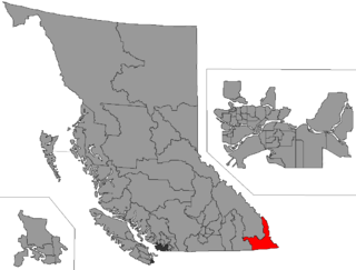
Kootenay East is a provincial electoral district for the Legislative Assembly of British Columbia, Canada. It was created before the 1966 election by the merger of Cranbrook and Fernie ridings, and despite its long period under the "Kootenay" moniker, never extended to cover more than a fraction of the whole "Kootenay" region.

Kokanee Glacier Provincial Park Canadian provincial park

Kokanee Glacier Provincial Park is one of the oldest provincial parks in British Columbia, established in 1922. The park has an area of 320.35 km2 (123.69 sq mi) and is located in the Selkirk Mountains in the West Kootenays region of BC. The park has three glaciers that feed over 30 alpine lakes which are the headwaters of many creeks.

Cody Caves Provincial Park is a provincial park in British Columbia, Canada. It was formed in July 1966 to protect the Cody Caves and was the first subterranean park in British Columbia. The park is 13 km by road, northwest from the hot springs community of Ainsworth Hot Springs on Kootenay Lake.

Champion Lakes Provincial Park Canadian provincial park

Champion Lakes Provincial Park is a provincial park in the West Kootenay region of British Columbia, Canada, located northeast of the city of Trail in the province's West Kootenay region.

Height of the Rockies Provincial Park is a provincial park in the Canadian Rockies of south eastern British Columbia, Canada. It is located west of the Continental Divide, adjacent to Elk Lakes Provincial Park.

James Chabot Provincial Park is a provincial park in British Columbia, Canada. Formerly Athalmer Beach Provincial Park, it is located in Invermere at the northeast end of Windermere Lake in the Columbia Valley region of the East Kootenay. Windermere Lake Provincial Park is located at the lake's southwestern end.

Kootenay Lake Provincial Park is a provincial park in British Columbia, Canada. It encompasses five widely dispersed parks around Kootenay Lake: Kootenay Lake Provincial Park, Kootenay Lake Provincial Park, Kootenay Lake Provincial Park, Kootenay Lake Provincial Park, and Kootenay Lake Provincial Park.

Kikomun Creek Provincial Park is a provincial park in British Columbia, Canada.

Kokanee Creek Provincial Park Provincial park in British Columbia, Canada

Kokanee Creek Provincial Park is a provincial park on the west shore of Kootenay Lake in the West Kootenay region of southeastern British Columbia. Highway 3A bisects the park 19 kilometres (12 mi) east of Nelson.

Lockhart Beach Provincial Park

Lockhart Beach Provincial Park is a provincial park Located 40 km north of Creston, British Columbia, Canada, on BC Highway 3A. "This park and the adjacent Lockhart Creek Provincial Park extend 3 hectares, from the sunny shores of Kootenay Lake to the headwaters of Lockhart Creek. "This small park provides the only easy access to public camping along the south arm of Kootenay Lake. An 18 site campground and day use area are located near a sand and fine gravel beach where visitors can relax and enjoy the clear waters of Kootenay Lake."

Nancy Greene Provincial Park

Nancy Greene Provincial Park is a provincial park in British Columbia, Canada, located approximately 27 km (17 mi) northwest of the city of Rossland and 31 km (19 mi) west of the city of Castlegar in that province's West Kootenay region, at the junction of Highway 3 and Highway 3B. It is named for Nancy Greene, Canadian Olympic medallist in downhill skiing, who is a native of Rossland.

Pilot Bay Provincial Park Provincial park in British Columbia, Canada

Pilot Bay Provincial Park is a provincial park in British Columbia, Canada.

Premier Lake Provincial Park is a provincial park near Cranbrook, British Columbia. It is located on the south and western shores of Premier Lake in the East Kootenays, a small lake situated on the eastern flank of the Kootenay trench about 60 km north of Cranbrook. Also contained within the park are several smaller lakes, including Rockbluff (Quartz) Lake, Yankee Lake and Canuck Lake, all notable for the vivid green colour of their water.

Purcell Wilderness Conservancy Provincial Park and Protected Area

The Purcell Wilderness Conservancy is a provincial park in British Columbia, Canada. It was established in 1974, and encompasses six large drainages in the Purcell Mountains in the southeast of the province. It contains high peaks, alpine meadows and ridges, deep creek and river valleys, and hot springs at Dewar Creek.

Syringa Park is a provincial park on the east shore of Lower Arrow Lake in the West Kootenay region of southeastern British Columbia. At the foot of the Norns Range, Tulip Creek passes through the centre, and Syringa Creek is closer to the southeastern boundary. The park is about 19 kilometres (12 mi) west of Castlegar via Broadwater Rd.

Summit Lake Provincial Park Provincial park in British Columbia, Canada

Summit Lake Provincial Park is a Class C provincial park located southeast of the community of Summit Lake in the Central Kootenay region of British Columbia, Canada.

Kootenay West (provincial electoral district) Provincial electoral district in British Columbia, Canada

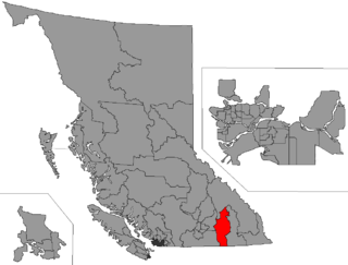
Kootenay West is a provincial electoral district in British Columbia, Canada, established by the Electoral Districts Act, 2008. It was first contested in the 2009 general election.

The Banff-Windermere Highway, also known as the Banff-Windermere Parkway, is a 105 km (65 mi) highway which runs through the Canadian Rockies in British Columbia and Alberta in Canada. It runs from Radium Hot Springs, British Columbia to Castle Junction, Alberta, passing through Kootenay National Park and Banff National Park. It is designated as part of British Columbia Highway 93 and Alberta Highway 93.