
The Wetʼsuwetʼen are a First Nation who live on the Bulkley River and around Burns Lake, Broman Lake, and François Lake in the northwestern Central Interior of British Columbia.
Babine Lake Marine Park is on Babine Lake, which borders the Skeena and Omineca regions of central British Columbia. This provincial park comprises six separate sites around the lake. Vehicle access to the lake, via BC Highway 16 and Nilkitkwa forestry service road, is by road about 105 kilometres (65 mi) northeast of Smithers; via BC Highway 16 and Central Babine Lake Highway, is about 132 kilometres (82 mi) east of Smithers; or via Babine Lake Road, is about 20 kilometres (12 mi) northeast of Burns Lake.
Babine Mountains Provincial Park is a provincial park in British Columbia, Canada, located to the east of the Bulkley River between the town of Smithers and Babine Lake. Established by Order-in-Council as the Babine Mountains Recreation Area in 1984, it was upgraded to park status and its name changed in 1999. It contains approximately 31,465 hectares.
Bulkley Junction Provincial Park is a provincial park in British Columbia, Canada, located on the west side of the Skeena River opposite Hazelton. It was established in 1997 and expanded in 2004 from 133 ha. to its current size of 169 ha.
Boulder Creek Provincial Park is a provincial park in British Columbia, Canada, located to the west of BC Highway 16 near Smithers, in the Bulkley Valley.
Bishop River Provincial Park is a provincial park in the Pacific Ranges of the Coast Mountains on the Mainland of British Columbia, Canada, located southwest of and adjoining Ts'yl-os Provincial Park."Bishop River Park". BC Geographical Names. It lies along the upper course of the Bishop River, the main tributary of the Southgate River, from the Bishop's source at the western side of the Lillooet Icecap to midway along its course above its confluence with the Southgate. The park is 19,947 ha. in size. There are no roads or trails in the park although a forest service road from Waddington Harbour at the head of Bute Inlet leads up the Southgate to within a few miles of the park boundary.
Dall River Old Growth Provincial Park is a provincial park in British Columbia, Canada. It is part of the larger Muskwa-Kechika Management Area and is located immediately northwest of Denetiah Provincial Park, northwest of the junction of the Gataga and Kechika Rivers. Established in 1999, the park is 642 ha. in area. The park protects areas of white spruce old growth.

Little Qualicum Falls Provincial Park is a provincial park in British Columbia, Canada, on central Vancouver Island, that encompasses the entire southern shore of Cameron Lake. The Island Rail Corridor line to Port Alberni passes through the park.
Lower Nimpkish Provincial Park is a provincial park in British Columbia, Canada, located on the lower Nimpkish River. It is an undeveloped wilderness park that seeks to preserve the habitat while offering fishing and nature appreciation opportunities to the public.

Marble River Provincial Park is a provincial park in British Columbia, Canada. The park is located on northern Vancouver Island. It is 14.19 km2 (5.48 sq mi) in area. The park protects an eagle nesting habitat near Quatsino Narrows in Quatsino Sound, a steelhead fishery, and an extensive waterfowl habitat. A 4.2 km (2.6 mi)-long biking or walking trail is available, as well as opportunities for wildlife viewing.
Netalzul Meadows Provincial Park is a provincial park in British Columbia, Canada. It is located in the Harold-Price watershed, about 50 km north of Smithers. The park consists of an unusual wet meadow complex, as well as a spectacular waterfall and rare plant species.
Peace River Corridor Provincial Park is a 2014 ha provincial park in British Columbia, Canada.
Scatter River Old Growth Provincial Park is a provincial park in British Columbia, Canada, located on the Liard River downstream from Liard River Hot Springs Provincial Park and Liard River Corridor Provincial Park and Protected Area. The park includes the Grand Canyon of the Liard, a 30 km stretch of canyon and whitewater between the Toad and Trout River converges with the Liard. The park includes high upland plateau and muskeg as well as stands of old growth spruce forests. Established in 1999, the park is c.1140 ha. in area.

Babine Lake borders the Skeena and Omineca regions of central British Columbia, Canada. Vehicle access to the lake, via BC Highway 16 and Nilkitkwa forestry service road, is by road about 105 kilometres (65 mi) northeast of Smithers; via BC Highway 16 and Central Babine Lake Highway, is about 132 kilometres (82 mi) east of Smithers; or via Babine Lake Road, is about 20 kilometres (12 mi) northeast of Burns Lake.
Babine River is a river in central British Columbia, Canada. It drains Babine Lake and is a tributary of the Skeena River, and is about 97 kilometres (60 mi) long.
Sutherland River Provincial Park and Protected Area is a provincial park in British Columbia, Canada.
Takla Lake Marine Provincial Park is a provincial park in British Columbia, Canada. Located northeast of the town of Smithers and roughly parallel to Babine Lake to its west/southwest, it comprises three sites on Takla Lake in the northwestern part of the Omineca Country of the province's North-Central Interior. The three sites are the Sandy Point Site, containing about 160 ha, Takla Lake West containing about 41 ha, and White Bluff, containing about 349 ha.
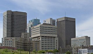
Southern Manitoba is the southernmost area of the Canadian province of Manitoba. Southern Manitoba encompasses the Winnipeg Metropolitan Region, Westman Region, Central Plains Region, Eastman Region, and Pembina Valley Region, as well as the Manitoba portion of Red River Valley. Holding a population of over one million, seven of the ten cities in Manitoba are located in this area, including Winnipeg, Brandon, Portage la Prairie, Selkirk, Morden, Winkler, and Steinbach.
The Sutherland River, also once known as the Beaver River, is a river in the area of Babine Lake in northeastern British Columbia, Canada. The river, which flows northwest into the southeast end of Babine Lake, is named for JOACHIM Sutherland, a PART-First Nations man WHO HAD A HOMESTEAD NEAR the Nautley Indian Reserve JOACHIM accompanied a British Columbia Land Survey Party in 1914.
Horneline Creek Provincial Park is a provincial park in far northern British Columbia, Canada. It is located west of the Kechika River about 130 km south of Lower Post and 30 km north of Denetiah Provincial Park and southwest of the community of Liard River.

