List of provincial parks of Mainland British Columbia Coast

Last updated

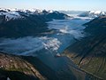
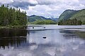
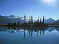
The list of provincial parks of the Mainland British Columbia Coast contains the provincial parks located within this geographic region of the province of British Columbia. It includes parks from the eight regional districts of Central Coast, Kitimat-Stikine, North Coast, qathet, Squamish-Lillooet, Sunshine Coast, and the mainland portions of Mount Waddington and Strathcona. These parks are administered by BC Parks under the jurisdiction of the Ministry of Environment and Climate Change Strategy.

Contents

Parks

Central Coast Regional District

#NameEstablishedCommons categoryPictureCoordinates
1 Codville Lagoon Marine Provincial Park 52°03′40″N127°50′31″W / 52.0611°N 127.842°W / 52.0611; -127.842
2 Oliver Cove Marine Provincial Park 1992-09-16 52°18′44″N128°21′19″W / 52.312222222222°N 128.35527777778°W / 52.312222222222; -128.35527777778
3 Penrose Island Marine Provincial Park 1992 51°27′40″N127°44′00″W / 51.46111111°N 127.73333333°W / 51.46111111; -127.73333333
4 Sir Alexander Mackenzie Provincial Park 1926-02-10 First Crossing of North America National Historic Site
Alex MacKenzie from Canada by land.jpg
52°23′00″N127°28′00″W / 52.38333333°N 127.46666667°W / 52.38333333; -127.46666667

Kitimat-Stikine Regional District

#NameEstablishedImageCoordinates
1 Bear Glacier Provincial Park 2000-05-11
Bear-glacier2.JPG
56°06′00″N129°40′01″W / 56.1°N 129.667°W / 56.1; -129.667
2 Border Lake Provincial Park 56°21′15″N130°42′50″W / 56.3542°N 130.714°W / 56.3542; -130.714
3 Bulkley Junction Provincial Park 55°14′30″N127°40′59″W / 55.2417°N 127.683°W / 55.2417; -127.683
4 Dala-Kildala Rivers Estuaries Provincial Park 53°50′06″N128°30′14″W / 53.835°N 128.504°W / 53.835; -128.504
5 Exchamsiks River Provincial Park 1956-03-16 54°20′09″N129°17′46″W / 54.335833333333°N 129.29611111111°W / 54.335833333333; -129.29611111111
6 Foch-Gilttoyees Provincial Park 53°52′37″N129°08′20″W / 53.877°N 129.139°W / 53.877; -129.139
7 Gitnadoiks River Provincial Park 1986-12-10 54°10′00″N129°10′00″W / 54.166666666667°N 129.16666666667°W / 54.166666666667; -129.16666666667
8 Great Glacier Provincial Park 2001 56°50′00″N131°49′59″W / 56.8333°N 131.833°W / 56.8333; -131.833
9 Green Inlet Marine Provincial Park 1992 52°55′10″N128°28′55″W / 52.9194°N 128.482°W / 52.9194; -128.482
10 Hai Lake–Mount Herman Provincial Park 2004-05-17 54°25′00″N128°35′45″W / 54.416666666667°N 128.59583333333°W / 54.416666666667; -128.59583333333
11 Iskut River Hot Springs Provincial Park 2001 57°05′02″N130°21′40″W / 57.0838°N 130.361°W / 57.0838; -130.361
12 Jackson Narrows Marine Provincial Park 1992 52°31′35″N128°18′00″W / 52.5264°N 128.3°W / 52.5264; -128.3
13 Kinaskan Lake Provincial Park 1987 57°30′00″N130°13′59″W / 57.5°N 130.233°W / 57.5; -130.233
14 Kitimat River Provincial Park 54°06′41″N128°36′32″W / 54.111388888889°N 128.60888888889°W / 54.111388888889; -128.60888888889
15 Kitsumkalum Provincial Park 1947-11-25 54°43′19″N128°46′16″W / 54.721944444444°N 128.77111111111°W / 54.721944444444; -128.77111111111
16 Kitwanga Mountain Provincial Park 1997 55°06′30″N128°08′31″W / 55.1083°N 128.142°W / 55.1083; -128.142
17 Kleanza Creek Provincial Park 1956-03-16 54°35′55″N128°23′45″W / 54.598611111111°N 128.39583333333°W / 54.598611111111; -128.39583333333
18 Lakelse Lake Provincial Park
Lakelse2.jpg
54°23′00″N128°31′01″W / 54.3833°N 128.517°W / 54.3833; -128.517
19 Lakelse Lake Wetlands Provincial Park 54°20′10″N128°35′10″W / 54.336111111111°N 128.58611111111°W / 54.336111111111; -128.58611111111
20 Lava Forks Provincial Park 2001
The Volcano.jpg
56°27′N130°54′W / 56.45°N 130.9°W / 56.45; -130.9
21 Lower Skeena River Provincial Park 2004-05-17 54°18′00″N129°20′38″W / 54.3°N 129.344°W / 54.3; -129.344
22 Meziadin Lake Provincial Park 1987 56°04′05″N129°16′44″W / 56.068°N 129.279°W / 56.068; -129.279
23 Mount Edziza Provincial Park and Recreation Area 1972
Mount Edziza, British Columbia.jpg
57°34′59″N130°40′01″W / 57.5831°N 130.667°W / 57.5831; -130.667
24 Nalbeelah Creek Wetlands Provincial Park 2004-05-17 54°08′40″N128°34′35″W / 54.144444444444°N 128.57638888889°W / 54.144444444444; -128.57638888889
25 Ningunsaw Provincial Park 56°50′20″N130°05′40″W / 56.838888888889°N 130.09444444444°W / 56.838888888889; -130.09444444444
26 Nisga'a Memorial Lava Bed Provincial Park 1992
Nisgaa Willkommenstafel.JPG
55°07′00″N128°52′01″W / 55.1167°N 128.867°W / 55.1167; -128.867
27 Owyacumish River Provincial Park 2004
Gardner Canal.jpg
53°31′54″N128°26′06″W / 53.531666666667°N 128.435°W / 53.531666666667; -128.435
28 Ross Lake Provincial Park 55°16′00″N127°31′01″W / 55.2667°N 127.517°W / 55.2667; -127.517
29 Seeley Lake Provincial Park 55°12′00″N127°40′59″W / 55.2°N 127.683°W / 55.2; -127.683
30 Seven Sisters Provincial Park 54°57′20″N128°00′47″W / 54.955555555556°N 128.01305555556°W / 54.955555555556; -128.01305555556
31 Seven Sisters Provincial Park and Protected Area 2000-06-29 54°58′00″N128°09′00″W / 54.9667°N 128.15°W / 54.9667; -128.15
32 Sleeping Beauty Mountain Provincial Park 2004 54°35′31″N128°46′09″W / 54.591944444444°N 128.76916666667°W / 54.591944444444; -128.76916666667
33 Sue Channel Provincial Park 2004 53°43′38″N128°50′56″W / 53.727222222222°N 128.84888888889°W / 53.727222222222; -128.84888888889
34 Swan Lake Kispiox River Provincial Park 1996 55°54′00″N128°34′59″W / 55.9°N 128.583°W / 55.9; -128.583
35 Tarahne Provincial Park 1974-05-02 59°34′41″N133°42′20″W / 59.578055555556°N 133.70555555556°W / 59.578055555556; -133.70555555556

North Coast Regional District

#NameEstablishedCommons categoryPictureCoordinates
1 Diana Lake Provincial Park 1980 54°13′41″N130°09′47″W / 54.228°N 130.163°W / 54.228; -130.163
2 Kennedy Island Conservancy June 27, 2008 Kennedy Island Conservancy
Western side of Kennedy Island, British Columbia, Canada.jpg
54°02′10″N130°11′15″W / 54.03611°N 130.18750°W / 54.03611; -130.18750
3 Khutzeymateen Grizzly Bear Sanctuary 1994 54°37′41″N129°46′59″W / 54.628°N 129.783°W / 54.628; -129.783
4 Kitson Island Marine Provincial Park 54°10′45″N130°19′01″W / 54.179166666667°N 130.31694444444°W / 54.179166666667; -130.31694444444
5 Klewnuggit Inlet Marine Provincial Park 1993-06-14 53°41′09″N129°42′07″W / 53.6858°N 129.702°W / 53.6858; -129.702
6 Lowe Inlet Marine Provincial Park Lowe Inlet Marine Provincial Park
Travels in Alaska 018.jpg
53°33′23″N129°35′15″W / 53.556388888889°N 129.5875°W / 53.556388888889; -129.5875
7 Naikoon Provincial Park 1973
NaikoonTowHill.JPG
53°50′N131°54′W / 53.84°N 131.9°W / 53.84; -131.9
8 Prudhomme Lake Provincial Park June 1, 1964 Prudhomme Lake Provincial Park
Prudhomme Lake, during a break in the weather..jpg
54°14′28″N130°07′55″W / 54.241°N 130.132°W / 54.241; -130.132
9 Pure Lake Provincial Park 1981 53°52′02″N132°05′06″W / 53.867222°N 132.085°W / 53.867222; -132.085
10 Union Passage Marine Provincial Park 53°24′45″N129°26′30″W / 53.4125°N 129.44166666667°W / 53.4125; -129.44166666667

Squamish-Lillooet Regional District

#NameEstablishedCommons categoryPictureCoordinates
1 Alice Lake Provincial Park 1956-11-23
Alice lake twilight.jpg
49°47′00″N123°07′01″W / 49.7833°N 123.117°W / 49.7833; -123.117
2 Big Creek Provincial Park 51°18′00″N123°10′01″W / 51.3°N 123.167°W / 51.3; -123.167
3 Birkenhead Lake Provincial Park 1963 Birkenhead Lake Provincial Park
Birkenhead lake.JPG
50°35′00″N122°45′00″W / 50.5833°N 122.75°W / 50.5833; -122.75
4 Blackcomb Glacier Provincial Park 50°05′30″N122°52′16″W / 50.0917°N 122.871°W / 50.0917; -122.871
5 Brackendale Eagles Provincial Park 49°46′00″N123°10′30″W / 49.7667°N 123.175°W / 49.7667; -123.175
6 Brandywine Falls Provincial Park 1973-01-18 Brandywine Falls Provincial Park
BrandywineFalls 1200W.jpg
50°02′07″N123°07′08″W / 50.0353°N 123.119°W / 50.0353; -123.119
7 Bridge River Delta Provincial Park 50°49′35″N123°12′18″W / 50.8264°N 123.205°W / 50.8264; -123.205
8 Callaghan Lake Provincial Park 1997-07-23 50°12′00″N123°10′59″W / 50.2°N 123.183°W / 50.2; -123.183
9 Clendinning Provincial Park 1998 50°25′00″N123°43′59″W / 50.4167°N 123.733°W / 50.4167; -123.733
10 Duffey Lake Provincial Park 1993 Duffey Lake Provincial Park
Duffey Lake.JPG
50°24′15″N122°20′31″W / 50.4042°N 122.342°W / 50.4042; -122.342
11 Fred Antoine Provincial Park 2010 51°05′24″N122°25′41″W / 51.09°N 122.428°W / 51.09; -122.428
12 French Bar Creek Provincial Park 2010 51°13′30″N122°12′14″W / 51.225°N 122.204°W / 51.225; -122.204
13 Garibaldi Provincial Park 1920-04-29 Garibaldi Provincial Park
Garibaldi Lake BC.jpg
49°55′00″N122°45′00″W / 49.9167°N 122.75°W / 49.9167; -122.75
14 Gwyneth Lake Provincial Park 2010 50°47′24″N122°52′34″W / 50.79°N 122.876°W / 50.79; -122.876
15 Joffre Lakes Provincial Park 1988-01-07 Joffre Lakes Provincial Park
ThirdLakePano 1000W.jpg
50°20′39″N122°28′41″W / 50.3442°N 122.478°W / 50.3442; -122.478
16 Murrin Provincial Park 49°38′40″N123°12′29″W / 49.6444°N 123.208°W / 49.6444; -123.208
17 Nairn Falls Provincial Park 1966-04-04
Nairnfalls.jpg
50°17′37″N122°49′08″W / 50.2937°N 122.819°W / 50.2937; -122.819
18 Porteau Cove Provincial Park 1981 Porteau Cove Provincial Park
Pcpp sa.jpg
49°33′26″N123°14′10″W / 49.5572°N 123.236°W / 49.5572; -123.236
19 Seton Portage Historic Provincial Park 1972-03-29 50°42′23″N122°17′35″W / 50.7063°N 122.293°W / 50.7063; -122.293
20 Shannon Falls Provincial Park 1984 Shannon Falls
Shannon falls pano.jpg
49°40′10″N123°09′22″W / 49.6694°N 123.156°W / 49.6694; -123.156
21 South Chilcotin Mountains Provincial Park 2010 51°02′00″N123°04′01″W / 51.0333°N 123.067°W / 51.0333; -123.067
22 Spruce Lake Protected Area 51°03′50″N123°02′10″W / 51.0639°N 123.036°W / 51.0639; -123.036
23 Stawamus Chief Provincial Park 1997
Stawamus Chief South Peak.JPG
49°40′55″N123°08′25″W / 49.682°N 123.1403°W / 49.682; -123.1403
24 Tantalus Provincial Park 49°50′30″N123°16′59″W / 49.8417°N 123.283°W / 49.8417; -123.283
25 Tetrahedron Provincial Park 49°36′00″N123°34′59″W / 49.6°N 123.583°W / 49.6; -123.583
26 Upper Lillooet Provincial Park 1997-07-23 50°41′00″N123°37′00″W / 50.683333333333°N 123.61666666667°W / 50.683333333333; -123.61666666667
27 Yalakom Provincial Park 51°05′24″N122°25′41″W / 51.09°N 122.428°W / 51.09; -122.428

Sunshine Coast Regional District

#NameEstablishedCommons categoryPictureCoordinates
1 Buccaneer Bay Provincial Park 49°29′40″N123°59′24″W / 49.4944°N 123.99°W / 49.4944; -123.99
2 Francis Point Provincial Park 2004 49°36′36″N124°03′26″W / 49.61°N 124.05722222°W / 49.61; -124.05722222
3 Garden Bay Marine Provincial Park 49°38′00″N124°00′00″W / 49.6333°N 124°W / 49.6333; -124
4 Halkett Bay Provincial Park 1988-06-16 49°27′05″N123°19′37″W / 49.4514°N 123.327°W / 49.4514; -123.327
5 Hardy Island Marine Provincial Park 49°43′42″N124°12′58″W / 49.728333333333°N 124.21611111111°W / 49.728333333333; -124.21611111111
6 Harmony Islands Marine Provincial Park 1992 49°51′45″N124°00′43″W / 49.8625°N 124.012°W / 49.8625; -124.012
7 Mount Elphinstone Provincial Park 2000 49°25′58″N123°36′46″W / 49.4328°N 123.6128°W / 49.4328; -123.6128
8 Mount Richardson Provincial Park 1999-06-28 49°34′05″N123°45′40″W / 49.568055555556°N 123.76111111111°W / 49.568055555556; -123.76111111111
9 Musket Island Marine Provincial Park 1992 49°43′35″N124°12′45″W / 49.726388888889°N 124.2125°W / 49.726388888889; -124.2125
10 Plumper Cove Marine Provincial Park 1955 49°24′16″N123°27′54″W / 49.40451°N 123.465116°W / 49.40451; -123.465116
11 Porpoise Bay Provincial Park 1971 49°30′24″N123°44′49″W / 49.5067°N 123.747°W / 49.5067; -123.747
12 Princess Louisa Marine Provincial Park 50°12′20″N123°46′12″W / 50.2056°N 123.77°W / 50.2056; -123.77
13 Roberts Creek Provincial Park 49°26′30″N123°40′20″W / 49.4417°N 123.6723°W / 49.4417; -123.6723
14 Sargeant Bay Provincial Park 1990 49°28′45″N123°52′01″W / 49.4792°N 123.867°W / 49.4792; -123.867
15 Sechelt Inlets Marine Provincial Park 1980 49°38′00″N123°48′00″W / 49.63333333°N 123.8°W / 49.63333333; -123.8
16 Simson Marine Provincial Park 1986 49°29′15″N123°57′55″W / 49.4875°N 123.96527777778°W / 49.4875; -123.96527777778
17 Skookumchuck Narrows Provincial Park
Skookumchuck.JPG
49°44′19″N123°54′29″W / 49.73861111°N 123.90805556°W / 49.73861111; -123.90805556
18 Smuggler Cove Marine Provincial Park 1971 49°30′59″N123°57′27″W / 49.516388888889°N 123.9575°W / 49.516388888889; -123.9575
19 Spipiyus Provincial Park 1999 49°38′33″N123°53′31″W / 49.6425°N 123.892°W / 49.6425; -123.892
Map all coordinates using: OpenStreetMap  
Download coordinates as: KML

Commons-logo.svg Media related to Provincial Parks of British Columbia at Wikimedia Commons

Related Research Articles

<span class="mw-page-title-main">British Columbia</span> Province of Canada

British Columbia is the westernmost province of Canada, situated between the Pacific Ocean and the Rocky Mountains. It has a diverse geography, with rugged landscapes that include rocky coastlines, sandy beaches, forests, lakes, mountains, inland deserts and grassy plains, and borders the province of Alberta to the east and the Yukon and Northwest Territories to the north. With an estimated population of 5.3 million as of 2022, it is Canada's third-most populous province. The capital of British Columbia is Victoria and its largest city is Vancouver. Vancouver is the third-largest metropolitan area in Canada; the 2021 census recorded 2.6 million people in Metro Vancouver.

<span class="mw-page-title-main">Gulf Islands</span> Group of islands off the eastern coast of Vancouver Island, British Columbia, Canada

The Gulf Islands are a group of islands in the Salish Sea between Vancouver Island and the mainland coast of British Columbia.

<span class="mw-page-title-main">Graham Island</span> Island in Canada

Graham Island is the largest island in the Haida Gwaii archipelago, lying off the mainland coast of British Columbia, Canada. It is separated by the narrow Skidegate Channel from the other principal island of the group to the south, Moresby Island. It has a population of 3,858, an area of 6,361 km2 (2,456 sq mi), and is the 101st largest island in the world and Canada's 22nd largest island.

<span class="mw-page-title-main">Sunshine Coast (British Columbia)</span> Subregion of British Columbia in Canada

The Sunshine Coast is a geographic subregion of the British Columbia Coast that generally comprises the regional districts of qathet and Sunshine Coast.

<span class="mw-page-title-main">Garibaldi Provincial Park</span> Wilderness park in British Columbia, Canada

Garibaldi Provincial Park, also called Garibaldi Park, is a wilderness park located on the coastal mainland of British Columbia, Canada, 70 kilometres (43.5 mi) north of Vancouver. It was established in 1920 and named a Class A Provincial Park of British Columbia in 1927. The park is a popular destination for outdoor recreation, with over 30,000 overnight campers and over 106,000 day users in the 2017/2018 season.

<span class="mw-page-title-main">Sechelt</span> District municipality in British Columbia, Canada

Sechelt is a district municipality located on the lower Sunshine Coast of British Columbia. Approximately 50 km northwest of Vancouver, it is accessible from mainland British Columbia by a 40-minute ferry trip between Horseshoe Bay and Langdale, and a 25-minute drive from Langdale along Highway 101, also known as the Sunshine Coast Highway. The name Sechelt is derived from the Sechelt language word, shishalh, the name of the First Nations people who first settled the area thousands of years ago.

<span class="mw-page-title-main">Geography of British Columbia</span> Overview of the geography of British Columbia

British Columbia is the westernmost province of Canada, bordered by the Pacific Ocean. With an area of 944,735 km2 (364,764 sq mi) it is Canada's third-largest province. The province is almost four times the size of the United Kingdom and larger than every United States state except Alaska. It is bounded on the northwest by the U.S. state of Alaska, directly north by Yukon and the Northwest Territories, on the east by Alberta, and on the south by the U.S. states of Washington, Idaho, and Montana. Formerly part of the British Empire, the southern border of British Columbia was established by the 1846 Oregon Treaty. The province is dominated by mountain ranges, among them the Canadian Rockies but dominantly the Coast Mountains, Cassiar Mountains, and the Columbia Mountains. Most of the population is concentrated on the Pacific coast, notably in the area of Vancouver, located on the southwestern tip of the mainland, which is known as the Lower Mainland. It is the most mountainous province of Canada.

<span class="mw-page-title-main">British Columbia Coast</span> Coastal region of British Columbia, Canada

The British Columbia Coast, popularly referred to as the BC Coast or simply the Coast, is a geographic region of the Canadian province of British Columbia. As the entire western continental coastline of Canada along the Pacific Ocean is in B.C., it is synonymous with being the West Coast of Canada.

<span class="mw-page-title-main">British Columbia Rugby Union</span>

The British Columbia Rugby Union (BCRU) is the provincial administrative body for rugby union in British Columbia, Canada. The BCRU consists of nine sub-unions and 65 clubs. It was originally organized in New Westminster in 1889 where Alfred St. George Hamersley, the former England rugby union captain and recent immigrant to Vancouver, and member of Vancouver Football (Rugby) Club, became the first President. The same man is credited with founding the Amateur Athletic Club of British Columbia. and previously had introduced the game of rugby to the youth of South Canterbury, New Zealand. The current headquarters is on the west side of Vancouver.

Bishop River Provincial Park is a provincial park in the Pacific Ranges of the Coast Mountains on the Mainland of British Columbia, Canada, located southwest of and adjoining Ts'yl-os Provincial Park."Bishop River Park". BC Geographical Names. It lies along the upper course of the Bishop River, the main tributary of the Southgate River, from the Bishop's source at the western side of the Lillooet Icecap to midway along its course above its confluence with the Southgate. The park is 19,947 ha. in size. There are no roads or trails in the park although a forest service road from Waddington Harbour at the head of Bute Inlet leads up the Southgate to within a few miles of the park boundary.

<span class="mw-page-title-main">Flores Island Marine Provincial Park</span> Provincial park on Flores Island in British Columbia, Canada

Flores Island Marine Provincial Park, also known as Flores Island Provincial Park, is a provincial park in British Columbia, Canada, located on the island of the same name in the central Clayoquot Sound region of the West Coast of Vancouver Island, British Columbia, Canada. The park contains 7113 ha. and was created on July 13, 1995, as part of the Clayoqout Land-Use Decision. Gibson Marine Provincial Park, which was created in 1967, adjoins it to the southeast. Sulphur Passage Provincial Park is off the northeast coast of Flores Island, surrounding Obstruction Island.

<span class="mw-page-title-main">French Beach Provincial Park</span> Provincial park in British Columbia, Canada

French Beach Provincial Park is a provincial park in British Columbia, Canada.

<span class="mw-page-title-main">Montague Harbour Marine Provincial Park</span> Provincial park on Galiano Island in British Columbia, Canada

Montague Harbour Marine Provincial Park is a provincial park in British Columbia, Canada, located on Galiano Island, one of the Gulf Islands off BC's South Coast in Canada. It is accessible by BC Ferries from Swartz Bay on Vancouver Island or Tsawwassen on the Mainland. The Island's ferry terminal is at Sturdies Bay, about 6 km (3.7 mi) from Montague.

<span class="mw-page-title-main">Mount Maxwell Provincial Park</span> Provincial park in British Columbia, Canada

Mount Maxwell Provincial Park is a provincial park in the Gulf Islands of British Columbia, Canada. It is located on Burgoyne Bay and the Sansum Narrows on the western shores of Saltspring Island.

<span class="mw-page-title-main">Rathtrevor Beach Provincial Park</span> Provincial park in British Columbia, Canada

Rathtrevor Beach Provincial Park is a provincial park in Parksville, British Columbia, Canada. Located at the east end of the town, the 347-hectare park features a two-kilometre long stretch of sandy beach, a stand of old-growth Douglas fir trees and 174 vehicle-accessible and 25 walk-in camping spaces. Popular year-round, the park is easily accessible from Highway 19. The sandy beach is the main attraction. At low tide, it stretches nearly a kilometre out into the Strait of Georgia.

Tweedsmuir South Provincial Park is a provincial park covering parts of the eastern Kitimat Ranges, northern Pacific Ranges, and the Rainbow Range in British Columbia, Canada. It was established on May 21, 1938 in the western interior of the province, to protect its important natural features. Tweedsmuir Provincial Park is located on the unceded ancestral territory of the Nuxalk Nation. The park hosts a variety of recreation activities for visitors. This park encompasses a range of diverse species in this park including bears, moose, and various fish. There are also a few at risk species in this park.

<span class="mw-page-title-main">Keats Island (British Columbia)</span> Place in British Columbia, Canada

Keats Island is an inhabited island located in Howe Sound near Vancouver, British Columbia. Around eighty people live on Keats Island year-round.

<span class="mw-page-title-main">Grenville Channel</span> Strait in the North Coast region of British Columbia, Canada

Grenville Channel is a strait on the North Coast of British Columbia, Canada, between Pitt Island and the mainland to the south of Prince Rupert. It is part of the Inside Passage shipping route, about 45 nautical miles long and is 0.2 nautical miles wide at its narrowest point.