British Columbia is the westernmost province of Canada. Situated in the Pacific Northwest between the Pacific Ocean and the Rocky Mountains, the province has a diverse geography, with rugged landscapes that include rocky coastlines, sandy beaches, forests, lakes, mountains, inland deserts and grassy plains. British Columbia borders the province of Alberta to the east; the territories of Yukon and Northwest Territories to the north; the U.S. states of Washington, Idaho and Montana to the south, and Alaska to the northwest. With an estimated population of over 5.6 million as of 2024, it is Canada's third-most populous province. The capital of British Columbia is Victoria, while the province's largest city is Vancouver. Vancouver and its suburbs together make up the third-largest metropolitan area in Canada, with the 2021 census recording 2.6 million people in Metro Vancouver. British Columbia is Canada's third-largest province in terms of total area, after Quebec and Ontario.

Haida Gwaii, also known as the Queen Charlotte Islands, is an archipelago located between 55–125 km (34–78 mi) off the northern Pacific coast of Canada. The islands are separated from the mainland to the east by the shallow Hecate Strait. Queen Charlotte Sound lies to the south, with Vancouver Island beyond. To the north, the disputed Dixon Entrance separates Haida Gwaii from the Alexander Archipelago in the U.S. state of Alaska.
Highway 16 is a highway in British Columbia, Canada. It is an important section of the Yellowhead Highway, a part of the Trans-Canada Highway that runs across Western Canada. The highway closely follows the path of the northern B.C. alignment of the Canadian National Railway (CN). The number "16" was first given to the highway in 1941, and originally, the route that the highway took was more to the north of today's highway, and it was not as long as it is now. Highway 16 originally ran from New Hazelton east to Aleza Lake. In 1948, Highway 16's western end was moved from New Hazelton to the coastal city of Prince Rupert, and in 1953, the highway was re-aligned to end at Prince George. In 1969, further alignment east into Yellowhead Pass was opened to traffic after being constructed up through 1968 and raised to all-weather standards in 1969. Highway 16's alignment on Haida Gwaii was commissioned in 1983 and is connected to the mainland segment via BC Ferries route #11.
The flag of British Columbia is based upon the shield of the provincial arms of British Columbia. At the top of the flag is a rendition of the Royal Union Flag, defaced in the centre by a crown, and with a setting sun, a view from parliament across the water at the province capitol, representing the location of the province of British Columbia at the western end of Canada.

Graham Island is the largest island in the Haida Gwaii archipelago, lying off the mainland coast of British Columbia, Canada. It is separated by the narrow Skidegate Channel from the other principal island of the group to the south, Moresby Island. It has a population of 3,858, an area of 6,361 km2 (2,456 sq mi), and is the 101st largest island in the world and Canada's 22nd largest island.

North Coast-Haida Gwaii is a provincial electoral district for the Legislative Assembly of British Columbia, Canada.

Gwaii Haanas National Park Reserve, National Marine Conservation Area, and Haida Heritage Site, usually referred to simply as Gwaii Haanas, is located in southernmost Haida Gwaii, 130 kilometres off the mainland of British Columbia, Canada. Gwaii Haanas protects an archipelago of 138 islands, the largest being Moresby Island and the southernmost being Kunghit Island. "Gwaii Haanas" means "Islands of Beauty" in X̱aayda kíl, a southern dialect of the Haida language.

British Columbia is the westernmost province of Canada, bordered by the Pacific Ocean. With an area of 944,735 km2 (364,764 sq mi) it is Canada's third-largest province. The province is almost four times the size of the United Kingdom and larger than every United States state except Alaska. It is bounded on the northwest by the U.S. state of Alaska, directly north by Yukon and the Northwest Territories, on the east by Alberta, and on the south by the U.S. states of Washington, Idaho, and Montana. Formerly part of the British Empire, the southern border of British Columbia was established by the 1846 Oregon Treaty. The province is dominated by mountain ranges, among them the Canadian Rockies but dominantly the Coast Mountains, Cassiar Mountains, and the Columbia Mountains. Most of the population is concentrated on the Pacific coast, notably in the area of Vancouver, located on the southwestern tip of the mainland, which is known as the Lower Mainland. It is the most mountainous province of Canada.

The British Columbia Coast, popularly referred to as the BC Coast or simply the Coast, is a geographic region of the Canadian province of British Columbia. As the entire western continental coastline of Canada along the Pacific Ocean is in the province, it is synonymous with being the West Coast of Canada.
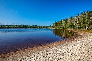
Pure Lake Provincial Park is a provincial park in British Columbia, Canada. The 142 ha park surrounds and protects Pure Lake.
Port Clements is an incorporated village situated at the east end of Masset Inlet in Haida Gwaii off the coast of the Province of British Columbia in Canada. Known as Gamadiis in HlG̱aagilda X̱aayda kil, it is one of seven village sites that flourished in the rich waters at the mouth of Yakoun River, where an estuary shelters nine Pacific salmonid species and many kinds of birds. Founded by Eli Tingley in 1907, it was once known under the name Queenstown, but renamed to Port Clements in 1914 after Herb S. Clements, the local MP at the time, when the name "Queenstown" duplicated and therefore became unusable for the post office.

Daajing Giids, known as Queen Charlotte City from 1891–2022, is a village municipality in the Haida Gwaii archipelago in the province of British Columbia, Canada. It is located on the southern end of Graham Island at Skidegate Inlet and is a member municipality of the North Coast Regional District.

Valdes Island is one of the Gulf Islands located in the Strait of Georgia, British Columbia, Canada. It is across Porlier Pass from Galiano Island, which lies to the southeast. It has an area of 23 square kilometres, and is 1.6 kilometres wide by 16 kilometres in length. The island is popular with kayakers, boaters and has historically been the site of several human settlements.

Taaw Tldáaw, formerly known as Tow Hill, is a large isolated volcanic plug located 21 km (13 mi) east of Masset on the north end of the Naikoon Peninsula of northeast Graham Island in Haida Gwaii, British Columbia, Canada, east of McIntyre Bay and near the mouth of the Hiellen River, which is the site of Hiellen, a now-abandoned Haida village and of the Hiellen Indian Reserve No. 2, on the site of that village. Formerly Tow Hill Provincial Park, it is now part of Naikoon Provincial Park, which covers most of the northeastern flatland of Graham Island.

Masset Inlet is a large saltwater bay located in the heart of the lowland of northern Graham Island, the northernmost and largest island of the Haida Gwaii islands on the North Coast of British Columbia, Canada. It is fed by several rivers, the largest of which is the Yakoun River, and is connected to the open sea of the Dixon Entrance by the narrow Masset Sound and Masset Harbour, which opens onto McIntyre Bay. The communities of Port Clements and Sewall are located on the shores of Masset Inlet. The community of Juskatla is located on Juus Ḵáahlii, the largest of Masset Inlet's arms. There are several islands in the inlet, the largest of which is Kumdis Island, at the inlet's egress to Masset Sound and just north of Port Clements. Masset Inlet helps form the isthmus of the Naikoon Peninsula.

SG̱ang Gwaay Llnagaay, commonly known by its English name Ninstints, is a village site of the Haida people and part of the Gwaii Haanas National Park Reserve and Haida Heritage Site on Haida Gwaii on the North Coast of British Columbia, Canada.
The Hiellen River is a river on Graham Island in the Queen Charlotte Islands of British Columbia, Canada. It flows north into McIntyre Bay to the east of Tow Hill, and is entirely within Naikoon Provincial Park, which covers most of the peninsula of the same name. At the mouth of the Hiellen River is Hiellen Indian Reserve No. 2, which is on the site of Hiellen, a once-large Haida village whose remaining families located to Masset during the 19th Century.
The 2012 Haida Gwaii earthquake occurred just after . The shock had a moment magnitude of 7.8 and a maximum Mercalli Intensity of V (Moderate). The earthquake's epicentre was on Moresby Island of the Haida Gwaii archipelago. This was the second largest Canadian earthquake ever recorded by a seismometer, after the 1949 Queen Charlotte Islands earthquake, about 135 kilometres (84 mi) away. One person died due to a car crash related to the tsunami in Oahu, Hawaii.
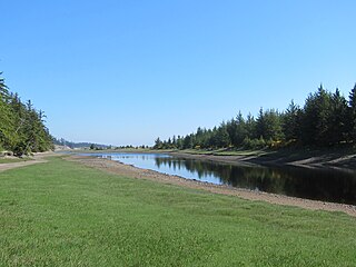
The Tlell River is a watercourse on the east side of Graham Island in Haida Gwaii, British Columbia, Canada. It enters Hecate Strait near the community of Tlell. It is the second-longest river in Haida Gwaii, after the Yakoun. Its lower reaches are within Naikoon Provincial Park. The Tlell's headwaters and the swamps of its upper reaches are protected within the Tlall Conservancy. The river is popular with anglers, as it supports large coho salmon.
Duu Guusd Heritage Site/Conservancy is a heritage site and conservancy located in the northwest corner of Graham Island in the Haida Gwaii archipelago of British Columbia, Canada. It was established on March 23, 2008 to protect the ecological integrity and cultural importance of the region. The conservancy is part of an archipelago-wide system of protected areas that includes Gwaii Haanas National Park Reserve and Haida Heritage Site, Gwaii Haanas National Marine Conservation Area Reserve and Haida Heritage Site, and 17 other provincially protected areas.