British Columbia Highway 101, also known as the Sunshine Coast Highway, is a 156 kilometres (97 mi) long highway that is the main north–south thoroughfare on the Sunshine Coast in British Columbia, Canada.
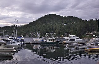
The Sunshine Coast is a geographic subregion of the British Columbia Coast that generally comprises the regional districts of qathet and Sunshine Coast.
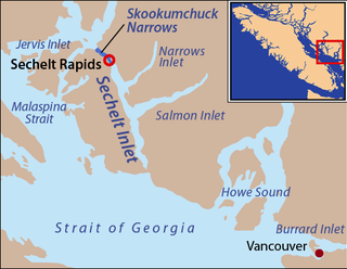
Skookumchuck Narrows is a strait forming the entrance of Sechelt Inlet on British Columbia's Sunshine Coast in Canada. Before broadening into Sechelt Inlet, all of its tidal flow together with that of Salmon Inlet and Narrows Inlet must pass through Sechelt Rapids. At peak flows, standing waves, whitecaps, and whirlpools form at the rapids even in calm weather. The narrows are also the site of Skookumchuck Narrows Provincial Park.
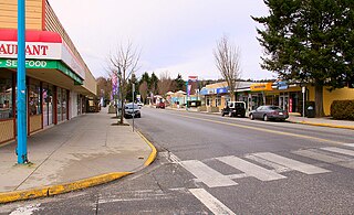
Sechelt is a district municipality located on the lower Sunshine Coast of British Columbia. Approximately 50 km northwest of Vancouver, it is accessible from mainland British Columbia by a 40-minute ferry trip between Horseshoe Bay and Langdale, and a 25-minute drive from Langdale along Highway 101, also known as the Sunshine Coast Highway. The name Sechelt is derived from the she shashishalhem word shíshálh, the name of the First Nations people who first settled the area thousands of years ago.

Sechelt Inlet formerly Seechelt Inlet is one of the principal inlets of the British Columbia Coast. The inlet is significant in that it almost makes an island of what is instead the Sechelt Peninsula, whose isthmus is at the town of Sechelt at the head of the inlet. The isthmus is less than 1.2 km (0.75 mi) in length. Sechelt Inlet's mouth is at Jervis Inlet, inland from the Malaspina Strait.
Skookumchuck is a Chinook Jargon term that is in common use in British Columbia English and occurs in Pacific Northwest English. Skookum means "strong" or "powerful", and "chuck" means water, so skookumchuck means "rapids" or "whitewater", or fresh, healthy water. It can mean any rapids, but in coastal usage refers to the powerful tidal rapids at the mouths of most of the major coastal inlets.
Bamberton Provincial Park is a provincial park located in Mill Bay, British Columbia, Canada. The park area consists of a beach that borders on Saanich Inlet, and is connected to a camping area by several trails. The traditional name of the beach is qʷələs in the Saanich dialect. It shares its name with the now abandoned company town of Bamberton.
Dawley Passage Provincial Park is a provincial park in British Columbia, Canada, located at the south end of Fortune Channel, which lies between Meares Island and the mainland of Vancouver Island just south. The park is to the north of the resort town of Tofino and is accessible by boat only. It was created on July 13, 1995 as part of the Clayoquot Land-Use Decision and contains 154 ha, .

Harmony Islands Marine Provincial Park is a provincial park in British Columbia, Canada, located on the east side of Hotham Sound, which is a side-inlet of the lower reaches of Jervis Inlet, on that inlet's north side roughly opposite the mouth of Sechelt Inlet.

Say Nuth Khaw Yum Provincial Park, also known as Indian Arm Provincial Park, is a provincial park located in the Lower Mainland of British Columbia, Canada. The park was established on July 13, 1995 by BC Parks to protect the forested mountain terrain of Indian Arm.

Khutzeeymateen Provincial Park, also known as Khutzeymateen/K'tzim-A-Deen Grizzly Sanctuary, is a Class A provincial park located in the North Coast region of British Columbia, Canada. The park, within the purview of BC Parks, was established on August 15, 1994, to protect critical habitat for the region's grizzly bear population and the largest contiguous stand of old-growth Sitka spruce in the world. It was officially opened by Prince Philip, Duke of Edinburgh, on August 17, 1994.

Klewnuggit Inlet Marine Provincial Park is a provincial park in British Columbia, Canada, located on the east side of Grenville Channel, 100 kilometres (62 mi) southeast of Prince Rupert, in the Range 4 Coast Land District.

Lowe Inlet Marine Provincial Park is a provincial park in British Columbia, Canada located on the Inside Passage of the North Coast, 118 km south of Prince Rupert and 75 km north of Butedale. Established on 14 June 1994, the park now contains approximately 765 hectares.

Sechelt Inlets Marine Provincial Park is a provincial park in British Columbia, Canada, that protects six separate sites along three inlets north of the city of Sechelt. The six sites are located at various locations on Sechelt Inlet and its two side arms, Salmon Inlet and Narrows Inlet. Established initially as a recreation area in 1980, it was converted to a park in 1999, consisting of approximately 140 hectares in total.
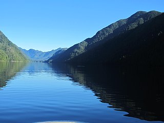
Sydney Inlet Provincial Park is a provincial park in the Clayoquot Sound region of the west coast of Vancouver Island, British Columbia, Canada, located north of the settlement of Hot Springs Cove and northwest of the resort town of Tofino. Sydney Inlet was the name of the post office in the area from its creation in 1947 to 1948, when it was renamed Hot Springs Cove, though that post office was subsequently closed in 1974.

The Sechelt Peninsula is located on the Sunshine Coast of British Columbia, just northwest of Vancouver. It is bounded to the west by Malaspina Strait, to the north by Agamemnon Channel and Jervis Inlet, to the east by Sechelt Inlet, and to the south by the Strait of Georgia (separating it from Vancouver Island. Its approximately 350 km2 is a mixture of drier and wetter temperate rain forest. The Caren Range extends north–south along the shore of Sechelt Inlet. The peninsula is a popular outdoor recreation destination, containing many lakes and opportunities for shoreline and woodland hiking, including to the renowned Skookumchuk Narrows. There are several parks, the largest of which is Spipiyus Provincial Park in the interior of the peninsula.
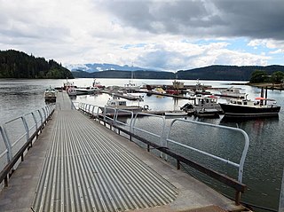
Quatsino Sound is a complex of coastal inlets, bays and islands on northwestern Vancouver Island in the Canadian province of British Columbia. It is the northernmost of the five sounds that pierce the west coast of Vancouver Island, the others being Kyuquot Sound, Nootka Sound, Clayoquot Sound, and Barkley Sound.

Salmon Inlet, formerly Salmon Arm, is a fjord branching east from Sechelt Inlet in the British Columbia, Canada. Its companion, Narrows Inlet, another side-inlet of Sechelt Inlet, lies roughly 10 km (6.2 mi) north. Misery and Sechelt Creeks flow freely into the inlet, while the Clowhom River flows in from the artificial Clowhom Lake, formed by a small hydroelectric power development. The fjord is 23 km (14 mi) long; Clowhom Lake, covering a waterfall on the Clowhom River, stretches a further 12 km (7.5 mi) to the western base of Mount Tantalus, which is best known from the direction of Squamish and the Cheakamus Canyon stretch of British Columbia Highway 99. Heavily affected by logging and milling operations, the inlet is split almost into two portions by an alluvial fan spreading from the mouth of Sechelt Creek.

Storm Bay is found in the Sechelt Inlet of the Pacific Ocean, near the mouth of Narrows Inlet.

Narrows Inlet formerly Narrows Arm is a fjord branching east from Sechelt Inlet in British Columbia, Canada. Its companion, Salmon Inlet, another side-inlet of Sechelt Inlet, lies roughly 10 km (6.2 mi) south.


