British Columbia Ferry Services Inc., operating as BC Ferries (BCF), is a former provincial Crown corporation, now operating as an independently managed, publicly owned Canadian company. BC Ferries provides all major passenger and vehicle ferry services for coastal and island communities in the Canadian province of British Columbia. Set up in 1960 to provide a similar service to that provided by the Black Ball Line and the Canadian Pacific Railway, which were affected by job action at the time, BC Ferries has become the largest passenger ferry line in North America, operating a fleet of 41 vessels with a total passenger and crew capacity of over 27,000, serving 47 locations on the B.C. coast.
British Columbia Highway 101, also known as the Sunshine Coast Highway, is the main north–south thoroughfare on the Sunshine Coast, British Columbia, Canada.

Powell River is a city on the northern Sunshine Coast of southwestern British Columbia, Canada. Most of its population lives near the eastern shores of Malaspina Strait, which is part of the larger Georgia Strait between Vancouver Island and the Mainland. With two intervening long, steep-sided fjords inhibiting the construction of a contiguous road connection with Vancouver to the south, geographical surroundings explain Powell River's remoteness as a community, despite relative proximity to Vancouver and other populous areas of the BC Coast. The city is the location of the head office of the qathet Regional District.
The Sunshine Coast is a geographic subregion of the British Columbia Coast that generally comprises the regional districts of qathet and Sunshine Coast.

The Sunshine Coast Regional District is a regional district in British Columbia, Canada. It is located on the southern mainland coast, across Georgia Strait from Vancouver Island. It borders on the qathet Regional District to the north, the Squamish-Lillooet Regional District to the east, and, across Howe Sound, the Metro Vancouver District to the south. The regional district offices are located in the District Municipality of Sechelt.
Sechelt is a district municipality located on the lower Sunshine Coast of British Columbia. Approximately 50 km northwest of Vancouver, it is accessible from mainland British Columbia by a 40-minute ferry trip between Horseshoe Bay and Langdale, and a 25-minute drive from Langdale along Highway 101, also known as the Sunshine Coast Highway. The name Sechelt is derived from the she shashishalhem word shíshálh, the name of the First Nations people who first settled the area thousands of years ago.
Howe Sound is a roughly triangular sound, that joins a network of fjords situated immediately northwest of Vancouver, British Columbia, Canada. It was designated as a UNESCO Biosphere Reserve in 2021.

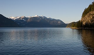
Jervis Inlet is one of the principal inlets of the British Columbia Coast, about 95 km (59 mi) northwest of Vancouver, and the third of such inlets north of the 49th parallel, the first of which is Burrard Inlet, Vancouver's harbour.

Saltery Bay Provincial Park is a provincial park in British Columbia, Canada, located southeast of the city of Powell River, and on the north side of the entrance to Jervis Inlet in the central area of that province's Sunshine Coast region.

Lund is a small craft harbour and unincorporated village on Tla'amin land in qathet Regional District, British Columbia, Canada. It is along the northern part of the Salish Sea on the mainland BC coast. The main landmark in the village is the Lund Hotel, established in 1905. By boat from Lund, the Copeland Islands and Desolation Sound, are nearby. Lund is home to many shops and services including a general store, a restaurant overlooking the water, kayak and adventure tourism stores, and Nancy's Bakery, a favourite of locals and tourists.

Keats Island is an inhabited island located in Howe Sound near Vancouver, British Columbia. Around eighty people live on Keats Island year-round.

MV Malaspina Sky is an Intermediate-class ferry in the BC Ferries fleet built in 2008.
The Sechelt Peninsula is located on the Sunshine Coast of British Columbia, just northwest of Vancouver. It is bounded to the west by Malaspina Strait, to the north by Agamemnon Channel and Jervis Inlet, to the east by Sechelt Inlet, and to the south by the Strait of Georgia (separating it from Vancouver Island. Its approximately 350 km2 is a mixture of drier and wetter temperate rain forest. The Caren Range extends north–south along the shore of Sechelt Inlet. The peninsula is a popular outdoor recreation destination, containing many lakes and opportunities for shoreline and woodland hiking, including to the renowned Skookumchuk Narrows. There are several parks, the largest of which is Spipiyus Provincial Park in the interior of the peninsula.
St. Vincent Bay was a cannery town on the South Coast of British Columbia, Canada, located on the northwest bank of Jervis Inlet near Hotham Sound, and just northeast of the Saltery Bay ferry terminal on the upper Sunshine Coast, and opposite the mouth of Sechelt Inlet. It was utilized as a log sort and booming ground. It has now been transformed into a quarry for aggregate.

M/V Queen of the Islands was a RORO ferry operated by BC Ferries between 1963 and 1991. Although the passenger areas provided for an enjoyable travel experience for the general public, she was much maligned by the crews that worked on her, and the Queen of the Islands quickly garnered a reputation as being one of the most unloved ships ever to have operated with BC Ferries.
The Lighthouse Pub is a Transportation Corridor / Restaurant and Pub at the southern tip of Sechelt Inlet. The building was originally a restaurant from Expo 86 and has since been slowly transformed into an air and sea gateway to Sechelt.

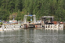
Saltery Bay is an unincorporated community on the Sunshine Coast of southern British Columbia, Canada. It is located about 30 kilometres (19 mi) southeast of the city of Powell River. It is adjacent to Saltery Bay Provincial Park.
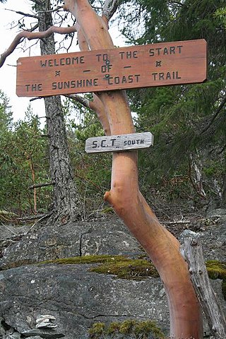
The Sunshine Coast Trail is a 180 km (112 mi) wilderness hiking trail in the Sunshine Coast region of British Columbia, Canada. The trail traverses the qathet Regional District from Sarah Point on the Desolation Sound in the north to the BC Ferries terminal at Saltery Bay on Jervis Inlet in the south. The trail goes within close proximity of the communities of Powell River, Lang Bay, Lund, and Teeshohsum, through public, private and Tla'amin Nation treaty lands. It connects provincial parks such as Malaspina Provincial Park and Inland Lake Provincial Park, as well as many recreation sites and regional parks.