Nelson Island (British Columbia)

Last updated
Nelson Island
NelsonIslandBritishColumbia.png
Nelson Island (British Columbia)
Geography
Location Strait of Georgia
Coordinates 49°42′00″N124°08′00″W / 49.70000°N 124.13333°W / 49.70000; -124.13333
ArchipelagoNorthern Gulf Islands
Area102.8 km2 (39.7 sq mi)
Administration
Canada
Province British Columbia

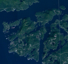
Nelson Island is an island in the Sunshine Coast region of the South Coast region of British Columbia. It is surrounded by Hotham Sound, Agamemnon Channel, and Malaspina Strait. The closest communities are Pender Harbour, British Columbia and Egmont, both on the Sechelt Peninsula.

The island is mostly forested, although there are some clear cut areas inland. Lakes and large mountainous hills define the geography. Hardy Island sits alongside Nelson Island with Blind Bay in between the two. Logging operations and granite quarries were early features of the island, and many buildings in BC were built out of Nelson Granite including the Parliament Buildings in Victoria.

There were once a few homesteads and small logging operations, most of which are now summer cabins. As a consequence, the permanent population is quite small. One of the most well known residents was Harry Roberts, who retired to the island in 1929. The house he built, Sunray, was a cottage with south-facing walls of glass the stretched out like the rays of a sun. It still stands in a cove at Cape Cockburn.

The island is named for the British naval hero, Horatio Nelson, 1st Viscount Nelson. The adjacent island of Hardy Island is named after his Commodore, who was the last man to whom Nelson spoke as he lay dying after the Battle of Trafalgar. The eastern side of Nelson Island is bordered by Agamemnon Channel, named after Nelson's first command and favourite ship, HMS Agamemnon. The southernmost part of the island is Fearney Point, named after Nelson's bargeman William Fearney who took charge of the swords of surrendered Spaniards during the Battle of Cape St Vincent. The scene is commemorated on a bas-relief plaque at the foot of Nelson's Column in Trafalgar Square, London.

Related Research Articles

<span class="mw-page-title-main">Vancouver Island</span> Largest island in British Columbia, Canada

Vancouver Island is an island in the northeastern Pacific Ocean and part of the Canadian province of British Columbia. The island is 456 km (283 mi) in length, 100 km (62 mi) in width at its widest point, and 32,100 km2 (12,400 sq mi) in total area, while 31,285 km2 (12,079 sq mi) are of land. The island is the largest by area and the most populous along the west coasts of the Americas.

<span class="mw-page-title-main">Nelson's Column</span> Monument in Trafalgar Square, London

Nelson's Column is a monument in Trafalgar Square in the City of Westminster, Central London, built to commemorate Vice-Admiral Horatio Nelson's decisive victory at the Battle of Trafalgar over the combined French and Spanish navies, during which he lost his life, killed by a French sniper. The monument was constructed between 1840 and 1843 to a design by William Railton at a cost of £47,000. It is a column of the Corinthian order built from Dartmoor granite. The statue of Nelson was carved from Craigleith sandstone by sculptor Edward Hodges Baily. The four bronze lions around its base, designed by Sir Edwin Landseer, were added in 1867.

<span class="mw-page-title-main">Sir Thomas Hardy, 1st Baronet</span> Royal Navy Vice-Admiral (1769–1839)

Vice-Admiral Sir Thomas Masterman Hardy, 1st Baronet, GCB was a British Royal Navy officer. He took part in the Battle of Cape St. Vincent in February 1797, the Battle of the Nile in August 1798 and the Battle of Copenhagen in April 1801 during the French Revolutionary Wars. He served as flag captain to Admiral Lord Nelson, and commanded HMS Victory at the Battle of Trafalgar in October 1805 during the Napoleonic Wars. Nelson was shot as he paced the decks with Hardy, and as he lay dying, Nelson's famous remark of "Kiss me, Hardy" was directed at him. Hardy went on to become First Naval Lord in November 1830 and in that capacity refused to become a Member of Parliament and encouraged the introduction of steam warships.

HMS <i>Agamemnon</i> (1781) 1781 ship

HMS Agamemnon was a 64-gun third-rate ship of the line of the British Royal Navy. She saw service in the American Revolutionary War, French Revolutionary and Napoleonic Wars, and fought in many of the major naval battles of those conflicts. She is remembered as being Nelson's favourite ship, and was named after the mythical ancient Greek king Agamemnon, being the first ship of the Royal Navy to bear the name.

<span class="mw-page-title-main">Port Hardy</span> District municipality in British Columbia, Canada

Port Hardy is a district municipality in British Columbia, Canada located on the north-east end of Vancouver Island. Port Hardy has a population of 3,902 as of the 2021 census.

<span class="mw-page-title-main">British Columbia Coast</span> Coastal region of British Columbia, Canada

The British Columbia Coast, popularly referred to as the BC Coast or simply the Coast, is a geographic region of the Canadian province of British Columbia. As the entire western continental coastline of Canada along the Pacific Ocean is in the province, it is synonymous with being the West Coast of Canada.

<span class="mw-page-title-main">Jervis Inlet</span> Inlet in British Columbia, Canada

Jervis Inlet is one of the principal inlets of the British Columbia Coast, about 95 km (59 mi) northwest of Vancouver, and the third of such inlets north of the 49th parallel, the first of which is Burrard Inlet, Vancouver's harbour.

<span class="mw-page-title-main">Holberg, British Columbia</span> Place in British Columbia, Canada

Holberg is a former ferry terminal about 35 kilometres (22 mi) from the northwest tip of Vancouver Island, British Columbia. This unincorporated community is at the head of Holberg Inlet, which forms the western arm of Quatsino Sound.

<span class="mw-page-title-main">Coal Harbour (Vancouver Island)</span> Village on Vancouver Island, British Columbia, Canada

Coal Harbour is a harbour and community on northern Vancouver Island, British Columbia, Canada located on the north side of Holberg Inlet in the Quatsino Sound region. It is named after a small and unsuccessful local coal mine that was founded in 1883. The village's most successful industry, however, was whaling. It was the last whaling station in British Columbia when it closed in 1967. The station utilized the original buildings of the RCAF.

<span class="mw-page-title-main">Cayetano Valdés y Flores</span> Spanish commander and explorer

Cayetano Valdés y Flores Bazán (1767–1835) was a commander of the Spanish Navy, explorer, and captain general who served in the French Revolutionary and Napoleonic Wars, fighting for both sides at different times due to the changing fortunes of Spain in the conflict. He took part in a number of naval battles, including the Great Siege of Gibraltar, the Battle of Cape St Vincent, and the Battle of Trafalgar. He was an explorer, most notable in the Pacific Northwest, where he and Dionisio Alcalá Galiano conducted the first circumnavigation of Vancouver Island, in partial cooperation with George Vancouver. Over his long career he achieved the highest ranks in the Spanish Navy, eventually being named Captain General of Cadiz and Captain General of the Spanish Navy.

<span class="mw-page-title-main">Pender Harbour, British Columbia</span> Harbour in British Columbia, Canada

Pender Harbour is a harbour on British Columbia's Sunshine Coast, on the east side of Malaspina Strait. The name Pender Harbour also refers collectively to the surrounding unincorporated communities of Madeira Park, Kleindale, Irvines Landing, and Garden Bay, within the Sunshine Coast Regional District (SCRD).

<span class="mw-page-title-main">Porcher Island</span>

Porcher Island is an island in Hecate Strait, British Columbia, Canada, near the mouth of the Skeena River and southwest of the port city of Prince Rupert. The locality of Porcher Island is located near the island's northern tip at Humpback Bay, 54°05′11″N130°23′23″W. Stephens and Prescott Islands are located off its northwestern tip.

HMS <i>Edgar</i> (1779) 74-gun Royal Navy ship of the line

HMS Edgar was a 74-gun third-rate ship of the line of the Royal Navy, that saw service in the American Revolutionary, French Revolutionary and Napoleonic Wars. Launched in 1779, she fought in the battles of Cape St Vincent and Copenhagen, two of the major naval engagements of the wars.

<span class="mw-page-title-main">Britannia Range (Canada)</span>

The Britannia Range is a small mountain range of the Coast Mountains that runs along the eastern shore of Howe Sound just north of Vancouver, British Columbia, Canada. It is a subrange of the Pacific Ranges and often considered part of the North Shore Mountains. The range is bounded by the Howe Sound to the west, the Stawamus River to the north, Loch Lomond on the upper Seymour River to the east, and Deeks Lake to the south. However, some official maps extend the range further south of these boundaries and many local sources such as hiking guidebooks will often include all of the peaks along the Howe Sound between Deeks Lake and Cypress Mountain as part of the range.

Agamemnon Channel is a channel or strait in British Columbia, Canada, at the mouth of Jervis Inlet on the South Coast, separating Nelson Island from the mainland of the Sunshine Coast. The ferry terminal and recreational community of Earls Cove is on its mainland side.

<span class="mw-page-title-main">Allemand's expedition of 1805</span> French naval expedition during the Napoleonic Wars

Allemand's expedition of 1805, often referred to as the Escadre invisible in French sources, was an important French naval expedition during the Napoleonic Wars, which formed a major diversion to the ongoing Trafalgar Campaign in the Atlantic Ocean. With the French Mediterranean Fleet at sea, Emperor Napoleon I hoped to unite it with the French Atlantic Fleet and together form a force powerful enough to temporarily displace the British Royal Navy Channel Fleet for long enough to allow an invasion force to cross the English Channel and land in Britain. In support of this plan, the French squadron based at Rochefort put to sea in July 1805, initially with the intention that they would join the Atlantic Fleet from Brest. When this fleet failed to put to sea, the Rochefort squadron, under Contre-Admiral Zacharie Allemand, went on an extended raiding cruise across the Atlantic, both to intercept British trade left lightly defended by the concentration of British forces in European waters and with the intention of eventually combining with the French Mediterranean Fleet then blockaded in Spanish harbours.

<span class="mw-page-title-main">Horatio Nelson, 1st Viscount Nelson</span> British Royal Navy admiral (1758–1805)

Vice-Admiral Horatio Nelson, 1st Viscount Nelson, 1st Duke of Bronte was a British flag officer in the Royal Navy. His inspirational leadership, grasp of strategy and unconventional tactics brought about a number of decisive British naval victories during the French Revolutionary and Napoleonic Wars. He is widely regarded as one of the greatest naval commanders in history. His victory on 21 October 1805 at the Battle of Trafalgar, led to British naval supremacy for over another century and beyond.

<span class="mw-page-title-main">Seaforth Channel</span> Watercourse in Canada

Seaforth Channel is a channel in the Central Coast region of the Canadian province of British Columbia which is part of the Inside Passage - the 950 miles (1,530 km) passage between Seattle, Washington and Juneau, Alaska. The marine highway goes through Seaforth Channel on the way to Milbanke Sound, one of the open sea portions of the Inland Passage. Seaforth Channel which is part of the Prince Rupert/Port Hardy BC ferry route, extends in a westerly direction from Denny Island to Milbanke Sound between Denny Island, Campbell Island and the Wright group of islands on the south. In October 2016, a Texas-owned tug/barge transiting the Canadian waters of the Inside Passage without a local pilot was hard grounded on a reef at the entrance to Seaforth Channel in October 2016. More than 100,000 L of fuel contaminated the coast, coves and shores 20 km (12 mi) west of Bella Bella, the core community of the Heiltsuk Nation as well as the environmentally sensitive Great Bear Rainforest - Canada's contribution to the Queen's Commonwealth Canopy (QCC), a network of forest conservation programs. Clean up response and salvage was criticized by the Heiltsuk, B.C. Premier Christy Clark and Prime Minister Justin Trudeau. In November in Vancouver the Prime Minister announced a $1.5B ocean protection plan to "create a marine safety system, restore marine ecosystems and undertake research into oil spill cleanup methods."

The Nahwitti River is a 40-kilometre (25 mi) long river in northernmost Vancouver Island, British Columbia, Canada. It flows through Cape Scott Provincial Park into Goletas Channel near Hope Island and Queen Charlotte Sound. Its watershed, 229 km2 (88 sq mi) large, is located west and northwest of Port Hardy, north and northeast of Holberg, and north of Holberg Inlet, part of Quatsino Sound.

<span class="mw-page-title-main">Hardy Island</span> Island of British Columbia, Canada

Hardy Island is an island of the Northern Gulf Islands archipelago located in the Sunshine Coast region of British Columbia.

References