Moresby Island (Gulf Islands)

Last updated

Moresby Island, in the Gulf Islands. Moresby Island (Gulf Island) location.png
Moresby Island, in the Gulf Islands.

Moresby Island is one of the Gulf Islands of British Columbia, located on the west side of Swanson Channel and east of the southern end of Saltspring Island. It is not to be confused with Moresby Island, the second largest of the Haida Gwaii Islands off the north coast of BC. It is currently a privately owned island, and is used by its current owners to raise beef cattle. The island is not open to the general public. Its current population is 2 people, a manager and his wife.

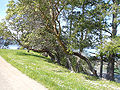
Moresby Island has an elevation of 148 meters (485 feet 6 inches) above sea level at its highest point, [1] and has a total land area of 3.22 sq. miles. [2] The island is 3.7 km (2.3 mi) in length, and is 2.2 km (1.4 mi) across. [3] :9 The island was first settled in 1863. It was named for Rear Admiral Fairfax Moresby, who was the naval commander-in-chief of the Pacific Station of the Royal Navy between 1850 and 1853, as was Fairfax Point at the island's southern tip [4] :342 and the other Moresby Island in Haida Gwaii. During the 1880s, land was cleared by Capt. H. J. Robertson, then owner, in order to plant fruit trees. [5] In 1940, the island again changed hands. [6]

The island has been logged three times by separate Chinese logging companies. The evidence of this logging is nearly gone, yet there are a few signs of logging still remaining. Traces of the trails built for the machines can still be found. It has a very rich history, including a ghost story, the remains of a long-gone mansion, and evidence of First Nations people using the island as a resting place when traveling[ citation needed ].

Related Research Articles

<span class="mw-page-title-main">Haida people</span> Indigenous group in British Columbia, Canada

Haida are an indigenous group who have traditionally occupied Haida Gwaii, an archipelago just off the coast of British Columbia, Canada, for at least 12,500 years.

<span class="mw-page-title-main">Haida Gwaii</span> An archipelago in British Columbia, Canada

Haida Gwaii is an archipelago located between 55–125 km (34–78 mi) off the northern Pacific coast of Canada. The islands are separated from the mainland to the east by the shallow Hecate Strait. Queen Charlotte Sound lies to the south, with Vancouver Island beyond. To the north, the disputed Dixon Entrance separates Haida Gwaii from the Alexander Archipelago in the U.S. state of Alaska.

<span class="mw-page-title-main">Graham Island</span> Island in Canada

Graham Island is the largest island in the Haida Gwaii archipelago, lying off the mainland coast of British Columbia, Canada. It is separated by the narrow Skidegate Channel from the other principal island of the group to the south, Moresby Island. It has a population of 3,858, an area of 6,361 km2 (2,456 sq mi), and is the 101st largest island in the world and Canada's 22nd largest island.

<span class="mw-page-title-main">Gwaii Haanas National Park Reserve and Haida Heritage Site</span> National park reserve and heritage site in British Columbia, Canada

Gwaii Haanas National Park Reserve, National Marine Conservation Area, and Haida Heritage Site, usually referred to simply as Gwaii Haanas, is located in southernmost Haida Gwaii, 130 kilometres off the mainland of British Columbia, Canada. Gwaii Haanas protects an archipelago of 138 islands, the largest being Moresby Island and the southernmost being Kunghit Island. "Gwaii Haanas" means "Islands of Beauty" in X̱aayda kíl, the language of the Haida people.

<span class="mw-page-title-main">British Columbia Coast</span> Coastal region of British Columbia, Canada

The British Columbia Coast, popularly referred to as the BC Coast or simply the Coast, is a geographic region of the Canadian province of British Columbia. As the entire western continental coastline of Canada along the Pacific Ocean is in B.C., it is synonymous with being the West Coast of Canada.

<span class="mw-page-title-main">North Coast Regional District</span> Regional district in British Columbia, Canada

The North Coast Regional District is a quasi-municipal administrative area in British Columbia. It is located on British Columbia's west coast and includes Haida Gwaii, the largest of which are Graham Island and Moresby Island. Its administrative offices are in the City of Prince Rupert.

<span class="mw-page-title-main">Skidegate</span> Indigenous reserve in British Columbia, Canada

Skidegate is a Haida community in Haida Gwaii in British Columbia, Canada. It is located on the southeast coast of Graham Island, the largest island in the archipelago, and is approximately 50 kilometres (31 mi) west of mainland British Columbia across Hecate Strait.

<span class="mw-page-title-main">Sandspit, British Columbia</span> Unincorporated community in British Columbia, Canada

Sandspit is the largest community on Moresby Island, in Haida Gwaii off the Pacific coast of British Columbia, Canada. The only town on Moresby Island, Sandspit has accommodations, a campground, supermarket and 85-berth harbour serving visitors to Gwaii Haanas.

<span class="mw-page-title-main">Daajing Giids</span> Village in British Columbia, Canada

Daajing Giids, known as Queen Charlotte from 1891–2022, is a village municipality in the Haida Gwaii archipelago in the province of British Columbia, Canada. It is located on the southern end of Graham Island at Skidegate Inlet and is a member municipality of the North Coast Regional District.

<span class="mw-page-title-main">Moresby Island</span> Island in Canada

Moresby Island is a large island that forms part of the Haida Gwaii archipelago in British Columbia, Canada, located at 52°45′00″N131°50′00″W. It is separated by the narrow Skidegate Channel from the other principal island of the group to the north, Graham Island.

<span class="mw-page-title-main">Valdes Island</span> Island in British Columbia, Canada

Valdes Island is one of the Gulf Islands located in the Strait of Georgia, British Columbia, Canada. It is across Porlier Pass from Galiano Island, which lies to the southeast. It has an area of 23 square kilometres, and is 1.6 kilometres wide by 16 kilometres in length. The island is popular with kayakers, boaters and has historically been the site of several human settlements.

The Queen Charlottes Gold Rush was a gold rush in southern Haida Gwaii of what is now the North Coast of British Columbia, Canada, in 1851.

<span class="mw-page-title-main">Colony of the Queen Charlotte Islands</span> British colony

The Colony of the Queen Charlotte Islands was a British colony constituting the archipelago of the same name from 1853 to 1858, when it was amalgamated into the Colony of British Columbia. In 2010 the archipelago was renamed Haida Gwaii.

<span class="mw-page-title-main">Skidegate Channel</span> Body of water

Skidegate Channel is a strait located in the Haida Gwaii archipelago of British Columbia, Canada. It divides the archipelago's two main islands, Graham Island to the north and Moresby Island to the south.

Cumshewa Inlet, also recorded or referred to in exploration logs as Cumchewas Harbour and Tooscondolth Sound, is a large inlet on the east coast of Moresby Island in the Haida Gwaii islands of the North Coast of British Columbia. The inlet was the site of various Haida villages, including Cumshewa, Tanu and Djí-gua. The name for the inlet was conferred in the days of the Maritime Fur Trade following a custom whereby captains named locations for the most important local chief, in this case Cumshewa, who figures in maritime fur trade vessel logs from 1787 onwards. In 1794 Cumshewa and his followers massacred the crew of the American trading vessel Resolution in Cumshewa Inlet.

<span class="mw-page-title-main">Ninstints</span> Haida village site in Haida Gwaii, British Columbia, Canada

SG̱ang Gwaay Llanagaay, commonly known by its English name Ninstints, is a village site of the Haida people and part of the Gwaii Haanas National Park Reserve and Haida Heritage Site on Haida Gwaii on the North Coast of British Columbia, Canada.

<span class="mw-page-title-main">Louise Island</span>

Louise Island is a 275-square-kilometre (106 sq mi) island in Haida Gwaii, in British Columbia, Canada, off the east coast of Moresby Island. It was named for Princess Louise, Duchess of Argyll, fourth daughter of Queen Victoria. Louise Island is located east of Moresby Island and Carmichael Passage, and south of Cumshewa Inlet.

<span class="mw-page-title-main">Portland Island (British Columbia)</span>

Portland Island is an island of the Southern Gulf Islands of the South Coast of British Columbia, Canada. It is located in the Salish Sea west of Moresby Island and off the south tip of Saltspring Island, adjacent to the main BC Ferries route just offshore from the terminal at Swartz Bay at the tip of the Saanich Peninsula. It was named after HMS Portland, the flagship of Rear-Admiral Fairfax Moresby, Commander in Chief of the Pacific Station 1850–1853.

Houston Stewart Channel is a strait in Haida Gwaii, British Columbia, Canada. It separates Moresby Island and Kunghit Island.

<span class="mw-page-title-main">Hlk'yah G̱awG̱a</span>

Hlk'yah G̱awG̱a, also known as Windy Bay, is located on Athlii Gwaii in southern Haida Gwaii, British Columbia. The site was historically the location of a Haida village named Hlk'yah Llnagaay, meaning Peregrine Falcon Town in English. In the 1980s, Hlk'yah G̱awG̱a was the focus of a series of lawsuits and protests opposing clearcut logging on the island. These demonstrations were the impetus for the signing of the Gwaii Haanas Agreement of 1993 and the creation of the Gwaii Haanas National Park Reserve, National Marine Conservation Area Reserve, and Haida Heritage Site.

References

  1. http://www.env.gov.bc.ca/esd/distdata/ecosystems/Soils_Reports/bc43-5_report.pdf [ bare URL PDF ]
  2. "Moresby Island". BC Geographical Names .
  3. mMorris, Frank; Heath, Willis R (1979). Marine Atlas, Vol 1 Olympia to Malcolm Island. Seattle: Bayless Enterprises.
  4. Walbran, Captain John T. (1971). British Columbia Place Names, Their Origin and History (Facsimile reprint of 1909 ed.). Vancouver/Toronto: Douglas & McIntyre. ISBN   0-88894-143-9. Archived from the original on 2016-03-03. Retrieved 2008-07-13.
  5. "The Gulf Islands". Vancouver Daily World. 3 Aug 1889. p. 1. Retrieved 21 July 2015 via Newspapers.com.
  6. "Sale of Game Island To Industrialist Told". The San Bernardino County Sun. 24 Jan 1940. p. 4. Retrieved 22 July 2015 via Newspapers.com.

Coordinates: 48°43′N123°19′W / 48.717°N 123.317°W / 48.717; -123.317