Campbell River | |
---|---|
City of Campbell River | |
Nickname: Salmon Capital of the World. | |
Location of Campbell River in British Columbia | |
Coordinates: 50°01′23″N125°14′37″W / 50.02306°N 125.24361°W [1] | |
Country | Canada |
Province | British Columbia |
Region | Mid-Island |
Regional District | Strathcona |
Founded | 1855 |
Incorporated | 1947 |
Government | |
• Type | Elected city council |
• Mayor | Kermit Dahl |
• MP | Rachel Blaney (NDP) |
• MLA | Michele Babchuk (BC NDP) |
Area (2021) [3] | |
• Land | 144.38 km2 (55.75 sq mi) |
• Population centre | 33.0 km2 (12.7 sq mi) |
• Census agglomeration | 1,734.05 km2 (669.52 sq mi) |
Elevation | 24 m (79 ft) |
Population (2024) [3] | |
• Total | 37,117 |
• Density | 246.0/km2 (637/sq mi) |
• Population centre | 38,108 |
• Population centre density | 1,154.7/km2 (2,991/sq mi) |
• Census agglomeration | 40,704 |
• Census agglomeration density | 23.5/km2 (61/sq mi) |
Time zone | UTC−08:00 (PST) |
Forward sortation area | |
Area code(s) | 236, 250, 672, 778 |
Highways | Highway 19 Highway 19A |
Waterways | Discovery Passage, Strait of Georgia |
Website | campbellriver |
Campbell River is a city in the Sayward Land District of British Columbia, Canada, on the east coast of Vancouver Island at the south end of Discovery Passage, which lies along the 50th parallel north along the important Inside Passage shipping route. Campbell River has a population (2021 census) of 35,138 [3] and has long been touted as the "salmon capital of the world." Campbell River and Region are near the communities of Quadra and the Discovery Islands, Sayward, Oyster River, Gold River, Tahsis and Zeballos.
Campbell River is served by the coast-spanning Island Highway, the nearby but now defunct Island Rail Corridor, and Campbell River Airport.
The first settlers known in the area were members of the Kʼómoks (Island Comox) and related Coast Salish peoples. During the 18th century, a migration of Kwakwakaʼwakw (Kwakʼwala-speaking) people of the Wakashan linguistic and cultural group migrated south from the area of Fort Rupert. Establishing themselves in the Campbell River area, they enslaved and later absorbed the Kʼómoks. These newcomers became infamous as raiders of the Coast Salish peoples farther south, who are known to history as the Euclataws (also spelled Yucultas), a variant on the Laich-kwil-tach, Lekwiltok or Legwildok, which is their name for themselves. There are two subdivisions of this group, also known as the Southern Kwakiutl: the Wekayi or Weiwaikai of the We Wai Kai Nation (Cape Mudge Indian Band) on Quadra Island and the Weiwaikum of the Campbell River Band located in and around the city of Campbell River.
Captain George Vancouver reached Campbell River in 1792 aboard the ships HMS Discovery and HMS Chatham. The channel between Quadra Island and Campbell River is named Discovery Passage after HMS Discovery. The captain and his botanist, Mr Archibald Menzies, encountered a small tribe of 350 natives who spoke the Salish language. A Laich-kwil-tach war party, heavily armed with European rifles, paddled south from Johnstone Strait in the middle of the 19th century and were in control of the area when HMS Plumper came through on a cartography mission under Captain George Henry Richards around 1859. Dr Samuel Campbell was the ship surgeon, and historians believe his name was given to the river by Richards. The community took the name "Campbell River" when its post office was constructed in 1907. [4] Likewise, the name of HMS Discovery's First Lieutenant Zachary Mudge is preserved in the nearby Cape Mudge.
Sports fishermen travelled to the area as early as the 1880s, especially after the tales from anglers such as Sir Richard Musgrave [5] [6] and Sir John Rogers. The formation of the Campbell River Tyee Club in 1924, over concern regarding over-fishing of the salmon stocks, served to popularize the area among fishermen. [7] E.P. Painter, for instance, moved to Campbell River the following year and opened his Painter's Lodge in 1929. Painter's Lodge attracted clientèle from Hollywood and regular patrons included Bob Hope and Bing Crosby. Commercial fishing was a large industry for many years. The town's magistrate Roderick Haig-Brown purchased a fishing cabin on Campbell River and wrote a number of books on fly fishing for both sport fishermen and conservationists.
Industrial logging took off in the 1920s with Merrill Ring and Company, Bloedel, Stewart and Welch and Comox Logging. A large forest fire started near Buttle Lake and burned much of the valley in 1938. Rock Bay, Menzies Bay, and Englewood all were big logging camps.
After 1912, Campbell River became a supply point for northern Vancouver Island, Quadra Island, and Cortes Island. [8] The E and N Railway was surveyed to Campbell River, yet it only reached Courtenay, 64 km (40 mi) south. In its original conception, it would have been the last leg of the transcontinental railway, which had been proposed to run down Bute Inlet after crossing the British Columbia Interior, connecting to Vancouver Island just north of Campbell River at Seymour Narrows. After the Second World War, Campbell River became a boomtown and industrial centre with the building of the John Hart Dam, the Elk Falls Mill, and nearby mills in Tahsis and Gold River. Logging and mining in the area prospered. There is a lead zinc mine nearby as well as coal mines, while a large copper mine operated to the north.
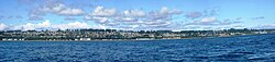
In recent years Campbell River, about halfway up Vancouver Island, has continued to mark the boundary between the more developed south and the wild and natural areas of the northern part of the island. [9] Local fish hatcheries help to maintain salmon stocks for the fishing industry. [10]
There is uncertainty about the source of the name of the city. It is thought that the river and the city may have been named for Dr. Samuel Campbell, who was assistant surgeon aboard HMS Plumper from 1857 to 1861. [11] : 37
Campbell River has a Mediterranean climate (Köppen climate classification Csb), very closely bordering on oceanic (Cfb). The most precipitation is measured in November, at 231 mm (9.1 in) on average. [12] January tends to see the most snow, 23.3 cm (9.2 in) on average. [12] In the winter months, occasional Arctic bursts from the interior of British Columbia can make their way to the coast, bringing temperatures below freezing. If a Pacific low reaches the coast, a large snowfall can occur. Snowfalls in excess of 45 cm (18 in) have been recorded in a 24-hour period, and the greatest recorded snowfall was 53.3 centimetres (21.0 in) in 1978.[ citation needed ]
Vancouver Island's coldest temperature of −23.9 °C (−11.0 °F) was recorded in Campbell River on 30 January 1969. [12]
Climate data for Campbell River (Campbell River Airport) Climate ID: 1021261; coordinates 49°57′07″N125°16′23″W / 49.95194°N 125.27306°W ; elevation: 108.8 m (357 ft); 1981–2010 normals | |||||||||||||
---|---|---|---|---|---|---|---|---|---|---|---|---|---|
Month | Jan | Feb | Mar | Apr | May | Jun | Jul | Aug | Sep | Oct | Nov | Dec | Year |
Record high humidex | 13.9 | 16.1 | 18.6 | 28.0 | 32.4 | 43.5 | 40.9 | 40.0 | 33.4 | 27.7 | 17.9 | 15.7 | 43.5 |
Record high °C (°F) | 16.1 (61.0) | 17.5 (63.5) | 20.6 (69.1) | 28.5 (83.3) | 33.2 (91.8) | 39.6 (103.3) | 37.2 (99.0) | 37.8 (100.0) | 31.6 (88.9) | 26.3 (79.3) | 17.8 (64.0) | 15.1 (59.2) | 39.6 (103.3) |
Mean daily maximum °C (°F) | 5.5 (41.9) | 7.2 (45.0) | 9.7 (49.5) | 13.2 (55.8) | 17.0 (62.6) | 20.1 (68.2) | 23.0 (73.4) | 23.3 (73.9) | 19.8 (67.6) | 13.1 (55.6) | 7.7 (45.9) | 4.9 (40.8) | 13.7 (56.7) |
Daily mean °C (°F) | 2.4 (36.3) | 3.2 (37.8) | 5.2 (41.4) | 8.0 (46.4) | 11.6 (52.9) | 14.7 (58.5) | 17.3 (63.1) | 17.2 (63.0) | 13.7 (56.7) | 8.6 (47.5) | 4.4 (39.9) | 2.1 (35.8) | 9.0 (48.2) |
Mean daily minimum °C (°F) | −0.8 (30.6) | −0.7 (30.7) | 0.7 (33.3) | 2.8 (37.0) | 6.2 (43.2) | 9.3 (48.7) | 11.5 (52.7) | 11.1 (52.0) | 7.6 (45.7) | 4.0 (39.2) | 1.0 (33.8) | −0.8 (30.6) | 4.3 (39.7) |
Record low °C (°F) | −23.9 (−11.0) | −17.8 (0.0) | −12.8 (9.0) | −5.6 (21.9) | −2.2 (28.0) | −0.6 (30.9) | 2.2 (36.0) | 1.7 (35.1) | −2.8 (27.0) | −9.7 (14.5) | −20.4 (−4.7) | −18.5 (−1.3) | −23.9 (−11.0) |
Record low wind chill | −30 | −23 | −15 | −8 | −4 | 0.0 | 0.0 | 0.0 | −5 | −12 | −26 | −24 | −30 |
Average precipitation mm (inches) | 217.5 (8.56) | 149.5 (5.89) | 140.0 (5.51) | 92.1 (3.63) | 68.4 (2.69) | 62.9 (2.48) | 39.4 (1.55) | 44.6 (1.76) | 55.2 (2.17) | 162.2 (6.39) | 231.9 (9.13) | 225.7 (8.89) | 1,489.3 (58.63) |
Average rainfall mm (inches) | 194.6 (7.66) | 135.5 (5.33) | 128.4 (5.06) | 91.6 (3.61) | 68.4 (2.69) | 62.9 (2.48) | 39.4 (1.55) | 44.6 (1.76) | 55.2 (2.17) | 161.0 (6.34) | 222.1 (8.74) | 204.2 (8.04) | 1,407.8 (55.43) |
Average snowfall cm (inches) | 23.3 (9.2) | 14.4 (5.7) | 11.7 (4.6) | 0.5 (0.2) | 0.0 (0.0) | 0.0 (0.0) | 0.0 (0.0) | 0.0 (0.0) | 0.0 (0.0) | 1.2 (0.5) | 10.5 (4.1) | 22.6 (8.9) | 84.3 (33.2) |
Average precipitation days (≥ 0.2 mm) | 20.8 | 16.4 | 19.7 | 17.1 | 15.5 | 13.7 | 9.4 | 9.3 | 9.7 | 18.4 | 21.6 | 21.2 | 192.8 |
Average rainy days (≥ 0.2 mm) | 18.7 | 15.0 | 18.9 | 17.1 | 15.5 | 13.7 | 9.4 | 9.3 | 9.7 | 18.4 | 21.0 | 19.3 | 185.9 |
Average snowy days (≥ 0.2 cm) | 4.3 | 3.0 | 2.7 | 0.4 | 0.0 | 0.0 | 0.0 | 0.0 | 0.0 | 0.1 | 1.8 | 4.1 | 16.3 |
Average relative humidity (%) (at 1500 Local standard time) | 84.9 | 75.1 | 67.8 | 59.6 | 57.2 | 57.6 | 54.4 | 55.1 | 59.1 | 74.0 | 83.3 | 86.3 | 67.9 |
Source: Environment and Climate Change Canada [12] (October maximum) [13] |
In the 2021 Canadian census conducted by Statistics Canada, Campbell River had a population of 35,519 living in 15,557 of its 16,194 total private dwellings, a change of 7.6% from its 2016 population of 33,007. With a land area of 144.38 km2 (55.75 sq mi), it had a population density of 246.0/km2 (637.2/sq mi) in 2021. [3]
Panethnic group | 2021 [3] | 2016 [14] | 2011 [15] | 2006 [16] | 2001 [17] | 1996 [18] | 1991 [19] [20] | 1986 [21] [22] [23] : 93 | 1981 [24] [25] | ||||||||||
---|---|---|---|---|---|---|---|---|---|---|---|---|---|---|---|---|---|---|---|
Pop. | % | Pop. | % | Pop. | % | Pop. | % | Pop. | % | Pop. | % | Pop. | % | Pop. | % | Pop. | % | ||
European [a] | 28,995 | 83.12% | 26,680 | 83.48% | 26,820 | 87.29% | 25,730 | 87.61% | 25,035 | 88.48% | 26,065 | 90.72% | 18,270 | 86.81% | 15,040 | 89.21% | 14,250 | 89.76% | |
Indigenous | 3,870 | 11.09% | 3,670 | 11.48% | 2,670 | 8.69% | 2,540 | 8.65% | 1,560 | 5.51% | 1,305 | 4.54% | 1,870 | 8.89% | 1,220 | 7.24% | 970 | 6.11% | |
Southeast Asian [b] | 645 | 1.85% | 635 | 1.99% | 600 | 1.95% | 475 | 1.62% | 665 | 2.35% | 395 | 1.37% | 295 | 1.4% | 40 | 0.24% | — | — | |
South Asian | 535 | 1.53% | 245 | 0.77% | 120 | 0.39% | 85 | 0.29% | 500 | 1.77% | 515 | 1.79% | 280 | 1.33% | 385 | 2.28% | 475 | 2.99% | |
East Asian [c] | 445 | 1.28% | 385 | 1.2% | 210 | 0.68% | 315 | 1.07% | 360 | 1.27% | 300 | 1.04% | 185 | 0.88% | 110 | 0.65% | 165 | 1.04% | |
African | 175 | 0.5% | 125 | 0.39% | 120 | 0.39% | 45 | 0.15% | 90 | 0.32% | 90 | 0.31% | 55 | 0.26% | 10 | 0.06% | — | — | |
Latin American | 120 | 0.34% | 115 | 0.36% | 95 | 0.31% | 105 | 0.36% | 30 | 0.11% | 45 | 0.16% | 65 | 0.31% | 25 | 0.15% | 15 | 0.09% | |
Middle Eastern [d] | 15 | 0.04% | 45 | 0.14% | 0 | 0% | 10 | 0.03% | 0 | 0% | 0 | 0% | 25 | 0.12% | 30 | 0.18% | 0 | 0% | |
Other [e] | 80 | 0.23% | 55 | 0.17% | 65 | 0.21% | 45 | 0.15% | 60 | 0.21% | 0 | 0% | — | — | — | — | — | — | |
Total responses | 34,885 | 98.22% | 31,960 | 98.07% | 30,725 | 98.52% | 29,370 | 99.32% | 28,295 | 99.43% | 28,730 | 99.58% | 21,045 | 99.39% | 16,860 | 99.26% | 15,875 | 100.27% | |
Total population | 35,519 | 100% | 32,588 | 100% | 31,186 | 100% | 29,572 | 100% | 28,456 | 100% | 28,851 | 100% | 21,175 | 100% | 16,986 | 100% | 15,832 | 100% | |
Note: Totals greater than 100% due to multiple origin responses |
According to the 2021 census, religious groups in Campbell River included: [3]
Campbell River has a variety of growing industries and small businesses suitable to an ocean side community. As of 2012, the focus of business is directed towards aquaculture, agrifoods, clean energy development, construction, creative industries, forestry, fishing, [26] health care, international education, mining, technology and tourism. [8] Elk Falls Mill, one of the largest employers in the area shut down in 2009; however, logging continues to be a significant source of employment. [8] There have been many cases of former mill employees moving away to other places with higher demands for a similar labour force, particularly Fort McMurray, Alberta.
Public schools are administered by School District 72 Campbell River and North Island College has a campus in Campbell River. Campbell River has recently developed a new international program accepting students from Germany, Austria, and various other countries across Europe, South America, and Asia. Along with School District 72, there is also a private K–12 Christian school, this being Campbell River Christian School. The two public high schools are Carihi Secondary School and Timberline Secondary School. Carihi Secondary School is also a part of School District 93 Conseil scolaire francophone.
The Conseil scolaire francophone de la Colombie-Britannique operates one Francophone school in Campbell River: the école Mer-et-montagne primary school. [27]
In the House of Commons of Canada, Campbell River is represented by the riding of North Island—Powell River (Rachel Blaney, New Democratic Party (NDP)). In the Legislative Assembly of British Columbia, Campbell River is represented by the North Island (Claire Trevena, British Columbia New Democratic Party (BC NDP)) riding.
The mayor of Campbell River is Kermit Dahl. He was elected on 15 October 2022. [28]
The city is served by Campbell River Airport (YBL), Campbell River Water Aerodrome at Campbell River Harbour, a BC Ferries route to Quadra Island, [29] and an inland island highway and an ocean side island highway which connect the community to the rest of Vancouver Island. [30] Campbell River Transit System provides bus service to the city and neighbouring communities. Operated by Watson and Ash Transportation, the transit system is funded under a partnership between the City of Campbell River and BC Transit, the provincial agency that plans and manages municipal transit systems.[ citation needed ]
Since 1983, Campbell River has been a sister or twinned city of Ishikari, Hokkaido, Japan. This twinning was based on the importance of salmon to both cities. [32]
Fernie is a city in the Elk Valley area of the East Kootenay region of southeastern British Columbia, Canada, located on BC Highway 3 on the western approaches to the Crowsnest Pass through the Rocky Mountains. Founded in 1898 and incorporated as the City of Fernie in July 1904, the municipality has a population of over 5,000 with an additional 2,000 outside city limits in communities under the jurisdiction of the Regional District of East Kootenay. A substantial seasonal population swells the city during the winter months.
Port Alberni is a city located on Vancouver Island in the province of British Columbia, Canada. The city lies within the Alberni Valley at the head of the Alberni Inlet, Vancouver Island's longest inlet. Port Alberni currently has a total population of 18,259.
Saanich is a district municipality on the southern end of Vancouver Island in British Columbia, Canada, within the Greater Victoria area. The population was 117,735 at the 2021 census, making it the most populous municipality in the Capital Regional District and Vancouver Island, and the eighth-most populous in the province. With an area of 103.44 square kilometres (39.94 sq mi), Saanich is also the largest municipality in Greater Victoria. The district adopted its name after the Saanich First Nation, meaning "emerging land" or "emerging people".
The Township of Esquimalt is a municipality at the southern tip of Vancouver Island, in British Columbia, Canada. It is bordered to the east by the provincial capital, Victoria, to the south by the Strait of Juan de Fuca, to the west by Esquimalt Harbour and Royal Roads, to the northwest by the New Songhees 1A Indian reserve and the town of View Royal, and to the north by a narrow inlet of water called the Gorge, across which is the district municipality of Saanich. It is almost tangential to Esquimalt 1 Indian Reserve near Admirals Road. It is one of the 13 municipalities of Greater Victoria and part of the Capital Regional District.
Parksville is a city on Vancouver Island in British Columbia, Canada. As of the 2021 Census, Parksville's population was 13,642, representing a 9.5% increase over the 2016 Census.
Ladysmith, originally Oyster Harbour, is a town located on the 49th parallel north on the east coast of Vancouver Island, British Columbia, Canada. The local economy is based on forestry, tourism, and agriculture. A hillside location adjacent to a sheltered harbour forms the natural geography of the community.
Sparwood is a district municipality in the Canadian province of British Columbia. It is the second-largest community on the Elk River.
Duncan is a city on southern Vancouver Island in British Columbia, Canada. It is the smallest city by area in Canada. It was incorporated in 1912.
Greater Vancouver, also known as Metro Vancouver, is the metropolitan area with its major urban centre being the city of Vancouver, British Columbia, Canada. The term "Greater Vancouver" describes an area that is roughly coterminous with the region governed by the Metro Vancouver Regional District (MVRD), though it predates the 1966 creation of the regional district. It is often used to include areas beyond the boundaries of the regional district but does not generally include wilderness and agricultural areas that are included within the MVRD.
North Cowichan is a district municipality established in 1873 on Vancouver Island, in British Columbia, Canada. The municipality is part of the Cowichan Valley Regional District. North Cowichan is noted for a landscape including forests, beaches, rivers, and lakes. The municipality encompasses the communities of Chemainus; Westholme; Crofton; Maple Bay; and "the South End". The latter is an informal name for a built-up area which is essentially a suburb of the City of Duncan, a separate municipality.
Lantzville is a coastal community on the east side of Vancouver Island, British Columbia, Canada, along the western shore of the Strait of Georgia and immediately north of Nanaimo.
The Cowichan Valley Regional District is a regional district in the Canadian province of British Columbia that is on the southern part of Vancouver Island, bordered by the Nanaimo and Alberni-Clayoquot Regional Districts to the north and northwest, and by the Capital Regional District to the south and east. As of the 2021 Census, the Regional District had a population of 89,013. The regional district offices are in Duncan.
The City of Enderby is in the North Okanagan region of the Canadian province of British Columbia, between Armstrong and Salmon Arm. It is approximately 80 km north of Kelowna and 130 km east of Kamloops. Highway 97A passes through Enderby and the Shuswap River marks the eastern and northeastern limits of the City. There are two major schools in Enderby: M.V. Beattie Elementary School and A.L. Fortune Secondary School. M.V. Beattie Elementary School was rebuilt in 2012.
Vanderhoof is a district municipality near the geographical centre of British Columbia, Canada. Covering 2.92 square kilometers, it has a population of about 4,500 within town limits, and offers services to nearly 10,000 people in nearby rural communities. Its main industries are forestry, agriculture, and related businesses. Tourism is also growing, and mining operations are being developed in the area. It has many elementary schools, and one major secondary school, Nechako Valley Secondary School (NVSS), comprising School District 91 Nechako Lakes. The College of New Caledonia has a regional campus there.
Kitimat is a district municipality in the North Coast region of British Columbia, Canada. It is a member municipality of the Regional District of Kitimat–Stikine regional government. The Kitimat Valley is part of the most populous urban district in northwest British Columbia, which includes Terrace to the north along the Skeena River Valley. The city was planned and built by the Aluminum Company of Canada (Alcan) during the 1950s. Its post office was approved on 6 June 1952.
Port Hardy is a district municipality in British Columbia, Canada located on the north-east tip of Vancouver Island. Port Hardy has a population of 3,902 as of the 2021 census.
Houston is a forestry, mining and tourism town in the Bulkley Valley of the Northern Interior of British Columbia, Canada. Its population as of 2021 was 3,052, with approximately 2,000 in the surrounding rural area. It is known as the "steelhead capital" and it has the world's largest fly fishing rod. Houston's tourism industry is largely based on ecotourism and Steelhead Park, situated along Highway 16. Houston is named in honour of the pioneer newspaperman John Houston.
The Regional District of Fraser–Fort George (RDFFG) is a regional district located in the Central Interior of British Columbia, Canada. It is bounded by the Alberta border to the east, the Columbia–Shuswap and Thompson–Nicola regional districts to the south and southeast, Cariboo Regional District to the southwest, the Regional District of Bulkley–Nechako to the west, and the Peace River Regional District to the north and northeast. As of the Canada 2011 Census, Fraser–Fort George had a population of 91,879 and a land area of 51,083.73 km2. The offices of the regional district are located at Prince George.
The demographics of Metro Vancouver indicate a multicultural and multiracial region. Metro Vancouver is a metropolitan area, with its major urban centre being Vancouver, British Columbia, Canada. The Vancouver census metropolitan area, as defined by Statistics Canada, encompasses roughly the same territory as the Metro Vancouver Regional District, a regional district in British Columbia. The regional district includes 23 local authorities. Figures provided here are for the Vancouver census metropolitan area and not for the City of Vancouver.
Lake Cowichan is a town located near the eastern end of Cowichan Lake and, by highway, is a little over one hour northwest of Victoria, British Columbia. The town of Lake Cowichan was incorporated in 1944 and serves as the focal point of the Cowichan Lake Area, home to the indigenous c̓uubaʕsaʔtx̣ people. The Cowichan River flows through the middle of the town. The Cowichan River is designated as a Heritage River, and is also a popular location for tubing.