
The Trans-Canada Highway is a transcontinental federal–provincial highway system that travels through all ten provinces of Canada, from the Pacific Ocean on the west coast to the Atlantic Ocean on the east coast. The main route spans 7,476 km (4,645 mi) across the country, one of the longest routes of its type in the world. The highway system is recognizable by its distinctive white-on-green maple leaf route markers, although there are small variations in the markers in some provinces.

The Yellowhead Highway is a major interprovincial highway in Western Canada that runs from Winnipeg to Graham Island off the coast of British Columbia via Saskatoon and Edmonton. It stretches across the four western Canadian provinces of British Columbia, Alberta, Saskatchewan, and Manitoba and is part of the Trans-Canada Highway system and the larger National Highway System, but should not be confused with the more southerly, originally-designated Trans-Canada Highway. The highway was officially opened in 1970. Beginning in 1990, the green and white Trans-Canada logo is used to designate the roadway.

Highway 19 is the main north–south thoroughfare on Vancouver Island from Nanaimo to Port Hardy. It forms part of the Island Highway along with Highway 1 and Highway 19A. A highway has existed on the Island since about 1912. Originally gravel and rough, the highway was an essential link together with the Esquimalt & Nanaimo Railway. The paved highway first opened in 1953, replacing a stretch of Highway 1 between Nanaimo and Campbell River, finally being extended to the northern tip of the island in the late 1970s. The total length of the highway is 403 kilometres (250 mi).
Highway 19A, known locally as the Oceanside Route or the Old Island Highway, is a provincial highway in British Columbia, Canada. It runs along two former sections of Highway 19 on Vancouver Island, within Nanaimo and between Craig's Crossing and Campbell River. The section of Highway 19A between Craig's Crossing and Campbell River is 136.89 km (85.06 mi) long, and the Nanaimo alignment covers 10.64 km (6.61 mi). The highway was established after Highway 19 was realigned to a new road between 1996 and 2001.

Parksville is a city on Vancouver Island in British Columbia, Canada. As of the 2021 Census, Parksville's population was 13,642, representing a 9.5% increase over the 2016 Census.
Highway 4 is the longest east–west main vehicle route on Vancouver Island, British Columbia, Canada, with a total length of 162 km (101 mi). It is known locally as the Alberni Highway to the east of Port Alberni and the Pacific Rim Highway to the west. The original highway from Parksville to Alberni and Port Alberni was completed in 1942 and was originally designated as Highway 1A. It was re-designated as Highway 4 in 1953, and was extended in 1961 to the district of Tofino, on the west coast of the Island.
Highway 1 is a provincial highway in British Columbia, Canada, that carries the main route of the Trans-Canada Highway (TCH). The highway is 1,047 kilometres (651 mi) long and connects Vancouver Island, the Greater Vancouver region in the Lower Mainland, and the Interior. It is the westernmost portion of the main TCH to be numbered "Highway 1", which continues through Western Canada and extends to the Manitoba–Ontario boundary. The section of Highway 1 in the Lower Mainland is the second-busiest freeway in Canada, after Ontario Highway 401 in Toronto.
There are many roads in the southwestern part of British Columbia and Vancouver Island that were designated as Highway 1A. These roads were sections of the original 1941 route of Highway 1 before its various re-alignments, and are used today as service routes and frontage roads. The "B.C. Highway 1A" designations were removed from these sections by the province between 2005 and 2010, although signage remains along some of the route and the designation on some maps.
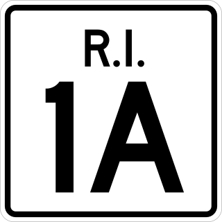
Route 1A, largely signed as Scenic 1A, is a 33.3-mile (53.6 km) long numbered state highway located in Washington County, Rhode Island, United States. The route, which parallels U.S. Route 1 for its entire length, has four distinct sections connected by US 1, two of which require median u-turn ramps to cross US 1. It travels through five towns in Washington County: Westerly, Charlestown, South Kingstown, Narragansett, and North Kingstown.
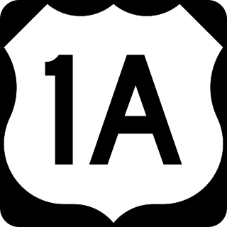
U.S. Route 1A (US 1A) is the name of several highways found in the United States.
Alberta Provincial Highway No. 1, commonly referred to as Highway 1, is a major east–west highway in southern Alberta that forms the southern mainline of the Trans-Canada Highway. It runs from the British Columbia border near Lake Louise through Calgary to the Saskatchewan border east of Medicine Hat. It continues as Highway 1 into both provinces. It spans approximately 534 km (332 mi) from Alberta's border with British Columbia in the west to its border with Saskatchewan in the east. Highway 1 is designated as a core route in Canada's National Highway System and is a core part of the developing Alberta Freeway Network.
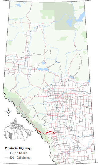
Alberta Provincial Highway No. 1A is the designation of two alternate routes off the Alberta portion of Trans-Canada Highway 1. However, it is not the only name used for spurs off Highway 1 - Highway 1X is another such designation. Despite these highways being suffixed routes of Highway 1, they are not part of the Trans-Canada Highway network, and are signed with Alberta's provincial primary highway shields instead of the Trans-Canada shields used for Highway 1.
Provincial Trunk Highway 1 is Manitoba's section of the Trans-Canada Highway. It is a heavily used, 4-lane divided highway, with the exception of a short 18 km section in the southeastern corner of the province. It is the main link between southern Manitoba's largest cities, and also serves as the province's main transportation link to the neighbouring provinces of Saskatchewan and Ontario. The highway is the only major east-west divided highway in Manitoba, and carries a large majority of east-west traffic within and through the province. It has full freeway status sections at Portage la Prairie and Winnipeg. The total distance of the Trans-Canada Highway in Manitoba is approximately 490 km (300 mi).
Route 1 is a highway in the Canada province of Newfoundland and Labrador, and is the easternmost stretch of the Trans-Canada Highway. Route 1 is the primary east–west road on the island of Newfoundland.

Alberta Provincial Highway No. 40, commonly referred to as Highway 40, is a south–north highway in western Alberta, Canada. It is also named Bighorn Highway and Kananaskis Trail in Kananaskis Country. Its segmented sections extend from Coleman in the Municipality of Crowsnest Pass northward to the City of Grande Prairie and is currently divided into four sections.

Route 340, also known as Road to the Isles, is a road in the Canadian province of Newfoundland and Labrador passing through the towns of Lewisporte, Summerford and Twillingate, all in The Isles of Notre Dame region of the province.
Marine Drive is the name for three major roadways in Greater Vancouver, British Columbia, Canada. The roads are known for running parallel to major bodies of water, with some sections being a major arterial road, while other serve local traffic. Marine Way is the name applied to a section of Marine Drive that was bypassed in the early 1980s.
