North Cowichan

Last updated

North Cowichan
The Corporation of the District of North Cowichan [1]
North Cowichan Skyline.jpg
Motto: 
No Steps Backwards
Canada Vancouver Island location map.svg
Red pog.svg
North Cowichan
Location of North Cowichan in British Columbia
Canada British Columbia location map 2.svg
Red pog.svg
North Cowichan
North Cowichan (British Columbia)
Coordinates: 48°49′29″N123°43′9″W / 48.82472°N 123.71917°W / 48.82472; -123.71917
CountryCanada
Province British Columbia
Regional district Cowichan Valley
Incorporated1873
Government
  MayorRob Douglas
  Governing body
North Cowichan Municipal Council
  • Mike Caljouw
  • Bruce Findlay
  • Becky Hogg
  • Chris Istace
  • Christopher Justice
  • Tek Manhas
   MP Jeff Kibble
   MLA Debra Toporowski
Area
  Total
195.54 km2 (75.50 sq mi)
Population
 (2021)
  Total
31,990
  Density163.7/km2 (424/sq mi)
Time zone UTC−8 (PST)
  Summer (DST) UTC−7 (PDT)
Area code +1-250
Website www.northcowichan.ca OOjs UI icon edit-ltr-progressive.svg

North Cowichan (Canada 2021 Census population 31,990) is a district municipality established in 1873 on Vancouver Island, in British Columbia, Canada. The municipality is part of the Cowichan Valley Regional District. North Cowichan is noted for a landscape including forests, beaches, rivers, and lakes. The municipality encompasses the communities of Chemainus; Westholme; Crofton; Maple Bay; and "the South End". The latter is an informal name for a built-up area which is essentially a suburb of the City of Duncan, a separate municipality.

Contents

Geography

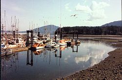
Located on the east coast of southern Vancouver Island, North Cowichan is centrally located immediately north of and adjacent to the city of Duncan and south of Ladysmith. Spanning 193.98 square kilometres, North Cowichan is the largest incorporated municipality by land area on Vancouver Island, and includes the communities of Chemainus, Crofton, Westholme, Maple Bay and the so-called "South End" which is functionally a suburb of Duncan, a separate municipality.

Geology

The last glacial period, the Fraser Glaciation occurred between 29,000 and 15,000 years ago. The glaciers that formed carved out the Cowichan Valley and left behind glaciers up to 30 metres thick. These fertile lands and mild climate have led to a history rich in agriculture. [2]

Climate

Sheltered by the mountains of the central Island and the Olympic Peninsula, North Cowichan has a temperate, Mediterranean-like climate, with mild, damp winters with little snowfall and warm, dry summers. North Cowichan is classified as a warm-summer mediterranean climate Csb by the Köppen system.

Climate data for North Cowichan
MonthJanFebMarAprMayJunJulAugSepOctNovDecYear
Record high °C (°F)13.5
(56.3)
18.5
(65.3)
23.5
(74.3)
28.5
(83.3)
32.0
(89.6)
42.0
(107.6)
37.0
(98.6)
34.5
(94.1)
35
(95)
27
(81)
18
(64)
15
(59)
42.0
(107.6)
Mean daily maximum °C (°F)6.6
(43.9)
8.6
(47.5)
11.3
(52.3)
14.9
(58.8)
18.5
(65.3)
21
(70)
24.5
(76.1)
24.3
(75.7)
22.5
(72.5)
15.1
(59.2)
9.6
(49.3)
6.1
(43.0)
15.3
(59.5)
Daily mean °C (°F)3.2
(37.8)
4.3
(39.7)
6.3
(43.3)
9.2
(48.6)
12.4
(54.3)
15.0
(59.0)
17.8
(64.0)
17.5
(63.5)
15.2
(59.4)
10.0
(50.0)
5.9
(42.6)
3.1
(37.6)
10.0
(50.0)
Mean daily minimum °C (°F)−0.2
(31.6)
−0.1
(31.8)
1.3
(34.3)
3.5
(38.3)
6.3
(43.3)
9.0
(48.2)
11.0
(51.8)
10.7
(51.3)
7.9
(46.2)
4.9
(40.8)
2.2
(36.0)
0.2
(32.4)
4.7
(40.5)
Record low °C (°F)−14.0
(6.8)
−15.0
(5.0)
−10.0
(14.0)
−3.0
(26.6)
−1.5
(29.3)
2.5
(36.5)
5.0
(41.0)
5.0
(41.0)
0.0
(32.0)
−4.5
(23.9)
−10.5
(13.1)
−15.5
(4.1)
−15.5
(4.1)
Average precipitation mm (inches)238.0
(9.37)
164.0
(6.46)
133.0
(5.24)
85.0
(3.35)
51.0
(2.01)
40.0
(1.57)
25.0
(0.98)
33.0
(1.30)
28.0
(1.10)
117.0
(4.61)
222.0
(8.74)
229.0
(9.02)
1,365
(53.75)
Source: The Weather Network [3]

Demographics

In the 2021 Census of Population conducted by Statistics Canada, North Cowichan had a population of 31,990 living in 13,741 of its 14,266 total private dwellings, a change of

The median family income in 2006 for North Cowichan was $62,125, which is below the British Columbia provincial average of $65,787. [5]

Ethnicity

Panethnic groups in the District of North Cowichan (1986−2021)
Panethnic
group
2021 [6] 2016 [7] 2011 [8] 2006 [9] 2001 [10] 1996 [11] 1991 [12] [13] 1986 [14] [15] [16] :104
Pop. %Pop.%Pop.%Pop.%Pop.%Pop.%Pop.%Pop.%
European [a] 25,87524,58524,88023,70522,69522,50519,10516,665
Indigenous 2,8602,3801,9851,8801,5701,225985790
South
Asian
9008707201,015995940800795
East
Asian
[b]
640535315340230270175245
Southeast
Asian
[c]
565370210200175906025
African 2808560459025550
Latin
American
9065505530202015
Middle
Eastern
[d]
8575030200550
Other [e] 135650352520N/AN/AN/AN/A
Total
responses
31,42529,03528,24027,31525,83525,10521,25518,535
Total
population
31,99029,67628,80727,55726,14825,30521,37318,674

Religion

According to the 2021 census, religious groups in North Cowichan included: [6]

Communities

Transportation

North Cowichan is serviced by the Maple Bay Airport (YAQ), which offers services to Downtown Vancouver, Vancouver Airport, Ganges on Salt Spring Island and Bedwell Harbour on Pender Island. Service is provided by Saltspring Air and Harbour Air.

The British Columbia Highway 1 traverses the municipality as a four-lane arterial divided highway with signals at major intersections. The speed limit varies between 80 and 90 km/h in the rural areas, lowering to 60 then 50 km/h in the denser urban area near Duncan.

British Columbia Highway 18 connects North Cowichan to Lake Cowichan as a 2-lane facility with a speed limit as high as 100 km/h.

Bus service in the municipality is provided by the Cowichan Valley Regional District with service connecting the North Cowichan communities of Chemainus and Crofton with the south end and Duncan.

North Cowichan is also serviced by the Nanaimo Regional Transit System with daily (except Sunday) service through North Cowichan between Nanaimo and Duncan. The NCX 70 service has a stop at the Cowichan Commons shopping centre in North Cowichan.

North Cowichan has embraced roundabouts at many intersections on its network of municipal roads. As of 2021 North Cowichan has 14 roundabouts.

Economy

The original economic drivers steamed from the abundance of natural resources, including the fur trade, fishing, mining, and the forest industry. Today, the forest industry, retail, construction, manufacturing, and health care are large contributors to the local economy.

Education

North Cowichan lies within the School District 79 Cowichan Valley. There are many elementary schools, and two secondary schools.

North Cowichan is served by one public post secondary educational institution, Vancouver Island University.

Media outlets

North Cowichan is served by three newspapers – the Duncan Journal, the Cowichan Valley Citizen, and the Chemainus Valley Courier. North Cowichan is also serviced by 89.7 Juice FM, a member of Vista Radio.

Attractions

North Cowichan is home to the BC Forest Discovery Centre, the Pacific Northwest Raptors Bird of Prey and Raptor Visitor Center, and the world famous Chemainus Murals.

Arts

The Cowichan Theatre hosts many performers and shows during the year. The Chemainus Theatre Festival features classic and award-winning comedies, musicals and dramas.

Recreation

North Cowichan is home to many recreation centres, including the Cowichan Aquatic Centre, cowichan community Centre, Fuller Lake Arena and the Cowichan Sportsplex. North Cowichan offers numerous parks and hiking trails.

Power supply

The Vancouver Island terminal of the HVDC Vancouver-Island is found here.

Notes

  1. Statistic includes all persons that did not make up part of a visible minority or an indigenous identity.
  2. Statistic includes total responses of "Chinese", "Korean", and "Japanese" under visible minority section on census.
  3. Statistic includes total responses of "Filipino" and "Southeast Asian" under visible minority section on census.
  4. Statistic includes total responses of "West Asian" and "Arab" under visible minority section on census.
  5. Statistic includes total responses of "Visible minority, n.i.e." and "Multiple visible minorities" under visible minority section on census.

References

  1. "British Columbia Regional Districts, Municipalities, Corporate Name, Date of Incorporation and Postal Address" (XLS). British Columbia Ministry of Communities, Sport and Cultural Development. Archived from the original on July 13, 2014. Retrieved November 2, 2014.
  2. "Geological History of Vancouver Island". CVRD. November 7, 2013.
  3. The Weather NetworkStatistics: Duncan, BC. Retrieved September 29, 2011.
  4. "Population and dwelling counts: Canada, provinces and territories, and census subdivisions (municipalities), British Columbia". Statistics Canada. February 9, 2022. Retrieved February 20, 2022.
  5. "British Columbia  Community Fact" (PDF). Archived from the original (PDF) on November 9, 1997. Retrieved November 29, 2010.
  6. 1 2 Government of Canada, Statistics Canada (October 26, 2022). "Census Profile, 2021 Census of Population". www12.statcan.gc.ca. Retrieved November 9, 2022.
  7. Government of Canada, Statistics Canada (October 27, 2021). "Census Profile, 2016 Census". www12.statcan.gc.ca. Retrieved January 6, 2023.
  8. Government of Canada, Statistics Canada (November 27, 2015). "NHS Profile". www12.statcan.gc.ca. Retrieved January 6, 2023.
  9. Government of Canada, Statistics Canada (August 20, 2019). "2006 Community Profiles". www12.statcan.gc.ca. Retrieved January 6, 2023.
  10. Government of Canada, Statistics Canada (July 2, 2019). "2001 Community Profiles". www12.statcan.gc.ca. Retrieved January 6, 2023.
  11. Government of Canada, Statistics Canada (July 2, 2019). "Profile of Census Divisions and Subdivisions, 1996 Census". www12.statcan.gc.ca. Retrieved January 6, 2023.
  12. Government of Canada, Statistics Canada (March 29, 2019). "1991 Census Area Profiles Profile of Census Divisions and Subdivisions - Part B". www12.statcan.gc.ca. Retrieved January 6, 2023.
  13. Government of Canada, Statistics Canada (March 29, 2019). "Data tables, 1991 Census Population by Ethnic Origin (24), Showing Single and Multiple Origins (2) - Canada, provinces and territories, census divisions and census subdivisions". www12.statcan.gc.ca. Retrieved January 6, 2022.
  14. Government of Canada, Statistics Canada (June 27, 2019). "Data tables, 1986 Census Census Profile for Canada, Provinces and Territories, Census Divisions and Census Subdivisions, 1986 Census - Part A". www12.statcan.gc.ca. Retrieved January 6, 2023.
  15. Government of Canada, Statistics Canada (June 27, 2019). "Data tables, 1986 Census Census Profile for Canada, Provinces and Territories, Census Divisions and Census Subdivisions, 1986 Census - Part B". www12.statcan.gc.ca. Retrieved January 6, 2023.
  16. Government of Canada, Statistics Canada (April 3, 2013). "Canada's aboriginal population by census subdivisions from the 1986 Census of Canada". www12.statcan.gc.ca. Retrieved January 6, 2023.