North Vancouver | |
---|---|
The Corporation of the District of North Vancouver [1] | |
Nickname: North Van | |
Motto(s): "Montes Rivique Nobis Inspirant" (English: "The Mountains and Rivers Inspire Us") | |
Coordinates: 49°18′40″N123°01′10″W / 49.31111°N 123.01944°W | |
Country | Canada |
Province | British Columbia |
Regional district | Metro Vancouver |
Incorporated | August 10, 1891 [2] |
Government | |
• Type | Mayor-council government |
• Mayor | Mike Little |
• Municipal council | List of councillors |
• MP | Jonathan Wilkinson-(Liberal) Terry Beech-(Liberal) |
• MLA | Bowinn Ma (Lonsdale- BC NDP) Susie Chant (Seymour-BC NDP) Karin Kirkpatrick (Capilano-BC Liberal) |
Area | |
• Land | 160.66 km2 (62.03 sq mi) |
Highest elevation | 1,449 m (4,754 ft) |
Lowest elevation | 0 m (0 ft) |
Population (2021) [3] | |
• Total | 88,168 |
• Estimate (2022) [4] | 92,390 |
• Density | 548.8/km2 (1,421/sq mi) |
Demonym | North Vancouverite |
Time zone | UTC−08:00 ( PST ) |
• Summer (DST) | UTC−07:00 (PDT) |
Forward sortation area | |
Area codes | 604, 778, 236, 672 |
Website | www |
The District of North Vancouver is a district municipality in British Columbia, Canada, and is part of Metro Vancouver. It surrounds the City of North Vancouver on three sides. It is largely characterized as a relatively quiet, affluent suburban hub home to many middle and upper-middle-class families. Homes in the District of North Vancouver generally range from mid-sized family bungalows to very large luxury houses. A number of dense multi-family and mixed-use developments have popped up across the district in recent years; however, the district remains a primarily suburban municipality. It is served by the Royal Canadian Mounted Police, British Columbia Ambulance Service, and the District of North Vancouver Fire Department.
For thousands of years, the Indigenous Squamish and their kin Tsleil-Waututh, of the Coast Salish, resided in the land known as North Vancouver. Slightly over 200 years ago, the people of the Squamish and Tsleil-Waututh living on the North Shore had their first glimpse of Europeans. First, the Spanish arrived, giving their name to Vancouver's Spanish Banks, and, in 1792, Captain George Vancouver explored the local shores. But it was not until 1862 that the first attempt was made to harvest the North Shore's rich stands of timber, leading to fuller settlement of the area that would later become North Vancouver.
The first industry on the North Shore was Pioneer Mills, founded in 1862 to log the huge trees of the coastal rainforest. After twice changing hands, the operation was bought by Sewell ("Sue") Prescott Moody in 1865. Near where the Saskatchewan Wheat Pool grain elevators now stand, the town of Moodyville grew up and stood as the main centre of activity on the North Shore until the mill closed in 1901. The first school was established in Moodyville. The second, Central School, opened in 1902 in a building that still stands as part of what is now Presentation House at 3rd Street and Chesterfield Avenue, the current home of the North Vancouver Museum and Archives.
In 1891, the first municipality on the North Shore was formed as the District of North Vancouver. It stretched across the North Shore from Horseshoe Bay to Deep Cove but omitted Moodyville. In the early years of the 20th century, a real estate boom took place, with speculators – including the British poet Rudyard Kipling – eager to turn a quick dollar. A new community began to take shape. In 1902, the Hotel North Vancouver was built; in 1905, the first bank, a branch of the Bank of North America, opened. A newspaper, the Express, commenced publication in 1905, and in 1906 the British Columbia Electric Railway began streetcar service.
Industry, particularly shipbuilding, became central, with the nearby stands of trees a rich resource for a society in which ships, houses, and most other manmade things were constructed mainly of wood. The Wallace Shipyards moved in 1906 to the area just east of Lonsdale Avenue, drawn by the arrival of electricity. Over the years, this company, later known as Burrard Dry Dock and then Versatile Pacific Shipyards, became a major force in the local economy. Many of the shipyard's buildings still stand although the company has now ceased operations.
Economic prosperity and rapid growth in the Lower Lonsdale area of North Vancouver led to the establishment in 1907 of the separate City of North Vancouver, with a population of approximately 1,500. West Vancouver separated from the district in 1912. Apart from the addition of Moodyville in 1915, the boundaries of the city have not changed, even though far more people now call the district home.
Communications with Vancouver have always been an important factor in the development of the North Shore. The first ferry service was supplied by "Navvy Jack’s" rowboat in 1866. In 1867, the Sea Foam established a regular ferry service that continued until 1958. The SeaBus re-established water transportation in 1977. Rail service was slower in developing. While the Pacific Great Eastern Railway inaugurated a 12.7-mile run from North Vancouver to Whytecliff Park in 1914, it was not until the completion of the first Second Narrows Bridge in 1925 that rail and road links with the Lower Mainland supplemented the local ferry service.
Early plans for North Vancouver were ambitious. However, early grandiose plans met with a number of setbacks. The real estate boom was overtaken by a worldwide depression in 1913 and then World War I delayed many projects. The depression that began in 1929, coupled with disruptions to communications over the Second Narrows caused by ships colliding with the bridge, led to economic difficulties and severe tax shortfalls. Both the city and the district were placed in receivership in 1933. But the opening of the second road crossing, the Lions Gate Bridge, in 1938 was a significant factor in making the North Shore more accessible. And the war years led to an economic revival of North Vancouver, especially because of the many ships built in the Burrard Dry Dock at the foot of Lonsdale for the Canadian war effort.
In the postwar years, the city and the District of North Vancouver boomed, with most of the growth taking place in the district because of its greater land resources.
Since 2018, there have been proposals to amalgamate the District of North Vancouver with the City of North Vancouver into a single North Vancouver. [5] [6] Surveys have shown that the majority of the municipalities' residents support the idea, and many do not even know that the city and the district are separate entities.
The District of North Vancouver is separated from Vancouver by the Burrard Inlet. It can be accessed by the Lions' Gate Bridge, the Ironworkers Memorial Second Narrows Crossing, and the SeaBus passenger ferry.
The district is bounded by the Capilano River to the west, Indian Arm to the east, Burrard Inlet to the south, and the Coast Mountains to the north. It sprawls in an east–west direction across the mountain slopes and is characterized by rugged terrain and steep and winding roadways. While there is no true urban core within the district, there are a number of separate commercial neighbourhood centres. These include (from west to east): Edgemont Village, Upper Lonsdale, Lynn Valley, Main Street, Parkgate, and Deep Cove.
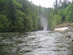
The district has much in common with West Vancouver and the City of North Vancouver. Together, these three municipalities are commonly referred to as the North Shore. Most of the residents of the district live in single-family dwellings. Except for a few more historical areas, much of the development of the district has occurred since the 1950s. The City of North Vancouver has considerably higher commercial and residential density.
North Vancouver has an oceanic climate (Köppen climate type Cfb).
Climate data for North Vancouver (N Vancouver 2nd Narrows) (Elevation: 4m) 1981–2010 | |||||||||||||
---|---|---|---|---|---|---|---|---|---|---|---|---|---|
Month | Jan | Feb | Mar | Apr | May | Jun | Jul | Aug | Sep | Oct | Nov | Dec | Year |
Average precipitation mm (inches) | 262.2 (10.32) | 172.3 (6.78) | 168.4 (6.63) | 136.3 (5.37) | 103.3 (4.07) | 82.5 (3.25) | 53.2 (2.09) | 54.9 (2.16) | 76.8 (3.02) | 189.0 (7.44) | 293.4 (11.55) | 238.6 (9.39) | 1,830.8 (72.08) |
Average rainfall mm (inches) | 255.3 (10.05) | 167.7 (6.60) | 166.8 (6.57) | 136.1 (5.36) | 103.3 (4.07) | 82.5 (3.25) | 53.2 (2.09) | 54.9 (2.16) | 76.8 (3.02) | 189.0 (7.44) | 290.2 (11.43) | 229.9 (9.05) | 1,805.6 (71.09) |
Average snowfall cm (inches) | 6.9 (2.7) | 5.2 (2.0) | 1.6 (0.6) | 0.2 (0.1) | 0.0 (0.0) | 0.0 (0.0) | 0.0 (0.0) | 0.0 (0.0) | 0.0 (0.0) | 0.1 (0.0) | 2.3 (0.9) | 8.7 (3.4) | 24.9 (9.8) |
Average precipitation days (≥ 0.2 mm) | 20.5 | 15.5 | 18.0 | 15.4 | 13.8 | 11.7 | 7.4 | 6.7 | 9.6 | 16.1 | 20.9 | 20.3 | 175.9 |
Average rainy days (≥ 0.2 mm) | 19.7 | 15.1 | 17.9 | 15.4 | 13.8 | 11.7 | 7.4 | 6.7 | 9.6 | 16.0 | 20.7 | 19.6 | 173.5 |
Average snowy days (≥ 0.2 cm) | 1.7 | 0.92 | 0.54 | 0.12 | 0.0 | 0.0 | 0.0 | 0.0 | 0.0 | 0.08 | 0.72 | 2.2 | 6.2 |
Source: Environment Canada (normals, 1981–2010) [7] |
Climate data for North Vancouver (N Vancouver Redonda Dr) (Elevation: 229m) 1971–2000 | |||||||||||||
---|---|---|---|---|---|---|---|---|---|---|---|---|---|
Month | Jan | Feb | Mar | Apr | May | Jun | Jul | Aug | Sep | Oct | Nov | Dec | Year |
Average precipitation mm (inches) | 301.9 (11.89) | 285.3 (11.23) | 223.8 (8.81) | 187.0 (7.36) | 141.7 (5.58) | 108.3 (4.26) | 66.6 (2.62) | 81.3 (3.20) | 105.0 (4.13) | 232.0 (9.13) | 389.9 (15.35) | 353.9 (13.93) | 2,476.8 (97.51) |
Average rainfall mm (inches) | 283.1 (11.15) | 263.9 (10.39) | 218.9 (8.62) | 186.0 (7.32) | 141.7 (5.58) | 108.3 (4.26) | 66.6 (2.62) | 81.3 (3.20) | 105.0 (4.13) | 231.7 (9.12) | 382.5 (15.06) | 331.6 (13.06) | 2,400.6 (94.51) |
Average snowfall cm (inches) | 18.8 (7.4) | 21.5 (8.5) | 4.9 (1.9) | 1.1 (0.4) | 0.0 (0.0) | 0.0 (0.0) | 0.0 (0.0) | 0.0 (0.0) | 0.0 (0.0) | 0.3 (0.1) | 7.4 (2.9) | 22.3 (8.8) | 76.2 (30.0) |
Average precipitation days (≥ 0.2 mm) | 19.1 | 17.8 | 17.4 | 16.2 | 14.8 | 12.1 | 7.4 | 7.1 | 10.0 | 15.5 | 20.0 | 20.7 | 177.9 |
Average rainy days (≥ 0.2 mm) | 17.6 | 15.9 | 17.0 | 16.2 | 14.8 | 12.1 | 7.4 | 7.1 | 10.0 | 15.4 | 19.5 | 18.6 | 171.4 |
Average snowy days (≥ 0.2 cm) | 3.9 | 3.5 | 1.6 | 0.45 | 0.0 | 0.0 | 0.0 | 0.0 | 0.0 | 0.10 | 1.9 | 4.5 | 15.8 |
Source: Environment Canada (normals, 1971–2000) [8] |
Mayor | Mike Little (2020) |
Councillors | Jordan Back (2018); Mathew Bond (2014, 2018); Megan Curren (2018); Betty Forbes (2018), Jim Hanson (2014, 2018); Lisa Muri (1996, 1999, 2002, 2005, 2008, 2011, 2014, 2018) |
Provincial MLAs | Susie Chant (North Vancouver-Seymour); Bowinn Ma (North Vancouver-Lonsdale); Karin Kirkpatrick (West Vancouver-Capilano) |
MPs | Jonathan Wilkinson (North Vancouver); Terry Beech (Burnaby North—Seymour) |
While industry was the engine that propelled North Vancouver for much of the twentieth century, this has now largely been replaced by enterprises more in tune with present economic realities. Many North Shore companies are in the business of creating and marketing high technology.
The television and film industry has made the area the centre of Hollywood North. Filming of the television series The X-Files took place in North Vancouver for five seasons, with many of its "wilderness" sequences shot in the Lower Seymour Conservation Reserve (LSCR).
The main (and only) highway through the District of North Vancouver is the Trans-Canada Highway (Highway 1). This crosses over the Ironworkers Memorial Second Narrows Crossing from Vancouver and goes through the district to the western border with West Vancouver.
Public transit is provided by TransLink and is mostly operated by its subsidiary Coast Mountain Bus Company, which runs a network of bus routes throughout the North Shore municipalities, including the R2 Marine Dr, as well as buses connecting the municipality with the rest of the Metro Vancouver. The SeaBus ferry, which is part of the TransLink system, is also an integral part of the district; it stops at Lonsdale Quay, which connects the North Shore with Vancouver, and Waterfront station, which connects to the SkyTrain network. West Vancouver Blue Bus also runs a few routes in the two North Vancouvers, along with the 255, which connects them to West Vancouver. There currently is no rapid transit system in North Vancouver, but TransLink aims to build a bus rapid transit line from Metrotown in Burnaby to Park Royal in West Vancouver as a measure to bring rapid transit to the traffic-congested North Shore. [12]
At the 2021 Canadian census conducted by Statistics Canada, North Vancouver had a population of 88,168 living in 32,700 of its 34,179 total private dwellings, a change of 2.9% from its 2016 population of 85,649. With a land area of 160.66 km2 (62.03 sq mi), it had a population density of 548.8/km2 (1,421.3/sq mi) in 2021. [3]
Panethnic group | 2021 [13] | 2016 [14] | 2011 [15] | 2006 [16] | 2001 [17] | |||||
---|---|---|---|---|---|---|---|---|---|---|
Pop. | % | Pop. | % | Pop. | % | Pop. | % | Pop. | % | |
European [lower-alpha 1] | 60,390 | 69.11% | 61,770 | 72.77% | 64,095 | 76.71% | 62,950 | 76.85% | 65,110 | 79.72% |
East Asian [lower-alpha 2] | 8,975 | 10.27% | 8,720 | 10.27% | 7,555 | 9.04% | 8,260 | 10.08% | 7,450 | 9.12% |
Middle Eastern [lower-alpha 3] | 7,900 | 9.04% | 5,705 | 6.72% | 4,680 | 5.6% | 3,755 | 4.58% | 3,505 | 4.29% |
South Asian | 2,780 | 3.18% | 3,060 | 3.61% | 2,245 | 2.69% | 2,605 | 3.18% | 2,310 | 2.83% |
Southeast Asian [lower-alpha 4] | 2,530 | 2.9% | 2,250 | 2.65% | 2,285 | 2.73% | 1,765 | 2.15% | 1,165 | 1.43% |
Indigenous | 1,580 | 1.81% | 1,360 | 1.6% | 1,080 | 1.29% | 755 | 0.92% | 830 | 1.02% |
Latin American | 1,255 | 1.44% | 780 | 0.92% | 790 | 0.95% | 740 | 0.9% | 660 | 0.81% |
African | 475 | 0.54% | 470 | 0.55% | 235 | 0.28% | 455 | 0.56% | 295 | 0.36% |
Other [lower-alpha 5] | 1,505 | 1.72% | 765 | 0.9% | 595 | 0.71% | 630 | 0.77% | 355 | 0.43% |
Total responses | 87,385 | 99.11% | 84,880 | 98.77% | 83,555 | 98.98% | 81,910 | 99.21% | 81,675 | 99.23% |
Total population | 88,168 | 100% | 85,935 | 100% | 84,412 | 100% | 82,562 | 100% | 82,310 | 100% |
Mother languages as reported by each person:
Mother tongue | Population | % of total population | % of non-official languages |
---|---|---|---|
English | 60,360 | 69.0% | N/A |
Persian | 7,180 | 8.2% | 31.3% |
Chinese languages | 4,020 | 4.6% | 17.5% |
English and non-official language(s) | 2,110 | 2.4% | N/A |
Korean | 1,530 | 1.7% | 6.7% |
Spanish | 1,480 | 1.7% | 6.4% |
French | 1,215 | 1.4% | N/A |
German | 1,110 | 1.3% | 4.8% |
Tagalog | 895 | 1.0% | 3.9% |
In terms of Chinese languages, 2.7% of the population speak Mandarin, 1.7% speak Cantonese and 0.2% speak other varieties.
According to the 2021 census, religious groups in North Vancouver included: [13]
In terms of Christianity, 12.4% of the population was Catholic, 11.4% were Protestant, 7.2% were Christian n.o.s, 0.9% were Christian Orthodox, and 2.2% belonged to other Christian denominations and Christian-related traditions.
The Lower Mainland is a geographic and cultural region of the mainland coast of British Columbia that generally comprises the regional districts of Metro Vancouver and the Fraser Valley. Home to approximately 3.05 million people as of the 2021 Canadian census, the Lower Mainland contains sixteen of the province's 30 most populous municipalities and approximately 60% of the province's total population.
Burnaby is a city in the Lower Mainland region of British Columbia, Canada. Located in the centre of the Burrard Peninsula, it neighbours the City of Vancouver to the west, the District of North Vancouver across the confluence of the Burrard Inlet with its Indian Arm to the north, Port Moody and Coquitlam to the east, New Westminster and Surrey across the Fraser River to the southeast, and Richmond on the Lulu Island to the southwest.
The Metro Vancouver Regional District (MVRD), or simply Metro Vancouver, is a Canadian political subdivision and corporate entity representing the metropolitan area of Greater Vancouver, designated by provincial legislation as one of the 28 regional districts in British Columbia. The organization was known as the Regional District of Fraser–Burrard for nearly one year upon incorporating in 1967, and as the Greater Vancouver Regional District (GVRD) from 1968 to 2017.
Port Coquitlam is a city in British Columbia, Canada. It is one of 21 municipalities comprising Metro Vancouver. Located 27 km (17 mi) east of Vancouver, it is on the north bank of the confluence of the Fraser River and the Pitt River. Coquitlam borders it to the north and west. Pitt Meadows lies across the Pitt River from it. Port Coquitlam is bisected by Lougheed Highway and the Canadian Pacific Kansas City railway. Port Coquitlam is often referred to as "PoCo". It is Canada's 93rd-largest municipality by population.
West Vancouver is a district municipality in the province of British Columbia, Canada. A member municipality of the Metro Vancouver Regional District, West Vancouver is to the northwest of the city of Vancouver on the northern side of English Bay and the southeast shore of Howe Sound, and is adjoined by the District of North Vancouver to its east. Together with the District of North Vancouver and the City of North Vancouver, it is part of a local regional grouping referred to as the North Shore municipalities, or simply "the North Shore".
The Township of Esquimalt is a municipality at the southern tip of Vancouver Island, in British Columbia, Canada. It is bordered to the east by the provincial capital, Victoria, to the south by the Strait of Juan de Fuca, to the west by Esquimalt Harbour and Royal Roads, to the northwest by the New Songhees 1A Indian reserve and the town of View Royal, and to the north by a narrow inlet of water called the Gorge, across which is the district municipality of Saanich. It is almost tangential to Esquimalt 1 Indian Reserve near Admirals Road. It is one of the 13 municipalities of Greater Victoria and part of the Capital Regional District.
The Capital Regional District (CRD) is a local government administrative district encompassing the southern tip of Vancouver Island and the southern Gulf Islands in the Canadian province of British Columbia. The CRD is one of several regional districts in British Columbia and had an official population of 415,451 as of the Canada 2021 Census.
The City of North Vancouver is a city on the north shore of Burrard Inlet, British Columbia, Canada. It is a suburb of Vancouver. It is the smallest in area and the most urbanized of the North Shore municipalities, although it has significant industry of its own – including shipping, chemical production, and film production. The city is served by the Royal Canadian Mounted Police, British Columbia Ambulance Service, and the North Vancouver City Fire Department.
Squamish is a community and a district municipality in the Canadian province of British Columbia, located at the north end of Howe Sound on the Sea to Sky Highway. The population of the Squamish census agglomeration, which includes First Nation reserves of the Squamish Nation although they are not governed by the municipality, is 24,232.
North Vancouver is a federal electoral district in the province of British Columbia, Canada, that has been represented in the House of Commons of Canada since 1988.
Duncan is a city on southern Vancouver Island in British Columbia, Canada. It is the smallest city by area in Canada. It was incorporated in 1912.
Greater Vancouver, also known as Metro Vancouver, is the metropolitan area with its major urban centre being the city of Vancouver, British Columbia, Canada. The term "Greater Vancouver" describes an area that is roughly coterminous with the region governed by the Metro Vancouver Regional District (MVRD), though it predates the 1966 creation of the regional district. It is often used to include areas beyond the boundaries of the regional district but does not generally include wilderness and agricultural areas that are included within the MVRD.
The Sunshine Coast Regional District is a regional district in British Columbia, Canada. It is located on the southern mainland coast, across Georgia Strait from Vancouver Island. It borders on the qathet Regional District to the north, the Squamish-Lillooet Regional District to the east, and, across Howe Sound, the Metro Vancouver District to the south. The regional district offices are located in the District Municipality of Sechelt.
North Cowichan is a district municipality established in 1873 on Vancouver Island, in British Columbia, Canada. The municipality is part of the Cowichan Valley Regional District. North Cowichan is noted for a landscape including forests, beaches, rivers, and lakes. The municipality encompasses the communities of Chemainus; Westholme; Crofton; Maple Bay; and "the South End". The latter is an informal name for a built-up area which is essentially a suburb of the City of Duncan, a separate municipality.
Lantzville is a coastal community on the east side of Vancouver Island, British Columbia, Canada, along the western shore of the Strait of Georgia and immediately north of Nanaimo.
The Cowichan Valley Regional District is a regional district in the Canadian province of British Columbia is on the southern part of Vancouver Island, bordered by the Nanaimo and Alberni-Clayoquot Regional Districts to the north and northwest, and by the Capital Regional District to the south and east. As of the 2021 Census, the Regional District had a population of 89,013. The regional district offices are in Duncan.
Port Hardy is a district municipality in British Columbia, Canada located on the north-east end of Vancouver Island. Port Hardy has a population of 3,902 as of the 2021 census.
The demographics of Metro Vancouver indicate a multicultural and multiracial region. Metro Vancouver is a metropolitan area, with its major urban centre being Vancouver, British Columbia, Canada. The Vancouver census metropolitan area, as defined by Statistics Canada, encompasses roughly the same territory as the Metro Vancouver Regional District, a regional district in British Columbia. The regional district includes 23 local authorities. Figures provided here are for the Vancouver census metropolitan area and not for the City of Vancouver.
Fort St. James is a district municipality and former fur trading post in northern central British Columbia, Canada. It is located on the south-eastern shore of Stuart Lake in the Omineca Country, at the northern terminus of Highway 27, which connects to Highway 16 at Vanderhoof.
Burnaby North—Seymour is a federal electoral district in British Columbia. It encompasses a portion of British Columbia previously included in the electoral districts of Burnaby—Douglas and North Vancouver.