Squamish Nation

Last updated
Squamish Nation
Band No. 555
Sḵwx̱wú7mesh Úxwumixw
Squamish-Territory-Wiki-Map.svg
A map showing traditional Squamish territory, totalling 6,732 km2 (2,599 sq mi)
People Squamish people
Province British Columbia
Land
Reserve(s)
List
Land area21.19 km2 (8¼ sq. mi.) km2
Government
Council
List
Website
www.squamish.net

The Squamish Nation is a First Nations government of the Squamish people. [1] The Squamish Nation government includes an elected council and an administrative body based primarily in West Vancouver, North Vancouver, and Squamish, BC. [2]

Contents

The Squamish Nation is responsible for the management of 26 First Nations reserves located around the Capilano River, Mosquito Creek, and Seymour River on the north shore of Burrard Inlet in North Vancouver, British Columbia, and along the Squamish River, and in Gibsons and Port Mellon in the Howe Sound. [3] They also jointly own private land holdings with neighbouring First Nations like the Musqueam, Tsleil-Waututh, and Lil’wat. [4]

The Squamish Nation is responsible for managing assets and revenues generated by the Squamish Nation, providing several programs and services to the Squamish People, and representing the Squamish People in intergovernmental relations with other Canadian governments and industries that operate within its territory.

The Squamish Nation government comprises an elected council, which includes the Council Chairperson, seven elected Councillors, and an elected Band Manager. The Council hires, oversees and provides direction to the Chief Administrative Officer who oversees the administrative arm of the Squamish Nation. [2]

History

Early History

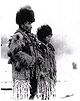
The Squamish Nation was formed in July 1923 [5] when several separate First Nations (at the time called Indian Bands) were amalgamated under Section 17 of the Indian Act. [6] All of the First Nations that amalgamated were communities largely considered and identified as Squamish People but resided on different First Nation reserve lands throughout the Squamish Valley, Burrard Inlet, and False Creek of Vancouver.

Two years of community meetings with held, with eventually a super-majority of eligible voters for the various First Nations voting to petition the Federal Department responsible for Indians to amalgamate the several First Nations into a single entity they called the Squamish Nation. Their petition called for a Council to represent the newly created Squamish Nation, all lands joined as Squamish Nation lands, and all trust accounts to be put into a single trust account. Approximately $167,740 was consolidated into a single trust account for the newly formed Squamish Nation (which is estimated to be $2,914,252.09 in 2022 dollars). [5]

Recent History

Prior to British Columbia's hosting of the 2010 Olympic Games, the Squamish Nation engaged in negotiations with the Provincial Government of British Columbia and Lil'wat First Nation. Numerous agreements were signed prior to and following the announcement of the host city for the Games, regarding issues such as Squamish land to be used for hosting the Games. Issues regarding the leasing of land, Nation-owned or operated businesses and other ventures currently account for much of the Squamish Nation's band council government business. The Squamish Nation recently announced the purchase of a Tree Farm License (License 38), which covers the Elaho Valley near Squamish, British Columbia.

The Squamish Nation has close ties with Tsleil-Waututh Nation, who reside further east on Burrard Inlet and to the Musqueam who reside on the southern edge of the city of Vancouver. [7]

Government

The elected councillors make up the executive political body of this government. They operate on a four-year term with elections occurring around in December. They also elect a band manager. The most recent Council was elected September 26, 2021. [8]

The elected Band Manager is Bianca "Tsiyaliya" Cameron.

Lands

Existing reserves

Indian reserves under the administration of the Squamish Nation are: [9]

Squamish Nation reserves
ReserveSquamish nameLocation descriptionAreaCoordinatesReference
Kitsilano Indian Reserve No. 6 Squamish : Sen̓áḵwIn the City of Vancouver, near English Bay, on the south side of the mouth of False Creek4.4 ha 49°16′26″N123°08′32″W / 49.27389°N 123.14222°W / 49.27389; -123.14222 [10]
Mission Indian Reserve No. 1 Squamish : Slhá7an̓North shore of Burrard Inlet on Wagg and Mosquito Creeks, bounded on the north and east by the City of North Vancouver59.6 ha 49°19′00″N123°06′00″W / 49.31667°N 123.10000°W / 49.31667; -123.10000 [11]
Seymour Creek Indian Reserve No. 2 Squamish : Ch'ich'éx̱wí7ḵwNorth shore of Burrard Inlet, on right bank of Seymour Creek, near the mouth of Second Narrows45.5 ha 49°18′00″N123°02′00″W / 49.30000°N 123.03333°W / 49.30000; -123.03333 [12]
Capilano Indian Reserve No. 5 Squamish : Xwmelch'stnNorth shore of Burrard Inlet at First Narrows, north end of Lions Gate Bridge155.6 ha 49°19′00″N123°08′00″W / 49.31667°N 123.13333°W / 49.31667; -123.13333 [13]
Skowishin Indian Reserve No. 7 Squamish : SkawshnLeft bank of the Squamish River29.6 ha 49°56′00″N123°18′00″W / 49.93333°N 123.30000°W / 49.93333; -123.30000 [14]
Skowishin Graveyard Indian Reserve No. 10Left bank of the Squamish River near the mouth of Ashlu Creek0.40 ha 49°54′32″N123°17′36″W / 49.9090097428499°N 123.29323705526882°W / 49.9090097428499; -123.29323705526882 [15]
Chukchuk Indian Reserve No. 8 Squamish : Ch’eḵ’ch’eḵ’ts0.1 ha 49°58′25″N123°18′21″W / 49.97359296702315°N 123.30573946023652°W / 49.97359296702315; -123.30573946023652 [16]
Poyam Indian Reserve No. 9Left bank of the Squamish River0.3 ha 49°59′24″N123°19′29″W / 49.98992070962588°N 123.324621110448°W / 49.98992070962588; -123.324621110448 [17]
Cheakamus Indian Reserve No. 11 Squamish : Xwakw’áyak’inAt and to the north of the junction of the Squamish and Cheakamus Rivers1639.4 ha 49°48′00″N123°11′00″W / 49.80000°N 123.18333°W / 49.80000; -123.18333 [18]
Yookwitz Indian Reserve No. 12 Squamish : Yewk’tsRight bank of the Squamish River, opposite mouth of the Cheakamus River9.3 ha 49°47′00″N123°12′00″W / 49.78333°N 123.20000°W / 49.78333; -123.20000 [19]
Poquiosin & Skamain Indian Reserve No. 13 Squamish : Pukway̓úsm-SkemínLeft bank of the Squamish River at the mouth of the Cheakamus River45.2 ha 49°47′00″N123°10′00″W / 49.78333°N 123.16667°W / 49.78333; -123.16667 [20]
Waiwakum Indian Reserve No. 14 Squamish : Wiwḵ’mLeft bank of the Squamish River 2 miles below the mouth of the Cheakamus River15.0 ha 49°46′00″N123°10′00″W / 49.76667°N 123.16667°W / 49.76667; -123.16667 [21]
Aikwucks Indian Reserve No. 15Left bank of the Squamish River11.1 ha 49°46′00″N123°10′00″W / 49.76667°N 123.16667°W / 49.76667; -123.16667 [22]
Seaichem Indian Reserve No. 16 Squamish : Siyích’mEast bank of Kowtain Slough of the Squamish River, 3 miles below the mouth of the Cheakamus River27.5 ha 49°45′00″N123°08′00″W / 49.75000°N 123.13333°W / 49.75000; -123.13333 [23]
Kowtain Indian Reserve No. 17 Squamish : Kaw̓tínLeft bank of Kowtain Slough of the Squamish River, 4 miles from the river mouth on Howe Sound20.8 ha 49°44′00″N123°08′00″W / 49.73333°N 123.13333°W / 49.73333; -123.13333 [24]
Yekwaupsum Indian Reserve No. 18 Squamish : Yekw’ápsmNear left bank of the Squamish River, 3 miles from its mouth on Howe Sound2 ha 49°43′00″N123°09′00″W / 49.71667°N 123.15000°W / 49.71667; -123.15000 [25]
Yekwaupsum Indian Reserve No. 19 Squamish : Pn’p’ániRight bank of the Squamish River, 3 miles north of its mouth on Howe Sound1 ha 49°44′00″N123°09′00″W / 49.73333°N 123.15000°W / 49.73333; -123.15000 [26]
Stawamus Indian Reserve No. 24 Squamish : St’á7mesAt the mouth of the Stawamus River at the head of Howe Sound, 1 mile southeast of downtown Squamish22.1 ha 49°41′00″N123°09′00″W / 49.68333°N 123.15000°W / 49.68333; -123.15000 [27]
Kaikalahun Indian Reserve No. 25 Squamish : Ḵ’iḵ’élx̱nWest shore of Howe Sound south of Port Mellon11.5 ha 49°31′00″N123°29′00″W / 49.51667°N 123.48333°W / 49.51667; -123.48333 [28]
Chekwelp Indian Reserve No. 26 Squamish : Ch’ḵw’elhpWest shore of Howe Sound, to the west of Keats Island11.3 ha 49°25′00″N123°30′00″W / 49.41667°N 123.50000°W / 49.41667; -123.50000 [29]
Chekwelp Indian Reserve No. 26A West shore of Howe Sound northwest of Keats Island0.2 ha 49°25′00″N123°29′00″W / 49.41667°N 123.48333°W / 49.41667; -123.48333 [30]
Schaltuuch Indian Reserve No. 27 Squamish : Ch’ḵw’elhpOn a small island north of Shelter Island in Shoal Channel of Howe Sound, west of Keats Island5 ha 49°24′00″N123°29′00″W / 49.40000°N 123.48333°W / 49.40000; -123.48333 [31]
Defence Island Indian Reserve No. 28 Squamish : Nínich Ḵw’émḵw’emIn Howe Sound, northeast from Anvil Island (Hat Island), the easterly of two islands called Defence Islands 1.7 ha 49°35′00″N123°16′00″W / 49.58333°N 123.26667°W / 49.58333; -123.26667 [32]
Kwum Kwum Indian Reserve Squamish : Ḵw’émḵw’emThe westerly of the two Defence Islands northeast of Anvil Island6.20 ha 49°35′00″N123°17′00″W / 49.58333°N 123.28333°W / 49.58333; -123.28333 [33]

Treaty negotiations

The Squamish Nation is currently in stage 3 of the BC Treaty Process but negotiations have not proceeded further in recent years.

Economic and resource development

The Squamish Nation owns land in the Lower Mainland in areas that have some of the highest real estate values in the province. Some of these lands and properties are leased out with rents returning to the Squamish Nation. Additional revenues are earned through businesses owned by the Squamish Nation, such as marinas, a driving range and a gas bar. [34] In a recently concluded business arrangement, digital billboards were erected on Squamish Nation lands in North Vancouver, West Vancouver, Vancouver and Squamish, including at the approaches to Vancouver's Burrard Street Bridge, Lions Gate Bridge and Ironworkers Memorial Second Narrows Crossing. [35] That contract has been projected to bring approximately $60 million in revenue to the Squamish Nation over three decades.

The Squamish Nation also recently completed an agreement that will see a large gaming facility built on the highway leading into Squamish.

The Squamish Nation, the Lil’wat Nation, Bell Canada and the Province of BC joined in the development of the Aboriginal Cultural Centre and Museum in Whistler BC.

The purchase of a Tree Farm Licence by the Nation generated public protest. [36]

In recent years the Squamish Nation has been involved in energy development, including the development of private hydro power projects on public rivers, including the Furry Creek and Ashlu hydro projects. It takes a share of the private revenue scheme developed by the BC Liberal Government under Gordon Campbell in a closed-door policy called the BC Energy Plan. [37]

2010 Olympic Games

The Squamish Nation joined with the Musqueam, Tsleil-Waututh, and Lil'wat through the Four Host First Nations Society to coordinate with the Vancouver Organizing Committee (VANOC), representing their interests in preparation for the 2010 Winter Olympics. [38] These 'Four Host First Nations' shared in hosting the 2010 Olympic Games in Vancouver. [34] Fourteen of the 20 Olympic and Paralympic events took place in the Nation's shared territories, primarily in and around Whistler, BC.

Social, educational and cultural programs and facilities

In July 2008, the Squamish Nation partnered with their neighbours the Lil'wat First Nation to open the multimillion-dollar Squamish Lilwat Cultural Centre in Whistler. The two nations, whose territories traditionally overlapped around the Whistler area, had signed a Protocol Agreement in 2001 to work together on such opportunities. The centre features traditional art, cultural and historical displays, wood carvings, an 80-seat theatre, longhouse, pit-house, outdoor forest walk, cafe and gift shop.

See also

Related Research Articles

<span class="mw-page-title-main">Kitsilano</span> Neighbourhood of Vancouver in British Columbia, Canada

Kitsilano is a neighbourhood located in the city of Vancouver, British Columbia, Canada. Kitsilano is named after Squamish chief August Jack Khatsahlano, and the neighbourhood is located in Vancouver's West Side along the south shore of English Bay, between the neighbourhoods of West Point Grey and Fairview. The area is mostly residential with two main commercial areas, West 4th Avenue and West Broadway, known for their retail stores, restaurants and organic food markets.

<span class="mw-page-title-main">Burrard Inlet</span> Coastal fjord in southwestern British Columbia, Canada

Burrard Inlet is a shallow-sided fjord in the northwestern Lower Mainland, British Columbia, Canada. Formed during the last Ice Age, it separates the City of Vancouver and the rest of the lowland Burrard Peninsula to the south from the coastal slopes of the North Shore Mountains, which span West Vancouver and the City and District of North Vancouver to the north.

<span class="mw-page-title-main">False Creek</span> Inlet in Vancouver, British Columbia, Canada

False Creek is a short narrow inlet in the heart of Vancouver, separating the Downtown and West End neighbourhoods from the rest of the city. It is one of the four main bodies of water bordering Vancouver, along with English Bay, Burrard Inlet, and the Fraser River. Granville Island is located within the inlet.

<span class="mw-page-title-main">Greater Vancouver</span> Metropolitan area in British Columbia, Canada

Greater Vancouver, also known as Metro Vancouver, is the metropolitan area with its major urban centre being the city of Vancouver, British Columbia, Canada. The term "Greater Vancouver" describes an area that is roughly coterminous with the region governed by the Metro Vancouver Regional District (MVRD), though it predates the 1966 creation of the regional district. It is often used to include areas beyond the boundaries of the regional district but does not generally include wilderness and agricultural areas that are included within the MVRD.

First Nations in British Columbia constitute many First Nations governments and peoples in the province of British Columbia. Many of these Indigenous Canadians are affiliated in tribal councils. Ethnic groups include the Haida, Coast Salish, Kwakwaka'wakw, Gitxsan, Tsimshian, Nisga'a and other examples of the Pacific Northwest Coast cultures, and also various Interior Salish and Athapaskan peoples, and also the Ktunaxa.

<span class="mw-page-title-main">Tsleil-Waututh First Nation</span> Autonomous area in British Columbia, Canada

The Tsleil-Waututh Nation, formerly known as the Burrard Indian Band or Burrard Inlet Indian Band, is a First Nations band government in the Canadian province of British Columbia. The Tsleil-Waututh Nation ("TWN") are Coast Salish peoples who speak hən̓q̓əmin̓əm̓, the Downriver dialect of the Halkomelem language, and are closely related to but politically and culturally separate from the nearby nations of the Sḵwx̱wú7mesh (Squamish) and xʷməθkʷəy̓əm (Musqueam), with whose traditional territories some claims overlap.

<span class="mw-page-title-main">Say Nuth Khaw Yum Provincial Park</span> Provincial park in British Columbia, Canada

Say Nuth Khaw Yum Provincial Park, also known as Indian Arm Provincial Park, is a provincial park located in the Lower Mainland of British Columbia, Canada. The park was established on July 13, 1995 by BC Parks to protect the forested mountain terrain of Indian Arm.

<span class="mw-page-title-main">West Point Grey</span> Neighbourhood in Metro Vancouver, British Columbia, Canada

West Point Grey is a neighbourhood in the northwest of the city of Vancouver, British Columbia, Canada. It is on Point Grey and bordered by 16th Avenue to the south, Alma Street to the east, English Bay to the north, and Blanca Street to the west. Notable beaches within West Point Grey include Spanish Banks, Locarno and Jericho. Immediately to the south is Pacific Spirit Regional Park and to the east is Kitsilano.

<span class="mw-page-title-main">Indian Arm</span> Fjord in British Columbia

Indian Arm is a steep-sided glacial fjord adjacent to the city of Vancouver in southwestern British Columbia. Formed during the last Ice Age, it extends due north from Burrard Inlet, between the communities of Belcarra and the District of North Vancouver, then on into mountainous wilderness. Burrard Inlet and the opening of Indian Arm was mapped by Captain George Vancouver and fully explored days later by Dionisio Alcalá Galiano in June 1792.

The Squamish people are an indigenous people of the Pacific Northwest Coast. Archaeological evidence shows they have lived in the area for more than a thousand years. In 2012, there was population of 3,893 band members registered with the Squamish Nation. Their language is the Squamish language or Sḵwx̱wú7mesh snichim, considered a part of the Coast Salish languages, and is categorized as nearly extinct with just 10 fluent speakers as of 2010. The traditional territory is in the area now in southwestern British Columbia, Canada, and covers Point Grey as the southern border. From here, it continues northward to Roberts Creek on the Sunshine Coast, up the Howe Sound. The northern part includes the Squamish, Cheakamus, Elaho and Mamquam rivers. Up the Cheakamus River it includes land past Whistler, British Columbia. The southern and eastern part of their territory includes Indian Arm, along Burrard Inlet, through False Creek then English Bay and Point Grey. Today the Squamish people live mostly in seven communities, located in West Vancouver, North Vancouver, and within and nearby to the District of Squamish.

Naut’sa mawt Tribal Council is a First Nations Tribal Council located in British Columbia, Canada, with offices in Tsawwassen and Nanaimo. NmTC advises and assists its 11-member Nations in the areas of Community Planning, Economic Development, Financial Management, Governance and Technical Services NmTC is also actively involved in fostering dialogue and understanding between its members and their neighbouring communities.

X̱wáýx̱way or x̌ʷay̓x̌ʷəy̓ , rendered in English as Xway xway and Whoiwhoi, is a First Nations village site, located in what is now Stanley Park in Vancouver, British Columbia, Canada. The village was located on the eastern peninsula of the park, near what is now Lumberman's Arch. The village was home for many Squamish, Musqueam and Tsleil-waututh people, but after European colonization began in the Vancouver area, the inhabitants were forced to re-locate to nearby villages. The village was named for a mask ceremony; thus, the best translation of x̱wáýx̱way would be "masked dance performance".

Jody Broomfield is a Canadian artist working in the Coast Salish tradition. His work includes several coin designs for the Royal Canadian Mint.

St Paul’s Indian Residential School was a Canadian Indian residential school located in the City of North Vancouver, in the 500 block of West Keith Road on what is now the parking lot of the St. Thomas Aquinas Regional Secondary School. It was a Roman Catholic school operated from 1899 to 1958 by the Order of the Oblates of Mary Immaculate. The students of the school came from the adjacent Mission Reserve as well other Squamish, Tsleil-Waututh and Musqueam peoples.

<span class="mw-page-title-main">History of Squamish and Tsleil-Waututh longshoremen, 1863–1963</span>

In the late 1870s, Squamish and Tsleil-Waututh communities on the North Shore of Burrard Inlet experienced an increase of physical and economic encroachment from the expansion of neighbouring Vancouver. Faced with urbanization and industrialization around reserve lands, Squamish and Tsleil-Waututh traditional economies became increasingly marginalized, while government-imposed laws increasingly restricted Native fishing, hunting, and access to land and waters for subsistence. In response, these communities increasingly turned to participating in the wage-labor economy.

<span class="mw-page-title-main">Ian Campbell (Canadian politician)</span>

Ian Campbell is an Indigenous Canadian politician. He is one of many hereditary chiefs, also known as head of family, and an elected councillor of the Squamish Nation. He serves as the chair of the Indigenous Partnerships Success Showcase, a business conference focused on economic reconciliation and partnerships between industry and Indigenous community. The event takes place annually in Vancouver, British Columbia. Campbell also serves on the board of MST Development Corporation (MST), a corporate entity which manages real estate properties owned by a partnership between the Musqueam Indian Band, the Squamish Nation, and the Tsleil-Waututh Nation. In 2018, he became the Vision Vancouver mayoral candidate for the 2018 Vancouver municipal election, but withdrew before the election.

Qayqayt was the name of an indigenous community located in the Brownsville area of Surrey, British Columbia. The community was part of the Kwantlen and Musqueam First Nations. It was used as a site for fishing by many different First Nations, including the Kwantlen, Musqueam, Squamish, Katzie, Kwikwetlem, Semiahmoo, Tsleil-waututh, and Tsawwassen.

Chrystal Sparrow is a traditional and contemporary Musqueam Coast Salish artist living in Vancouver, British Columbia on unceded Coast Salish territory.

References

  1. "About Page – Squamish Nation Website" . Retrieved 2023-08-31.
  2. 1 2 "About Page – Squamish Nation Website" . Retrieved 2023-08-31.
  3. "About Page – Squamish Nation Website" . Retrieved 2023-08-31.
  4. "MST Development Corp. is about First Nations becoming 'powerful in our territories once again' – Vancouver Sun" . Retrieved 2023-08-31.
  5. 1 2 "Squamish Nation to mark 100 years since watershed political merger - CBC" . Retrieved 2023-08-31.
  6. "Section 17 of the Indian Act (R.S.C., 1985, c. I-5) - Government of Canada" . Retrieved 2023-08-31.
  7. "MST Development Corporation - The Partners" . Retrieved 2023-08-31.
  8. "Nexwsxwníw̓ntm ta Úxwumixw Council". Squamish Nation. Archived from the original on 2022-01-21. Retrieved 2022-09-02.
  9. "Reserves/Settlements/Villages". Indigenous and Northern Affairs Canada . Government of Canada.
  10. "BC Geographical Names". apps.gov.bc.ca. Archived from the original on 2016-03-04. Retrieved 2022-09-02.
  11. "BC Geographical Names". apps.gov.bc.ca. Archived from the original on 2022-10-18. Retrieved 2022-09-02.
  12. "BC Geographical Names". apps.gov.bc.ca. Archived from the original on 2016-03-04. Retrieved 2022-09-02.
  13. "BC Geographical Names". apps.gov.bc.ca. Archived from the original on 2016-03-04. Retrieved 2022-09-02.
  14. "BC Geographical Names". apps.gov.bc.ca. Archived from the original on 2016-03-04. Retrieved 2022-09-02.
  15. "BC Geographical Names". apps.gov.bc.ca. Archived from the original on 2014-03-01. Retrieved 2022-09-02.
  16. "BC Geographical Names". apps.gov.bc.ca. Archived from the original on 2016-03-04. Retrieved 2022-09-02.
  17. "BC Geographical Names". apps.gov.bc.ca. Archived from the original on 2016-03-04. Retrieved 2022-09-02.
  18. "BC Geographical Names". apps.gov.bc.ca. Archived from the original on 2016-03-04. Retrieved 2022-09-02.
  19. "BC Geographical Names". apps.gov.bc.ca. Archived from the original on 2016-03-04. Retrieved 2022-09-02.
  20. "BC Geographical Names". apps.gov.bc.ca. Archived from the original on 2016-03-04. Retrieved 2022-09-02.
  21. "BC Geographical Names". apps.gov.bc.ca. Archived from the original on 2014-03-01. Retrieved 2022-09-02.
  22. "BC Geographical Names". apps.gov.bc.ca. Archived from the original on 2016-03-04. Retrieved 2022-09-02.
  23. "BC Geographical Names". apps.gov.bc.ca. Archived from the original on 2016-03-04. Retrieved 2022-09-02.
  24. "BC Geographical Names". apps.gov.bc.ca. Archived from the original on 2016-03-04. Retrieved 2022-09-02.
  25. "BC Geographical Names". apps.gov.bc.ca. Archived from the original on 2016-03-04. Retrieved 2022-09-02.
  26. "BC Geographical Names". apps.gov.bc.ca. Archived from the original on 2016-03-04. Retrieved 2022-09-02.
  27. "BC Geographical Names". apps.gov.bc.ca. Archived from the original on 2022-10-18. Retrieved 2022-09-02.
  28. "BC Geographical Names". apps.gov.bc.ca. Archived from the original on 2022-03-24. Retrieved 2022-09-02.
  29. "BC Geographical Names". apps.gov.bc.ca. Archived from the original on 2022-10-18. Retrieved 2022-09-02.
  30. "BC Geographical Names". apps.gov.bc.ca. Archived from the original on 2016-03-04. Retrieved 2022-09-02.
  31. "BC Geographical Names". apps.gov.bc.ca. Archived from the original on 2022-10-18. Retrieved 2022-09-02.
  32. "BC Geographical Names". apps.gov.bc.ca. Archived from the original on 2014-03-01. Retrieved 2022-09-02.
  33. "BC Geographical Names". apps.gov.bc.ca. Archived from the original on 2016-03-04. Retrieved 2022-09-02.
  34. 1 2 "Squamish Nation Fact Sheet" (PDF). Retrieved November 24, 2011.
  35. Hall, Neal (July 21, 2006). "Billboards planned near city bridges". Vancouver Sun . Archived from the original on 2007-03-27. Retrieved 2007-02-19.
  36. Penner, Derrick (2005-12-28) [December 20, 2005]. "Squamish Nation Buys Tree Farm License 38". Vancouver Sun . Archived from the original on 2012-02-05. Retrieved 2022-09-02 via mostlywater.org.
  37. "The BC Energy Plan: A Vision for Clean Energy Leadership". Archived from the original on December 24, 2011. Retrieved November 24, 2011.
  38. "Four Host First Nations Society - Home". fourhostfirstnations.com. Archived from the original on 2010-01-08. Retrieved 2022-11-23.{{cite web}}: CS1 maint: unfit URL (link)