Related Research Articles

Cowichan Bay is a bay and community located on the east coast of southern Vancouver Island near Duncan, in British Columbia, Canada. The mouth of the Cowichan River is near Cowichan Bay. Mount Tzouhalem with its hiking trails and ecological reserve stands to the north. The bay is known for its fishing and scenic value. The area's main industries are fishing and tourism.
Esquimalt—Juan de Fuca is a former federal electoral district in the province of British Columbia, Canada, which was represented in the House of Commons of Canada from 1988 to 2015

Fort Victoria began as a fur trading post of the Hudson's Bay Company and was the headquarters of HBC operations in the Columbia District, a large fur trading area now part of the province of British Columbia, Canada and the U.S. state of Washington. Construction of Fort Victoria in 1843 highlighted the beginning of a permanent British settlement now known as Victoria, the capital city of British Columbia. The fort itself was demolished in November 1864 as the town continued to grow as a commercial centre serving the local area as well as trading with California, Washington Territory, the United Kingdom, and others.
Juan de Fuca-Malahat is a provincial electoral district for the Legislative Assembly of British Columbia, Canada created by the 2021 British Columbia electoral redistribution that will come into effect in 2024. It has near-identical boundaries to the provincial electoral district of Malahat-Juan de Fuca in use from 1991 to 2009.
The Western Communities, also called the West Shore or Westshore, is the suburban municipalities of Colwood, Langford, Metchosin and The Highlands, Langford and unincorporated districts west of Esquimalt Harbour and Portage Inlet, and south of the Malahat in the Capital Regional District of British Columbia, Canada. The Town of View Royal, which straddles Esquimalt Harbour, may also be included. It is an area of growing residential subdivisions and commercial centres.
Royal Roads is a roadstead or anchorage located in Strait of Juan de Fuca near the entrance to Esquimalt Harbour in Greater Victoria, British Columbia, Canada.

Fort Rodd Hill National Historic Site is a 19th-century coastal artillery fort on the Colwood side of Esquimalt Harbour,. The site is adjacent to Fisgard Lighthouse National Historic Site, the first lighthouse on the west coast of Canada. Both the fort and lighthouse are managed and presented to the public by Parks Canada.
Cowichan Tribes is the band government of the Cowichan, a group of Coast Salish peoples who live in the Cowichan Valley region on Vancouver Island. With over 3,800 registered members, it is the single largest First Nations band in British Columbia.

Thetis Lake is a name that refers to two freshwater lakes connected by a narrow culvert in the 834-hectare (2,060-acre) Thetis Lake Regional Park outside Victoria, British Columbia, about 12 km (7.5 mi) from the city centre. The lake was likely named for the frigate HMS Thetis, which had been assigned to Esquimalt as part of the Royal Navy's Pacific Squadron. The two lakes are extremely popular as a swimming destination in the summer.

Victoria Harbour is a harbour, seaport, and seaplane airport in the Canadian city of Victoria, British Columbia. It serves as a cruise ship and ferry destination for tourists and visitors to the city and Vancouver Island. It is both a port of entry and an airport of entry for general aviation. Historically it was a shipbuilding and commercial fishing centre. While the Inner Harbour is fully within the City of Victoria, separating the city's downtown on its east side from the Victoria West neighbourhood, the Upper Harbour serves as the boundary between the City of Victoria and the district municipality of Esquimalt. The inner reaches are also bordered by the district of Saanich and the town of View Royal. Victoria is a federal "public harbour" as defined by Transport Canada. Several port facilities in the harbour are overseen and developed by the Greater Victoria Harbour Authority, however the harbour master's position is with Transport Canada.
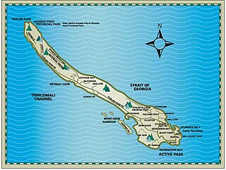
Parker Island is a roughly 400-acre (160 ha) island in the Southern Gulf Islands of British Columbia, Canada. It forms the western side of Montague Harbour, sheltering it from the strong wind gusts of Trincomali Channel. The island may be reached by floatplane, private boat, helicopter or water taxi; there is no public ferry service.
CILS-FM is a Canadian radio station, which broadcasts at 107.9 FM in Victoria, British Columbia. Branded as Radio Victoria, the station airs a community radio format for the region's Franco-Columbian community.
The Tseycum First Nation is a First Nations government located on Vancouver Island. In the 1850s they were signatories to the Douglas Treaties.
Albert Head is a neighbourhood in Metchosin, British Columbia, Canada, part of the Western Communities area of Greater Victoria, British Columbia, Canada. It is located around and named after the headland of Albert Head, which is Department of National Defence property. Canadian Forces Base (CFB) Esquimalt operates CFB Albert Head which contains the British Columbia Canadian Ranger Company of the 4th Canadian Ranger Patrol Group, CFB Esquimalt Range Control, the Naval Tactical Operations Group (MTOG) and previously the Regional Cadet Support Unit (Pacific) which hosted Cadet summer training at the camp. Albert Head Lagoon derives its name from the headland that was named by the Royal Navy for Prince Albert.
HMCS Malahat is a Royal Canadian Navy Reserve Division (NRD) located in Victoria, British Columbia. Dubbed a stone frigate, HMCS Malahat is a land-based naval training establishment for part-time sailors as well as a local recruitment centre for the Canadian Naval Reserve. It is one of 24 naval reserve divisions in major cities across Canada.

Victoria West, commonly called Vic West, is an historic neighbourhood of the city of Victoria, British Columbia, Canada, located just west of downtown across Victoria Harbour, bordering on the Township of Esquimalt.

Esquimalt and Nanaimo Railway Roundhouse in Victoria, British Columbia, was completed in 1913 and designated a historic building in 1992. The roundhouse has been virtually unchanged since its construction. It is surrounded by railway shops and outbuildings, representative of the steam railway era in Canada, once serving its namesake railway.
Fleming Bay is located in Esquimalt, adjacent to the city of Victoria, British Columbia, Canada. Fleming Bay is one of entrances to Macaulay Point and Buxton Green.
Signal Hill is a hill in Esquimalt, British Columbia, Canada, located on the south side of Constance Cove in CFB Esquimalt.
References
- ↑ "First Nations Profiles". services.sac-isc.gc.ca. Crown-Indigenous Relations and Northern Affairs Canada. Retrieved 2024-06-13.
48°25′50″N123°24′53″W / 48.4306°N 123.4147°W
| | This First Nations in Canada-related article is a stub. You can help Wikipedia by expanding it. |