Drafted | 1850–1854 |
---|---|
Location | Colony of Vancouver Island |
Parties | |
Language | English |
The Douglas Treaties, also known as the Vancouver Island Treaties or the Fort Victoria Treaties, were a series of treaties signed between a number of First Nations of Vancouver Island and the Colony of Vancouver Island.
With the signing of the Oregon Treaty in 1846, the Hudson's Bay Company (HBC) determined that its trapping rights in the Oregon Territory were tenuous. Thus in 1849, it moved its western headquarters from Fort Vancouver on the Columbia River (present-day Vancouver, Washington) to Fort Victoria. Fort Vancouver's Chief Factor, James Douglas, was relocated to the young trading post to oversee the company's operations west of the Rockies.
This development prompted the British colonial office to designate the territory a crown colony on January 13, 1849. The new Colony of Vancouver Island was leased to the HBC for a ten-year period, and Douglas was charged with encouraging British settlement. [1] Richard Blanshard was named the colony's governor. Blanshard discovered that the hold of the HBC over the affairs of the new colony was all but absolute, and that it was Douglas who held all practical authority in the territory. There was no civil service, no police, no militia, and virtually every British colonist was an employee of the HBC.[ citation needed ]
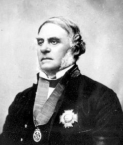
As the colony expanded the HBC started buying up lands for colonial settlement and industry from First Nations on Vancouver Island. [2] For four years Governor James Douglas, made a series of fourteen land purchases from First Nations.
To negotiate the terms, Douglas met first in April 1850 with leaders of the Lekwungen people (now Songhees and Esquimalt First Nations), and made verbal agreements. Each leader made an X at the bottom of a blank ledger. [3] The actual terms of the treaty were only incorporated in August, and modelled on the New Zealand Company's deeds of purchase for Maori land, used after the signing of Treaty of Waitangi. [4]
The Douglas Treaties cover approximately 930 square kilometres (360 sq mi) of land around Victoria, Saanich, Sooke, Nanaimo and Port Hardy, all on Vancouver Island, that were exchanged for cash, clothing and blankets. The terms of the treaties promised that they would be able to retain existing village lands and fields for their use, and also would be allowed to hunt and fish on the surrendered lands. [5]
These fourteen land purchases became the Douglas Treaties. Douglas didn't continue buying land due to lack of money and the slow growth of the Vancouver Island colony. [2] Along with Treaty 8, the Douglas Treaties were the last treaties signed between the Crown and the First Nations in British Columbia until Nisga'a Final Agreement.
The treaties are controversial for a number of reasons and have been subject to numerous court cases. One of the major sources of dispute regarding the treaties is the actual terms of the treaties were left blank at the time of signing and a number of clauses and pages were instead inserted at a later date. [6]
The treaties were signed during a period of severe cultural destruction in which the Songhees had experienced precipitous population decline, due to the arrival of foreign diseases. The treaties remain highly controversial given that it is unclear whether the Indigenous leaders knew exactly what they were signing over.
Treaty Group Name | Modern First Nation (band government) | Date | Land covered by Treaty | Money exchanged for land | Ref |
---|---|---|---|---|---|
Teechamitsa | Esquimalt First Nation | 29 April 1850 | Country lying between Esquimalt and Point Albert | £27 10 shillings (UK £3,714 in 2025) | [7] |
Kosampson | Esquimalt First Nation | 30 April 1850 | Esquimalt Peninsula and Colquitz Valley | £52 10 shillings (UK £7,091 in 2025) | [7] |
Whyomilth | Esquimalt First Nation | 30 April 1850 | Northwest of Esquimalt Harbour | £30 (UK £4,052 in 2025) | [7] |
Chewhaytsum | Becher Bay Band | 1 May 1850 | Sooke | £45 ten shillings (UK £6,146 in 2025) | [7] |
Chilcowitch | Songhees First Nation | 30 April 1850 | Point Gonzales | £45 (UK £6,078 in 2025) | [7] |
Che-ko-nein | Songhees First Nation | 30 April 1850 | Point Gonzales to Cedar Hill | £79 10 shillings (UK £10,738 in 2025) | [7] |
Sooke | T'sou-ke Nation | 10 May 1850 | Northwest of Sooke Inlet | £48 6 shillings 8 pence (UK £6,537 in 2025) | [7] |
Ka-ky-aakan | Becher Bay Band | 1 May 1850 | Metchosin | £43 6 shillings 8 pence (UK £5,862 in 2025) | [7] |
Saanich Tribe (South) | Tsawout First Nation and Tsartlip First Nation | 7 February 1852 | South Saanich | £41 13 shillings 4 pence (UK £5,619 in 2025) | [7] |
Saanich Tribe (North) | Pauquachin First Nation and Tseycum First Nations | 11 February 1852 | North Saanich | [amount not stated] | [7] |
Saalequun | Snuneymuxw First Nation | 23 December 1854 | [area not stated] | [amount not stated] | [7] |
Swengwhung | Songhees First Nation | 30 April 1850 | [area not stated] | [amount not stated] | [7] |
Queackar | Kwakiutl (Kwawkelth) Band | February 1851 | Fort Rupert | £64 (UK £8,645 in 2025) | [7] |
Quakiolth | Kwakiutl (Kwawkelth) Band | February 1851 | Fort Rupert | £86 (UK £11,616 in 2025) | [7] |
Vancouver Island is an island in the northeastern Pacific Ocean and part of the Canadian province of British Columbia. The island is 456 km (283 mi) in length, 100 km (62 mi) in width at its widest point, and 32,100 km2 (12,400 sq mi) in total area, while 31,285 km2 (12,079 sq mi) are of land. The island is the largest by area and the most populous along the west coasts of the Americas.
Fort Vancouver was a 19th-century fur trading post built in the winter of 1824–1825. It was the headquarters of the Hudson's Bay Company's Columbia Department, located in the Pacific Northwest. Named for Captain George Vancouver, the fort was located on the northern bank of the Columbia River in present-day Vancouver, Washington. The fort was a major center of the regional fur trading. Every year trade goods and supplies from London arrived either via ships sailing to the Pacific Ocean or overland from Hudson Bay via the York Factory Express. Supplies and trade goods were exchanged with a plethora of Indigenous cultures for fur pelts. Furs from Fort Vancouver were often shipped to the Chinese port of Guangzhou where they were traded for Chinese manufactured goods for sale in the United Kingdom. At its pinnacle, Fort Vancouver watched over 34 outposts, 24 ports, six ships, and 600 employees. Today, a full-scale replica of the fort, with internal buildings, has been constructed and is open to the public as Fort Vancouver National Historic Site.
The Township of Esquimalt is a municipality at the southern tip of Vancouver Island, in British Columbia, Canada. It is bordered to the east by the provincial capital, Victoria, to the south by the Strait of Juan de Fuca, to the west by Esquimalt Harbour and Royal Roads, to the northwest by the New Songhees 1A Indian reserve and the town of View Royal, and to the north by a narrow inlet of water called the Gorge, across which is the district municipality of Saanich. It is almost tangential to Esquimalt 1 Indian Reserve near Admirals Road. It is one of the 13 municipalities of Greater Victoria and part of the Capital Regional District.
The history of British Columbia covers the period from the arrival of Paleo-Indians thousands of years ago to the present day. Prior to European colonization, the lands encompassing present-day British Columbia were inhabited for millennia by a number of First Nations.
New Caledonia was a fur-trading district of the Hudson's Bay Company that comprised the territory of the north-central portions of present-day British Columbia, Canada. Though not a British colony, New Caledonia was part of the British claim to North America. Its administrative centre was Fort St. James. The rest of what is now mainland British Columbia was called the Columbia Department by the British, and the Oregon Country by the Americans. Even before the partition of the Columbia Department by the Oregon Treaty in 1846, New Caledonia was often used to describe anywhere on the mainland not in the Columbia Department, such as Fort Langley in the Fraser Valley.
Sir James Douglas, was a Canadian fur trader and politician who became the first Governor of the Colony of British Columbia. He is often credited as "The Father of British Columbia". He was instrumental to the resettlement of 35 African Americans fleeing a life of racial persecution in San Francisco who arrived in the province aboard the steamship Commodore in what later became known as the Pioneer Committee. In 1863, Douglas was knighted by Queen Victoria for his services to the Crown.
Fort Victoria began as a fur trading post of the Hudson's Bay Company and was the headquarters of HBC operations in the Columbia District, a large fur trading area now part of the province of British Columbia, Canada and the U.S. state of Washington. Construction of Fort Victoria in 1843 highlighted the beginning of a permanent British settlement now known as Victoria, the capital city of British Columbia. The fort itself was demolished in November 1864 as the town continued to grow as a commercial centre serving the local area as well as trading with California, Washington Territory, the United Kingdom, and others.
Richard Blanshard MA was an English barrister and first governor of the Colony of Vancouver Island from its foundation in 1849 to his resignation in 1851.
Joseph Despard Pemberton was a surveyor for the Hudson's Bay Company, Surveyor General for the Colony of Vancouver Island, a pre-Confederation politician, a businessman and a farmer. He was born in 1821 in Dublin, Ireland and died in 1893 in Oak Bay, British Columbia. Joseph Pemberton laid out Victoria's town site, southern Vancouver Island and townsites along the Fraser River. He married Teresa Jane Grautoff and they are the parents of Canadian painter Sophie Pemberton. The town of Pemberton was named after him.
The Colony of Vancouver Island, officially known as the Island of Vancouver and its Dependencies, was a Crown colony of British North America from 1849 to 1866, after which it was united with the mainland to form the Colony of British Columbia. The united colony joined Canadian Confederation, thus becoming part of Canada, in 1871. The colony comprised Vancouver Island and the Gulf Islands of the Strait of Georgia.
The Colony of British Columbia was a British Crown Colony that resulted from the 1866 merger of two British colonies, the Colony of Vancouver Island and the mainland Colony of British Columbia. The united colony existed until its incorporation into Canadian Confederation in 1871 as the Province of British Columbia.
The Colony of British Columbia was a crown colony in British North America from 1858 until 1866 that was founded by Richard Clement Moody, who was selected to 'found a second England on the shores of the Pacific', who was Chief Commissioner of Lands and Works for British Columbia and the first Lieutenant-Governor of British Columbia. Prior to the arrival of Moody's Royal Engineers, Columbia Detachment, the Colony's supreme authority was its Governor James Douglas, who was the Governor of the neighbouring colony of Vancouver Island.
John Sebastian Helmcken was a British Columbia physician who played a prominent role in bringing the province into Canadian Confederation. He was also the founding president of the British Columbia Medical Association.
Malahat First Nation is a Coast Salish First Nations community of W̱SÁNEĆ representing approximately 350 members with two reserve lands located on the western shore of Saanich Inlet, Vancouver Island in British Columbia, Canada. The Malahat First Nation is one of many nations within the Coastal Salish group that live on their traditional lands. The Coastal Salish are Indigenous to the Northwest mainland, coast, and islands. The Malahat First Nation is a member nation of the Naut'sa mawt Tribal Council and was the ninth First Nation in Canada to be certified by the First Nations Financial Management Board. The ancestral languages of Malahat Nation are Hul̓q̓umín̓um̓ and SENĆOŦEN. The Hul̓q̓umín̓um̓ or Halkomelem language is spoken in Washington State and British Columbia and is within the Coastal Salish language family. Currently it is being revitalized, as it is mainly spoken by elders in the community. The Chief of Malahat Nation is George Harry. George served on the council for four years before being elected as Chief on June 10, 2019.
The Lekwungen peoples are a Coast Salish people who reside on southeastern Vancouver Island, British Columbia in the Greater Victoria area. They are represented by the Songhees and Esquimalt First Nations. Their traditional language is Lekwungen, a dialect of the North Straits Salish language.
The Elk/Beaver Regional Park is a 1,072-acre (434 ha) park in Saanich, British Columbia, containing Elk Lake and Beaver Lake.
The Chatham Islands are a group of islands off the east coast of Oak Bay, British Columbia, Canada. All the islands are in Chatham Islands Indian Reserve No. 4, under the control of the Songhees First Nation. The island foreshore, defined as the land between low tide and the beginning of land-based vegetation, is provincial Crown land.
The Tsawout First Nation is a First Nations government located on Vancouver Island, British Columbia, Canada. They are a member of the Sencot'en Alliance. In the 1850s they were signatories to the Douglas Treaties. They speak the SENĆOŦEN language.
The Tsartlip First Nation is a First Nation located on the Saanich Peninsula, in Saanich territory on Vancouver Island. They are a member of the Sencot'en Alliance fighting for Native rights. In the 1850s, they were signatories to one of the Douglas Treaties.
The 1862 Pacific Northwest smallpox epidemic was a smallpox outbreak that started in Victoria on Vancouver Island and spread among the indigenous peoples of the Pacific Northwest Coast and into the indigenous peoples of the Northwest Plateau, killing a large portion of natives from the Puget Sound region to Southeast Alaska. Two-thirds of British Columbia natives died—around 20,000 people. The death rate was highest in southeast Alaska and Haida Gwaii—over 70% among the Haida and 60% among the Tlingit. Almost all native nations along the coast, and many in the interior, were devastated, with a death rate of over 50% for the entire coast from Puget Sound to Sitka, Alaska, part of Russian America at the time. In some areas the native population fell by as much as 90%. The disease was controlled among colonists in 1862 but it continued to spread among natives through 1863.