
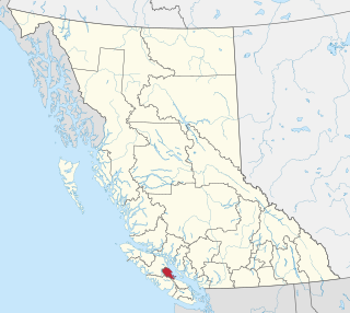
Vancouver Island is an island in the northeastern Pacific Ocean and part of the Canadian province of British Columbia. The island is 456 km (283 mi) in length, 100 km (62 mi) in width at its widest point, and 32,100 km2 (12,400 sq mi) in total area, while 31,285 km2 (12,079 sq mi) are of land. The island is the largest by area and the most populous along the west coasts of the Americas.

Soldotna is a city in the Kenai Peninsula Borough in the U.S. state of Alaska. At the 2020 census, the population was 4,342, up from 4,163 in 2010. It is the seat of the Kenai Peninsula Borough.
Campbell River is a city in British Columbia on the east coast of Vancouver Island at the south end of Discovery Passage, which lies along the 50th parallel north along the important Inside Passage shipping route. Campbell River has a population of 35,138 and has long been touted as the "salmon capital of the world." Campbell River and Region are near the communities of Quadra and the Discovery Islands, Sayward, Oyster River, Gold River, Tahsis and Zeballos.
Highway 19A, known locally as the Oceanside Route or the Old Island Highway, is a provincial highway in British Columbia, Canada. It runs along two former sections of Highway 19 on Vancouver Island, within Nanaimo and between Craig's Crossing and Campbell River. The section of Highway 19A between Craig's Crossing and Campbell River is 136.89 km (85.06 mi) long, and the Nanaimo alignment covers 10.64 km (6.61 mi). The highway was established after Highway 19 was realigned to a new road between 1996 and 2001.

Comox is a town on the southern coast of the Comox Peninsula in the Strait of Georgia on the eastern coast of Vancouver Island, British Columbia. Thousands of years ago, the warm dry summers, mild winters, fertile soil, and abundant sea life attracted First Nations, who called the area kw'umuxws.

Parksville is a city on Vancouver Island in British Columbia, Canada. As of the 2021 Census, Parksville's population was 13,642, representing a 9.5% increase over the 2016 Census.

Qualicum Beach is a town located on Vancouver Island, British Columbia, Canada. In the 2021 census, it had a population of 9,303. It is situated at the foot of Mount Arrowsmith, along the Strait of Georgia on Vancouver Island's northeastern coast.

Courtenay is a city of about 26,000 on the east coast of Vancouver Island, in the Canadian province of British Columbia. It is the largest community and only city in the area commonly known as the Comox Valley, and the seat of the Comox Valley Regional District, which replaced the Comox-Strathcona Regional District. Courtenay is 4 km (2.5 mi) west of the town of Comox, 7 km (4.3 mi) northeast of the village of Cumberland, 5 km (3.1 mi) northwest of the unincorporated settlement of Royston, and 108 km (67 mi) northwest of Nanaimo. Along with Nanaimo and Victoria, it is home to The Canadian Scottish Regiment, a Primary Reserve infantry regiment of the Canadian Armed Forces.

Clearwater is a district municipality in the North Thompson River valley in British Columbia, Canada, where the Clearwater River empties into the North Thompson River. It is located 124 km (77 mi) north of Kamloops. The District of Clearwater was established on December 3, 2007, making it one of the newest municipalities in British Columbia. It is near Wells Gray Provincial Park and is surrounded by the Trophy Mountains, Raft Mountain and Dunn Peak.

The Regional District of Comox-Strathcona was a regional district of British Columbia, Canada from 1967 to 2008. On February 15, 2008, the regional district was abolished and replaced by two successor regional districts, Comox Valley and Strathcona.
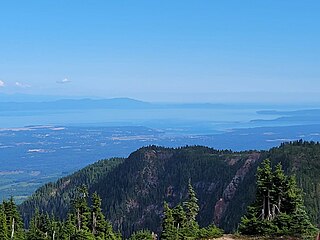
The Comox Valley is a region on the east coast of Vancouver Island, British Columbia, Canada, that includes the city of Courtenay, the town of Comox, the village of Cumberland, and the unincorporated settlements of Royston, Union Bay, Fanny Bay, Black Creek, and Merville. The communities of Denman Island and Hornby Island are also considered part of the Comox Valley. The Comox Valley contains the 47th largest metropolitan area in Canada with a population of about 76,000 as of 2022.
Black Creek is a community on the eastern side of Vancouver Island, British Columbia, Canada. It is approximately 16 kilometres (9.9 mi) north of Courtenay. It is primarily an agricultural hamlet and bedroom community to Courtenay and Campbell River - approximately 20 kilometres (12 mi) to the north. It is part of Electoral Area C in the Comox Valley Regional District.

Chase is a village located in the Interior of British Columbia, Canada. It has a population of 3,399, and its main industries are forestry and tourism. It is located at the outlet of Little Shuswap Lake, which is the source of the South Thompson River. Chase Creek, which drops over three small waterfalls before flowing through the town, enters the South Thompson just below the lake's outlet.

Miracle Beach Provincial Park is a provincial park on the eastern shore of Vancouver Island in British Columbia, Canada. Located between Comox and Campbell River, the park includes a foreshore area in the Strait of Georgia, much of the Black Creek estuary, and a forested area. According to its Master Plan, it fulfills primarily a recreational role with a focus on beach play, picnicking, nature appreciation, and camping, and a secondary conservation role with a focus on the natural shoreline and estuary. I support of its recreational focus the park is developed with a day-use parking area with accessible trails leading to the shoreline and a camping area with 200 drive-in sites. The park is also hosts a nature centre building and a sheltered group picnic shelter. Vegetation in the park is typical for the region's second-growth forests with Douglas-fir most prominent. Common associates include Western hemlock, Sitka spruce, red alder and bigleaf maple. Salal and sword fern are the most abundant shrub. Black Creek, which flows through the park, is a spawning area for coho salmon.


The ƛoʔos Klahoose are one of the three groups comprising the ʔayʔaǰuθəm Tla'Amin or Mainland Comox. The other two divisions of this once-populous group are the χʷɛmaɬku Homalco and Sliammon. The Klahoose, Homalco and Sliammon are, according to oral tradition, the descendants of the survivors of the Great Flood. The three groups were split by colonialism into different band councils but united historically as the Tla A'min, known as the Mainland Comox, and K’ómoks, the larger grouping of the Comox people, also known as the Island Comox and before the merger with the Laich-kwil-tach culture. Historically both groups are a subgroup of the Coast Salish though the K’ómoks name is from, and their language today, is the Lik'wala dialect of Kwak'wala. The ancestral tongue is the Comox language, though the Sahtloot/Island dialect is extinct.
The Comox Valley Regional District is a regional district in British Columbia, Canada. It was created on February 15, 2008, encompassing the southeastern portions of the former Regional District of Comox-Strathcona, and centred about the Comox Valley. The partition left the new Comox Valley Regional District with only 8.4 percent of the former Comox-Strathcona's land area, but 57.9 percent of its population. The CVRD covers an area of 2,425 square kilometres, of which 1,725 square kilometres is land, and serves a population of 66,527 according to the 2016 Census. The district borders the Strathcona Regional District to the northwest, the Alberni-Clayoquot Regional District to the southwest, and the Regional District of Nanaimo to the southeast, as well as the qathet Regional District along the Strait of Georgia to the east.
Comox Valley Transit System provides public transportation in the Comox Valley area on the east coast of Vancouver Island, British Columbia, Canada. Service is provided to the City of Courtenay and the towns of Comox, Royston, Oyster River, Black Creek, and Cumberland. Funding is provided under a partnership between the Comox Valley Regional District and BC Transit, the provincial agency which plans and manages municipal transit systems.


