Castlegar, British Columbia

Last updated

Castlegar
City of Castlegar
Castlegar- welcome sign.JPG
Motto(s): 
"Haec Lumina Numquam Errantiae"  (Latin)
"These Lights Never Wander"
Canada British Columbia location map 2.svg
Red pog.svg
Castlegar
Location of Castlegar in British Columbia
Coordinates: 49°19′28″N117°40′01″W / 49.32444°N 117.66694°W / 49.32444; -117.66694 [1]
CountryCanada
Province British Columbia
Region West Kootenay
Regional district Central Kootenay
Incorporated1946
Government
[3]
  TypeElected city council
  MayorMaria McFaddin
  Governing bodyCastlegar City Council
   MP Richard Cannings (NDP)
   MLA Katrine Conroy (BC NDP)
Area
  Total19.58 km2 (7.56 sq mi)
Elevation
At airport [4]
495.6 m (1,626.0 ft)
Population
 (2016)
  Total8,039
  Density408.6/km2 (1,058/sq mi)
Time zone UTC−08:00 (PST)
Forward sortation area
V1N
Area code 250 / 778 / 236 / 672
Website www.castlegar.ca OOjs UI icon edit-ltr-progressive.svg

Castlegar is a community in the West Kootenay region of British Columbia, Canada. In the Selkirk Mountains, at the confluence of the Kootenay and Columbia Rivers, it is a regional trade and transportation centre, with a local economy based on forestry, mining and tourism.

Contents

Castlegar is home to Selkirk College, a regional airport, a pulp mill, and several sawmills. Its population of 7,259 includes many Doukhobors, who were largely responsible for much of the town's early development and growth.

The area which became Castlegar was an important centre for the Sinixt (Lakes) Peoples. Outside the city limits are the small surrounding communities of Ootischenia, Brilliant, Robson, Robson West, Raspberry, Tarrys, Thrums, Glade, [5] Shoreacres, Fairview, Genelle, Pass Creek and Krestova, and the much smaller communities of Deer Park, Renata, and Syringa on Lower Arrow Lake. These outlying areas have a further population of about 8,000 people.

History

On 5 September 1811, David Thompson arrived in the area of present-day Castlegar, and camped near the mouth of the Kootenay River. A plaque dedicated to him is on the east bank of the Columbia River overlooking the town.

The area's first settlement was West Waterloo, now known as South Castlegar. With widespread provincial interest in gold prospecting in the late 19th century, by 1895 there were 40 houses in Waterloo. The town boomed until the end of the century when interest in the local mines declined.

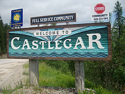
Castlegar takes its name from Castlegar Estate, the ancestral home of townsite founder Edward Mahon, near Ahascragh in County Galway, Ireland. [6] Castlegar, BC was planned in 1897. [6] Around 1902, the Canadian Pacific Railway (CPR) built the bridge there [7] and laid the wide-gauge railway tracks to Trail. They built a boxcar station at the old Waterloo Trail crossing and named it Kinnaird Station in honour of Lord Kinnaird, a CPR shareholder. [8]

There was little in Castlegar until after the completion of the CPR bridge. A Mr. Farmer built the first store, housing both the post office and town hall. William Gage built the Castlegar Hotel in 1908, which stood until 1982 when it was destroyed by fire. Also in 1908, the first schoolhouse was built by a few local residents. A dance pavilion, garage, tourist cabins and a slaughterhouse were established by 1925.

On 30 October 1946, Castlegar was incorporated into a village; and in 1966, became a town. It amalgamated with neighbouring Kinnaird into a city on 1 January 1974, effectively doubling its population. On 20 May 2004, the city's boundary was extended to include the Blueberry Creek Irrigation District.

Indigenous peoples history

Castlegar is in the border area between the Sinixt (Interior Salish) and Ktunaxa Indian bands. Experts cannot agree where one band's range ended and the other's began, as there was much overlapping of cultural and territorial activity between them. Most recent information suggests that the Sinixt were the area's original people, and that the Kootenai arrived several hundred years ago from central Canada.

Kp'itl'els was an Indigenous settlement on the north side of the Kootenay River, just above the junction with the Columbia River. Implements such as arrowheads and pestles have been found along the nearby Arrow Lakes. A reconstructed kekuli dwelling was discovered on Zuckerberg Island, at the confluence of the Kootenay and Columbia rivers.

Doukhobor history

The Doukhobors operated a ferry near Brilliant on the Kootenay River in 1910, and the Christian Community of Universal Brotherhood (CCUB) applied to CPR for a railway station and siding to that point. Brilliant was the centre of the CCUB commercial enterprises, including the Brilliant Jam Factory, a grain elevator, and a flax mill.

Columbia Avenue Castlegar Street.jpg
Columbia Avenue

Demographics

In the 2021 Census of Population conducted by Statistics Canada, Castlegar had a population of 8,338 living in 3,549 of its 3,702 total private dwellings, a change of

Ethnicity

Panethnic groups in the City of Castlegar (1996−2021)
Panethnic
group
2021 [11] 2016 [12] 2011 [13] 2006 [14] 2001 [15] 1996 [16]
Pop. %Pop.%Pop.%Pop.%Pop.%Pop.%
European [lower-alpha 1] 6,9206,8856,9006,6106,5306,500
Indigenous 550415345275215190
South Asian 270215601520120
East Asian [lower-alpha 2] 145100135653050
Southeast Asian [lower-alpha 3] 1005055355510
African 4575400010
Latin American 1025020100
Middle Eastern [lower-alpha 4] 000153035
Other/Multiracial [lower-alpha 5] 2020010100
Total responses8,0607,7807,5557,0606,8906,920
Total population8,3388,0397,8167,2597,0027,027
Note: Totals greater than 100% due to multiple origin responses

Language

Religion

According to the 2021 census, religious groups in Castlegar included: [11]

Climate

Castlegar has a humid continental climate (Köppen Dfb) or an inland oceanic climate (Cfb), bordering an inland warm-summer mediterranean climate (Köppen Csb). Summers are warm and sunny, with late summer being quite dry, while winters are cool and frequently unsettled. Precipitation peaks in the winter months when the Aleutian Low is strongest, and a range of precipitation is experienced, sometimes in short time periods. Castlegar is wetter than most places in the Southern Interior of BC, and the city receives around 400 mm more precipitation than nearby Kelowna, Penticton and Kamloops (which are in the drier Okanagan region of British Columbia, while Castlegar is in the Kootenay region).

The highest temperature ever recorded in Castlegar is 43.9 °C (111 °F) on June 30, 2021, [17] which exceeded the previous mark of 41.1 °C (106 °F), recorded on 2 July 1924 and 11 July 1926. [18] [19] The coldest temperature ever recorded was −30.6 °C (−23 °F) on 30 December 1968. [4]

Climate data for Castlegar (West Kootenay Regional Airport)
Climate ID: 1141455; coordinates 49°17′47″N117°37′57″W / 49.29639°N 117.63250°W / 49.29639; -117.63250 (Vancouver International Airport) ; elevation: 495.6 m (1,626 ft); 1981–2010 normals, extremes 1916–present [lower-alpha 6]
MonthJanFebMarAprMayJunJulAugSepOctNovDecYear
Record high humidex 9.014.122.627.735.946.953.442.837.928.219.210.653.4
Record high °C (°F)10.0
(50.0)
14.3
(57.7)
23.1
(73.6)
32.2
(90.0)
34.5
(94.1)
43.9
(111.0)
41.1
(106.0)
40.0
(104.0)
36.8
(98.2)
27.2
(81.0)
19.4
(66.9)
11.7
(53.1)
43.9
(111.0)
Mean daily maximum °C (°F)0.5
(32.9)
3.2
(37.8)
9.4
(48.9)
15.3
(59.5)
20.0
(68.0)
23.6
(74.5)
28.1
(82.6)
28.2
(82.8)
22.0
(71.6)
12.9
(55.2)
4.7
(40.5)
0.0
(32.0)
14.0
(57.2)
Daily mean °C (°F)−1.6
(29.1)
−0.1
(31.8)
4.4
(39.9)
8.8
(47.8)
13.3
(55.9)
16.8
(62.2)
20.2
(68.4)
20.0
(68.0)
14.7
(58.5)
8.0
(46.4)
2.1
(35.8)
−2.1
(28.2)
8.7
(47.7)
Mean daily minimum °C (°F)−3.7
(25.3)
−3.5
(25.7)
−0.7
(30.7)
2.3
(36.1)
6.5
(43.7)
10.0
(50.0)
12.2
(54.0)
11.7
(53.1)
7.3
(45.1)
3.0
(37.4)
−0.6
(30.9)
−4.2
(24.4)
3.4
(38.1)
Record low °C (°F)−25.7
(−14.3)
−25.0
(−13.0)
−18.3
(−0.9)
−10.0
(14.0)
−3.9
(25.0)
−1.1
(30.0)
3.3
(37.9)
0.0
(32.0)
−7.8
(18.0)
−11.3
(11.7)
−20.2
(−4.4)
−30.6
(−23.1)
−30.6
(−23.1)
Record low wind chill −32−33−28−9−4−700−5−19−30−42−42
Average precipitation mm (inches)75.5
(2.97)
51.2
(2.02)
62.9
(2.48)
59.3
(2.33)
70.3
(2.77)
72.3
(2.85)
48.1
(1.89)
30.4
(1.20)
42.4
(1.67)
51.3
(2.02)
96.7
(3.81)
90.3
(3.56)
750.9
(29.56)
Average rainfall mm (inches)26.2
(1.03)
28.1
(1.11)
50.1
(1.97)
57.1
(2.25)
70.1
(2.76)
72.3
(2.85)
48.1
(1.89)
30.4
(1.20)
42.4
(1.67)
49.4
(1.94)
58.7
(2.31)
31.3
(1.23)
564.3
(22.22)
Average snowfall cm (inches)55.4
(21.8)
25.7
(10.1)
13.2
(5.2)
2.0
(0.8)
0.2
(0.1)
0
(0)
0
(0)
0
(0)
0
(0)
1.9
(0.7)
37.5
(14.8)
64.8
(25.5)
200.6
(79.0)
Average precipitation days (≥ 0.2 mm)16.513.414.514.415.514.49.77.78.212.117.416.6160.3
Average rainy days (≥ 0.2 mm)7.88.112.414.215.514.49.77.78.212.013.05.7128.5
Average snowy days (≥ 0.2 cm)12.68.64.91.20.200000.78.214.550.7
Average relative humidity (%) (at 3pm)76.066.652.542.843.745.737.335.042.658.174.677.754.4
Mean monthly sunshine hours 38.976.1128.8173.8226.7233.0291.9276.3204.0123.248.233.41,854.2
Percent possible sunshine 14.426.735.042.347.848.059.661.953.836.817.513.038.1
Source: Environment and Climate Change Canada [4] [20]

Airport

West Kootenay Regional Airport Castlegar Airport.jpg
West Kootenay Regional Airport

The West Kootenay Regional Airport is owned and operated by the City of Castlegar, and provides regular service to Vancouver International Airport. The other nearest airport is Trail Airport, 40 km (25 mi) to the south.

Schools

Castlegar is part of School District 20 Kootenay-Columbia. There are four elementary schools in the town:

There is one high school, Stanley Humphries Secondary School.

Selkirk College's main campus is also in Castlegar.

Recreation

Dozens of walking trails in and near Castlegar [21] are maintained by the Castlegar Parks and Trails Society. The area attracts retirees and tourists for its summer and winter sports.

The Columbia River flows through Castlegar. Along the river to the west are Scotties Marina and Syringa Provincial Park, with boating and camping amenities.

Scotties Marina, near Castlegar Scotties Marina, near Castlegar.jpg
Scotties Marina, near Castlegar
Syringa Provincial Park Syringa Provincial Park.jpg
Syringa Provincial Park

Sports

The city's collegiate hockey team is the Selkirk College Saints of the BCIHL, who, as of 2016, are four-time defending league champions. The Castlegar Rebels of the KIJHL are the city's Junior "B" level hockey team.

Other local sport activities include Castlegar Baseball Association, Castlegar Skating Club, Dancing at Turning Pointe Dance Studio and Scottie School of Highland Dance, Castlegar Aquanauts, Castlegar Minor Soccer Association, Selkirk Challengers Gymnastics Club, Castlegar Minor Hockey, West Kootenay Minor Football Association, Castlegar Sentinels Football Club, and the Kootenay Jiu Jitsu Academy. There are local lacrosse, golf, curling, tennis, volleyball and basketball programs. Many other fitness programs (including yoga) are offered at the Castlegar Community Complex.

ClubLeagueSportVenueEstablishedChampionships
Castlegar Rebels KIJHL Ice Hockey Castlegar Community Complex19763

Geography

Castlegar's main business street, Columbia Avenue, runs the length of the city. It becomes Highway 22 at its south end, and the Robson Bridge at its north end. Most of Castlegar's local businesses are located there. There are several neighbourhoods in Castlegar, including Downtown, Southridge, Oglow Subdivision, Woodland Park, Grosvenor, Kinnaird, and Blueberry Creek. The city's outskirts include the neighbourhoods of Robson, Robson West, Brilliant, Raspberry, Pass Creek, Ootischenia, Tarrys, Thrums and Genelle.

Transportation

Kinnaird Bridge along Highway 3 across the Columbia River Bridge at Castlegar, BC.jpg
Kinnaird Bridge along Highway 3 across the Columbia River

Castlegar is a transportation hub for its region. In addition to its airport (above), it is at the junction of highways 3A, 3 and 22. Highway 22, known locally as Columbia Avenue, runs the length of the city. At its north end, Columbia meets the Robson Bridge, carrying traffic to the rural suburb of Robson, accessed via Broadwater Road.

There is a small highway interchange where the Robson Access Road meets Highway 3A towards Nelson. Highway 3 bisects Castlegar, providing the main access to the Grovesnor area, and crossing the Columbia River at the Kinnaird Bridge, to Ootischenia. Highway 3 and 3A provide routes through Ootischenia, and Highway 22 also connects to Blueberry. To the north, Highway 3A heads to Nelson. To the south, Highway 22 leads to Trail. To its east, Highway 3 leads to Salmo, and to Grand Forks to its west.

Notable residents

Sister cities

[22]

Notes

  1. Statistic includes all persons that did not make up part of a visible minority or an indigenous identity.
  2. Statistic includes total responses of "Chinese", "Korean", and "Japanese" under visible minority section on census.
  3. Statistic includes total responses of "Filipino" and "Southeast Asian" under visible minority section on census.
  4. Statistic includes total responses of "West Asian" and "Arab" under visible minority section on census.
  5. Statistic includes total responses of "Visible minority, n.i.e." and "Multiple visible minorities" under visible minority section on census.
  6. Climate data was recorded at Castlegar from July 1916 to June 1963 and at Castlegar Airport from December 1965 to present.

Related Research Articles

<span class="mw-page-title-main">Nelson, British Columbia</span> City in British Columbia, Canada

Nelson is a city located in the Selkirk Mountains on the West Arm of Kootenay Lake in the Southern Interior of British Columbia, Canada. Known as "The Queen City" and acknowledged for its impressive collection of restored heritage buildings from its glory days in a regional silver rush, Nelson is one of the three cities forming the commercial and population core of the West Kootenay region, the others being Castlegar and Trail. The city is the seat of the Regional District of Central Kootenay. It is represented in the provincial legislature by the riding of Nelson-Creston, and in the Parliament of Canada by the riding of Kootenay—Columbia.

<span class="mw-page-title-main">Fernie, British Columbia</span> City in British Columbia, Canada

Fernie is a city in the Elk Valley area of the East Kootenay region of southeastern British Columbia, Canada, located on BC Highway 3 on the western approaches to the Crowsnest Pass through the Rocky Mountains. Founded in 1898 and incorporated as the City of Fernie in July 1904, the municipality has a population of over 5,000 with an additional 2,000 outside city limits in communities under the jurisdiction of the Regional District of East Kootenay. A substantial seasonal population swells the city during the winter months.

<span class="mw-page-title-main">Invermere</span> District municipality in British Columbia, Canada

Invermere is a community in eastern British Columbia, Canada, near the border of Alberta. It is the hub of the Columbia Valley between Golden to the north and Cranbrook to the south. Invermere sits on the northwest shore of Windermere Lake and is a popular summer destination for visitors and second home owners from Edmonton and Calgary.

<span class="mw-page-title-main">Cranbrook, British Columbia</span> City in British Columbia, Canada

Cranbrook is a city in southeast British Columbia, Canada, located approximately 10 km southwest of the confluence of the Kootenay River and the St. Mary's River. It is the largest urban centre in the region known as the East Kootenay. As of 2016, Cranbrook's population is 20,499 with a census agglomeration population of 27,040. It is the location of the headquarters of the Regional District of East Kootenay and also the location of the regional headquarters of various provincial ministries and agencies, notably the Rocky Mountain Forest District.

<span class="mw-page-title-main">Regional District of Kootenay Boundary</span> Regional district in British Columbia, Canada

The Regional District of Kootenay Boundary (RDKB) is one of 28 regional districts in the province of British Columbia, Canada. As of the 2016 Canadian census, the population was 31,447. The area is 8,095.62 km2. The RDKB was incorporated in 1966 and consists of eight incorporated municipalities and five unincorporated electoral areas. The regional district's offices are in the City of Trail, with secondary offices in the City of Grand Forks. Other major population centres include the cities of Rossland and Greenwood, and the villages of Fruitvale, Warfield, and Montrose. The region also encompasses electoral areas A, B/Lower Columbia-Old Glory, C/Christina Lake, D/Rural Grand Forks and E/West Boundary including Rock Creek, Bridesville, Beaverdell and Big White Ski Resort.

<span class="mw-page-title-main">Sparwood</span> District municipality in British Columbia, Canada

Sparwood is a district municipality in the Canadian province of British Columbia. It is the second-largest community on the Elk River.

The Village of Nakusp is located south of the mouth of Kuskanax Creek, on the Upper Arrow Lake in the West Kootenay region of southeastern British Columbia. Lying between the Selkirk and Monashee ranges, the village is known for its nearby hot springs and picturesque mountain lakeside setting.

<span class="mw-page-title-main">Golden, British Columbia</span> Town in British Columbia, Canada

Golden is a town in southeastern British Columbia, Canada, 262 kilometres (163 mi) west of Calgary, Alberta, and 713 kilometres (443 mi) east of Vancouver.

<span class="mw-page-title-main">Rossland, British Columbia</span> City in British Columbia, Canada

Rossland is in the West Kootenay region of south central British Columbia. High in the Monashee Mountains, the city lies immediately east of the intersections of BC highways 3B and 22. The facilities provide a winter base for the nearby multi-peak ski hills of the Red Mountain Resort. In the non-winter months Rossland is frequented by mountain bikers, with golf and fishing options nearby as well.

<span class="mw-page-title-main">Creston, British Columbia</span> Town in British Columbia, Canada

Creston is a town in the Kootenay region of southeastern British Columbia, Canada.

<span class="mw-page-title-main">Selkirk, Manitoba</span> City in Manitoba, Canada

Selkirk is a city in the western Canadian province of Manitoba, located on the Red River about 22 kilometres (14 mi) northeast of Winnipeg, the provincial capital. It has a population of 10,504 as of the 2021 census.

<span class="mw-page-title-main">Regional District of Central Kootenay</span> Regional district in British Columbia, Canada

The Regional District of Central Kootenay (RDCK) is a regional district in the province of British Columbia, Canada. As of the 2016 census, the population was 59,517. The area is 22,130.72 square kilometres. The administrative centre is located in the city of Nelson. Other municipalities include the City of Castlegar, the Town of Creston, the Village of Salmo, the Village of Nakusp, the Village of Kaslo, the Village of New Denver, the Village of Silverton, the Village of Ymir and the Village of Slocan.

<span class="mw-page-title-main">Kimberley, British Columbia</span> City in British Columbia, Canada

Kimberley is a city in southeast British Columbia, Canada along Highway 95A between the Purcell and Rocky Mountains. Kimberley was named in 1896 after the Kimberley mine in South Africa. From 1917 to 2001, it was the home to the world's largest lead-zinc mine, the Sullivan Mine. Now it is mainly a tourist destination and home to the Kimberley Alpine Resort, a ski area and Kimberley's Underground Mining Railway that features a 750-foot-long (230 m) underground mining interpretive centre complete with operational 3 ft narrow-gauge railway equipment. Recreational pursuits include world-class skiing, snowboarding, snowmobiling, fishing, whitewater rafting, kayaking, biking, hiking and golfing on championship golf courses. The city has the largest urban park in Canada. At 1,977 acres (800 ha), the Kimberley Nature Park is the largest incorporated park in Canada.

<span class="mw-page-title-main">Grand Forks, British Columbia</span> City in British Columbia, Canada

Grand Forks is a city in the Boundary Country of the West Kootenay region of British Columbia, Canada. It is located at the confluence of the Granby and Kettle Rivers, a tributary of the Columbia River. The city is just north of the Canada–United States border, approximately 500 km (310 mi) from Vancouver and 200 km (120 mi) from Kelowna and 23 km (14 mi) west of the resort area of Christina Lake by road.

<span class="mw-page-title-main">Rural Municipality of St. Andrews</span> Rural municipality in Manitoba, Canada

St. Andrews is a rural municipality (RM) in Manitoba, Canada. It lies west of the Red River; its southern border is approximately 8 kilometres (5.0 mi) north of Winnipeg.

<span class="mw-page-title-main">Rural Municipality of St. Clements</span> Rural municipality in Manitoba, Canada

St. Clements is a rural municipality (RM) in Manitoba, Canada. It is located to the north-east of Winnipeg, stretching from East St. Paul and Birds Hill Provincial Park in the south to Lake Winnipeg and Grand Beach Provincial Park to the north. The Red River demarcates the western boundary of the municipality. St. Clements contains the communities of East Selkirk, and Lockport east of the Red River. It almost completely surrounds the Brokenhead 4 Indian reserve, with the exception of a small lakefront on Lake Winnipeg.

<span class="mw-page-title-main">Ymir, British Columbia</span> Unincorporated Community in British Columbia, Canada

Ymir is a village in the Selkirk Mountains in the West Kootenay region of southeastern British Columbia. Ymir is located where the Salmo River meets Quartz Creek, and Ymir Creek. The locality, on BC Highway 6, is by road about 10 kilometres (6 mi) northeast of Salmo and 34 kilometres (21 mi) south of Nelson.

<span class="mw-page-title-main">Midway, British Columbia</span> Village in British Columbia, Canada

Midway is in the West Kootenay region of south central British Columbia. The village lies 13 kilometres (8 mi) west of Greenwood and 51 kilometres (32 mi) east of Osoyoos along Highway 3.

<span class="mw-page-title-main">Revelstoke, British Columbia</span> City in British Columbia, Canada

Revelstoke is a city in southeastern British Columbia, Canada, with a census population of 8,275 in 2021. Revelstoke is located 641 kilometres (398 mi) east of Vancouver, and 415 kilometres (258 mi) west of Calgary, Alberta. The city is situated on the banks of the Columbia River just south of the Revelstoke Dam and near its confluence with the Illecillewaet River. East of Revelstoke are the Selkirk Mountains and Glacier National Park, penetrated by Rogers Pass used by the Trans-Canada Highway and the Canadian Pacific Railway. South of the community down the Columbia River are the Arrow Lakes, Mount Begbie, and the Kootenays. West of the city is Eagle Pass through the Monashee Mountains and the route to Shuswap Lake.

<span class="mw-page-title-main">Trail, British Columbia</span> City in British Columbia, Canada

Trail is a city in the West Kootenay region of the Interior of British Columbia, Canada. It was named after the Dewdney Trail, which passed through the area. The town was first called Trail Creek or Trail Creek Landing, and the name was shortened to Trail in 1897.

References

  1. "Castlegar". Geographical Names Data Base . Natural Resources Canada.
  2. "Castlegar". Geographical Names Data Base . Natural Resources Canada.
  3. City Council Members
  4. 1 2 3 "Canadian Climate Normals 1981-2010 Station Data". Environment Canada. 25 September 2013. Retrieved 27 February 2017.
  5. "Nelson Star, 20 Sep 2014". www.nelsonstar.com. 20 September 2014.
  6. 1 2 Nesteroff, Greg (16 September 2013). "Castlegar named for founder's Irish family estate". nelsonstar.com. Nelson Star.
  7. Nesteroff, Greg (22 September 2013). "CPR, lawsuits stymied Castlegar's early growth". nelsonstar.com. Nelson Star.
  8. Mitchell, Andy (2011). Arthur Kinnaird First Lord of Football. p. 136. ISBN   978-1463621117.
  9. "Population and dwelling counts: Canada, provinces and territories, and census subdivisions (municipalities), British Columbia". Statistics Canada. 9 February 2022. Retrieved 20 February 2022.
  10. "Census profile, 2016 Census". Statistics Canada. 8 February 2017.
  11. 1 2 Government of Canada, Statistics Canada (26 October 2022). "Census Profile, 2021 Census of Population". www12.statcan.gc.ca. Retrieved 11 November 2022.
  12. Government of Canada, Statistics Canada (27 October 2021). "Census Profile, 2016 Census". www12.statcan.gc.ca. Retrieved 8 March 2023.
  13. Government of Canada, Statistics Canada (27 November 2015). "NHS Profile". www12.statcan.gc.ca. Retrieved 8 March 2023.
  14. Government of Canada, Statistics Canada (20 August 2019). "2006 Community Profiles". www12.statcan.gc.ca. Retrieved 8 March 2023.
  15. Government of Canada, Statistics Canada (2 July 2019). "2001 Community Profiles". www12.statcan.gc.ca. Retrieved 8 March 2023.
  16. Government of Canada, Statistics Canada (4 June 2019). "Electronic Area Profiles Profile of Census Divisions and Subdivisions, 1996 Census". www12.statcan.gc.ca. Retrieved 8 March 2023.
  17. "Historical Data - Climate - Environment and Climate Change Canada". 31 October 2011.
  18. "Daily Data Report for July 1924". Environment Canada. 31 October 2011. Retrieved 27 February 2017.
  19. "Daily Data Report for July 1926". Environment Canada. 31 October 2011. Retrieved 27 February 2017.
  20. "Daily Data Report for June 2015". Environment Canada. 31 October 2011. Retrieved 27 February 2017.
  21. "Hiking".
  22. "The City of Castlegar - City Hall - Sister Cities". Archived from the original on 28 February 2018. Retrieved 25 June 2009.