
The Arrow Lakes in British Columbia, Canada, divided into Upper Arrow Lake and Lower Arrow Lake, are widenings of the Columbia River. The lakes are situated between the Selkirk Mountains to the east and the Monashee Mountains to the west. Beachland is fairly rare, and is interspersed with rocky headlands and steep cliffs. Mountain sides are heavily forested, and rise sharply to elevations around 2,600 metres.

The Lakes Route is an alternate name for the Douglas Road, which was the first formally designated "road" into the Interior of British Columbia, Canada from its Lower Mainland area flanking the Lower Fraser River. Also known as the Douglas-Lillooet Trail or the Lillooet Trail, the route consisted of a series of wagon roads connected via lake travel in between. A variety of craft were used on the lakes, from steamboats to sail-driven rafts to, through the early 20th Century, diesel and other engines. Lake travel continued for commerce, passenger travel and heavy freight until after World War II.
An arrowhead is the point of an arrow.

Bonnington was a sternwheel steamboat that ran on the Arrow Lakes in British Columbia from 1911 to 1931. Bonnington and two sisterships were the largest sternwheelers ever built in British Columbia. Bonnington was partially dismantled in the 1950s, and later sank, making the vessel the largest freshwater wreck site in British Columbia.

The era of steamboats on the Arrow Lakes and adjoining reaches of the Columbia River is long-gone but was an important part of the history of the West Kootenay and Columbia Country regions of British Columbia Canada. The Arrow Lakes are formed by the Columbia River in southeastern British Columbia. Steamboats were employed on both sides of the border in the upper reaches of the Columbia, linking port towns on either side of the border, and sometimes boats would be built in one country and operated in the other. Tributaries of the Columbia include the Kootenay River which rises in Canada, then flows south into the United States, then bends north again back into Canada, where it widens into Kootenay Lake. As with the Arrow Lakes, steamboats once operated on the Kootenay River and Kootenay Lake.
Dalles des Morts, also known as Death Rapids in English, was a famously violent stretch of the Columbia River upstream from Revelstoke, British Columbia, Canada, now submerged beneath the waters of Lake Revelstoke.

The Rossland was a sternwheel steamboat that ran on the Arrow Lakes in British Columbia. It was named after Rossland, British Columbia, once a prosperous mining town in the region.
Minto was a sternwheel steamboat that ran on the Arrow Lakes in British Columbia from 1898 to 1954. In those years of service, Minto had steamed over 3.2 million kilometers serving the small communities on Arrow Lakes. Minto and her sister Moyie were the last sternwheelers to run in regularly scheduled passenger service in the Pacific Northwest. The "Minto" class of sailing dinghies is named after this vessel.
Lytton was a sternwheel steamboat that ran on the Arrow Lakes and the Columbia River in southeastern British Columbia and northeastern Washington from 1890 to 1904.

Columbia was a sternwheel steamboat that ran on the Arrow Lakes in British Columbia from 1891 to 1894. Columbia should be distinguished from the many other vessels with the same or similar names, including in particular the propeller-driven steamboat Columbia that ran on the Arrow Lakes for many years.

The Nakusp was a sternwheel steamboat that operated from 1895 to 1897 on the Arrow Lakes of British Columbia.

Needles is an unincorporated locality on the west shore of Lower Arrow Lake in the West Kootenay region of southeastern British Columbia. The western terminal for the Needles Ferry to Fauquier, the landing on Highway 6 is 108 kilometres (67 mi) east of Lumby, and 60 kilometres (37 mi) southwest of Nakusp.

Marion was a small sternwheel steamboat that operated in several waterways in inland British Columbia from 1888 to 1901.

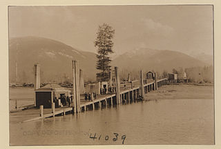
Galena Bay is an unincorporated locality, on the bay of the same name, at the head of Upper Arrow Lake in the West Kootenay region of southeastern British Columbia.

From 1886 to 1920, steamboats ran on the upper reaches of the Columbia and Kootenay in the Rocky Mountain Trench, in western North America. The circumstances of the rivers in the area, and the construction of transcontinental railways across the trench from east to west made steamboat navigation possible.
Comaplix was a former mining town on the Incomappleux River in the Upper Arrow Lake area of the West Kootenay region of British Columbia. The name of the town and an adjacent mountain and creek derived from the river. Cleared in 1896, the town was surveyed and a sawmill established the next year. The suspicious 1915 fire, which levelled the buildings, largely ended the flourishing hamlet. The site, north of Beaton, on the northeast side of the lake's Beaton Arm, comprised merely concrete foundations when the Keenleyside Dam reservoir submerged the area in 1968. The small overgrown cemetery above the townsite is all that remains.

Beaton is at the head of the Beaton Arm of Upper Arrow Lake in the West Kootenay region of southeastern British Columbia. The locality is sometimes confused with nearby Evansport.
St. Leon, formerly known as Leon and also known as St. Leon Hot Springs because of an active mineral spring located nearby, is an unincorporated settlement and former hot springs resort and steamboat landing on the east side of Upper Arrow Lake in the Kootenay Country of British Columbia, Canada, located at the mouth of St. Leon Creek, between Nakusp (S) and Halcyon Hot Springs (N). The name of nearby Mount St. Leon is derived from that of the springs and settlement.
Burton is a settlement on the east shore of Lower Arrow Lake in the West Kootenay region of southeastern British Columbia.

The Upper Arrow Lake Ferry is a ferry across Upper Arrow Lake in the West Kootenay region of southeastern British Columbia. Linking Shelter Bay and Galena Bay, the ferry, part of BC Highway 23, is by road about 52 kilometres (32 mi) south of Revelstoke and 47 kilometres (29 mi) north of Nakusp.

