Alexander is a town in Washington County, Maine, United States. The population was 525 at the 2020 census. The town is named for Alexander Baring, 1st Baron Ashburton, the British negotiator of the Webster–Ashburton Treaty which ended the Aroostook War in 1838–1839.
Beals is a town in Washington County, Maine, United States, located on an island opposite Jonesport. The town was named after Manwarren Beal, an early settler. The population was 443 at the 2020 census.
Beddington is a town in Washington County, Maine, United States. The population was 60 at the 2020 census. It is the third-smallest organized town in Maine after Frye Island and Frenchboro.
Charlotte is a town in Washington County, Maine, United States. The town was named for the wife of legislator William Vance. The population was 337 at the 2020 census.
Cooper is a town in Washington County, Maine, United States. The community was named after General John Cooper, a landowner. The population was 168 at the 2020 census.
Deblois is a town in Washington County, Maine, United States. The town was named after T.A. Deblois, president of the Bank of Portland. The population was 74 at the 2020 census.
Dennysville is a town in Washington County, Maine, United States. The population was 300 at the 2020 census.

East Machias is a town in Washington County, Maine, United States on the East Machias River. At the 2020 census, the town population was 1,326. It is the home of Washington Academy, a private school founded in 1792.
Marshfield is a town in Washington County, Maine, United States. The population was 528 at the 2020 census.
Meddybemps is a town in Washington County, Maine, United States. The population was 139 at the 2020 census.
Northfield is a town in Washington County, Maine, United States. The population was 178 at the 2020 census.
Princeton is a town in Washington County, Maine, United States. The town was named after Princeton, Massachusetts. The population was 745 at the 2020 census.
Roque Bluffs is a town in Washington County, Maine, United States. The population was 296 at the 2020 census. The town is home to Roque Bluffs State Park.

Waite is a town in Washington County, Maine, United States. The town was named after Benjamin Waite, a lumberman and businessman from Calais, Maine. The population was 66 at the 2020 census.

Whitneyville is a town in Washington County, Maine, United States. The town was named after Colonel Joseph Whitney, a mill owner. The population was 202 at the 2020 census.
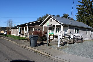
South Prairie is a town in Pierce County, Washington, United States. The population was 373 at the 2020 census.

Farmington is a town in Whitman County, Washington, United States. The population was 131 at the 2020 census.

Oakesdale is a town in Whitman County, Washington, United States. The population was 395 at the 2020 census.

Naches is a town in Yakima County, Washington, United States. The population was 1,084 at the 2020 census. The town is located along the Naches River west of Yakima near the eastern foothills of the Cascade Range.

Northfork is a town in McDowell County, West Virginia, United States, located on U.S. Route 52 between Welch and Bluefield.


